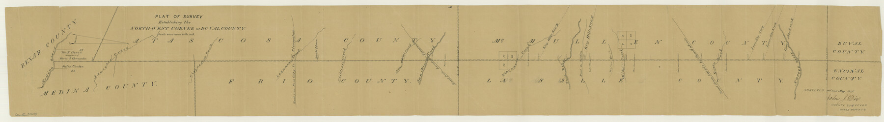
Duval County Boundary File 1d
Plat of Survey Establishing the Northwest Corner of Duval County
-
Map/Doc
52699
-
Collection
General Map Collection
-
Counties
Duval
-
Subjects
County Boundaries
-
Height x Width
6.6 x 47.7 inches
16.8 x 121.2 cm
Part of: General Map Collection
Intracoastal Waterway in Texas - Corpus Christi to Point Isabel including Arroyo Colorado to Mo. Pac. R.R. Bridge Near Harlingen

Print $20.00
- Digital $50.00
Intracoastal Waterway in Texas - Corpus Christi to Point Isabel including Arroyo Colorado to Mo. Pac. R.R. Bridge Near Harlingen
1933
Size 27.8 x 40.9 inches
Map/Doc 61864
[St. Louis & Southwestern]
![64279, [St. Louis & Southwestern], General Map Collection](https://historictexasmaps.com/wmedia_w700/maps/64279.tif.jpg)
Print $20.00
- Digital $50.00
[St. Louis & Southwestern]
Size 20.7 x 28.5 inches
Map/Doc 64279
Brewster County Working Sketch 68

Print $20.00
- Digital $50.00
Brewster County Working Sketch 68
1958
Size 23.3 x 22.6 inches
Map/Doc 67669
Galveston County Working Sketch 3

Print $20.00
- Digital $50.00
Galveston County Working Sketch 3
1915
Size 21.4 x 19.5 inches
Map/Doc 69340
Map of Africa (Inset: Liberia and Sierra Leone)

Print $20.00
- Digital $50.00
Map of Africa (Inset: Liberia and Sierra Leone)
1844
Size 9.5 x 12.1 inches
Map/Doc 93549
Schleicher County Sketch File 25

Print $20.00
- Digital $50.00
Schleicher County Sketch File 25
1937
Size 24.1 x 17.5 inches
Map/Doc 12304
Harris County Sketch File 90

Print $46.00
- Digital $50.00
Harris County Sketch File 90
1967
Size 12.2 x 14.4 inches
Map/Doc 25596
A New Map, or Chart in Mercators Projection, of the Western or Atlantic Ocean, with part of Europe, Africa and America

Print $20.00
- Digital $50.00
A New Map, or Chart in Mercators Projection, of the Western or Atlantic Ocean, with part of Europe, Africa and America
1781
Size 17.3 x 21.7 inches
Map/Doc 95368
Borden County Rolled Sketch 9

Print $40.00
- Digital $50.00
Borden County Rolled Sketch 9
1951
Size 114.7 x 29.6 inches
Map/Doc 8448
Map of the Western Part of Bexar District

Print $40.00
- Digital $50.00
Map of the Western Part of Bexar District
1849
Size 63.7 x 36.2 inches
Map/Doc 87376

Harris County Working Sketch 61

Print $20.00
- Digital $50.00
Harris County Working Sketch 61
1954
Size 22.2 x 24.3 inches
Map/Doc 65953
You may also like
Carte du Spits-Berg, et partie de la Côte de Galles hams-kes au nouveau Groenland

Print $20.00
- Digital $50.00
Carte du Spits-Berg, et partie de la Côte de Galles hams-kes au nouveau Groenland
1782
Size 13.8 x 19.8 inches
Map/Doc 97123
Webb County Rolled Sketch 73

Print $20.00
- Digital $50.00
Webb County Rolled Sketch 73
1982
Size 33.2 x 17.2 inches
Map/Doc 8221
Montgomery County Working Sketch 38

Print $20.00
- Digital $50.00
Montgomery County Working Sketch 38
1954
Size 23.6 x 28.5 inches
Map/Doc 71145
Smith County Sketch File 7

Print $4.00
- Digital $50.00
Smith County Sketch File 7
1848
Size 12.7 x 8.2 inches
Map/Doc 36759
Flight Mission No. DQO-8K, Frame 10, Galveston County

Print $20.00
- Digital $50.00
Flight Mission No. DQO-8K, Frame 10, Galveston County
1952
Size 18.7 x 22.4 inches
Map/Doc 85133
Yoakum County Sketch File 17

Print $48.00
- Digital $50.00
Yoakum County Sketch File 17
1898
Size 14.5 x 8.9 inches
Map/Doc 40796
[I. & G. N. Block 1, sections 64, 65, 67-71 and 545 along river]
![91602, [I. & G. N. Block 1, sections 64, 65, 67-71 and 545 along river], Twichell Survey Records](https://historictexasmaps.com/wmedia_w700/maps/91602-1.tif.jpg)
Print $2.00
- Digital $50.00
[I. & G. N. Block 1, sections 64, 65, 67-71 and 545 along river]
Size 8.8 x 14.3 inches
Map/Doc 91602
Hemphill County Rolled Sketch 15A

Print $20.00
- Digital $50.00
Hemphill County Rolled Sketch 15A
1961
Size 26.6 x 17.3 inches
Map/Doc 6195
Orange County Sketch File 9a

Print $4.00
- Digital $50.00
Orange County Sketch File 9a
1873
Size 8.1 x 7.5 inches
Map/Doc 33313
Right of Way and Track Map of The Missouri, Kansas & Texas Railway of Texas

Print $40.00
- Digital $50.00
Right of Way and Track Map of The Missouri, Kansas & Texas Railway of Texas
1918
Size 25.2 x 51.6 inches
Map/Doc 64530
Hutchinson County Sketch File 9

Print $4.00
- Digital $50.00
Hutchinson County Sketch File 9
1900
Size 12.7 x 9.2 inches
Map/Doc 27209
Ellis County Boundary File 3b

Print $14.00
- Digital $50.00
Ellis County Boundary File 3b
Size 11.2 x 8.7 inches
Map/Doc 52965