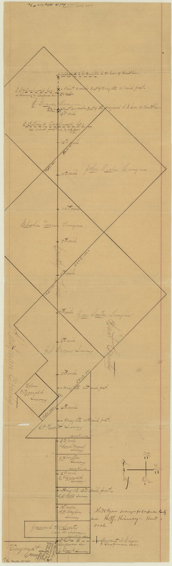
Hunt County Boundary File 7a
[Sketch of Hunt-Kaufman Boundary line]
-
Map/Doc
55235
-
Collection
General Map Collection
-
Counties
Hunt
-
Subjects
County Boundaries
-
Height x Width
27.9 x 8.5 inches
70.9 x 21.6 cm
Part of: General Map Collection
Parker County Rolled Sketch 5

Print $20.00
- Digital $50.00
Parker County Rolled Sketch 5
1987
Size 21.9 x 21.4 inches
Map/Doc 7206
Gillespie County Boundary File 6

Print $2.00
- Digital $50.00
Gillespie County Boundary File 6
Size 11.3 x 8.9 inches
Map/Doc 53770
Swisher County Sketch File 1

Print $28.00
- Digital $50.00
Swisher County Sketch File 1
1884
Size 13.0 x 8.2 inches
Map/Doc 37566
Flight Mission No. BRA-7M, Frame 139, Jefferson County

Print $20.00
- Digital $50.00
Flight Mission No. BRA-7M, Frame 139, Jefferson County
1953
Size 18.7 x 22.4 inches
Map/Doc 85533
Callahan County Working Sketch 11

Print $40.00
- Digital $50.00
Callahan County Working Sketch 11
1978
Size 43.0 x 48.1 inches
Map/Doc 67893
Webb County Rolled Sketch 5

Print $20.00
- Digital $50.00
Webb County Rolled Sketch 5
Size 43.2 x 23.0 inches
Map/Doc 8172
Gillespie County Boundary File 7a

Print $40.00
- Digital $50.00
Gillespie County Boundary File 7a
Size 8.7 x 51.2 inches
Map/Doc 53780
Current Miscellaneous File 98

Print $40.00
- Digital $50.00
Current Miscellaneous File 98
Size 18.4 x 26.3 inches
Map/Doc 74338
Hardin County Sketch File 27

Print $4.00
- Digital $50.00
Hardin County Sketch File 27
Size 13.0 x 8.1 inches
Map/Doc 25151
Bandera County Sketch File 2

Print $4.00
- Digital $50.00
Bandera County Sketch File 2
1855
Size 7.1 x 7.9 inches
Map/Doc 13997
Harris County NRC Article 33.136 Sketch 12

Print $30.00
- Digital $50.00
Harris County NRC Article 33.136 Sketch 12
2007
Size 24.0 x 17.5 inches
Map/Doc 94627
Lynn County Sketch File A

Print $2.00
- Digital $50.00
Lynn County Sketch File A
1905
Size 8.6 x 6.3 inches
Map/Doc 30477
You may also like
Borden County Working Sketch 14

Print $20.00
- Digital $50.00
Borden County Working Sketch 14
1959
Size 27.8 x 25.2 inches
Map/Doc 67474
Comal County Sketch File 9

Print $4.00
- Digital $50.00
Comal County Sketch File 9
1859
Size 13.6 x 8.5 inches
Map/Doc 19016
Map of Lavaca County, Texas

Print $20.00
- Digital $50.00
Map of Lavaca County, Texas
1879
Size 22.8 x 25.0 inches
Map/Doc 561
University of Texas System University Lands

Print $20.00
- Digital $50.00
University of Texas System University Lands
Size 17.8 x 23.4 inches
Map/Doc 93245
Upton County Rolled Sketch 7

Print $62.00
- Digital $50.00
Upton County Rolled Sketch 7
1911
Size 10.5 x 15.0 inches
Map/Doc 49398
Terrell County Working Sketch 85

Print $20.00
- Digital $50.00
Terrell County Working Sketch 85
1994
Size 31.3 x 42.8 inches
Map/Doc 69609
Dickens County, Texas

Print $20.00
- Digital $50.00
Dickens County, Texas
Size 33.7 x 39.8 inches
Map/Doc 92588
State Highway System of Texas Showing Condition of Improvement

Print $5.00
- Digital $50.00
State Highway System of Texas Showing Condition of Improvement
1929
Size 28.5 x 30.9 inches
Map/Doc 93720
Blanco County Working Sketch 11

Print $3.00
- Digital $50.00
Blanco County Working Sketch 11
1941
Size 10.8 x 10.4 inches
Map/Doc 67371
Jarrott Ranch Yeso, New Mexico

Print $20.00
- Digital $50.00
Jarrott Ranch Yeso, New Mexico
Size 26.3 x 19.8 inches
Map/Doc 92423
Crockett County Rolled Sketch 41

Print $20.00
- Digital $50.00
Crockett County Rolled Sketch 41
Size 24.7 x 19.6 inches
Map/Doc 5591
Hudspeth County Working Sketch 22

Print $40.00
- Digital $50.00
Hudspeth County Working Sketch 22
1967
Size 45.8 x 62.8 inches
Map/Doc 66304