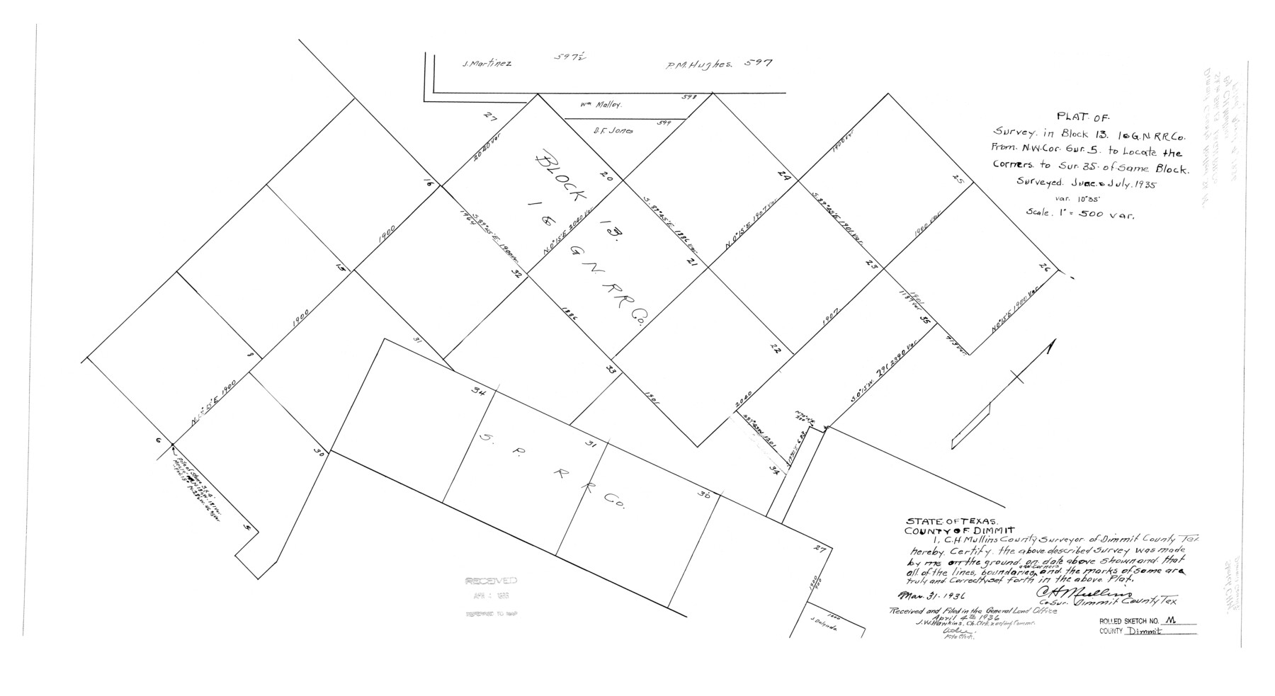
Dimmit County Rolled Sketch M
Plat of survey in Block 13 I. & G. N. R.R. Co. from NW cor. sur. 5 to locate the corners to sur. 35 of same Block
-
Map/Doc
5727
-
Collection
General Map Collection
-
Object Dates
1936/3/31 (Creation Date)
1936/4/4 (File Date)
-
People and Organizations
C.H. Mullins (Surveyor/Engineer)
-
Counties
Dimmit
-
Subjects
Surveying Rolled Sketch
-
Height x Width
21.5 x 39.3 inches
54.6 x 99.8 cm
-
Scale
1" = 500 varas
Part of: General Map Collection
Haskell County Sketch File A

Print $4.00
- Digital $50.00
Haskell County Sketch File A
Size 7.8 x 11.9 inches
Map/Doc 26117
Old Miscellaneous File 36

Print $4.00
- Digital $50.00
Old Miscellaneous File 36
1891
Size 11.3 x 8.8 inches
Map/Doc 75759
Sketch of Robertson Co., Tehuacana Creek

Print $3.00
- Digital $50.00
Sketch of Robertson Co., Tehuacana Creek
1846
Size 10.3 x 16.4 inches
Map/Doc 264
Harris County NRC Article 33.136 Sketch 3

Print $26.00
- Digital $50.00
Harris County NRC Article 33.136 Sketch 3
2001
Size 18.6 x 24.8 inches
Map/Doc 61597
Yoakum County Sketch File 5

Print $10.00
- Digital $50.00
Yoakum County Sketch File 5
1899
Size 14.3 x 9.0 inches
Map/Doc 40733
Leon County Working Sketch 20

Print $20.00
- Digital $50.00
Leon County Working Sketch 20
1963
Size 37.8 x 38.2 inches
Map/Doc 70419
Flight Mission No. CRC-2R, Frame 120, Chambers County

Print $20.00
- Digital $50.00
Flight Mission No. CRC-2R, Frame 120, Chambers County
1956
Size 18.5 x 22.3 inches
Map/Doc 84744
Rio Grande Rectification Project, El Paso and Juarez Valley

Print $20.00
- Digital $50.00
Rio Grande Rectification Project, El Paso and Juarez Valley
1935
Size 10.7 x 29.7 inches
Map/Doc 60863
Lavaca County Sketch File 23

Print $20.00
- Digital $50.00
Lavaca County Sketch File 23
1986
Size 14.0 x 8.6 inches
Map/Doc 29668
Upper Galveston Bay, Houston Ship Channel, Dollar Pt. to Atkinson I.

Print $40.00
- Digital $50.00
Upper Galveston Bay, Houston Ship Channel, Dollar Pt. to Atkinson I.
1978
Size 49.3 x 36.8 inches
Map/Doc 69898
Hidalgo County Working Sketch 2

Print $20.00
- Digital $50.00
Hidalgo County Working Sketch 2
1906
Size 22.0 x 28.0 inches
Map/Doc 66179
General Road Map, Webb County, Texas

Print $40.00
- Digital $50.00
General Road Map, Webb County, Texas
1944
Size 37.1 x 50.0 inches
Map/Doc 10126
You may also like
Kerr County Sketch File 23

Print $8.00
- Digital $50.00
Kerr County Sketch File 23
1959
Size 14.2 x 8.8 inches
Map/Doc 28901
Aransas County NRC Article 33.136 Sketch 17

Print $206.00
- Digital $50.00
Aransas County NRC Article 33.136 Sketch 17
2019
Size 22.4 x 35.8 inches
Map/Doc 96475
The Chief Justice County of Liberty. April 25, 1837

Print $20.00
The Chief Justice County of Liberty. April 25, 1837
2020
Size 20.5 x 21.7 inches
Map/Doc 96055
Callahan County Sketch File 10

Print $40.00
- Digital $50.00
Callahan County Sketch File 10
Size 21.7 x 24.7 inches
Map/Doc 11039
Richardson's New Map of the State of Texas prepared for the Texas Almanac

Print $20.00
- Digital $50.00
Richardson's New Map of the State of Texas prepared for the Texas Almanac
1873
Size 19.8 x 27.1 inches
Map/Doc 96873
Kendall County Working Sketch 11

Print $20.00
- Digital $50.00
Kendall County Working Sketch 11
1954
Size 34.0 x 24.8 inches
Map/Doc 66683
Shackelford County Working Sketch Graphic Index

Print $20.00
- Digital $50.00
Shackelford County Working Sketch Graphic Index
1972
Size 42.2 x 36.1 inches
Map/Doc 76696
Presidio County Rolled Sketch 30

Print $40.00
- Digital $50.00
Presidio County Rolled Sketch 30
Size 40.8 x 84.9 inches
Map/Doc 9767
Upton County Sketch File 11

Print $20.00
- Digital $50.00
Upton County Sketch File 11
1919
Size 22.5 x 27.6 inches
Map/Doc 12511
Red River County Working Sketch 58

Print $40.00
- Digital $50.00
Red River County Working Sketch 58
1972
Size 51.4 x 39.0 inches
Map/Doc 72041
McMullen County Rolled Sketch 22

Print $20.00
- Digital $50.00
McMullen County Rolled Sketch 22
2004
Size 15.3 x 24.6 inches
Map/Doc 88824
Map and Profile of the Denison and Pacific Railway from Denison to Whitesboro

Print $40.00
- Digital $50.00
Map and Profile of the Denison and Pacific Railway from Denison to Whitesboro
1878
Size 42.5 x 57.5 inches
Map/Doc 64284