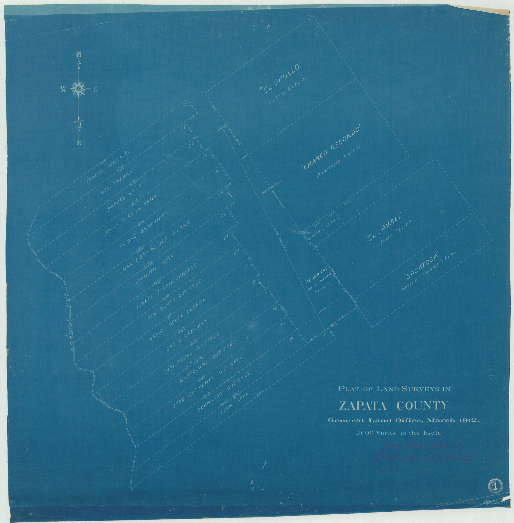
Zapata County Working Sketch 1
-
Map/Doc
62052
-
Collection
General Map Collection
-
Object Dates
3/1912 (Creation Date)
-
Counties
Zapata
-
Subjects
Surveying Working Sketch
-
Height x Width
26.2 x 25.7 inches
66.6 x 65.3 cm
-
Scale
1" = 2000 varas
Part of: General Map Collection
Aransas Pass to Baffin Bay

Print $20.00
- Digital $50.00
Aransas Pass to Baffin Bay
1938
Size 41.6 x 34.5 inches
Map/Doc 73411
Flight Mission No. BRE-2P, Frame 132, Nueces County

Print $20.00
- Digital $50.00
Flight Mission No. BRE-2P, Frame 132, Nueces County
1956
Size 18.4 x 22.5 inches
Map/Doc 86805
Flight Mission No. CRC-2R, Frame 120, Chambers County

Print $20.00
- Digital $50.00
Flight Mission No. CRC-2R, Frame 120, Chambers County
1956
Size 18.5 x 22.3 inches
Map/Doc 84744
Map of Nacogdoches County

Print $20.00
- Digital $50.00
Map of Nacogdoches County
1881
Size 24.1 x 21.5 inches
Map/Doc 3909
Angelina County Working Sketch 6

Print $20.00
- Digital $50.00
Angelina County Working Sketch 6
1914
Size 17.5 x 15.1 inches
Map/Doc 67087

[Surveys along the San Fernando and Santa Gertrudis, San Patricio District]
![290, [Surveys along the San Fernando and Santa Gertrudis, San Patricio District], General Map Collection](https://historictexasmaps.com/wmedia_w700/maps/290.tif.jpg)
Print $20.00
- Digital $50.00
[Surveys along the San Fernando and Santa Gertrudis, San Patricio District]
1847
Size 13.2 x 16.4 inches
Map/Doc 290
Gregg County Rolled Sketch 18

Print $40.00
- Digital $50.00
Gregg County Rolled Sketch 18
1934
Size 71.1 x 46.3 inches
Map/Doc 9068
Flight Mission No. CGI-3N, Frame 106, Cameron County

Print $20.00
- Digital $50.00
Flight Mission No. CGI-3N, Frame 106, Cameron County
1954
Size 18.5 x 22.2 inches
Map/Doc 84586
Hartley County Sketch File 3

Print $20.00
- Digital $50.00
Hartley County Sketch File 3
1883
Size 26.8 x 38.4 inches
Map/Doc 10489
Corpus Christi Bay

Print $20.00
- Digital $50.00
Corpus Christi Bay
1976
Size 36.2 x 47.8 inches
Map/Doc 73476
[Sketch for Mineral Application 33721 - 33725 Incl. - Padre and Mustang Island]
![2869, [Sketch for Mineral Application 33721 - 33725 Incl. - Padre and Mustang Island], General Map Collection](https://historictexasmaps.com/wmedia_w700/maps/2869.tif.jpg)
Print $20.00
- Digital $50.00
[Sketch for Mineral Application 33721 - 33725 Incl. - Padre and Mustang Island]
1942
Size 22.2 x 22.3 inches
Map/Doc 2869
You may also like
Stonewall County Sketch File 31

Print $77.00
- Digital $50.00
Stonewall County Sketch File 31
2001
Size 11.3 x 8.9 inches
Map/Doc 37308
Rio Grande Rectification Project, El Paso and Juarez Valley

Print $20.00
- Digital $50.00
Rio Grande Rectification Project, El Paso and Juarez Valley
1935
Size 10.7 x 29.5 inches
Map/Doc 60869
Cass County Working Sketch 31

Print $20.00
- Digital $50.00
Cass County Working Sketch 31
1981
Size 30.7 x 31.1 inches
Map/Doc 67934
Map of the Texas & Pacific Railway and connections

Print $20.00
- Digital $50.00
Map of the Texas & Pacific Railway and connections
1899
Size 17.9 x 36.6 inches
Map/Doc 95765
Houston County Sketch File 18a

Print $40.00
- Digital $50.00
Houston County Sketch File 18a
Size 12.7 x 15.9 inches
Map/Doc 26783
Concho County Sketch File 45

Print $6.00
- Digital $50.00
Concho County Sketch File 45
1958
Size 11.2 x 8.8 inches
Map/Doc 19210
Montgomery County Sketch File 25

Print $4.00
- Digital $50.00
Montgomery County Sketch File 25
1839
Size 13.8 x 8.2 inches
Map/Doc 31869
[Southeast part of County]
![89956, [Southeast part of County], Twichell Survey Records](https://historictexasmaps.com/wmedia_w700/maps/89956-2.tif.jpg)
Print $40.00
- Digital $50.00
[Southeast part of County]
Size 37.1 x 48.2 inches
Map/Doc 89956
Henderson County Rolled Sketch 11

Print $20.00
- Digital $50.00
Henderson County Rolled Sketch 11
1915
Size 29.0 x 42.6 inches
Map/Doc 76151
[1/4 of a WWI French map of Attigny used by the 142nd Infantry for planning purposes for the Battle of Forest Ferme (farm)]
![96642, [1/4 of a WWI French map of Attigny used by the 142nd Infantry for planning purposes for the Battle of Forest Ferme (farm)], Non-GLO Digital Images](https://historictexasmaps.com/wmedia_w700/maps/96642.tif.jpg)
Print $20.00
[1/4 of a WWI French map of Attigny used by the 142nd Infantry for planning purposes for the Battle of Forest Ferme (farm)]
1918
Size 21.1 x 17.7 inches
Map/Doc 96642
Crockett County Sketch File 51

Print $16.00
- Digital $50.00
Crockett County Sketch File 51
Size 10.1 x 9.1 inches
Map/Doc 19799
Flight Mission No. CRC-2R, Frame 193, Chambers County

Print $20.00
- Digital $50.00
Flight Mission No. CRC-2R, Frame 193, Chambers County
1956
Size 18.9 x 22.5 inches
Map/Doc 84771