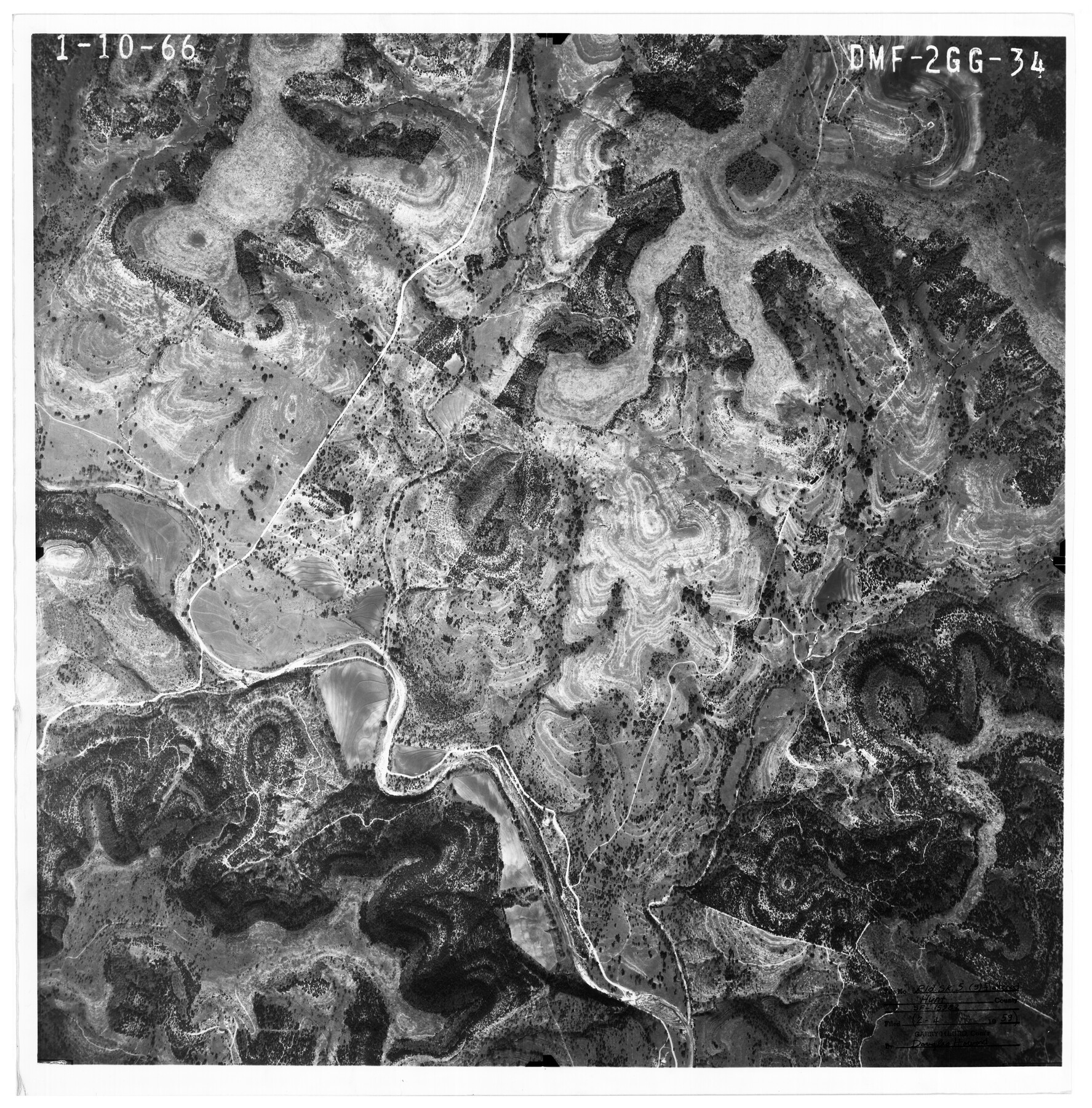
Hunt County Rolled Sketch 5
[Aerial photo relating to SF-15982]
-
Map/Doc
6276
-
Collection
General Map Collection
-
Object Dates
1/10/1966 (Creation Date)
-
Counties
Hunt
-
Subjects
Surveying Rolled Sketch
-
Height x Width
24.6 x 24.2 inches
62.5 x 61.5 cm
-
Medium
photograph
Part of: General Map Collection
Matagorda County Rolled Sketch 38

Print $295.00
- Digital $50.00
Matagorda County Rolled Sketch 38
1984
Size 23.2 x 23.2 inches
Map/Doc 6697
Smith County Working Sketch 10

Print $20.00
- Digital $50.00
Smith County Working Sketch 10
1952
Size 33.4 x 24.2 inches
Map/Doc 63895
Gillespie County Boundary File 7a

Print $40.00
- Digital $50.00
Gillespie County Boundary File 7a
Size 8.7 x 51.2 inches
Map/Doc 53780
Flight Mission No. BQR-16K, Frame 33, Brazoria County

Print $20.00
- Digital $50.00
Flight Mission No. BQR-16K, Frame 33, Brazoria County
1952
Size 18.5 x 22.3 inches
Map/Doc 84100
Erath County Working Sketch 33

Print $20.00
- Digital $50.00
Erath County Working Sketch 33
1972
Size 25.1 x 21.0 inches
Map/Doc 69114
La Salle County Sketch File 13

Print $6.00
- Digital $50.00
La Salle County Sketch File 13
Size 8.1 x 16.6 inches
Map/Doc 29477
Crane County Working Sketch 4

Print $20.00
- Digital $50.00
Crane County Working Sketch 4
Size 24.5 x 18.2 inches
Map/Doc 68281
El Paso County Working Sketch 4

Print $20.00
- Digital $50.00
El Paso County Working Sketch 4
1916
Size 21.4 x 37.3 inches
Map/Doc 69026
Fort Bend County State Real Property Sketch 3

Print $40.00
- Digital $50.00
Fort Bend County State Real Property Sketch 3
1986
Size 34.5 x 43.6 inches
Map/Doc 61677

Pecos County Sketch File 14

Print $20.00
- Digital $50.00
Pecos County Sketch File 14
Size 27.7 x 16.5 inches
Map/Doc 12157
Schleicher County Sketch File 42

Print $40.00
- Digital $50.00
Schleicher County Sketch File 42
1963
Size 16.3 x 14.4 inches
Map/Doc 36546
You may also like
Presidio County Working Sketch 34

Print $20.00
- Digital $50.00
Presidio County Working Sketch 34
1947
Size 41.7 x 37.6 inches
Map/Doc 71711
Flight Mission No. DQN-6K, Frame 11, Calhoun County

Print $20.00
- Digital $50.00
Flight Mission No. DQN-6K, Frame 11, Calhoun County
1953
Size 18.4 x 22.2 inches
Map/Doc 84433
[Surveys in Robertson's Colony]
![78358, [Surveys in Robertson's Colony], General Map Collection](https://historictexasmaps.com/wmedia_w700/maps/78358.tif.jpg)
Print $20.00
- Digital $50.00
[Surveys in Robertson's Colony]
Size 18.6 x 26.5 inches
Map/Doc 78358
Mills County Sketch File 9

Print $20.00
- Digital $50.00
Mills County Sketch File 9
Size 36.0 x 29.5 inches
Map/Doc 10544
Pecos County Rolled Sketch 44A

Print $20.00
- Digital $50.00
Pecos County Rolled Sketch 44A
1912
Size 19.7 x 34.6 inches
Map/Doc 7223
Northern Mexico Campaign of the U.S. - Mexico War

Northern Mexico Campaign of the U.S. - Mexico War
2023
Size 8.5 x 11.0 inches
Map/Doc 97152
Mrs. Don D. Kinnebrew Farm Section 72, Block A

Print $20.00
- Digital $50.00
Mrs. Don D. Kinnebrew Farm Section 72, Block A
Size 15.6 x 18.0 inches
Map/Doc 92290
Culberson County Working Sketch 76
Print $20.00
- Digital $50.00
Culberson County Working Sketch 76
1975
Size 33.4 x 43.1 inches
Map/Doc 68530
Tom Green County Working Sketch 13

Print $20.00
- Digital $50.00
Tom Green County Working Sketch 13
1981
Size 34.3 x 26.4 inches
Map/Doc 69382
Castro County Sketch File 2

Print $20.00
- Digital $50.00
Castro County Sketch File 2
Size 24.7 x 17.7 inches
Map/Doc 11057
[Right of Way Map, Belton Branch of the M.K.&T. RR.]
![64223, [Right of Way Map, Belton Branch of the M.K.&T. RR.], General Map Collection](https://historictexasmaps.com/wmedia_w700/maps/64223.tif.jpg)
Print $20.00
- Digital $50.00
[Right of Way Map, Belton Branch of the M.K.&T. RR.]
1896
Size 21.7 x 7.2 inches
Map/Doc 64223
Val Verde County Rolled Sketch 36

Print $40.00
- Digital $50.00
Val Verde County Rolled Sketch 36
Size 49.6 x 43.7 inches
Map/Doc 10072