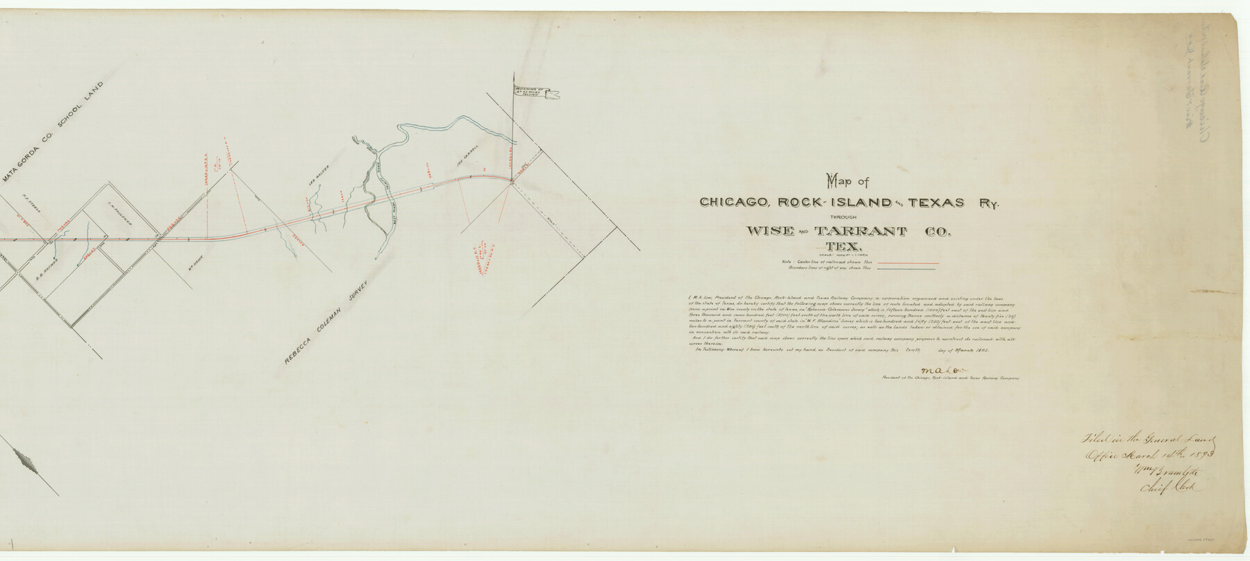
Map of Chicago, Rock Island & Texas Railway through Wise and Tarrant County, Texas
Z-2-112
-
Map/Doc
64429
-
Collection
General Map Collection
-
Object Dates
1893 (Creation Date)
1893/3/14 (File Date)
-
Counties
Tarrant Wise
-
Subjects
Railroads
-
Height x Width
19.6 x 43.7 inches
49.8 x 111.0 cm
-
Medium
linen, manuscript
-
Scale
1000 ft. = 1 in.
-
Comments
Segment 1; see counter no. 64429 for segment 2.
-
Features
CRI&T
West Fork of Trinity River
Part of: General Map Collection
El Paso County Working Sketch 56

Print $40.00
- Digital $50.00
El Paso County Working Sketch 56
1971
Size 65.7 x 43.4 inches
Map/Doc 69078
Palo Pinto County Working Sketch 1

Print $20.00
- Digital $50.00
Palo Pinto County Working Sketch 1
1903
Size 19.0 x 14.6 inches
Map/Doc 71384
Glasscock County Sketch File 2

Print $20.00
- Digital $50.00
Glasscock County Sketch File 2
1931
Size 35.1 x 16.2 inches
Map/Doc 11559
Terrell County Sketch File 41

Print $8.00
- Digital $50.00
Terrell County Sketch File 41
Size 11.3 x 8.8 inches
Map/Doc 38008

Hays County Boundary File 3

Print $20.00
- Digital $50.00
Hays County Boundary File 3
Size 11.2 x 8.8 inches
Map/Doc 54597
Crockett County Rolled Sketch 30

Print $20.00
- Digital $50.00
Crockett County Rolled Sketch 30
1934
Size 24.5 x 43.1 inches
Map/Doc 8700
Map of Galveston, Turtle & East Bays & portions of the Gulf of Mexico in Chambers & Galveston Counties, Texas showing subdivision for mineral development

Print $40.00
- Digital $50.00
Map of Galveston, Turtle & East Bays & portions of the Gulf of Mexico in Chambers & Galveston Counties, Texas showing subdivision for mineral development
1949
Size 48.9 x 54.8 inches
Map/Doc 2977
Burnet County Rolled Sketch 8

Print $40.00
- Digital $50.00
Burnet County Rolled Sketch 8
1971
Size 36.9 x 49.9 inches
Map/Doc 8554
Nolan County Rolled Sketch 1

Print $20.00
- Digital $50.00
Nolan County Rolled Sketch 1
Size 27.8 x 21.5 inches
Map/Doc 6859
Blanco County Sketch File 29

Print $40.00
- Digital $50.00
Blanco County Sketch File 29
1888
Size 14.2 x 13.2 inches
Map/Doc 14625
Blanco County Rolled Sketch 16

Print $20.00
- Digital $50.00
Blanco County Rolled Sketch 16
Size 18.8 x 19.4 inches
Map/Doc 5152
You may also like
Marion County Sketch File 2

Print $4.00
- Digital $50.00
Marion County Sketch File 2
1853
Size 8.3 x 14.2 inches
Map/Doc 30564
Flight Mission No. CRC-2R, Frame 183, Chambers County

Print $20.00
- Digital $50.00
Flight Mission No. CRC-2R, Frame 183, Chambers County
1956
Size 18.7 x 22.3 inches
Map/Doc 84761
Orange County Working Sketch 47

Print $20.00
- Digital $50.00
Orange County Working Sketch 47
1987
Size 27.5 x 26.5 inches
Map/Doc 71379
Real County Working Sketch 38

Print $20.00
- Digital $50.00
Real County Working Sketch 38
1951
Size 34.0 x 37.9 inches
Map/Doc 71930
Knox County Working Sketch 17

Print $20.00
- Digital $50.00
Knox County Working Sketch 17
1967
Size 36.8 x 27.1 inches
Map/Doc 70259
La Salle County Working Sketch 39

Print $20.00
- Digital $50.00
La Salle County Working Sketch 39
1963
Size 30.4 x 25.4 inches
Map/Doc 70340
Coleman County Working Sketch 15

Print $20.00
- Digital $50.00
Coleman County Working Sketch 15
1952
Size 24.3 x 18.1 inches
Map/Doc 68081
Connected Map of Austin's Colony

Print $20.00
- Digital $50.00
Connected Map of Austin's Colony
1892
Size 46.9 x 43.5 inches
Map/Doc 76076
General Highway Map. Detail of Cities and Towns in Milam County, Texas [Rockdale and Cameron and vicinities]
![79598, General Highway Map. Detail of Cities and Towns in Milam County, Texas [Rockdale and Cameron and vicinities], Texas State Library and Archives](https://historictexasmaps.com/wmedia_w700/maps/79598.tif.jpg)
Print $20.00
General Highway Map. Detail of Cities and Towns in Milam County, Texas [Rockdale and Cameron and vicinities]
1961
Size 18.1 x 24.6 inches
Map/Doc 79598
Stonewall County Boundary File 3a

Print $68.00
- Digital $50.00
Stonewall County Boundary File 3a
Size 14.4 x 9.0 inches
Map/Doc 58970
Map of Terry County

Print $20.00
- Digital $50.00
Map of Terry County
Size 26.5 x 27.8 inches
Map/Doc 92908
Ward County Rolled Sketch 24A

Print $20.00
- Digital $50.00
Ward County Rolled Sketch 24A
Size 19.9 x 42.3 inches
Map/Doc 8164