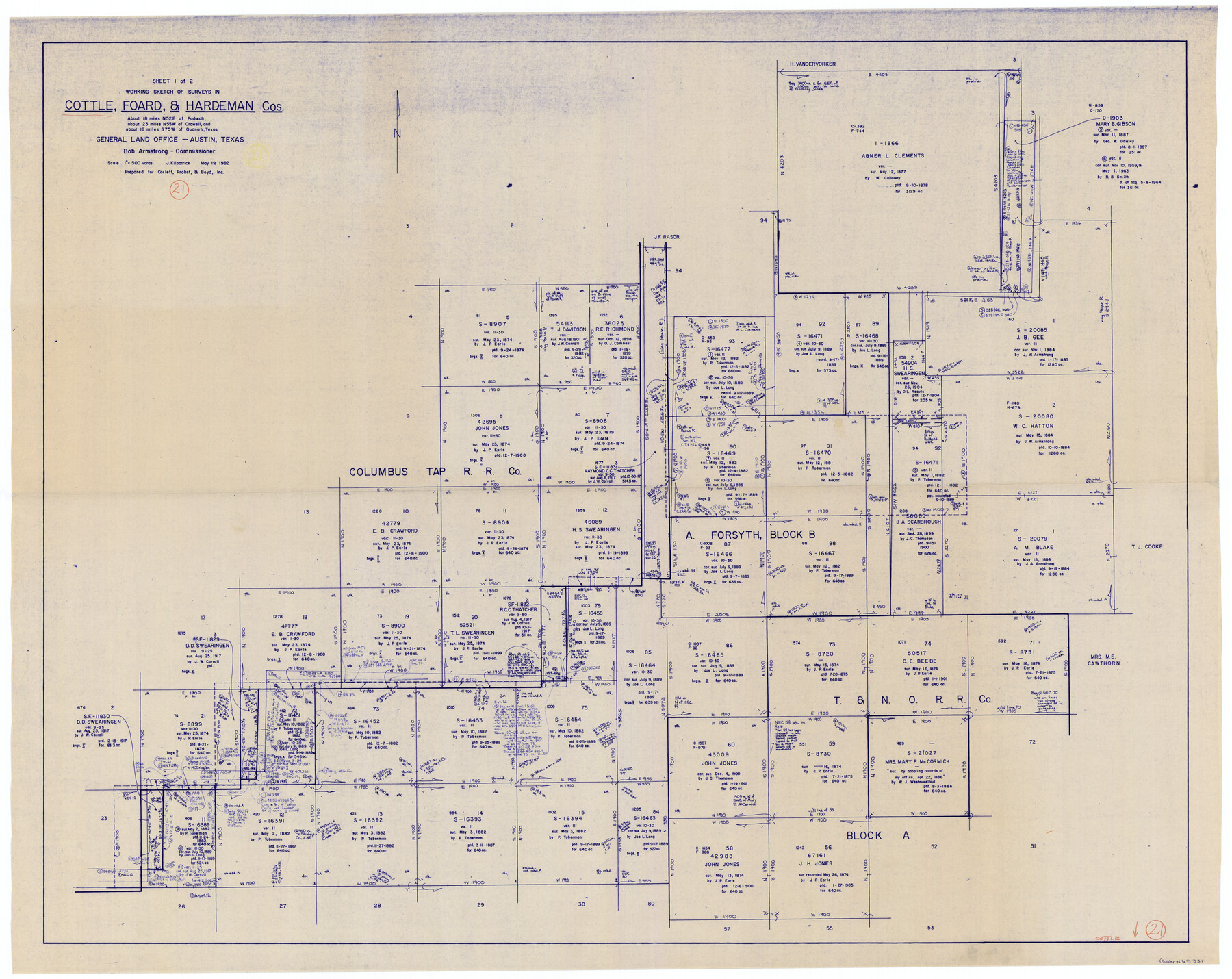
Cottle County Working Sketch 21
-
Map/Doc
68331
-
Collection
General Map Collection
-
Object Dates
5/19/1982 (Creation Date)
-
People and Organizations
Joan Kilpatrick (Draftsman)
-
Counties
Cottle Foard Hardeman
-
Subjects
Surveying Working Sketch
-
Height x Width
37.0 x 46.6 inches
94.0 x 118.4 cm
-
Scale
1" = 500 varas
Part of: General Map Collection
Harris County Working Sketch 100

Print $20.00
- Digital $50.00
Harris County Working Sketch 100
1979
Size 29.9 x 31.3 inches
Map/Doc 65992
Crosby County Sketch File 21

Print $6.00
- Digital $50.00
Crosby County Sketch File 21
Size 13.8 x 8.8 inches
Map/Doc 20087
Liberty County Rolled Sketch Q

Print $20.00
- Digital $50.00
Liberty County Rolled Sketch Q
1890
Size 31.7 x 25.1 inches
Map/Doc 6625
Parmer County Sketch File 2

Print $26.00
- Digital $50.00
Parmer County Sketch File 2
1903
Size 7.2 x 8.7 inches
Map/Doc 33626
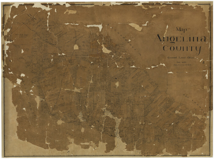
Map of Angelina County
Print $40.00
- Digital $50.00
Map of Angelina County
1899
Size 39.1 x 52.3 inches
Map/Doc 4777
Flight Mission No. DQN-2K, Frame 22, Calhoun County

Print $20.00
- Digital $50.00
Flight Mission No. DQN-2K, Frame 22, Calhoun County
1953
Size 16.9 x 18.9 inches
Map/Doc 84229
Terrell County Working Sketch 80

Print $20.00
- Digital $50.00
Terrell County Working Sketch 80
1985
Size 20.7 x 36.4 inches
Map/Doc 69601
Flight Mission No. BQY-4M, Frame 58, Harris County

Print $20.00
- Digital $50.00
Flight Mission No. BQY-4M, Frame 58, Harris County
1953
Size 18.5 x 22.3 inches
Map/Doc 85267

Bosque County Sketch File 19

Print $4.00
- Digital $50.00
Bosque County Sketch File 19
1863
Size 12.9 x 6.2 inches
Map/Doc 14794
Crockett County Sketch File 98

Print $8.00
- Digital $50.00
Crockett County Sketch File 98
1925
Size 12.5 x 8.9 inches
Map/Doc 19976
Flight Mission No. BRE-2P, Frame 81, Nueces County

Print $20.00
- Digital $50.00
Flight Mission No. BRE-2P, Frame 81, Nueces County
1956
Size 18.6 x 22.5 inches
Map/Doc 86776
You may also like
Medina County Working Sketch 19

Print $20.00
- Digital $50.00
Medina County Working Sketch 19
1980
Size 19.4 x 29.1 inches
Map/Doc 70934
Ile de la Réunion, Colonie Française (Océan indien)

Print $20.00
- Digital $50.00
Ile de la Réunion, Colonie Française (Océan indien)
Size 14.5 x 20.5 inches
Map/Doc 94451
Topographical Map for Commerce of Dallas, Texas

Print $20.00
- Digital $50.00
Topographical Map for Commerce of Dallas, Texas
1890
Size 26.3 x 20.6 inches
Map/Doc 96792
Nueces County NRC Article 33.136 Sketch 25

Print $36.00
Nueces County NRC Article 33.136 Sketch 25
2025
Map/Doc 97513
Flight Mission No. BRA-9M, Frame 78, Jefferson County

Print $20.00
- Digital $50.00
Flight Mission No. BRA-9M, Frame 78, Jefferson County
1953
Size 18.5 x 22.5 inches
Map/Doc 85661
General Highway Map, Glasscock County, Texas

Print $20.00
General Highway Map, Glasscock County, Texas
1961
Size 18.2 x 24.8 inches
Map/Doc 79480
Bowie County Sketch File 7

Print $40.00
- Digital $50.00
Bowie County Sketch File 7
1927
Size 18.0 x 35.5 inches
Map/Doc 10943
Upton County Rolled Sketch JSP

Print $40.00
- Digital $50.00
Upton County Rolled Sketch JSP
1937
Size 39.2 x 68.0 inches
Map/Doc 10042
Gonzales County Sketch File 11

Print $4.00
- Digital $50.00
Gonzales County Sketch File 11
1842
Size 12.8 x 7.9 inches
Map/Doc 24392
Hudspeth County Working Sketch 2

Print $20.00
- Digital $50.00
Hudspeth County Working Sketch 2
1912
Size 22.3 x 17.7 inches
Map/Doc 66283
Floyd County Sketch File 14

Print $10.00
- Digital $50.00
Floyd County Sketch File 14
1913
Size 11.3 x 8.7 inches
Map/Doc 22731
Edwards County Working Sketch 77

Print $20.00
- Digital $50.00
Edwards County Working Sketch 77
1960
Size 32.8 x 39.9 inches
Map/Doc 68953