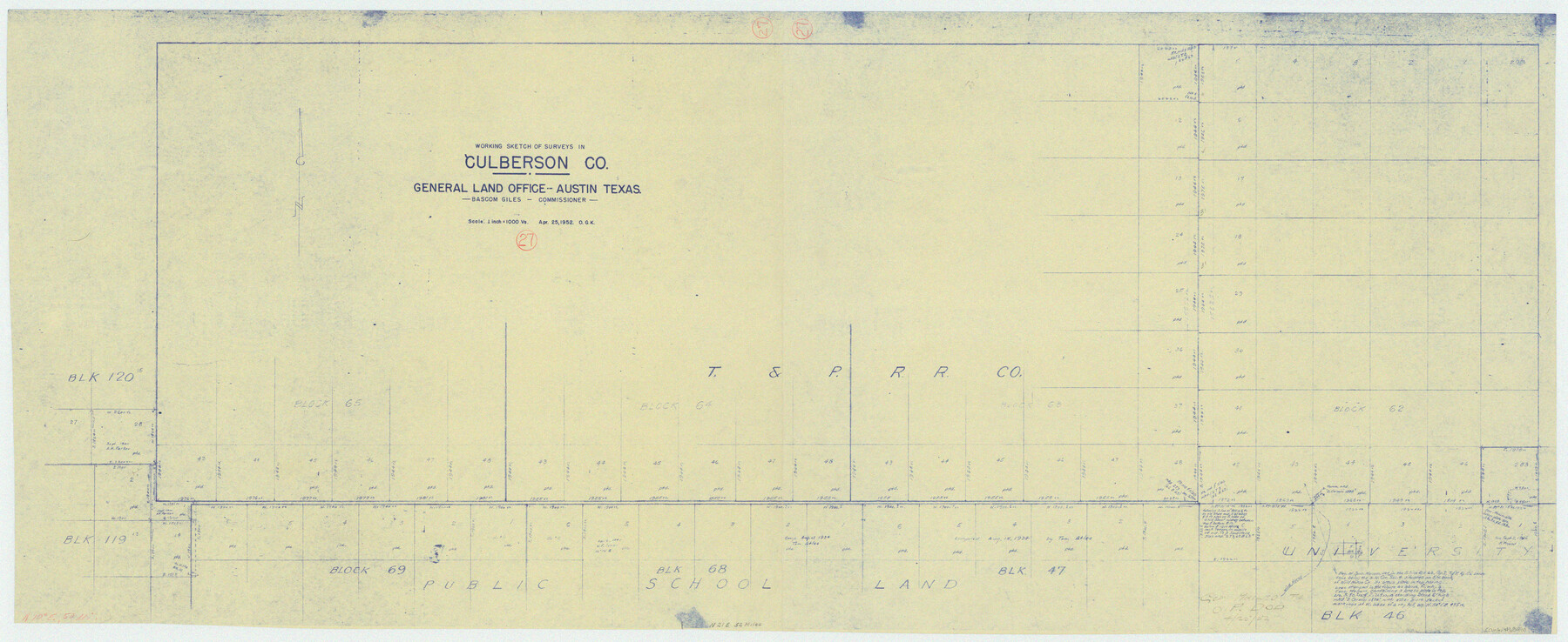
Culberson County Working Sketch 27
-
Map/Doc
68480
-
Collection
General Map Collection
-
Object Dates
4/25/1952 (Creation Date)
-
People and Organizations
Otto G. Kurio (Draftsman)
-
Counties
Culberson
-
Subjects
Surveying Working Sketch
-
Height x Width
22.2 x 53.4 inches
56.4 x 135.6 cm
-
Scale
1" = 1000 varas
Part of: General Map Collection
Webb County Working Sketch 39

Print $20.00
- Digital $50.00
Webb County Working Sketch 39
1941
Size 22.9 x 17.2 inches
Map/Doc 72404
Culberson County Rolled Sketch 41

Print $88.00
- Digital $50.00
Culberson County Rolled Sketch 41
1944
Size 57.5 x 46.0 inches
Map/Doc 8752
Collin County Sketch File 12

Print $40.00
- Digital $50.00
Collin County Sketch File 12
1851
Size 24.3 x 31.3 inches
Map/Doc 11127
Duval County Boundary File 6

Print $18.00
- Digital $50.00
Duval County Boundary File 6
Size 5.0 x 7.3 inches
Map/Doc 52771
Map of Hemisfair '68 and Downtown San Antonio compliments of the Pearl Brewing Company

Print $3.00
- Digital $50.00
Map of Hemisfair '68 and Downtown San Antonio compliments of the Pearl Brewing Company
1968
Size 6.0 x 11.3 inches
Map/Doc 94793
Flight Mission No. CGI-3N, Frame 72, Cameron County

Print $20.00
- Digital $50.00
Flight Mission No. CGI-3N, Frame 72, Cameron County
1954
Size 18.5 x 22.3 inches
Map/Doc 84566
Jim Wells County Working Sketch 4

Print $20.00
- Digital $50.00
Jim Wells County Working Sketch 4
1938
Size 44.1 x 32.8 inches
Map/Doc 66602
Kleberg County Rolled Sketch 10-17

Print $20.00
- Digital $50.00
Kleberg County Rolled Sketch 10-17
1951
Size 38.1 x 32.0 inches
Map/Doc 9390
El Paso County Rolled Sketch 40

Print $20.00
- Digital $50.00
El Paso County Rolled Sketch 40
1930
Size 11.6 x 16.8 inches
Map/Doc 5826
Morris County Working Sketch 4

Print $20.00
- Digital $50.00
Morris County Working Sketch 4
1959
Size 35.2 x 23.8 inches
Map/Doc 71203
Bee County Working Sketch 11

Print $20.00
- Digital $50.00
Bee County Working Sketch 11
1942
Size 19.8 x 24.4 inches
Map/Doc 67261
East Part of Edwards County

Print $40.00
- Digital $50.00
East Part of Edwards County
1975
Size 56.3 x 41.1 inches
Map/Doc 95488
You may also like
The Chief Justice County of Milam. Lands in Conflict with Bexar County

Print $20.00
The Chief Justice County of Milam. Lands in Conflict with Bexar County
2020
Size 16.8 x 21.7 inches
Map/Doc 96060
[Part of Block 3, Leagues 83, 84, 95, 96, 104, 105, 116-113, 127-132, 140-142]
![90572, [Part of Block 3, Leagues 83, 84, 95, 96, 104, 105, 116-113, 127-132, 140-142], Twichell Survey Records](https://historictexasmaps.com/wmedia_w700/maps/90572-1.tif.jpg)
Print $20.00
- Digital $50.00
[Part of Block 3, Leagues 83, 84, 95, 96, 104, 105, 116-113, 127-132, 140-142]
Size 25.9 x 31.6 inches
Map/Doc 90572
Jefferson County Rolled Sketch 30

Print $20.00
- Digital $50.00
Jefferson County Rolled Sketch 30
1954
Size 34.1 x 39.9 inches
Map/Doc 6392
Terrell County Working Sketch Graphic Index - sheet A

Print $20.00
- Digital $50.00
Terrell County Working Sketch Graphic Index - sheet A
1931
Size 47.9 x 39.2 inches
Map/Doc 76710
Gulf Intracoastal Waterway, Tex. - Aransas Bay to Corpus Christi Bay - Modified Route of Main Channel/Dredging

Print $20.00
- Digital $50.00
Gulf Intracoastal Waterway, Tex. - Aransas Bay to Corpus Christi Bay - Modified Route of Main Channel/Dredging
1958
Size 31.0 x 42.8 inches
Map/Doc 61893
Uvalde County Sketch File 17

Print $20.00
- Digital $50.00
Uvalde County Sketch File 17
1882
Size 17.5 x 17.9 inches
Map/Doc 12531

Panola County Sketch File 4

Print $4.00
- Digital $50.00
Panola County Sketch File 4
1860
Size 8.9 x 8.9 inches
Map/Doc 33449
Fort Bend County Sketch File 18 1/2

Print $20.00
- Digital $50.00
Fort Bend County Sketch File 18 1/2
1896
Size 18.3 x 15.3 inches
Map/Doc 11508
Blanco County Working Sketch 14

Print $20.00
- Digital $50.00
Blanco County Working Sketch 14
1948
Size 36.2 x 28.8 inches
Map/Doc 67374
Flight Mission No. DCL-6C, Frame 28, Kenedy County

Print $20.00
- Digital $50.00
Flight Mission No. DCL-6C, Frame 28, Kenedy County
1943
Size 18.7 x 22.4 inches
Map/Doc 85885
Floyd County Working Sketch 2

Print $20.00
- Digital $50.00
Floyd County Working Sketch 2
1911
Size 41.0 x 24.8 inches
Map/Doc 69181