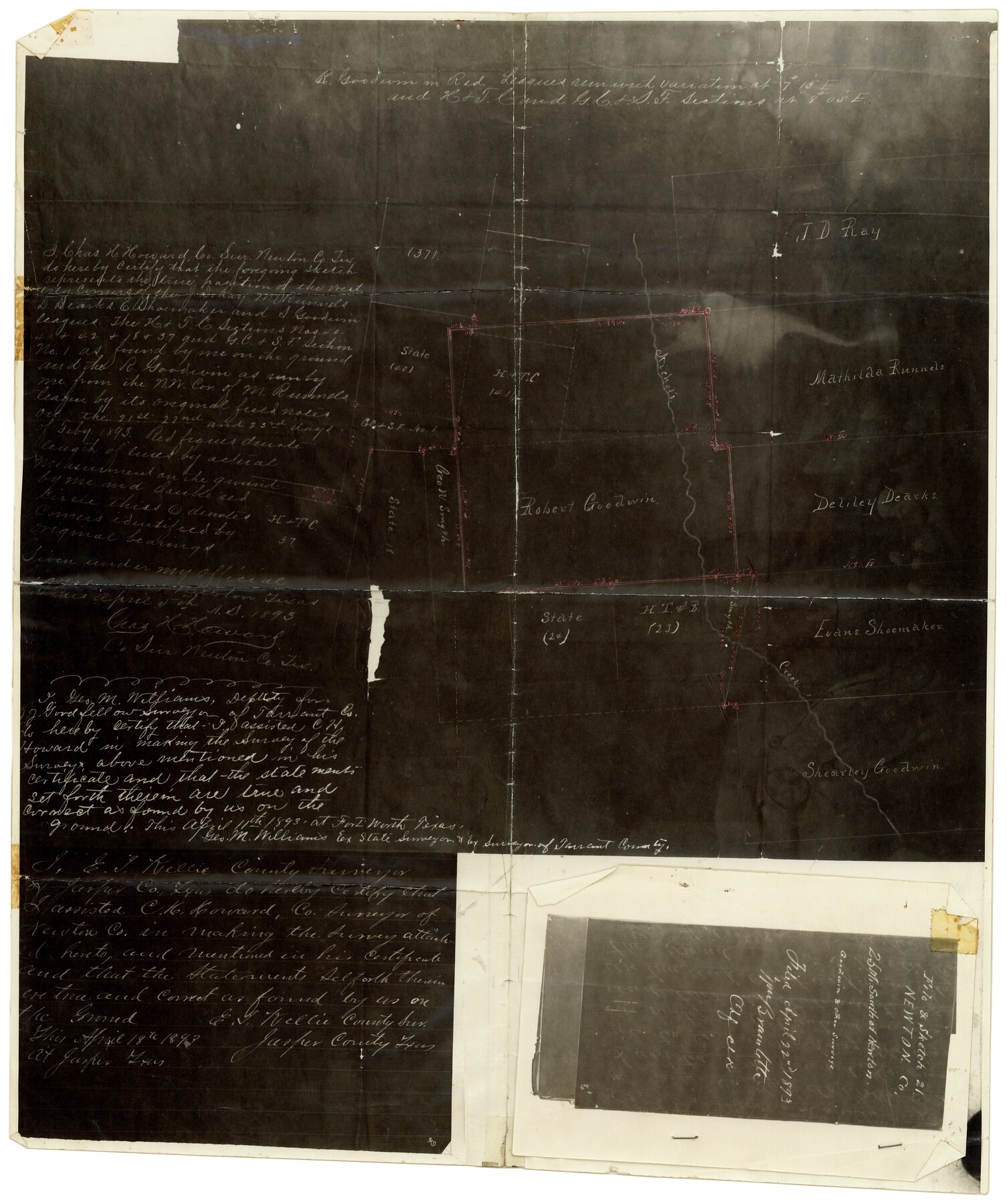
Newton County Rolled Sketch 23
[Photostat of sketch showing surveys in the vicinity of Nichols Creek]
-
Map/Doc
6850
-
Collection
General Map Collection
-
Object Dates
4/11/1893 (Creation Date)
6/4/1958 (File Date)
-
People and Organizations
Chas. H. Howard (Surveyor/Engineer)
Geo. M. Williams (Surveyor/Engineer)
-
Counties
Newton
-
Subjects
Surveying Rolled Sketch
-
Height x Width
22.7 x 18.5 inches
57.7 x 47.0 cm
-
Medium
photostat
Part of: General Map Collection
Flight Mission No. CLL-1N, Frame 198, Willacy County

Print $20.00
- Digital $50.00
Flight Mission No. CLL-1N, Frame 198, Willacy County
1954
Size 18.4 x 22.1 inches
Map/Doc 87068
Bandera County Rolled Sketch 1

Print $20.00
- Digital $50.00
Bandera County Rolled Sketch 1
1945
Size 16.5 x 16.0 inches
Map/Doc 5113
Sterling County Boundary File 1

Print $56.00
- Digital $50.00
Sterling County Boundary File 1
Size 9.0 x 8.7 inches
Map/Doc 58919
Crockett County Sketch File 12

Print $20.00
- Digital $50.00
Crockett County Sketch File 12
Size 26.8 x 18.9 inches
Map/Doc 11216
Orange County NRC Article 33.136 Sketch 6

Print $42.00
Orange County NRC Article 33.136 Sketch 6
2025
Map/Doc 97430

Flight Mission No. DQO-7K, Frame 104, Galveston County

Print $20.00
- Digital $50.00
Flight Mission No. DQO-7K, Frame 104, Galveston County
1952
Size 18.7 x 22.4 inches
Map/Doc 85119
Pecos County Rolled Sketch 155

Print $40.00
- Digital $50.00
Pecos County Rolled Sketch 155
Size 65.1 x 44.8 inches
Map/Doc 9737
Hutchinson County Rolled Sketch 37A

Print $40.00
- Digital $50.00
Hutchinson County Rolled Sketch 37A
1950
Size 26.0 x 51.1 inches
Map/Doc 9247
Motley County Sketch File 18 (N)

Print $4.00
- Digital $50.00
Motley County Sketch File 18 (N)
1913
Size 11.3 x 8.7 inches
Map/Doc 32062
Nolan County Sketch File 1

Print $48.00
- Digital $50.00
Nolan County Sketch File 1
1890
Size 14.1 x 8.5 inches
Map/Doc 32470
Sutton County Sketch File 3

Print $8.00
- Digital $50.00
Sutton County Sketch File 3
Size 12.9 x 8.5 inches
Map/Doc 37353
You may also like
Knox County Working Sketch 4

Print $20.00
- Digital $50.00
Knox County Working Sketch 4
1919
Size 18.0 x 25.6 inches
Map/Doc 70246
King County Working Sketch 1

Print $20.00
- Digital $50.00
King County Working Sketch 1
1913
Size 18.2 x 23.8 inches
Map/Doc 70165
Flight Mission No. BRA-6M, Frame 151, Jefferson County

Print $20.00
- Digital $50.00
Flight Mission No. BRA-6M, Frame 151, Jefferson County
1953
Size 18.6 x 22.1 inches
Map/Doc 85452
Hood County Working Sketch 24

Print $20.00
- Digital $50.00
Hood County Working Sketch 24
1993
Size 36.2 x 37.4 inches
Map/Doc 66218
Red River County Working Sketch 18

Print $20.00
- Digital $50.00
Red River County Working Sketch 18
1955
Size 31.1 x 34.3 inches
Map/Doc 72001

Fort Bend County Rolled Sketch B

Print $20.00
- Digital $50.00
Fort Bend County Rolled Sketch B
Size 20.4 x 28.9 inches
Map/Doc 5904
McMullen County Sketch File 19

Print $4.00
- Digital $50.00
McMullen County Sketch File 19
Size 12.8 x 8.1 inches
Map/Doc 31371

[Ft. W. & R. G. Ry. Right of Way Map, Chapin to Bluffdale, Hood County, Texas]
![64643, [Ft. W. & R. G. Ry. Right of Way Map, Chapin to Bluffdale, Hood County, Texas], General Map Collection](https://historictexasmaps.com/wmedia_w700/maps/64643.tif.jpg)
Print $40.00
- Digital $50.00
[Ft. W. & R. G. Ry. Right of Way Map, Chapin to Bluffdale, Hood County, Texas]
1918
Size 38.8 x 120.3 inches
Map/Doc 64643
Flight Mission No. DCL-7C, Frame 18, Kenedy County

Print $20.00
- Digital $50.00
Flight Mission No. DCL-7C, Frame 18, Kenedy County
1943
Size 15.4 x 15.2 inches
Map/Doc 86010
Travis County

Print $40.00
- Digital $50.00
Travis County
1880
Size 59.0 x 70.2 inches
Map/Doc 16902