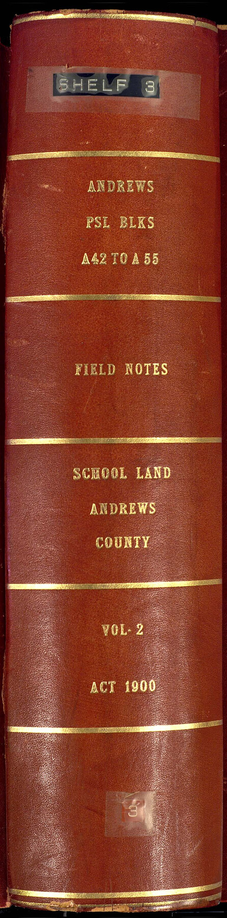
PSL Field Notes for Blocks A42 through A55 in Andrews County
Field Notes, School Land, Andrews County, Vol. 2, PSL Blocks A42 to A55
-
Map/Doc
81644
-
Collection
General Map Collection
-
People and Organizations
Charles Rogan (GLO Commissioner)
Frank Lupton (Surveyor/Engineer)
Joseph W. Luchini (Surveyor/Engineer)
T.O. Wallis (Surveyor/Engineer)
Robt. E. Estes (Surveyor/Engineer)
D. Boone (Surveyor/Engineer)
R.T. Bucy (Surveyor/Engineer)
Kenneth E. Esmond (Surveyor/Engineer)
-
Counties
Andrews
-
Subjects
Bound Volume Public School Land
-
Medium
paper, bound volume
-
Comments
See 97176 for an index to the Public School Land field note volumes.
Related maps
Public School Land Field Note Volume Index

Public School Land Field Note Volume Index
2023
Size 8.5 x 11.0 inches
Map/Doc 97176
Part of: General Map Collection
Hutchinson County Working Sketch 13

Print $20.00
- Digital $50.00
Hutchinson County Working Sketch 13
1926
Size 22.6 x 31.5 inches
Map/Doc 66371
Tarrant County Working Sketch 12

Print $20.00
- Digital $50.00
Tarrant County Working Sketch 12
1986
Size 30.8 x 23.4 inches
Map/Doc 62429
Sutton County Rolled Sketch 64

Print $20.00
- Digital $50.00
Sutton County Rolled Sketch 64
1975
Size 17.9 x 19.6 inches
Map/Doc 7899
Llano County Working Sketch 5

Print $20.00
- Digital $50.00
Llano County Working Sketch 5
1961
Size 43.1 x 34.4 inches
Map/Doc 70623
Grimes County Working Sketch 9

Print $20.00
- Digital $50.00
Grimes County Working Sketch 9
1977
Size 20.1 x 30.3 inches
Map/Doc 63300
Travis County Rolled Sketch 29

Print $20.00
- Digital $50.00
Travis County Rolled Sketch 29
1946
Size 25.1 x 37.8 inches
Map/Doc 8031
El Paso County Rolled Sketch 52

Print $20.00
- Digital $50.00
El Paso County Rolled Sketch 52
1929
Size 19.1 x 24.3 inches
Map/Doc 5850
Duval County Sketch File 19

Print $4.00
- Digital $50.00
Duval County Sketch File 19
1880
Size 10.3 x 8.2 inches
Map/Doc 21316
Wilson County Rolled Sketch 2

Print $20.00
- Digital $50.00
Wilson County Rolled Sketch 2
1941
Size 30.4 x 26.1 inches
Map/Doc 8368
East Part of Brewster Co.

Print $40.00
- Digital $50.00
East Part of Brewster Co.
1952
Size 48.7 x 29.6 inches
Map/Doc 66734
Trinity County Sketch File 30

Print $8.00
- Digital $50.00
Trinity County Sketch File 30
1891
Size 14.2 x 8.9 inches
Map/Doc 38566
Montague County Working Sketch 2

Print $20.00
- Digital $50.00
Montague County Working Sketch 2
1923
Size 14.4 x 19.9 inches
Map/Doc 71068
You may also like
Terry County Sketch File 11

Print $20.00
- Digital $50.00
Terry County Sketch File 11
Size 10.9 x 43.2 inches
Map/Doc 10395
Sabine Pass and Lake

Print $20.00
- Digital $50.00
Sabine Pass and Lake
1961
Size 46.7 x 28.1 inches
Map/Doc 69824
Liberty County Rolled Sketch A

Print $20.00
- Digital $50.00
Liberty County Rolled Sketch A
1919
Size 31.8 x 35.9 inches
Map/Doc 9569
Pecos County Working Sketch 2

Print $20.00
- Digital $50.00
Pecos County Working Sketch 2
Size 18.1 x 28.3 inches
Map/Doc 71472
Hartley County Working Sketch 4

Print $20.00
- Digital $50.00
Hartley County Working Sketch 4
1934
Size 23.9 x 30.6 inches
Map/Doc 66054
Jones County Sketch File 7

Print $20.00
- Digital $50.00
Jones County Sketch File 7
Size 12.5 x 27.5 inches
Map/Doc 11897
Zapata County Rolled Sketch 12 1/2

Print $40.00
- Digital $50.00
Zapata County Rolled Sketch 12 1/2
1917
Size 53.1 x 38.8 inches
Map/Doc 10167
Tarrant County, Texas

Print $20.00
- Digital $50.00
Tarrant County, Texas
1870
Size 24.1 x 19.1 inches
Map/Doc 758
Rockwall County Working Sketch 4

Print $20.00
- Digital $50.00
Rockwall County Working Sketch 4
1966
Size 34.9 x 28.9 inches
Map/Doc 63596
Pecos County Working Sketch 30

Print $20.00
- Digital $50.00
Pecos County Working Sketch 30
1936
Size 27.9 x 27.4 inches
Map/Doc 71502
La Salle County Sketch File 30

Print $22.00
- Digital $50.00
La Salle County Sketch File 30
1880
Size 12.6 x 8.2 inches
Map/Doc 29565
Flight Mission No. CGI-3N, Frame 43, Cameron County

Print $20.00
- Digital $50.00
Flight Mission No. CGI-3N, Frame 43, Cameron County
1954
Size 18.5 x 22.1 inches
Map/Doc 84549