University Land Field Notes for Blocks 12, 13, and 14 in Andrews County, and Block 11 in Andrews and Winkler Counties
University Field Notes
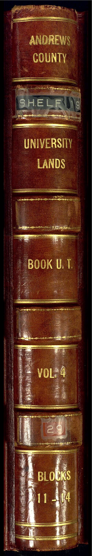
Andrews County University Lands Book U.T., Vol. 4, Blocks 11-14
-
Map/Doc
81711
-
Collection
General Map Collection
-
People and Organizations
Dennis Corwin (Surveyor/Engineer)
J.H. Walker (GLO Commissioner)
Frank F. Friend (Surveyor/Engineer)
-
Counties
Andrews
-
Subjects
Bound Volume University Land
-
Medium
paper, bound volume
-
Comments
See 97177 for an index to the University Land field note volumes.
Related maps
University Land Field Note Volume Index

University Land Field Note Volume Index
2023
Size 8.5 x 11.0 inches
Map/Doc 97177
Part of: General Map Collection
Right of Way and Track Map, the Missouri, Kansas and Texas Ry. of Texas operated by the Missouri, Kansas and Texas Ry. of Texas, San Antonio Division

Print $40.00
- Digital $50.00
Right of Way and Track Map, the Missouri, Kansas and Texas Ry. of Texas operated by the Missouri, Kansas and Texas Ry. of Texas, San Antonio Division
1918
Size 25.2 x 58.8 inches
Map/Doc 64584
Starr County Rolled Sketch 10

Print $20.00
- Digital $50.00
Starr County Rolled Sketch 10
1912
Size 15.2 x 24.0 inches
Map/Doc 7797
Flight Mission No. CGI-3N, Frame 95, Cameron County

Print $20.00
- Digital $50.00
Flight Mission No. CGI-3N, Frame 95, Cameron County
1954
Size 18.7 x 22.3 inches
Map/Doc 84575
Tarrant County Boundary File 4 and 4a

Print $14.00
- Digital $50.00
Tarrant County Boundary File 4 and 4a
Size 11.5 x 8.9 inches
Map/Doc 59154
Fort Bend County Sketch File 5

Print $4.00
- Digital $50.00
Fort Bend County Sketch File 5
Size 8.2 x 13.0 inches
Map/Doc 22889
Hartley County Boundary File 4

Print $56.00
- Digital $50.00
Hartley County Boundary File 4
Size 8.6 x 20.7 inches
Map/Doc 54495
Randall County Rolled Sketch 3

Print $20.00
- Digital $50.00
Randall County Rolled Sketch 3
Size 22.0 x 24.9 inches
Map/Doc 7423
Amistad International Reservoir on Rio Grande 90

Print $20.00
- Digital $50.00
Amistad International Reservoir on Rio Grande 90
1950
Size 28.5 x 39.7 inches
Map/Doc 75520
Matagorda County Boundary File 101

Print $10.00
- Digital $50.00
Matagorda County Boundary File 101
Size 8.9 x 7.4 inches
Map/Doc 56896
Supreme Court of the United States, October Term, 1923, No. 15, Original - The State of Oklahoma, Complainant vs. The State of Texas, Defendant, The United States, Intervener; Report of the Boundary Commissioners

Print $20.00
- Digital $50.00
Supreme Court of the United States, October Term, 1923, No. 15, Original - The State of Oklahoma, Complainant vs. The State of Texas, Defendant, The United States, Intervener; Report of the Boundary Commissioners
1923
Size 33.9 x 36.8 inches
Map/Doc 75134
Edwards County

Print $20.00
- Digital $50.00
Edwards County
1883
Size 28.2 x 17.9 inches
Map/Doc 3505
Flight Mission No. CUG-1P, Frame 162, Kleberg County

Print $20.00
- Digital $50.00
Flight Mission No. CUG-1P, Frame 162, Kleberg County
1956
Size 18.7 x 22.2 inches
Map/Doc 86169
You may also like
Texas Official Highway Travel Map

Digital $50.00
Texas Official Highway Travel Map
1975
Size 27.2 x 36.2 inches
Map/Doc 94312
Williamson County Sketch File 32

Print $6.00
- Digital $50.00
Williamson County Sketch File 32
1986
Size 11.3 x 8.5 inches
Map/Doc 40393
Williamson County Sketch File 19

Print $24.00
- Digital $50.00
Williamson County Sketch File 19
Size 12.8 x 8.0 inches
Map/Doc 40345
Harris County Rolled Sketch HI

Print $20.00
- Digital $50.00
Harris County Rolled Sketch HI
1922
Size 30.9 x 42.0 inches
Map/Doc 9117
Plat Showing Block Z, W. D. and F. W. Johnson Subdivision, Bailey County, Texas

Print $20.00
- Digital $50.00
Plat Showing Block Z, W. D. and F. W. Johnson Subdivision, Bailey County, Texas
1955
Size 24.3 x 15.7 inches
Map/Doc 92538
[Surveys in Chambers County, along East Bay Bayou and Elm Bayou]
![69752, [Surveys in Chambers County, along East Bay Bayou and Elm Bayou], General Map Collection](https://historictexasmaps.com/wmedia_w700/maps/69752.tif.jpg)
Print $2.00
- Digital $50.00
[Surveys in Chambers County, along East Bay Bayou and Elm Bayou]
1847
Size 7.5 x 9.3 inches
Map/Doc 69752
Lampasas County Sketch File 9a

Print $4.00
- Digital $50.00
Lampasas County Sketch File 9a
1872
Size 12.8 x 8.0 inches
Map/Doc 29410
[Block M24, Surveys 1-8 and vicinity]
![91231, [Block M24, Surveys 1-8 and vicinity], Twichell Survey Records](https://historictexasmaps.com/wmedia_w700/maps/91231-1.tif.jpg)
Print $20.00
- Digital $50.00
[Block M24, Surveys 1-8 and vicinity]
1909
Size 16.4 x 18.2 inches
Map/Doc 91231
[Leagues 444, 445, 447, 426 1/2, 464-469, Gregg County School Land Leagues 1 and 2, part of Block B]
![91554, [Leagues 444, 445, 447, 426 1/2, 464-469, Gregg County School Land Leagues 1 and 2, part of Block B], Twichell Survey Records](https://historictexasmaps.com/wmedia_w700/maps/91554-1.tif.jpg)
Print $20.00
- Digital $50.00
[Leagues 444, 445, 447, 426 1/2, 464-469, Gregg County School Land Leagues 1 and 2, part of Block B]
Size 13.4 x 14.0 inches
Map/Doc 91554
Hutchinson County, 1922

Print $20.00
- Digital $50.00
Hutchinson County, 1922
1922
Size 36.4 x 43.7 inches
Map/Doc 89700
Boundary and Ownership map, Laguna Atascosa National Wildlife Refuge, Cameron and Willacy Counties, Texas

Print $40.00
- Digital $50.00
Boundary and Ownership map, Laguna Atascosa National Wildlife Refuge, Cameron and Willacy Counties, Texas
Size 72.7 x 43.0 inches
Map/Doc 60396
Potter County Sketch File 2

Print $20.00
- Digital $50.00
Potter County Sketch File 2
1887
Size 29.3 x 39.4 inches
Map/Doc 10573