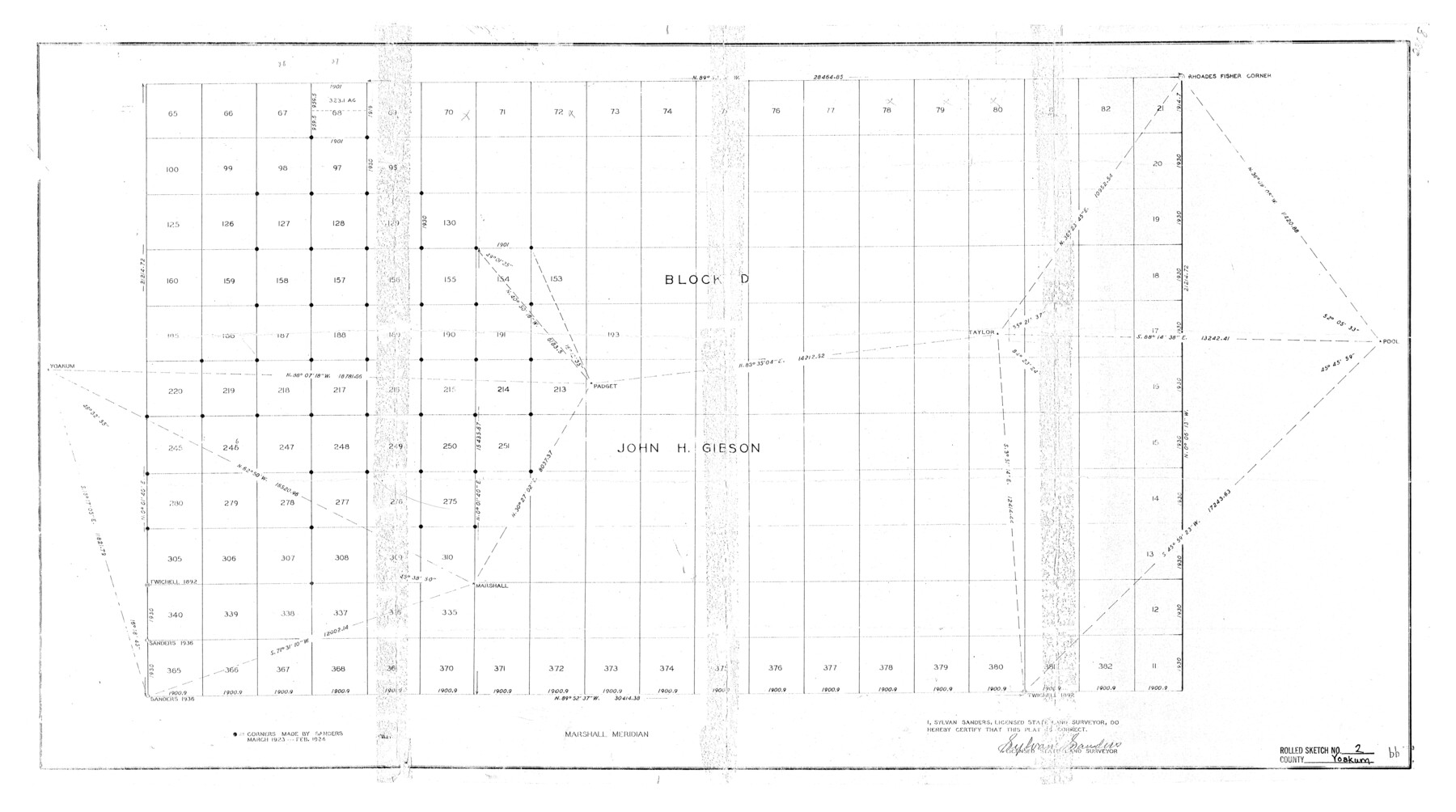
Yoakum County Rolled Sketch 2
[North part of John Gibson Block D]
- 
                          Map/Doc8288
- 
                            CollectionGeneral Map Collection
- 
                            Object Dates1943/2/24 (Creation Date)1943/4/5 (File Date)
- 
                            People and OrganizationsSylvan Sanders (Surveyor/Engineer)
- 
                            CountiesYoakum
- 
                            SubjectsSurveying Rolled Sketch
- 
                            Height x Width18.6 x 33.4 inches47.2 x 84.8 cm
Part of: General Map Collection
            Little River, Buckholts Sheet


                                            Print $4.00                    
                                             -                         Digital $50.00                                    
                Little River, Buckholts Sheet
1936
Size 30.0 x 24.2 inches
                                Map/Doc 65065
            
            [F. W. & D. C. Ry. Co. Alignment and Right of Way Map, Clay County]
            
                                    ![64734, [F. W. & D. C. Ry. Co. Alignment and Right of Way Map, Clay County], General Map Collection](https://historictexasmaps.com/wmedia_w700/maps/64734-GC.tif.jpg) 


    ![64734, [F. W. & D. C. Ry. Co. Alignment and Right of Way Map, Clay County], General Map Collection](https://historictexasmaps.com/wmedia_w700/maps/64734-GC.tif.jpg) 
                                
            
                                            Print $20.00                    
                                             -                         Digital $50.00                                    
                [F. W. & D. C. Ry. Co. Alignment and Right of Way Map, Clay County]
1927
Size 18.6 x 11.8 inches
                                Map/Doc 64734
            
            Arroyo Colorado, Rio Hondo Sheet


                                            Print $40.00                    
                                             -                         Digital $50.00                                    
                Arroyo Colorado, Rio Hondo Sheet
1929
Size 35.0 x 52.6 inches
                                Map/Doc 65129
            
            Val Verde County Rolled Sketch 74


                                            Print $20.00                    
                                             -                         Digital $50.00                                    
                Val Verde County Rolled Sketch 74
Size 18.9 x 19.5 inches
                                Map/Doc 8137
            
            Brewster County Rolled Sketch 122


                                            Print $20.00                    
                                             -                         Digital $50.00                                    
                Brewster County Rolled Sketch 122
1974
Size 31.9 x 24.6 inches
                                Map/Doc 5298
            
            Deaf Smith County Working Sketch 3


                                            Print $40.00                    
                                             -                         Digital $50.00                                    
                Deaf Smith County Working Sketch 3
1951
Size 61.4 x 22.3 inches
                                Map/Doc 68643
            
            Map of Stephens County


                                            Print $20.00                    
                                             -                         Digital $50.00                                    
                Map of Stephens County
1897
Size 42.8 x 37.5 inches
                                Map/Doc 78394
            
            Flight Mission No. DCL-4C, Frame 70, Kenedy County


                                            Print $20.00                    
                                             -                         Digital $50.00                                    
                Flight Mission No. DCL-4C, Frame 70, Kenedy County
1943
Size 18.7 x 22.4 inches
                                Map/Doc 85815
            
            Jeff Davis County Rolled Sketch 29


                                            Print $20.00                    
                                             -                         Digital $50.00                                    
                Jeff Davis County Rolled Sketch 29
Size 40.4 x 27.2 inches
                                Map/Doc 6377
            
            Clay County Boundary File 9


                                            Print $8.00                    
                                             -                         Digital $50.00                                    
                Clay County Boundary File 9
Size 7.7 x 8.2 inches
                                Map/Doc 51393
            
            [Right of Way & Track Map, The Texas & Pacific Ry. Co. Main Line]
            
                                    ![64659, [Right of Way & Track Map, The Texas & Pacific Ry. Co. Main Line], General Map Collection](https://historictexasmaps.com/wmedia_w700/maps/64659.tif.jpg) 


    ![64659, [Right of Way & Track Map, The Texas & Pacific Ry. Co. Main Line], General Map Collection](https://historictexasmaps.com/wmedia_w700/maps/64659.tif.jpg) 
                                
            
                                            Print $20.00                    
                                             -                         Digital $50.00                                    
                [Right of Way & Track Map, The Texas & Pacific Ry. Co. Main Line]
Size 11.0 x 18.4 inches
                                Map/Doc 64659
            
            Montgomery County


                                            Print $20.00                    
                                             -                         Digital $50.00                                    
                Montgomery County
1901
Size 42.2 x 47.4 inches
                                Map/Doc 66939
            You may also like
            Flight Mission No. BRA-16M, Frame 145, Jefferson County


                                            Print $20.00                    
                                             -                         Digital $50.00                                    
                Flight Mission No. BRA-16M, Frame 145, Jefferson County
1953
Size 18.7 x 22.3 inches
                                Map/Doc 85751
            
            [Northwest Garza Co., E. J. Powell surveys and vicinity]
            
                                    ![90852, [Northwest Garza Co., E. J. Powell surveys and vicinity], Twichell Survey Records](https://historictexasmaps.com/wmedia_w700/maps/90852-2.tif.jpg) 


    ![90852, [Northwest Garza Co., E. J. Powell surveys and vicinity], Twichell Survey Records](https://historictexasmaps.com/wmedia_w700/maps/90852-2.tif.jpg) 
                                
            
                                            Print $2.00                    
                                             -                         Digital $50.00                                    
                [Northwest Garza Co., E. J. Powell surveys and vicinity]
Size 8.9 x 14.2 inches
                                Map/Doc 90852
            
            Right of Way and Track Map of The Missouri, Kansas & Texas Railway of Texas


                                            Print $40.00                    
                                             -                         Digital $50.00                                    
                Right of Way and Track Map of The Missouri, Kansas & Texas Railway of Texas
1918
Size 24.4 x 50.7 inches
                                Map/Doc 64538
            
            Brazos River, Harlem-Imperial Farms Project


                                            Print $4.00                    
                                             -                         Digital $50.00                                    
                Brazos River, Harlem-Imperial Farms Project
1931
Size 29.4 x 26.6 inches
                                Map/Doc 65285
            
            Mapa de los Estados Unidos de Méjico, Segun lo organizado y definido por las varias actas del Congreso de dicha Republica: y construido por las mejores autoridades


                                            Print $20.00                    
                                    
                Mapa de los Estados Unidos de Méjico, Segun lo organizado y definido por las varias actas del Congreso de dicha Republica: y construido por las mejores autoridades
1846
Size 30.8 x 42.4 inches
                                Map/Doc 79727
            
            Plains, Yoakum County, Texas


                                            Print $20.00                    
                                             -                         Digital $50.00                                    
                Plains, Yoakum County, Texas
Size 41.0 x 43.6 inches
                                Map/Doc 89907
            
            Carta Historica y Arqueologica


                                            Print $20.00                    
                                             -                         Digital $50.00                                    
                Carta Historica y Arqueologica
Size 26.0 x 34.4 inches
                                Map/Doc 96806
            
            McMullen County Working Sketch 24


                                            Print $20.00                    
                                             -                         Digital $50.00                                    
                McMullen County Working Sketch 24
1950
Size 31.5 x 31.0 inches
                                Map/Doc 70725
            
            Map of the post of Fort Brown, Brownsville, Texas


                                            Print $20.00                    
                                    
                Map of the post of Fort Brown, Brownsville, Texas
1877
Size 24.0 x 33.9 inches
                                Map/Doc 93560
            
            Potter County


                                            Print $20.00                    
                                             -                         Digital $50.00                                    
                Potter County
1909
Size 45.3 x 40.6 inches
                                Map/Doc 16790
            
            Nueces County Rolled Sketch 92


                                            Print $222.00                    
                                    
                Nueces County Rolled Sketch 92
1983
Size 24.6 x 43.7 inches
                                Map/Doc 7028
             
                        