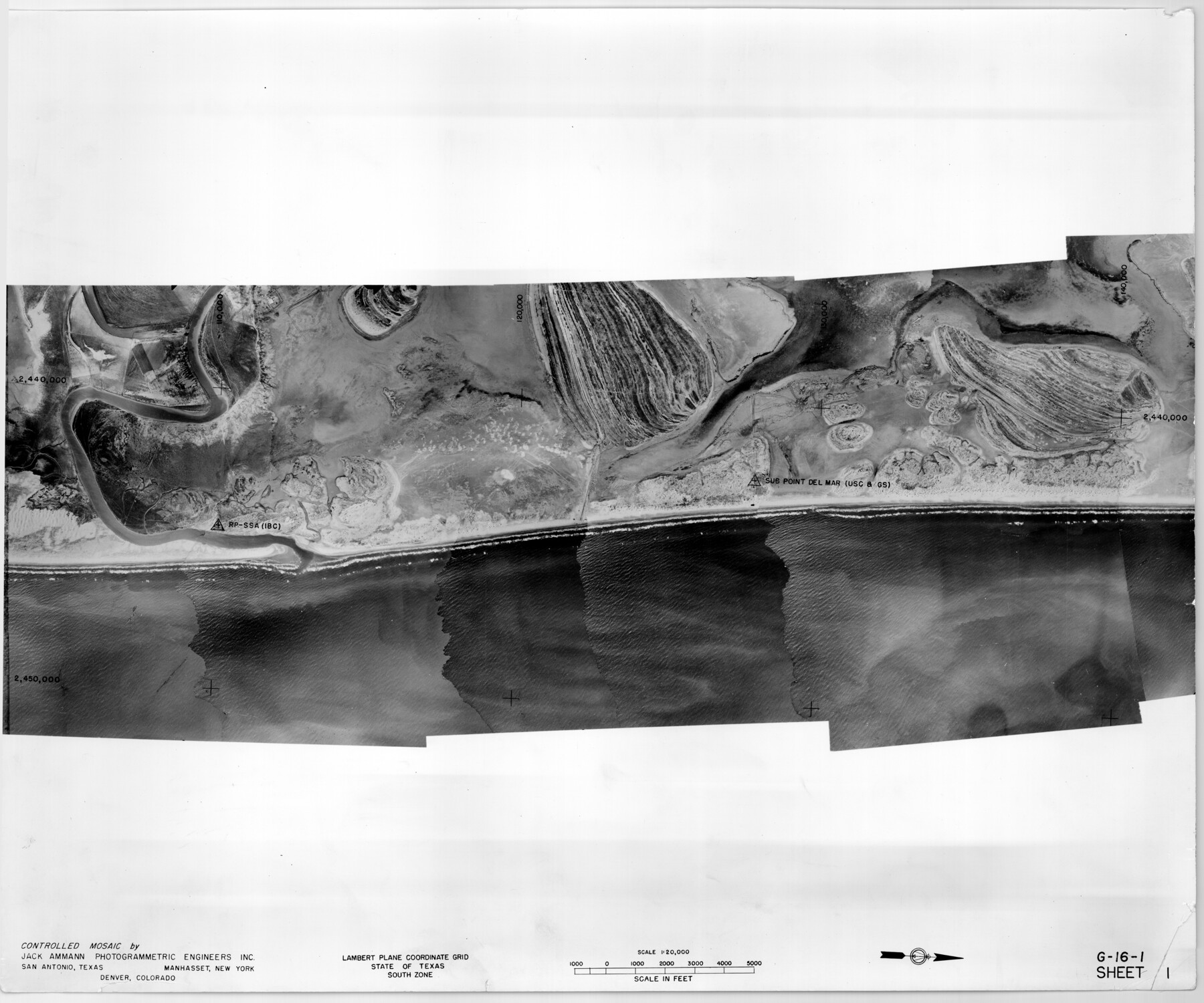
Controlled Mosaic by Jack Amman Photogrammetric Engineers, Inc - Sheet 1
[Coastal Aerial Photograph]
G-16-1
-
Map/Doc
83445
-
Collection
General Map Collection
-
Object Dates
1954 (Creation Date)
-
Subjects
Aerial Photograph
-
Height x Width
20.0 x 24.0 inches
50.8 x 61.0 cm
-
Comments
Statement on reverse side: "The reverse reflects the data shown thereon which was obtained by aerial survey made from December 31, 1953 to March 17, 1954 by Jack Ammann Photogrammetric Engineers, Inc."
Part of: General Map Collection
Flight Mission No. CUG-2P, Frame 82, Kleberg County

Print $20.00
- Digital $50.00
Flight Mission No. CUG-2P, Frame 82, Kleberg County
1956
Size 18.5 x 22.3 inches
Map/Doc 86214
Colorado River, Sandy Creek Sheet

Print $6.00
- Digital $50.00
Colorado River, Sandy Creek Sheet
1941
Size 27.5 x 30.7 inches
Map/Doc 65319

Map of Wheeler County

Print $20.00
- Digital $50.00
Map of Wheeler County
1899
Size 40.1 x 32.7 inches
Map/Doc 63120
Flight Mission No. CLL-3N, Frame 34, Willacy County

Print $20.00
- Digital $50.00
Flight Mission No. CLL-3N, Frame 34, Willacy County
1954
Size 18.6 x 22.2 inches
Map/Doc 87092
Grayson County Boundary File 4a

Print $24.00
- Digital $50.00
Grayson County Boundary File 4a
Size 10.0 x 42.7 inches
Map/Doc 53956
Maps of Gulf Intracoastal Waterway, Texas - Sabine River to the Rio Grande and connecting waterways including ship channels

Print $20.00
- Digital $50.00
Maps of Gulf Intracoastal Waterway, Texas - Sabine River to the Rio Grande and connecting waterways including ship channels
1966
Size 14.5 x 22.2 inches
Map/Doc 61963
Flight Mission No. DQO-12K, Frame 38, Galveston County

Print $20.00
- Digital $50.00
Flight Mission No. DQO-12K, Frame 38, Galveston County
1952
Size 18.8 x 22.5 inches
Map/Doc 85229
Harris County Boundary File 39 (11)

Print $8.00
- Digital $50.00
Harris County Boundary File 39 (11)
Size 12.8 x 8.0 inches
Map/Doc 54335
Map of Hamilton County

Print $20.00
- Digital $50.00
Map of Hamilton County
1872
Size 15.0 x 21.9 inches
Map/Doc 4557
Blanco County Sketch File 22

Print $4.00
- Digital $50.00
Blanco County Sketch File 22
1884
Size 8.7 x 15.5 inches
Map/Doc 14604
Roberts County Rolled Sketch 2

Print $20.00
- Digital $50.00
Roberts County Rolled Sketch 2
Size 25.8 x 29.4 inches
Map/Doc 7511
You may also like
Kimble County Sketch File 12

Print $5.00
- Digital $50.00
Kimble County Sketch File 12
Size 10.7 x 10.5 inches
Map/Doc 28935

Flight Mission No. BRE-1P, Frame 123, Nueces County

Print $20.00
- Digital $50.00
Flight Mission No. BRE-1P, Frame 123, Nueces County
1956
Size 18.6 x 22.7 inches
Map/Doc 86689

Township 1 South Range 12 West, South Western District, Louisiana

Print $20.00
- Digital $50.00
Township 1 South Range 12 West, South Western District, Louisiana
1884
Size 19.5 x 24.7 inches
Map/Doc 65880

Edwards County Rolled Sketch 22

Print $20.00
- Digital $50.00
Edwards County Rolled Sketch 22
1951
Size 46.0 x 25.4 inches
Map/Doc 8845

Concho County Rolled Sketch 9

Print $20.00
- Digital $50.00
Concho County Rolled Sketch 9
1956
Size 18.9 x 14.0 inches
Map/Doc 5547
Menard County Rolled Sketch 6

Print $20.00
- Digital $50.00
Menard County Rolled Sketch 6
Size 17.3 x 21.2 inches
Map/Doc 6755
Pecos County Rolled Sketch 82

Print $20.00
- Digital $50.00
Pecos County Rolled Sketch 82
1930
Size 29.6 x 27.1 inches
Map/Doc 8371
Val Verde County

Print $20.00
- Digital $50.00
Val Verde County
1944
Size 40.8 x 37.7 inches
Map/Doc 78448