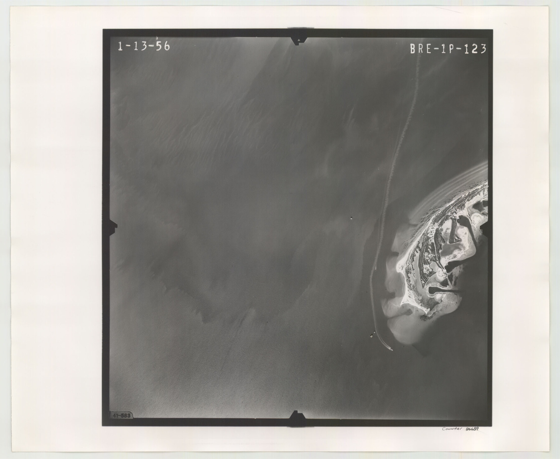
Flight Mission No. BRE-1P, Frame 123, Nueces County
BRE-1P-123
-
Map/Doc
86689
-
Collection
General Map Collection
-
Object Dates
1956/1/13 (Creation Date)
-
People and Organizations
U. S. Department of Agriculture (Publisher)
-
Counties
Nueces
-
Subjects
Aerial Photograph
-
Height x Width
18.6 x 22.7 inches
47.2 x 57.7 cm
-
Comments
Flown by V. L. Beavers and Associates of San Antonio, Texas.
Part of: General Map Collection
Bosque County Working Sketch 20

Print $20.00
- Digital $50.00
Bosque County Working Sketch 20
1976
Size 37.4 x 32.8 inches
Map/Doc 67453
Smith County Rolled Sketch 6E1

Print $20.00
- Digital $50.00
Smith County Rolled Sketch 6E1
1966
Size 27.4 x 22.7 inches
Map/Doc 10612
Colorado County Working Sketch 23

Print $20.00
- Digital $50.00
Colorado County Working Sketch 23
1967
Size 38.0 x 32.9 inches
Map/Doc 68123
Amistad International Reservoir on Rio Grande 88

Print $20.00
- Digital $50.00
Amistad International Reservoir on Rio Grande 88
1949
Size 28.5 x 40.2 inches
Map/Doc 75517
Trinity County Sketch File 18 1/2

Print $4.00
- Digital $50.00
Trinity County Sketch File 18 1/2
1876
Size 9.0 x 11.2 inches
Map/Doc 38548
Bee County Boundary File 6

Print $4.00
- Digital $50.00
Bee County Boundary File 6
Size 10.4 x 7.9 inches
Map/Doc 50458
Val Verde County Sketch File Z3

Print $12.00
- Digital $50.00
Val Verde County Sketch File Z3
Size 8.8 x 7.8 inches
Map/Doc 39131
W. Alvin Lloyd's Southern Rail-Road Map

Print $20.00
- Digital $50.00
W. Alvin Lloyd's Southern Rail-Road Map
1863
Size 18.4 x 23.7 inches
Map/Doc 97496
Chambers County Sketch File 4a

Print $19.00
- Digital $50.00
Chambers County Sketch File 4a
1839
Size 11.4 x 17.8 inches
Map/Doc 17523
Brewster County Rolled Sketch 49A

Print $20.00
- Digital $50.00
Brewster County Rolled Sketch 49A
1930
Size 23.5 x 29.6 inches
Map/Doc 5224
Hardeman County Sketch File 29

Print $20.00
- Digital $50.00
Hardeman County Sketch File 29
1890
Size 12.9 x 8.2 inches
Map/Doc 25056
Rains County Sketch File 6

Print $4.00
- Digital $50.00
Rains County Sketch File 6
Size 8.0 x 9.1 inches
Map/Doc 34954
You may also like
Shelby County Rolled Sketch 5

Print $20.00
- Digital $50.00
Shelby County Rolled Sketch 5
1942
Size 37.9 x 43.7 inches
Map/Doc 9921
Map of Chicago, Rock Island & Texas Railway through Montague and Wise Counties, Texas

Print $40.00
- Digital $50.00
Map of Chicago, Rock Island & Texas Railway through Montague and Wise Counties, Texas
1893
Size 20.2 x 124.5 inches
Map/Doc 64468
Hardin County Working Sketch 9

Print $20.00
- Digital $50.00
Hardin County Working Sketch 9
1928
Size 21.7 x 21.1 inches
Map/Doc 63407
Flight Mission No. BQY-4M, Frame 70, Harris County

Print $20.00
- Digital $50.00
Flight Mission No. BQY-4M, Frame 70, Harris County
1953
Size 18.7 x 22.4 inches
Map/Doc 85279
Wise County Working Sketch 12

Print $20.00
- Digital $50.00
Wise County Working Sketch 12
1958
Size 23.0 x 29.6 inches
Map/Doc 72626
San Saba County Sketch File 3

Print $4.00
- Digital $50.00
San Saba County Sketch File 3
1848
Size 12.5 x 7.9 inches
Map/Doc 36408
Webb County Sketch File 57

Print $20.00
- Digital $50.00
Webb County Sketch File 57
1942
Size 34.0 x 17.7 inches
Map/Doc 12652
Eastland County Working Sketch 59

Print $20.00
- Digital $50.00
Eastland County Working Sketch 59
1987
Size 19.7 x 37.9 inches
Map/Doc 68840
Montgomery County Working Sketch 24

Print $40.00
- Digital $50.00
Montgomery County Working Sketch 24
1941
Size 35.8 x 52.5 inches
Map/Doc 71131
A Map of the United States of Mexico as organized and defined by the several Acts of the Congress of that Republic

Print $20.00
A Map of the United States of Mexico as organized and defined by the several Acts of the Congress of that Republic
1826
Size 23.2 x 28.9 inches
Map/Doc 93635
[Right of Way & Track Map, The Texas & Pacific Ry. Co. Main Line]
![64674, [Right of Way & Track Map, The Texas & Pacific Ry. Co. Main Line], General Map Collection](https://historictexasmaps.com/wmedia_w700/maps/64674.tif.jpg)
Print $20.00
- Digital $50.00
[Right of Way & Track Map, The Texas & Pacific Ry. Co. Main Line]
Size 11.1 x 18.6 inches
Map/Doc 64674
Plat showing surveys made for N. Vasquez, Sr. of Casa Piedra, Texas in Block 312, T. C. Ry. Co.

Print $20.00
- Digital $50.00
Plat showing surveys made for N. Vasquez, Sr. of Casa Piedra, Texas in Block 312, T. C. Ry. Co.
1947
Size 16.5 x 22.3 inches
Map/Doc 2062