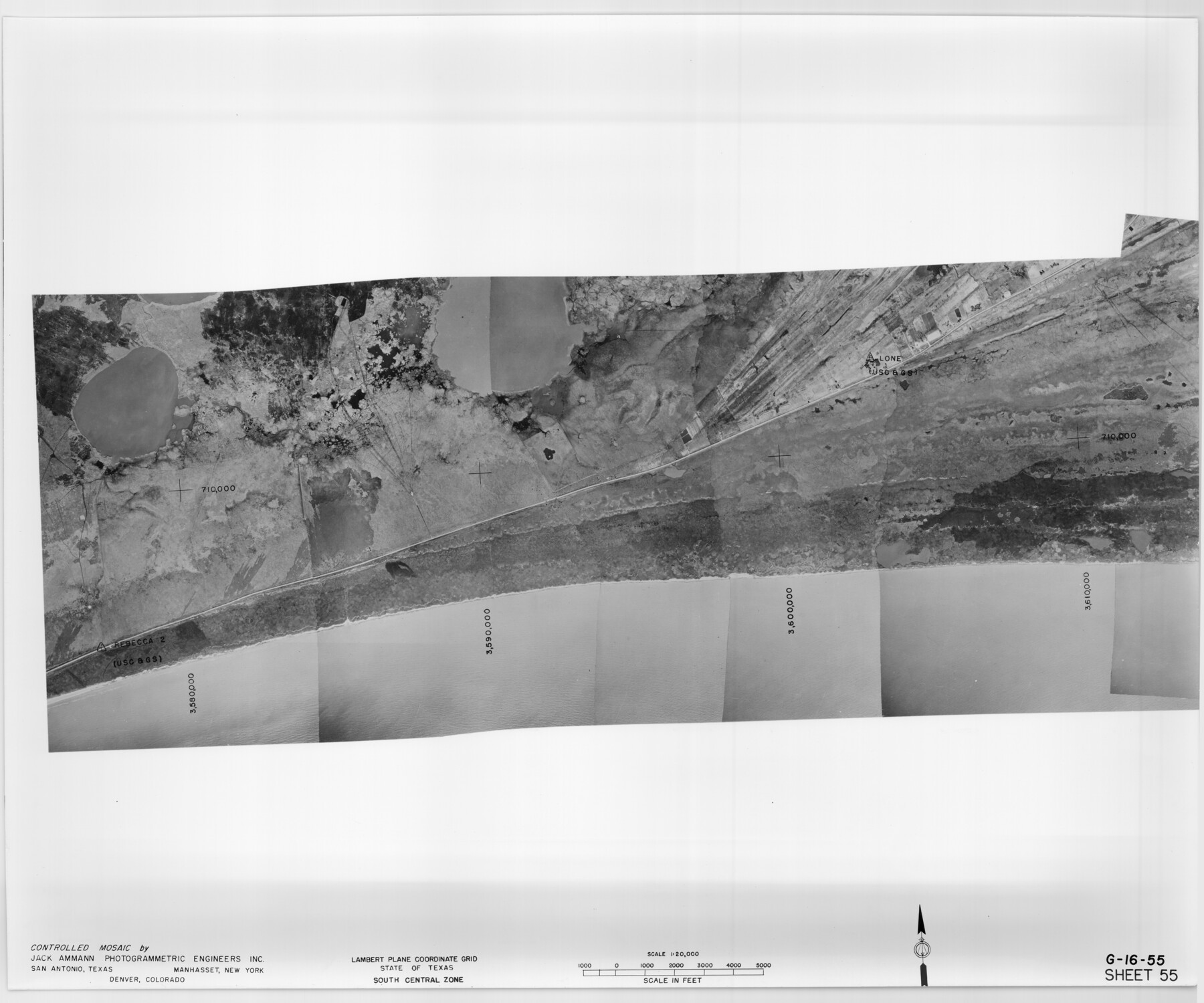
Controlled Mosaic by Jack Amman Photogrammetric Engineers, Inc - Sheet 55
[Coastal Aerial Photograph]
G-16-55
-
Map/Doc
83514
-
Collection
General Map Collection
-
Object Dates
1954 (Creation Date)
-
Subjects
Aerial Photograph
-
Height x Width
20.0 x 24.0 inches
50.8 x 61.0 cm
-
Comments
Statement on reverse side: "The reverse reflects the data shown thereon which was obtained by aerial survey made from December 31, 1953 to March 17, 1954 by Jack Ammann Photogrammetric Engineers, Inc."
Part of: General Map Collection
Harbor of Brazos Santiago, Texas

Print $20.00
- Digital $50.00
Harbor of Brazos Santiago, Texas
1887
Size 27.1 x 18.1 inches
Map/Doc 72991
Jeff Davis County Sketch File 18a

Print $14.00
- Digital $50.00
Jeff Davis County Sketch File 18a
Size 9.3 x 6.0 inches
Map/Doc 27966
Kinney County Working Sketch 59

Print $20.00
- Digital $50.00
Kinney County Working Sketch 59
1999
Size 19.9 x 24.8 inches
Map/Doc 70241
Nueces County Working Sketch 9

Print $20.00
- Digital $50.00
Nueces County Working Sketch 9
1977
Size 36.1 x 24.1 inches
Map/Doc 71311
Shackelford County Working Sketch 4

Print $20.00
- Digital $50.00
Shackelford County Working Sketch 4
1935
Size 24.8 x 36.7 inches
Map/Doc 63844
Hutchinson County Sketch File 1

Print $22.00
- Digital $50.00
Hutchinson County Sketch File 1
Size 8.9 x 7.8 inches
Map/Doc 27172
Duval County Working Sketch 25

Print $20.00
- Digital $50.00
Duval County Working Sketch 25
1946
Size 23.7 x 20.1 inches
Map/Doc 68749
Right of Way and Track Map, Dayton-Goose Creek Ry. Co., Station 401+20 to Station 612+40

Print $40.00
- Digital $50.00
Right of Way and Track Map, Dayton-Goose Creek Ry. Co., Station 401+20 to Station 612+40
1917
Size 25.4 x 56.4 inches
Map/Doc 64367
Val Verde County Sketch File 19a

Print $42.00
- Digital $50.00
Val Verde County Sketch File 19a
Size 29.4 x 15.1 inches
Map/Doc 12568
Pecos County Rolled Sketch 109

Print $40.00
- Digital $50.00
Pecos County Rolled Sketch 109
1940
Size 40.6 x 49.3 inches
Map/Doc 9719
Coryell County Working Sketch 27

Print $20.00
- Digital $50.00
Coryell County Working Sketch 27
1988
Size 15.5 x 20.0 inches
Map/Doc 68234
Refugio District

Print $20.00
- Digital $50.00
Refugio District
1855
Size 30.7 x 34.7 inches
Map/Doc 2139
You may also like
Intracoastal Waterway in Texas - Corpus Christi to Point Isabel including Arroyo Colorado to Mo. Pac. R.R. Bridge Near Harlingen

Print $20.00
- Digital $50.00
Intracoastal Waterway in Texas - Corpus Christi to Point Isabel including Arroyo Colorado to Mo. Pac. R.R. Bridge Near Harlingen
1933
Size 28.0 x 41.0 inches
Map/Doc 61875
Val Verde County Working Sketch 53

Print $20.00
- Digital $50.00
Val Verde County Working Sketch 53
1956
Size 42.8 x 47.7 inches
Map/Doc 72188
Gaines County Rolled Sketch 17

Print $20.00
- Digital $50.00
Gaines County Rolled Sketch 17
1940
Size 24.5 x 17.8 inches
Map/Doc 5934
Flight Mission No. DAH-9M, Frame 161, Orange County

Print $20.00
- Digital $50.00
Flight Mission No. DAH-9M, Frame 161, Orange County
1953
Size 18.6 x 22.4 inches
Map/Doc 86860
Somervell County Working Sketch 3

Print $20.00
- Digital $50.00
Somervell County Working Sketch 3
1968
Size 23.0 x 30.4 inches
Map/Doc 63907
Johnson County

Print $20.00
- Digital $50.00
Johnson County
1943
Size 43.3 x 40.2 inches
Map/Doc 95549
Hardin County Rolled Sketch 10

Print $20.00
- Digital $50.00
Hardin County Rolled Sketch 10
1948
Size 23.7 x 33.0 inches
Map/Doc 6082
Olton Independent School District Lamb County, Texas

Print $20.00
- Digital $50.00
Olton Independent School District Lamb County, Texas
Size 22.3 x 28.5 inches
Map/Doc 92202
Flight Mission No. BRA-7M, Frame 24, Jefferson County

Print $20.00
- Digital $50.00
Flight Mission No. BRA-7M, Frame 24, Jefferson County
1953
Size 18.6 x 22.3 inches
Map/Doc 85475
Morris County Rolled Sketch 2A

Print $20.00
- Digital $50.00
Morris County Rolled Sketch 2A
Size 24.0 x 18.7 inches
Map/Doc 10258
Kleberg County Rolled Sketch 10-18

Print $20.00
- Digital $50.00
Kleberg County Rolled Sketch 10-18
1952
Size 37.3 x 38.2 inches
Map/Doc 9364
Hardeman County Working Sketch 1

Print $20.00
- Digital $50.00
Hardeman County Working Sketch 1
Size 16.3 x 21.3 inches
Map/Doc 63382