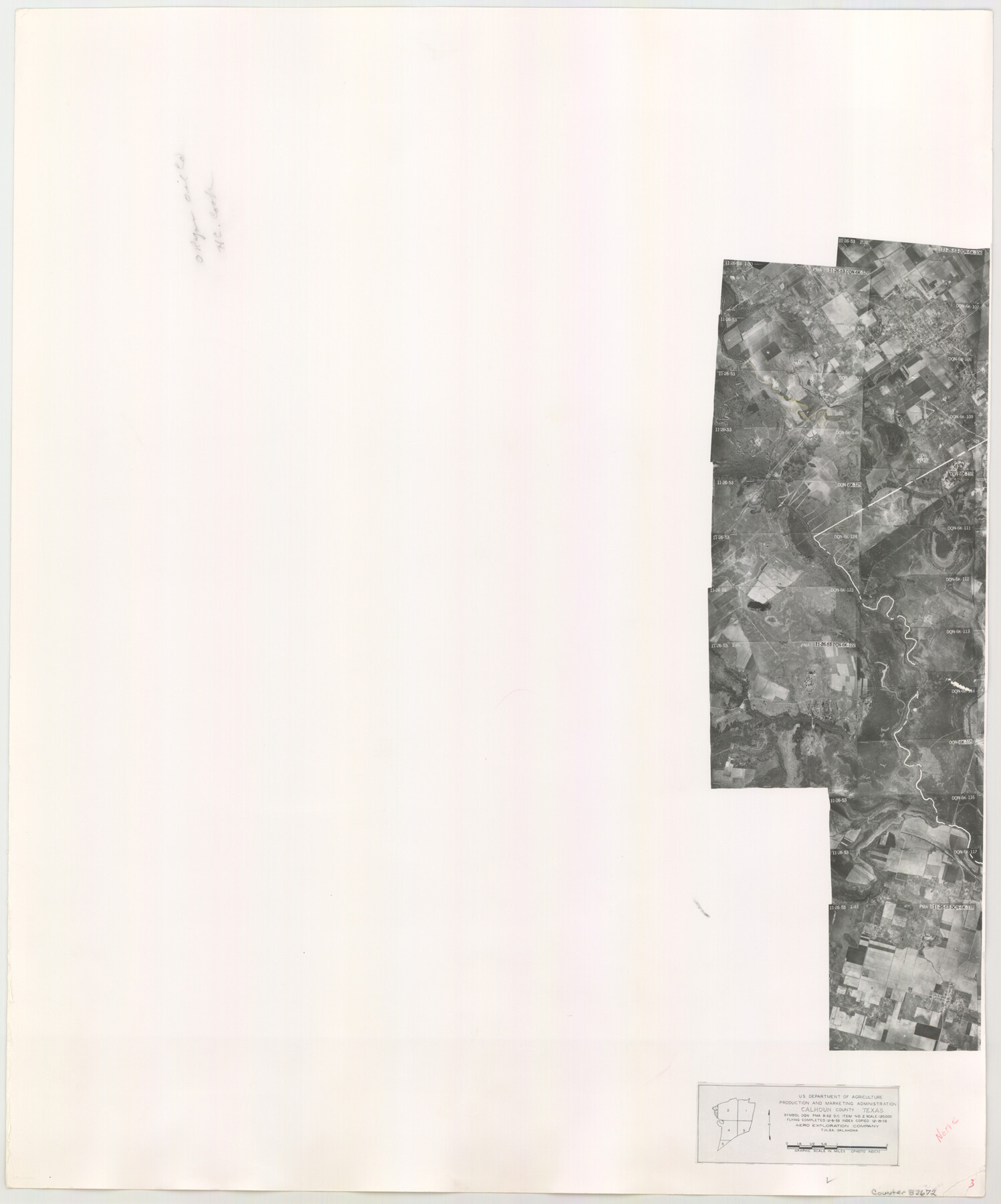
Calhoun County Aerial Photograph Index Sheet 3
Calhoun County Aerial Photograph Index 3
-
Map/Doc
83672
-
Collection
General Map Collection
-
Object Dates
1953/12/15 (Creation Date)
-
People and Organizations
U. S. Department of Agriculture (Publisher)
-
Counties
Calhoun
-
Subjects
Aerial Photograph
-
Height x Width
23.8 x 19.8 inches
60.5 x 50.3 cm
-
Comments
Flying completed December 6, 1953 by Aero Exploration Company of Tulsa, Oklahoma.
Part of: General Map Collection
Map of the Survey of the Parallel 36 1/2 Degrees North Latitude, Commencing at the 100th and Running to the 103rd Degree of Longitude West of Greenwich

Print $40.00
- Digital $50.00
Map of the Survey of the Parallel 36 1/2 Degrees North Latitude, Commencing at the 100th and Running to the 103rd Degree of Longitude West of Greenwich
1862
Size 115.6 x 14.9 inches
Map/Doc 73566
Flight Mission No. BQR-9K, Frame 5, Brazoria County

Print $20.00
- Digital $50.00
Flight Mission No. BQR-9K, Frame 5, Brazoria County
1952
Size 18.7 x 22.3 inches
Map/Doc 84034
Texas, San Bernard River, Cedar Lakes

Print $40.00
- Digital $50.00
Texas, San Bernard River, Cedar Lakes
1933
Size 26.7 x 48.6 inches
Map/Doc 69993
Hamilton County Working Sketch 6

Print $20.00
- Digital $50.00
Hamilton County Working Sketch 6
1942
Size 21.7 x 20.1 inches
Map/Doc 63344
[Surveys along Meridian Creek]
![242, [Surveys along Meridian Creek], General Map Collection](https://historictexasmaps.com/wmedia_w700/maps/242.tif.jpg)
Print $2.00
- Digital $50.00
[Surveys along Meridian Creek]
1846
Size 6.4 x 7.7 inches
Map/Doc 242
Upton County Rolled Sketch 56

Print $158.00
- Digital $50.00
Upton County Rolled Sketch 56
1934
Size 10.0 x 15.1 inches
Map/Doc 49413
Map of the Gainesville, Henrietta & Western Railway

Print $20.00
- Digital $50.00
Map of the Gainesville, Henrietta & Western Railway
1887
Size 9.6 x 41.7 inches
Map/Doc 64482
Flight Mission No. BQR-9K, Frame 14, Brazoria County

Print $20.00
- Digital $50.00
Flight Mission No. BQR-9K, Frame 14, Brazoria County
1952
Size 18.7 x 22.3 inches
Map/Doc 84043
[Galveston, Harrisburg & San Antonio from El Paso-Presidio county boundary to Presidio-Pecos county boundary]
![64716, [Galveston, Harrisburg & San Antonio from El Paso-Presidio county boundary to Presidio-Pecos county boundary], General Map Collection](https://historictexasmaps.com/wmedia_w700/maps/64716.tif.jpg)
Print $40.00
- Digital $50.00
[Galveston, Harrisburg & San Antonio from El Paso-Presidio county boundary to Presidio-Pecos county boundary]
Size 124.4 x 45.3 inches
Map/Doc 64716
Flight Mission No. BRA-9M, Frame 62, Jefferson County

Print $20.00
- Digital $50.00
Flight Mission No. BRA-9M, Frame 62, Jefferson County
1953
Size 18.7 x 22.3 inches
Map/Doc 85645
Flight Mission No. BRE-2P, Frame 69, Nueces County

Print $20.00
- Digital $50.00
Flight Mission No. BRE-2P, Frame 69, Nueces County
1956
Size 18.6 x 22.5 inches
Map/Doc 86764
Glasscock County Sketch File 18

Print $8.00
- Digital $50.00
Glasscock County Sketch File 18
1931
Size 9.7 x 6.2 inches
Map/Doc 24192
You may also like
Flight Mission No. DAG-17K, Frame 121, Matagorda County

Print $20.00
- Digital $50.00
Flight Mission No. DAG-17K, Frame 121, Matagorda County
1952
Size 16.4 x 16.5 inches
Map/Doc 86341
Hutchinson County Working Sketch 9

Print $20.00
- Digital $50.00
Hutchinson County Working Sketch 9
1920
Size 38.5 x 43.3 inches
Map/Doc 66367
Hardeman County Boundary File 4

Print $142.00
- Digital $50.00
Hardeman County Boundary File 4
Size 24.0 x 18.2 inches
Map/Doc 54392
Tarrant County Sketch File 11

Print $11.00
- Digital $50.00
Tarrant County Sketch File 11
1859
Size 7.5 x 6.2 inches
Map/Doc 37698
Flight Mission No. DQO-2K, Frame 146, Galveston County

Print $20.00
- Digital $50.00
Flight Mission No. DQO-2K, Frame 146, Galveston County
1952
Size 18.7 x 22.4 inches
Map/Doc 85043
Robertson County Working Sketch 18

Print $20.00
- Digital $50.00
Robertson County Working Sketch 18
1995
Size 29.9 x 34.1 inches
Map/Doc 63591
General Homes Free Houston Area Map

General Homes Free Houston Area Map
Size 27.3 x 42.5 inches
Map/Doc 94394
Jeff Davis County Working Sketch 29

Print $20.00
- Digital $50.00
Jeff Davis County Working Sketch 29
1967
Size 25.8 x 41.6 inches
Map/Doc 66524

Dimmit County Rolled Sketch 21

Print $20.00
- Digital $50.00
Dimmit County Rolled Sketch 21
2013
Size 25.5 x 22.5 inches
Map/Doc 93488
Dallam Co. Texas, Standard Single County Oil Development Survey

Print $20.00
- Digital $50.00
Dallam Co. Texas, Standard Single County Oil Development Survey
Size 20.7 x 15.8 inches
Map/Doc 90583
[School Leagues in Bailey and Lamb County]
![90987, [School Leagues in Bailey and Lamb County], Twichell Survey Records](https://historictexasmaps.com/wmedia_w700/maps/90987-2.tif.jpg)
Print $20.00
- Digital $50.00
[School Leagues in Bailey and Lamb County]
Size 30.5 x 25.2 inches
Map/Doc 90987