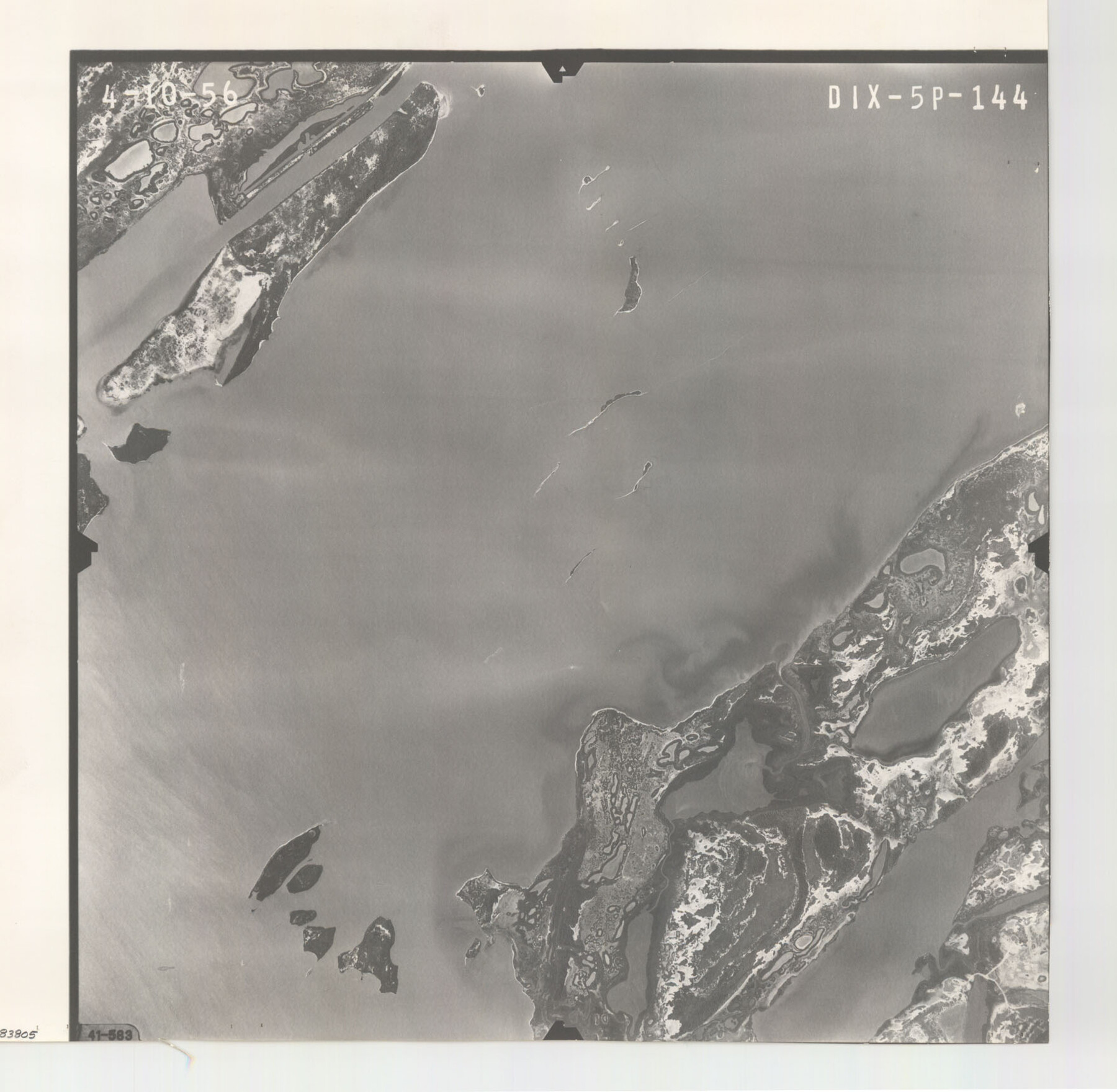
Flight Mission No. DIX-5P, Frame 144, Aransas County
DIX-5P-144
-
Map/Doc
83805
-
Collection
General Map Collection
-
Object Dates
1956/4/10 (Creation Date)
-
People and Organizations
U. S. Department of Agriculture (Publisher)
-
Counties
Aransas
-
Subjects
Aerial Photograph
-
Height x Width
17.2 x 17.6 inches
43.7 x 44.7 cm
-
Comments
Flown by V. L. Beavers and Associates of San Antonio, Texas.
Part of: General Map Collection
Flight Mission No. DAG-22K, Frame 76, Matagorda County

Print $20.00
- Digital $50.00
Flight Mission No. DAG-22K, Frame 76, Matagorda County
1953
Size 18.7 x 22.4 inches
Map/Doc 86463
Jeff Davis County Sketch File 13

Print $14.00
- Digital $50.00
Jeff Davis County Sketch File 13
1889
Size 13.9 x 8.5 inches
Map/Doc 27941
Flight Mission No. CGI-3N, Frame 142, Cameron County

Print $20.00
- Digital $50.00
Flight Mission No. CGI-3N, Frame 142, Cameron County
1954
Size 18.7 x 22.3 inches
Map/Doc 84615
Pecos County Working Sketch 34

Print $20.00
- Digital $50.00
Pecos County Working Sketch 34
1939
Size 32.7 x 27.6 inches
Map/Doc 71506
Map of the Fort Worth & Denver City Railway, Wichita County, Texas

Print $40.00
- Digital $50.00
Map of the Fort Worth & Denver City Railway, Wichita County, Texas
1885
Size 23.7 x 66.5 inches
Map/Doc 64455
Van Zandt County Sketch File 16a

Print $4.00
- Digital $50.00
Van Zandt County Sketch File 16a
1858
Size 8.5 x 8.0 inches
Map/Doc 39412
Coke County Working Sketch 13

Print $20.00
- Digital $50.00
Coke County Working Sketch 13
1947
Size 47.0 x 44.5 inches
Map/Doc 68050
Jack County Working Sketch 12

Print $20.00
- Digital $50.00
Jack County Working Sketch 12
1959
Size 18.0 x 22.4 inches
Map/Doc 66438
Sabine Bank to East Bay including Heald Bank

Print $20.00
- Digital $50.00
Sabine Bank to East Bay including Heald Bank
1957
Size 45.0 x 34.4 inches
Map/Doc 69846
Grimes County Sketch File 4b

Print $10.00
- Digital $50.00
Grimes County Sketch File 4b
1873
Size 10.2 x 8.4 inches
Map/Doc 24637
1988 Land Use - El Paso, Ciudad Juarez and Vicinity

Print $20.00
- Digital $50.00
1988 Land Use - El Paso, Ciudad Juarez and Vicinity
1988
Size 34.1 x 25.0 inches
Map/Doc 87370
Atascosa County Boundary File 1

Print $14.00
- Digital $50.00
Atascosa County Boundary File 1
Size 12.9 x 8.3 inches
Map/Doc 50153
You may also like
Aransas County Rolled Sketch 2

Print $40.00
- Digital $50.00
Aransas County Rolled Sketch 2
1950
Size 27.9 x 51.4 inches
Map/Doc 73613
[Sketch of Blocks in Swisher, Deaf Smith, Randall and Castro Counties, Texas]
![75559, [Sketch of Blocks in Swisher, Deaf Smith, Randall and Castro Counties, Texas], Maddox Collection](https://historictexasmaps.com/wmedia_w700/maps/75559.tif.jpg)
Print $20.00
- Digital $50.00
[Sketch of Blocks in Swisher, Deaf Smith, Randall and Castro Counties, Texas]
1882
Size 22.0 x 22.8 inches
Map/Doc 75559

Flight Mission No. DAG-17K, Frame 64, Matagorda County

Print $20.00
- Digital $50.00
Flight Mission No. DAG-17K, Frame 64, Matagorda County
1952
Size 16.5 x 16.4 inches
Map/Doc 86326
Map of Texas and Pacific Ry. Company's Surveys in the 80 Mile Reserve

Print $20.00
- Digital $50.00
Map of Texas and Pacific Ry. Company's Surveys in the 80 Mile Reserve
1885
Size 44.0 x 46.6 inches
Map/Doc 83558
Robertson Co.

Print $20.00
- Digital $50.00
Robertson Co.
1945
Size 47.9 x 39.0 inches
Map/Doc 63004

Leon County Working Sketch 29

Print $20.00
- Digital $50.00
Leon County Working Sketch 29
1971
Size 25.8 x 33.1 inches
Map/Doc 70428
Brazoria County NRC Article 33.136 Sketch 32

Print $24.00
Brazoria County NRC Article 33.136 Sketch 32
2025
Map/Doc 97490
Floyd County Sketch File 8

Print $40.00
- Digital $50.00
Floyd County Sketch File 8
1878
Map/Doc 93784
Hardin County Working Sketch 11

Print $20.00
- Digital $50.00
Hardin County Working Sketch 11
1929
Size 25.4 x 24.1 inches
Map/Doc 63409
Map of a part of Laguna Madre showing subdivision for mineral development

Print $20.00
- Digital $50.00
Map of a part of Laguna Madre showing subdivision for mineral development
1948
Size 37.4 x 27.7 inches
Map/Doc 2914