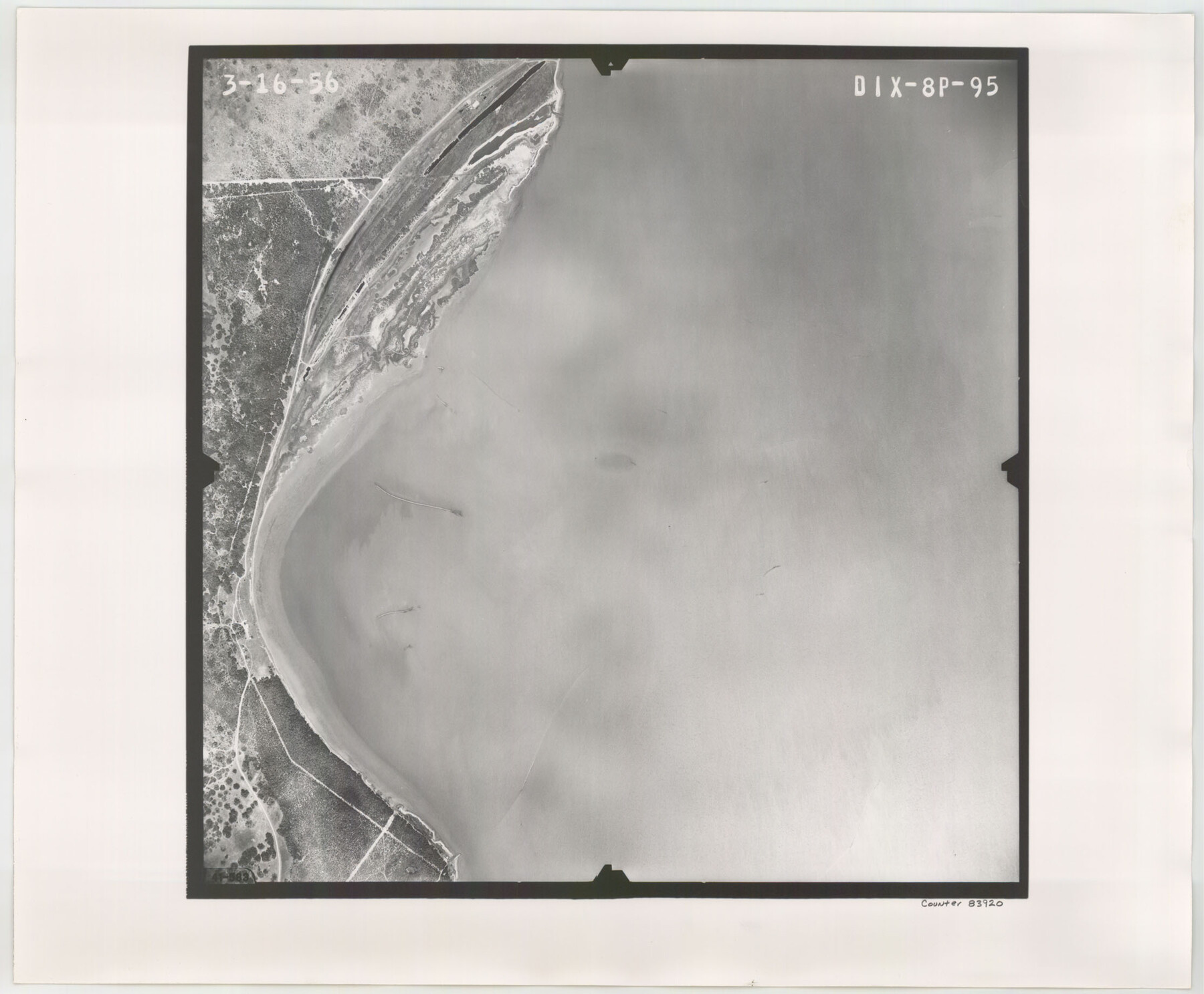
Flight Mission No. DIX-8P, Frame 95, Aransas County
DIX-8P-95
-
Map/Doc
83920
-
Collection
General Map Collection
-
Object Dates
1956/3/16 (Creation Date)
-
People and Organizations
U. S. Department of Agriculture (Publisher)
-
Counties
Aransas
-
Subjects
Aerial Photograph
-
Height x Width
18.4 x 22.3 inches
46.7 x 56.6 cm
-
Comments
Flown by V. L. Beavers and Associates of San Antonio, Texas.
Part of: General Map Collection
Pecos County Working Sketch 75

Print $20.00
- Digital $50.00
Pecos County Working Sketch 75
1958
Size 43.2 x 40.6 inches
Map/Doc 71547
Andrews County

Print $40.00
- Digital $50.00
Andrews County
1951
Size 42.7 x 54.4 inches
Map/Doc 73067

Dimmit County Sketch File 10

Print $20.00
- Digital $50.00
Dimmit County Sketch File 10
Size 23.5 x 22.6 inches
Map/Doc 11338
Dimmit County Working Sketch 22

Print $20.00
- Digital $50.00
Dimmit County Working Sketch 22
1951
Size 37.3 x 38.7 inches
Map/Doc 68683
Galveston County NRC Article 33.136 Location Key Sheet

Print $20.00
- Digital $50.00
Galveston County NRC Article 33.136 Location Key Sheet
1994
Size 27.0 x 21.8 inches
Map/Doc 77016

Flight Mission No. BRA-16M, Frame 51, Jefferson County

Print $20.00
- Digital $50.00
Flight Mission No. BRA-16M, Frame 51, Jefferson County
1953
Size 18.6 x 22.6 inches
Map/Doc 85668
Reeves County Working Sketch 9

Print $20.00
- Digital $50.00
Reeves County Working Sketch 9
1948
Size 19.0 x 24.0 inches
Map/Doc 63452
Houston County Sketch File 31

Print $2.00
- Digital $50.00
Houston County Sketch File 31
1888
Size 9.1 x 7.9 inches
Map/Doc 26808
Dimmit County Working Sketch 9

Print $20.00
- Digital $50.00
Dimmit County Working Sketch 9
1934
Size 36.3 x 42.2 inches
Map/Doc 68670
Dimmit County Working Sketch 50

Print $20.00
- Digital $50.00
Dimmit County Working Sketch 50
1981
Size 34.0 x 39.0 inches
Map/Doc 68711
You may also like
Hudspeth County Sketch File 16a

Print $2.00
- Digital $50.00
Hudspeth County Sketch File 16a
1886
Size 8.7 x 5.8 inches
Map/Doc 26953
Kerr County Sketch File 10

Print $6.00
- Digital $50.00
Kerr County Sketch File 10
Size 13.9 x 10.6 inches
Map/Doc 28877
Briscoe County Rolled Sketch 11A

Print $20.00
- Digital $50.00
Briscoe County Rolled Sketch 11A
1913
Size 11.7 x 12.3 inches
Map/Doc 5329
Map of City of Brownfield, Texas

Print $20.00
- Digital $50.00
Map of City of Brownfield, Texas
1953
Size 44.4 x 40.1 inches
Map/Doc 89890
Working Sketch in Randall and Swisher Cos.

Print $20.00
- Digital $50.00
Working Sketch in Randall and Swisher Cos.
1917
Size 14.6 x 36.3 inches
Map/Doc 93048
Liberty County Rolled Sketch A

Print $20.00
- Digital $50.00
Liberty County Rolled Sketch A
1919
Size 31.8 x 35.9 inches
Map/Doc 9569
Young County Sketch File 17

Print $20.00
- Digital $50.00
Young County Sketch File 17
Size 18.5 x 24.3 inches
Map/Doc 12713
Coast Chart No. 202 - Calcasieu Pass to Sabine Light, Louisiana

Print $20.00
- Digital $50.00
Coast Chart No. 202 - Calcasieu Pass to Sabine Light, Louisiana
1905
Size 40.7 x 34.4 inches
Map/Doc 69803
Upton County Rolled Sketch 51

Print $20.00
- Digital $50.00
Upton County Rolled Sketch 51
1961
Size 34.0 x 29.8 inches
Map/Doc 8086
[Sketch of surveys north of Jefferson County School Land]
![91890, [Sketch of surveys north of Jefferson County School Land], Twichell Survey Records](https://historictexasmaps.com/wmedia_w700/maps/91890-1.tif.jpg)
Print $3.00
- Digital $50.00
[Sketch of surveys north of Jefferson County School Land]
1891
Size 10.3 x 11.2 inches
Map/Doc 91890
Louisiana and Texas Intracoastal Waterway, Sabine River Galveston Bay Section Survey

Print $20.00
- Digital $50.00
Louisiana and Texas Intracoastal Waterway, Sabine River Galveston Bay Section Survey
1927
Size 30.7 x 43.0 inches
Map/Doc 61838
[Sketch of Berry Doolittle, C. B. Emmons. R. D. Price and other surveys]
![90213, [Sketch of Berry Doolittle, C. B. Emmons. R. D. Price and other surveys], Twichell Survey Records](https://historictexasmaps.com/wmedia_w700/maps/90213-1.tif.jpg)
Print $20.00
- Digital $50.00
[Sketch of Berry Doolittle, C. B. Emmons. R. D. Price and other surveys]
Size 25.8 x 19.7 inches
Map/Doc 90213