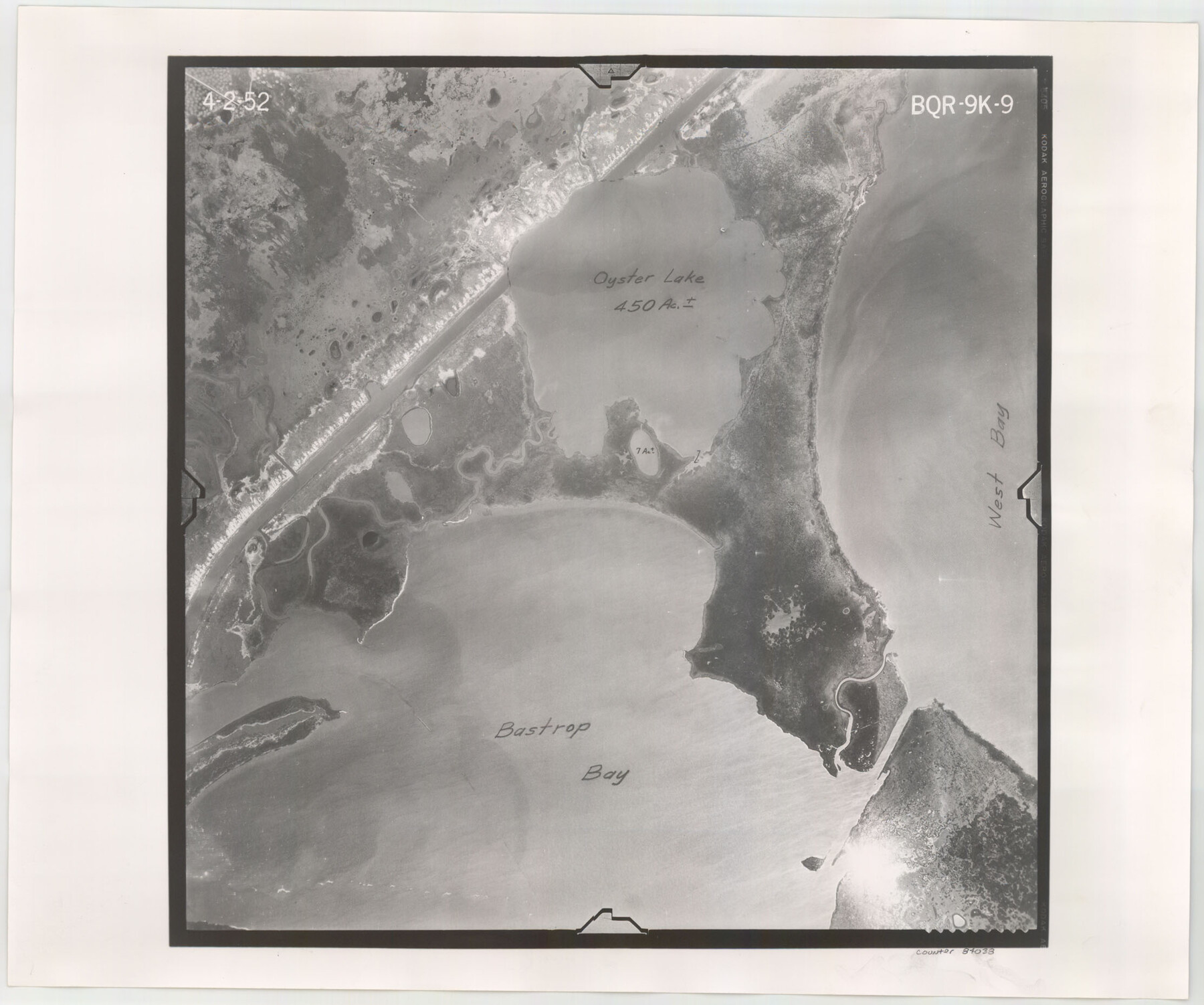
Flight Mission No. BQR-9K, Frame 9, Brazoria County
BQR-9K-9
-
Map/Doc
84038
-
Collection
General Map Collection
-
Object Dates
1952/4/2 (Creation Date)
-
People and Organizations
U. S. Department of Agriculture (Publisher)
-
Counties
Brazoria
-
Subjects
Aerial Photograph
-
Height x Width
18.6 x 22.3 inches
47.2 x 56.6 cm
-
Comments
Flown by Aero Exploration Company of Tulsa, Oklahoma.
Part of: General Map Collection
Gray County Working Sketch 1

Print $20.00
- Digital $50.00
Gray County Working Sketch 1
1957
Size 37.3 x 17.4 inches
Map/Doc 62196
Flight Mission No. CRC-2R, Frame 184, Chambers County

Print $20.00
- Digital $50.00
Flight Mission No. CRC-2R, Frame 184, Chambers County
1956
Size 18.6 x 22.2 inches
Map/Doc 84762
Flight Mission No. CRK-5P, Frame 130, Refugio County

Print $20.00
- Digital $50.00
Flight Mission No. CRK-5P, Frame 130, Refugio County
1956
Size 18.6 x 22.5 inches
Map/Doc 86933
Ector County Working Sketch 17

Print $40.00
- Digital $50.00
Ector County Working Sketch 17
1956
Size 59.9 x 24.2 inches
Map/Doc 68860
Burleson County Working Sketch 41

Print $20.00
- Digital $50.00
Burleson County Working Sketch 41
1990
Size 25.6 x 14.8 inches
Map/Doc 67760
Culberson County Rolled Sketch 58

Print $40.00
- Digital $50.00
Culberson County Rolled Sketch 58
1979
Size 37.8 x 52.6 inches
Map/Doc 8759

Young Territory

Print $20.00
- Digital $50.00
Young Territory
1865
Size 29.7 x 30.5 inches
Map/Doc 1978
Flight Mission No. BRE-1P, Frame 145, Nueces County

Print $20.00
- Digital $50.00
Flight Mission No. BRE-1P, Frame 145, Nueces County
1956
Size 18.4 x 22.1 inches
Map/Doc 86705
Hutchinson County Boundary File 4

Print $17.00
- Digital $50.00
Hutchinson County Boundary File 4
Size 14.3 x 8.7 inches
Map/Doc 55305
Right of Way & Track Map, The Texas & Pacific Ry. Co. Main Line

Print $20.00
- Digital $50.00
Right of Way & Track Map, The Texas & Pacific Ry. Co. Main Line
Size 11.0 x 18.3 inches
Map/Doc 64687
Map of Nacogdoches County

Print $20.00
- Digital $50.00
Map of Nacogdoches County
1881
Size 24.1 x 21.5 inches
Map/Doc 3909
You may also like
Real County Working Sketch 86

Print $20.00
- Digital $50.00
Real County Working Sketch 86
1988
Size 37.8 x 26.6 inches
Map/Doc 71978
Hays County Working Sketch 12

Print $20.00
- Digital $50.00
Hays County Working Sketch 12
1950
Size 22.8 x 24.3 inches
Map/Doc 66086
Ector County Rolled Sketch 15

Print $20.00
- Digital $50.00
Ector County Rolled Sketch 15
1987
Size 47.5 x 36.6 inches
Map/Doc 8842
Hardeman County Sketch File 7

Print $10.00
- Digital $50.00
Hardeman County Sketch File 7
Size 8.9 x 14.1 inches
Map/Doc 24997
Topographical Map of the Rio Grande, Sheet No. 25

Print $20.00
- Digital $50.00
Topographical Map of the Rio Grande, Sheet No. 25
1912
Map/Doc 89549
Kinney County Sketch File B

Print $8.00
- Digital $50.00
Kinney County Sketch File B
1873
Size 11.9 x 8.1 inches
Map/Doc 29119
Swisher County Working Sketch 1

Print $20.00
- Digital $50.00
Swisher County Working Sketch 1
1907
Size 19.4 x 16.3 inches
Map/Doc 62412
Subdivision Map, Calhoun County School Land Leagues 1-4, Located in Hale and Floyd Counties

Print $20.00
- Digital $50.00
Subdivision Map, Calhoun County School Land Leagues 1-4, Located in Hale and Floyd Counties
Size 28.1 x 31.5 inches
Map/Doc 92660
Galveston Harbor, Texas, South Jetty sketch showing extension of shoreline - Sheet 5

Print $2.00
- Digital $50.00
Galveston Harbor, Texas, South Jetty sketch showing extension of shoreline - Sheet 5
1936
Size 8.8 x 13.3 inches
Map/Doc 61819
Map of Pecos County Texas

Print $20.00
- Digital $50.00
Map of Pecos County Texas
Size 24.5 x 19.8 inches
Map/Doc 3951
Lavaca County Working Sketch 26

Print $20.00
- Digital $50.00
Lavaca County Working Sketch 26
1986
Size 25.0 x 28.1 inches
Map/Doc 70379
Duval County Sketch File 35b

Print $6.00
- Digital $50.00
Duval County Sketch File 35b
1935
Size 14.4 x 8.8 inches
Map/Doc 21374