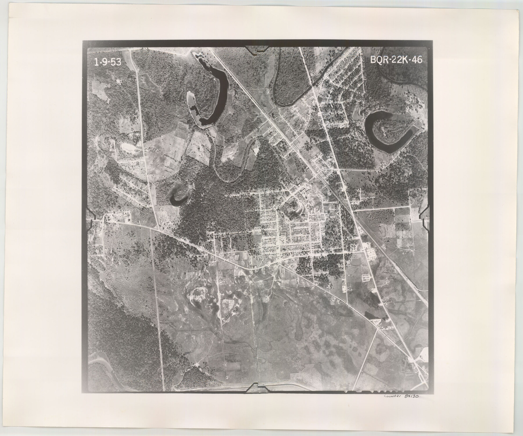
Flight Mission No. BQR-22K, Frame 46, Brazoria County
BQR-22K-46
-
Map/Doc
84130
-
Collection
General Map Collection
-
Object Dates
1953/1/9 (Creation Date)
-
People and Organizations
U. S. Department of Agriculture (Publisher)
-
Counties
Brazoria
-
Subjects
Aerial Photograph
-
Height x Width
18.6 x 22.4 inches
47.2 x 56.9 cm
-
Comments
Flown by Aero Exploration Company of Tulsa, Oklahoma.
Part of: General Map Collection
Carte d'une partie de L'Amérique Séptentrionale, qui contient partie de la Nle. Espagne, et de la Louisiane

Print $20.00
- Digital $50.00
Carte d'une partie de L'Amérique Séptentrionale, qui contient partie de la Nle. Espagne, et de la Louisiane
1782
Size 14.1 x 18.1 inches
Map/Doc 97118

Coke County Rolled Sketch 14B

Print $20.00
- Digital $50.00
Coke County Rolled Sketch 14B
Size 16.3 x 19.3 inches
Map/Doc 5516
Gaines County Working Sketch 18

Print $20.00
- Digital $50.00
Gaines County Working Sketch 18
1970
Size 25.4 x 44.5 inches
Map/Doc 69318
Blucher's Directory Map of Corpus Christi and Road Map of Nueces County

Print $20.00
- Digital $50.00
Blucher's Directory Map of Corpus Christi and Road Map of Nueces County
1945
Size 22.6 x 34.3 inches
Map/Doc 94106
Jeff Davis County Working Sketch 6

Print $20.00
- Digital $50.00
Jeff Davis County Working Sketch 6
1928
Size 43.5 x 39.8 inches
Map/Doc 66501
Hunt County Rolled Sketch 5

Print $20.00
- Digital $50.00
Hunt County Rolled Sketch 5
1966
Size 23.9 x 23.7 inches
Map/Doc 6274
Morris County Rolled Sketch 2A

Print $20.00
- Digital $50.00
Morris County Rolled Sketch 2A
Size 24.1 x 19.0 inches
Map/Doc 10279
Montgomery County

Print $20.00
- Digital $50.00
Montgomery County
1855
Size 26.5 x 28.3 inches
Map/Doc 3889
McMullen County Working Sketch Graphic Index

Print $40.00
- Digital $50.00
McMullen County Working Sketch Graphic Index
1967
Size 49.4 x 34.6 inches
Map/Doc 76638
Dickens County Working Sketch Graphic Index

Print $20.00
- Digital $50.00
Dickens County Working Sketch Graphic Index
1963
Size 42.5 x 33.6 inches
Map/Doc 76523
Intracoastal Waterway - Port Arthur to Galveston Bay

Print $20.00
- Digital $50.00
Intracoastal Waterway - Port Arthur to Galveston Bay
1957
Size 27.0 x 38.6 inches
Map/Doc 69830
You may also like
[Leagues 157-160]
![90298, [Leagues 157-160], Twichell Survey Records](https://historictexasmaps.com/wmedia_w700/maps/90298-1.tif.jpg)
Print $20.00
- Digital $50.00
[Leagues 157-160]
Size 8.2 x 22.6 inches
Map/Doc 90298
Schleicher County Working Sketch 16

Print $20.00
- Digital $50.00
Schleicher County Working Sketch 16
1942
Size 24.5 x 26.4 inches
Map/Doc 63818
Tarrant County Working Sketch 24

Print $20.00
- Digital $50.00
Tarrant County Working Sketch 24
2003
Size 26.0 x 34.9 inches
Map/Doc 78642
Wharton County Sketch File 15

Print $20.00
- Digital $50.00
Wharton County Sketch File 15
Size 18.2 x 21.1 inches
Map/Doc 12665
Hays County Rolled Sketch 23

Print $20.00
- Digital $50.00
Hays County Rolled Sketch 23
Size 20.1 x 19.4 inches
Map/Doc 6179
Map of Hays County

Print $20.00
- Digital $50.00
Map of Hays County
1880
Size 26.0 x 21.8 inches
Map/Doc 4562
Webb County Rolled Sketch 15

Print $20.00
- Digital $50.00
Webb County Rolled Sketch 15
Size 25.1 x 15.1 inches
Map/Doc 8179
Nueces County Sketch File 33

Print $20.00
- Digital $50.00
Nueces County Sketch File 33
1908
Size 22.0 x 19.2 inches
Map/Doc 42188
[Worksheets related to the Wilson Strickland survey and vicinity]
![91282, [Worksheets related to the Wilson Strickland survey and vicinity], Twichell Survey Records](https://historictexasmaps.com/wmedia_w700/maps/91282-1.tif.jpg)
Print $20.00
- Digital $50.00
[Worksheets related to the Wilson Strickland survey and vicinity]
Size 7.9 x 24.3 inches
Map/Doc 91282
Oldham County

Print $40.00
- Digital $50.00
Oldham County
1925
Size 42.6 x 51.5 inches
Map/Doc 77387
Current Miscellaneous File 56

Print $10.00
- Digital $50.00
Current Miscellaneous File 56
1954
Size 12.2 x 9.2 inches
Map/Doc 74045
Crockett County Rolled Sketch 52

Print $20.00
- Digital $50.00
Crockett County Rolled Sketch 52
Size 36.7 x 44.7 inches
Map/Doc 8715