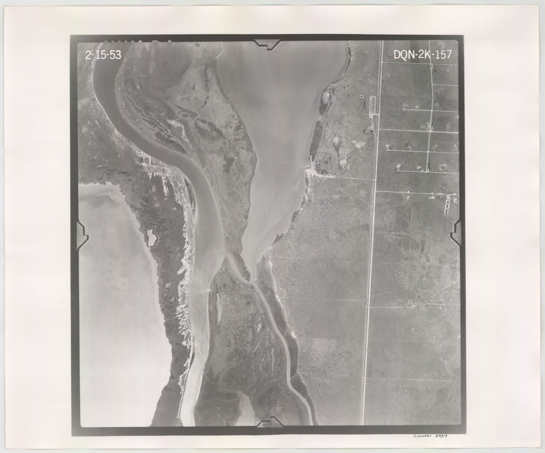
Flight Mission No. DQN-2K, Frame 157, Calhoun County
DQN-2K-157
-
Map/Doc
84319
-
Collection
General Map Collection
-
Object Dates
1953/2/15 (Creation Date)
-
People and Organizations
U. S. Department of Agriculture (Publisher)
-
Counties
Calhoun
-
Subjects
Aerial Photograph
-
Height x Width
18.5 x 22.2 inches
47.0 x 56.4 cm
-
Comments
Flown by Aero Exploration Company of Tulsa, Oklahoma.
Part of: General Map Collection
Walker County Sketch File 5

Print $4.00
- Digital $50.00
Walker County Sketch File 5
Size 13.5 x 8.3 inches
Map/Doc 39555
Lampasas County Boundary File 15a

Print $33.00
- Digital $50.00
Lampasas County Boundary File 15a
Size 13.3 x 8.2 inches
Map/Doc 56210
Nueces County Rolled Sketch 49

Print $20.00
- Digital $50.00
Nueces County Rolled Sketch 49
1979
Size 21.1 x 20.7 inches
Map/Doc 6888
Live Oak County Working Sketch 19

Print $20.00
- Digital $50.00
Live Oak County Working Sketch 19
1962
Size 27.4 x 34.5 inches
Map/Doc 70604
Asher and Adams' Texas

Print $20.00
- Digital $50.00
Asher and Adams' Texas
1871
Size 25.4 x 18.5 inches
Map/Doc 93788
Wharton County Rolled Sketch 13

Print $20.00
- Digital $50.00
Wharton County Rolled Sketch 13
1990
Size 22.4 x 28.1 inches
Map/Doc 8238
Harris County Working Sketch 11

Print $20.00
- Digital $50.00
Harris County Working Sketch 11
1913
Size 30.4 x 22.5 inches
Map/Doc 65903
PSL Field Notes for Blocks A27 and A28 in Andrews and Gaines Counties, and Blocks A6 through A13, A20 through A26, and A30 in Gaines County

PSL Field Notes for Blocks A27 and A28 in Andrews and Gaines Counties, and Blocks A6 through A13, A20 through A26, and A30 in Gaines County
Map/Doc 81654
Milam County Boundary File 2

Print $30.00
- Digital $50.00
Milam County Boundary File 2
Size 12.7 x 8.2 inches
Map/Doc 57202
Hamilton County Working Sketch 4

Print $20.00
- Digital $50.00
Hamilton County Working Sketch 4
1935
Size 32.6 x 36.9 inches
Map/Doc 63342
Garza County Sketch File 30

Print $8.00
- Digital $50.00
Garza County Sketch File 30
1959
Size 14.3 x 8.8 inches
Map/Doc 24100
Colorado County Working Sketch 14

Print $20.00
- Digital $50.00
Colorado County Working Sketch 14
1944
Size 30.8 x 21.6 inches
Map/Doc 68114
You may also like
Jasper County Boundary File 4

Print $4.00
- Digital $50.00
Jasper County Boundary File 4
Size 14.4 x 8.9 inches
Map/Doc 55489
Edwards County Working Sketch 123

Print $20.00
- Digital $50.00
Edwards County Working Sketch 123
1976
Size 18.3 x 25.2 inches
Map/Doc 68999
Edwards-Kinney County Line, Field Notes & Correspondence, 1933

Print $42.00
- Digital $50.00
Edwards-Kinney County Line, Field Notes & Correspondence, 1933
1931
Size 11.2 x 8.7 inches
Map/Doc 62881
Liberty County Sketch File 27a

Print $4.00
- Digital $50.00
Liberty County Sketch File 27a
1870
Size 11.6 x 9.0 inches
Map/Doc 29950
[Surveys in Milam's Colony along the Colorado River, Onion Creek, Cedar Creek, and north of the San Antonio Road]
![88, [Surveys in Milam's Colony along the Colorado River, Onion Creek, Cedar Creek, and north of the San Antonio Road], General Map Collection](https://historictexasmaps.com/wmedia_w700/maps/88-1.tif.jpg)
Print $20.00
- Digital $50.00
[Surveys in Milam's Colony along the Colorado River, Onion Creek, Cedar Creek, and north of the San Antonio Road]
Size 13.4 x 26.8 inches
Map/Doc 88
[Right of Way and Track Map, the Missouri, Kansas and Texas Ry. of Texas - Henrietta Division]
![64757, [Right of Way and Track Map, the Missouri, Kansas and Texas Ry. of Texas - Henrietta Division], General Map Collection](https://historictexasmaps.com/wmedia_w700/maps/64757.tif.jpg)
Print $20.00
- Digital $50.00
[Right of Way and Track Map, the Missouri, Kansas and Texas Ry. of Texas - Henrietta Division]
1918
Size 11.8 x 26.9 inches
Map/Doc 64757
Live Oak County Working Sketch 28

Print $20.00
- Digital $50.00
Live Oak County Working Sketch 28
1982
Size 33.3 x 21.1 inches
Map/Doc 70613
Lampasas County Working Sketch 17

Print $20.00
- Digital $50.00
Lampasas County Working Sketch 17
1977
Size 24.0 x 13.2 inches
Map/Doc 70294
Brewster County Rolled Sketch 114

Print $20.00
- Digital $50.00
Brewster County Rolled Sketch 114
1964
Size 11.5 x 17.6 inches
Map/Doc 5274
Karnes County Rolled Sketch 3

Print $20.00
- Digital $50.00
Karnes County Rolled Sketch 3
1959
Size 27.9 x 41.6 inches
Map/Doc 6454
Map of Comal County

Print $20.00
- Digital $50.00
Map of Comal County
1871
Size 16.0 x 19.7 inches
Map/Doc 3430
Gaines County Rolled Sketch 29

Print $20.00
- Digital $50.00
Gaines County Rolled Sketch 29
1990
Size 14.7 x 20.5 inches
Map/Doc 5942