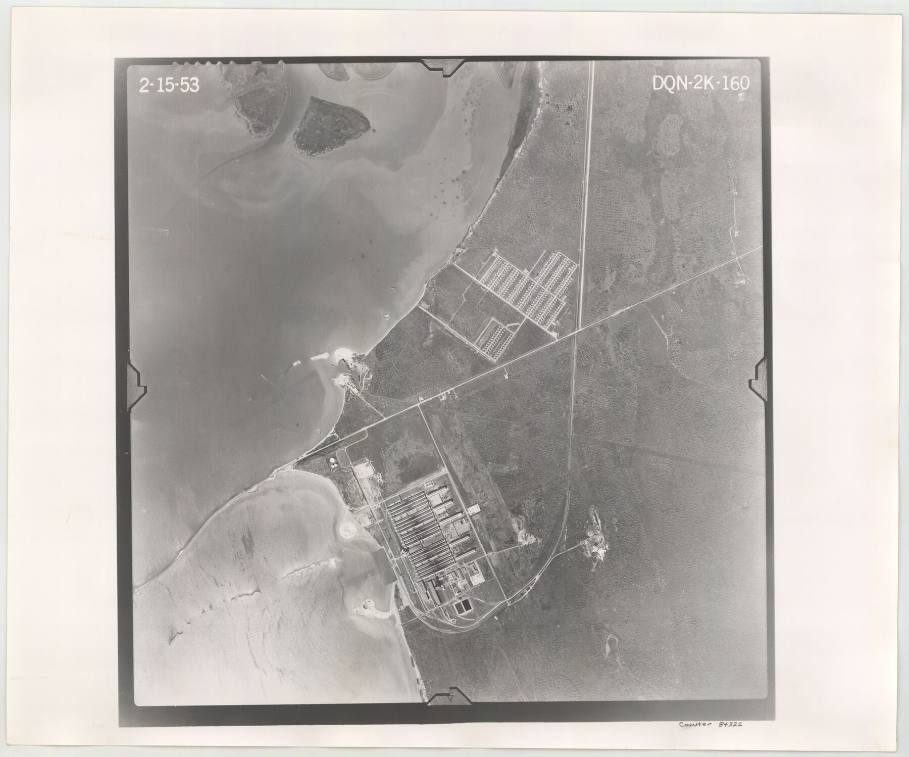
Flight Mission No. DQN-2K, Frame 160, Calhoun County
DQN-2K-160
-
Map/Doc
84322
-
Collection
General Map Collection
-
Object Dates
1953/2/15 (Creation Date)
-
People and Organizations
U. S. Department of Agriculture (Publisher)
-
Counties
Calhoun
-
Subjects
Aerial Photograph
-
Height x Width
18.6 x 22.3 inches
47.2 x 56.6 cm
-
Comments
Flown by Aero Exploration Company of Tulsa, Oklahoma.
Part of: General Map Collection
Trinity County Working Sketch 9

Print $20.00
- Digital $50.00
Trinity County Working Sketch 9
1947
Size 23.5 x 28.1 inches
Map/Doc 69458
Maverick County Sketch File 23

Print $7.00
- Digital $50.00
Maverick County Sketch File 23
Size 9.1 x 8.5 inches
Map/Doc 31142
Flight Mission No. CZW-3R, Frame 82

Print $20.00
- Digital $50.00
Flight Mission No. CZW-3R, Frame 82
1956
Size 18.6 x 22.3 inches
Map/Doc 85240
Lavaca County Rolled Sketch 6

Print $20.00
- Digital $50.00
Lavaca County Rolled Sketch 6
1986
Size 44.8 x 33.9 inches
Map/Doc 10290
Hutchinson County Sketch File 53

Print $2.00
- Digital $50.00
Hutchinson County Sketch File 53
2000
Size 11.2 x 8.8 inches
Map/Doc 27455
Map showing eight tidal areas in Oso Bay and Oso Creek, Nueces County, Texas offered for Mineral Development

Print $20.00
- Digital $50.00
Map showing eight tidal areas in Oso Bay and Oso Creek, Nueces County, Texas offered for Mineral Development
1936
Size 17.9 x 29.7 inches
Map/Doc 2067
Johnson County Sketch File 10a

Print $4.00
- Digital $50.00
Johnson County Sketch File 10a
1877
Size 6.7 x 10.6 inches
Map/Doc 28445
Pecos County Working Sketch 120

Print $20.00
- Digital $50.00
Pecos County Working Sketch 120
1973
Size 34.7 x 29.1 inches
Map/Doc 71593
Reagan County Sketch File 32

Print $6.00
- Digital $50.00
Reagan County Sketch File 32
1954
Size 11.5 x 9.0 inches
Map/Doc 35025
Rusk County Working Sketch 1

Print $20.00
- Digital $50.00
Rusk County Working Sketch 1
Size 14.2 x 23.1 inches
Map/Doc 63636
Plano General de los Ferrocarriles Nacionales de Mexico, F.C. Internacional Mexicano, F.C. Interoceanico de Mexico, F.C. Mexicano del sur y sus Conexiones

Print $20.00
- Digital $50.00
Plano General de los Ferrocarriles Nacionales de Mexico, F.C. Internacional Mexicano, F.C. Interoceanico de Mexico, F.C. Mexicano del sur y sus Conexiones
1910
Size 27.8 x 32.5 inches
Map/Doc 95743
Kinney County Working Sketch 54

Print $20.00
- Digital $50.00
Kinney County Working Sketch 54
1981
Size 40.0 x 32.8 inches
Map/Doc 70236
You may also like
Nacogdoches County Working Sketch 4

Print $20.00
- Digital $50.00
Nacogdoches County Working Sketch 4
1946
Size 22.2 x 23.2 inches
Map/Doc 71220
Medina County, Texas

Print $20.00
- Digital $50.00
Medina County, Texas
1879
Size 31.8 x 26.4 inches
Map/Doc 579
Map of Lands Belonging to the Austin & Northern Land & Cattle Co., Coke Co., Texas

Print $20.00
- Digital $50.00
Map of Lands Belonging to the Austin & Northern Land & Cattle Co., Coke Co., Texas
Size 23.5 x 19.0 inches
Map/Doc 379
Schleicher County Rolled Sketch 24

Print $20.00
- Digital $50.00
Schleicher County Rolled Sketch 24
Size 29.1 x 15.9 inches
Map/Doc 7763
Trinity River, Cooks Ferry Sheet

Print $40.00
- Digital $50.00
Trinity River, Cooks Ferry Sheet
1926
Size 36.5 x 56.2 inches
Map/Doc 65215
Pecos County Sketch File 24

Print $22.00
- Digital $50.00
Pecos County Sketch File 24
Size 7.6 x 5.6 inches
Map/Doc 33680
Bowie County Boundary File 72 (23)

Print $10.00
- Digital $50.00
Bowie County Boundary File 72 (23)
Size 13.0 x 8.0 inches
Map/Doc 50694
Denton County Working Sketch 38

Print $20.00
- Digital $50.00
Denton County Working Sketch 38
2010
Size 23.4 x 29.5 inches
Map/Doc 89571
Well Locations in Gaines County, Texas for American Liberty Oil Co.

Print $20.00
- Digital $50.00
Well Locations in Gaines County, Texas for American Liberty Oil Co.
Size 20.1 x 22.2 inches
Map/Doc 92855
Webb County Rolled Sketch 48

Print $20.00
- Digital $50.00
Webb County Rolled Sketch 48
1943
Size 20.1 x 37.3 inches
Map/Doc 8204
Stephens County Working Sketch 21

Print $20.00
- Digital $50.00
Stephens County Working Sketch 21
1975
Size 34.7 x 31.9 inches
Map/Doc 63964
Subdivision of Mallet Land and Cattle Company's Ranch Hockley, Cochran, Terry, and Yoakum Counties, Texas

Print $20.00
- Digital $50.00
Subdivision of Mallet Land and Cattle Company's Ranch Hockley, Cochran, Terry, and Yoakum Counties, Texas
Size 17.3 x 16.4 inches
Map/Doc 92207