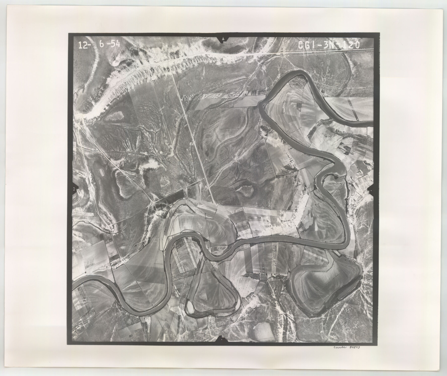
Flight Mission No. CGI-3N, Frame 120, Cameron County
CGI-3N-120
-
Map/Doc
84593
-
Collection
General Map Collection
-
Object Dates
1954/12/6 (Creation Date)
-
People and Organizations
U. S. Department of Agriculture (Publisher)
-
Counties
Cameron
-
Subjects
Aerial Photograph
-
Height x Width
18.8 x 22.3 inches
47.8 x 56.6 cm
-
Comments
Flown by Puckett Aerial Surveys, Inc. of Jackson, Mississippi.
Part of: General Map Collection
Brazoria County Rolled Sketch 25

Print $40.00
- Digital $50.00
Brazoria County Rolled Sketch 25
1935
Size 50.8 x 33.5 inches
Map/Doc 8928
Donley County Sketch File 5a

Print $6.00
- Digital $50.00
Donley County Sketch File 5a
Size 11.0 x 12.6 inches
Map/Doc 21268
Map of Chicago, Rock Island & Texas Railroad

Print $40.00
- Digital $50.00
Map of Chicago, Rock Island & Texas Railroad
1892
Size 23.9 x 122.0 inches
Map/Doc 64442
Flight Mission No. CRC-4R, Frame 160, Chambers County

Print $20.00
- Digital $50.00
Flight Mission No. CRC-4R, Frame 160, Chambers County
1956
Size 18.5 x 22.3 inches
Map/Doc 84919
Hidalgo County Rolled Sketch 8

Print $20.00
- Digital $50.00
Hidalgo County Rolled Sketch 8
1905
Size 20.1 x 26.3 inches
Map/Doc 6209
Flight Mission No. DIX-8P, Frame 93, Aransas County

Print $20.00
- Digital $50.00
Flight Mission No. DIX-8P, Frame 93, Aransas County
1956
Size 18.5 x 22.3 inches
Map/Doc 83918
Matagorda County Working Sketch 33

Print $20.00
- Digital $50.00
Matagorda County Working Sketch 33
1998
Size 32.0 x 42.5 inches
Map/Doc 70891
Armstrong County

Print $20.00
- Digital $50.00
Armstrong County
1933
Size 44.0 x 41.3 inches
Map/Doc 1773
Nueces County Sketch File 36

Print $20.00
- Digital $50.00
Nueces County Sketch File 36
1913
Size 17.0 x 18.4 inches
Map/Doc 42189
Montague County Rolled Sketch R

Print $20.00
- Digital $50.00
Montague County Rolled Sketch R
Size 44.3 x 29.8 inches
Map/Doc 6794
Flight Mission No. CRC-3R, Frame 34, Chambers County

Print $20.00
- Digital $50.00
Flight Mission No. CRC-3R, Frame 34, Chambers County
1956
Size 18.5 x 22.3 inches
Map/Doc 84807

You may also like
Coke County Rolled Sketch 14A

Print $20.00
- Digital $50.00
Coke County Rolled Sketch 14A
Size 21.0 x 14.1 inches
Map/Doc 5515
Sutton County Sketch File 27B

Print $20.00
- Digital $50.00
Sutton County Sketch File 27B
Size 19.1 x 14.6 inches
Map/Doc 12384
DeWitt County Rolled Sketch 2

Print $20.00
- Digital $50.00
DeWitt County Rolled Sketch 2
1943
Size 32.0 x 42.7 inches
Map/Doc 8778
General Highway Map. Detail of Cities and Towns in Bastrop County, Texas [Bastrop, Smithville, Elgin, etc.]
![79362, General Highway Map. Detail of Cities and Towns in Bastrop County, Texas [Bastrop, Smithville, Elgin, etc.], Texas State Library and Archives](https://historictexasmaps.com/wmedia_w700/maps/79362.tif.jpg)
Print $20.00
General Highway Map. Detail of Cities and Towns in Bastrop County, Texas [Bastrop, Smithville, Elgin, etc.]
1961
Size 18.3 x 25.0 inches
Map/Doc 79362
Burnet County Sketch File 15

Print $4.00
- Digital $50.00
Burnet County Sketch File 15
Size 8.3 x 10.3 inches
Map/Doc 16702
Stonewall County Sketch File 21

Print $4.00
- Digital $50.00
Stonewall County Sketch File 21
1933
Size 7.1 x 8.7 inches
Map/Doc 37291
[Sketch showing Blocks B17-B29 and vicinity]
![89732, [Sketch showing Blocks B17-B29 and vicinity], Twichell Survey Records](https://historictexasmaps.com/wmedia_w700/maps/89732-1.tif.jpg)
Print $40.00
- Digital $50.00
[Sketch showing Blocks B17-B29 and vicinity]
Size 61.8 x 28.6 inches
Map/Doc 89732
General Highway Map, Baylor County, Texas

Print $20.00
General Highway Map, Baylor County, Texas
1940
Size 18.3 x 25.1 inches
Map/Doc 79013
Chambers County Sketch File 51

Print $35.00
- Digital $50.00
Chambers County Sketch File 51
1935
Size 14.3 x 9.0 inches
Map/Doc 18068
[Galveston, Harrisburg & San Antonio through El Paso County]
![64004, [Galveston, Harrisburg & San Antonio through El Paso County], General Map Collection](https://historictexasmaps.com/wmedia_w700/maps/64004.tif.jpg)
Print $20.00
- Digital $50.00
[Galveston, Harrisburg & San Antonio through El Paso County]
Size 13.6 x 33.6 inches
Map/Doc 64004
Map of Comal County

Print $20.00
- Digital $50.00
Map of Comal County
1879
Size 19.3 x 25.7 inches
Map/Doc 4521
Comal County Sketch File 7

Print $4.00
- Digital $50.00
Comal County Sketch File 7
Size 13.5 x 8.3 inches
Map/Doc 19011