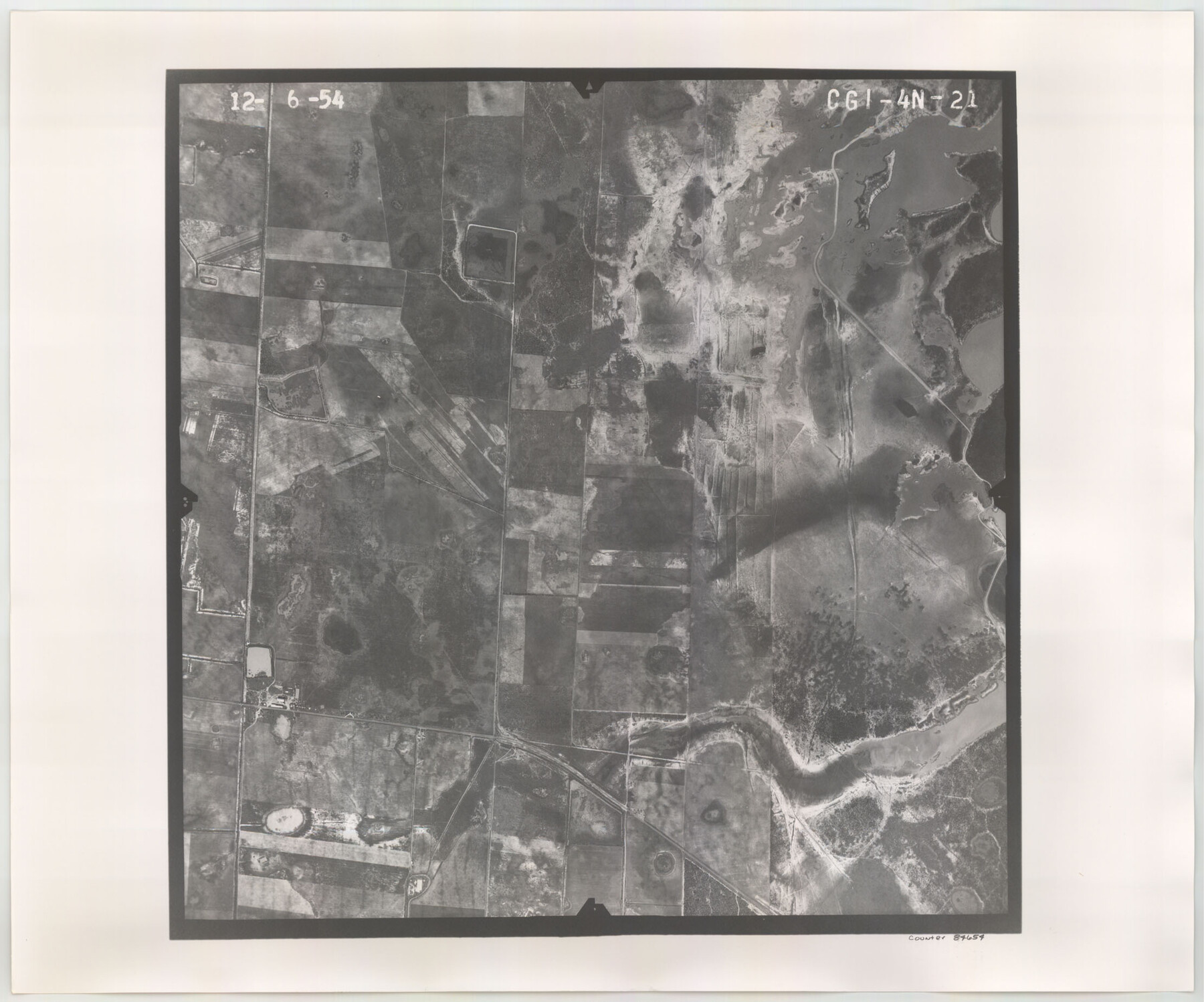
Flight Mission No. CGI-4N, Frame 21, Cameron County
CGI-4N-21
-
Map/Doc
84654
-
Collection
General Map Collection
-
Object Dates
1954/12/6 (Creation Date)
-
People and Organizations
U. S. Department of Agriculture (Publisher)
-
Counties
Cameron
-
Subjects
Aerial Photograph
-
Height x Width
18.5 x 22.2 inches
47.0 x 56.4 cm
-
Comments
Flown by Puckett Aerial Surveys, Inc. of Jackson, Mississippi.
Part of: General Map Collection
Williamson County Working Sketch 11

Print $20.00
- Digital $50.00
Williamson County Working Sketch 11
1961
Size 37.3 x 36.2 inches
Map/Doc 72571
University Land Loving-Ward-Winkler Counties

Print $40.00
- Digital $50.00
University Land Loving-Ward-Winkler Counties
1931
Size 47.9 x 63.2 inches
Map/Doc 2415
[Plat of Trinity River w/ Midstream Profile in Liberty County by US Government 1899]
![65335, [Plat of Trinity River w/ Midstream Profile in Liberty County by US Government 1899], General Map Collection](https://historictexasmaps.com/wmedia_w700/maps/65335.tif.jpg)
Print $20.00
- Digital $50.00
[Plat of Trinity River w/ Midstream Profile in Liberty County by US Government 1899]
1899
Size 11.5 x 18.3 inches
Map/Doc 65335
Brewster County Rolled Sketch 66

Print $20.00
- Digital $50.00
Brewster County Rolled Sketch 66
1940
Size 33.0 x 36.2 inches
Map/Doc 8490
Comanche County Sketch File 5

Print $4.00
- Digital $50.00
Comanche County Sketch File 5
1848
Size 8.6 x 8.3 inches
Map/Doc 19059
Trinity River, Hughes Crossing Sheet/Chambers Creek

Print $6.00
- Digital $50.00
Trinity River, Hughes Crossing Sheet/Chambers Creek
1931
Size 32.5 x 30.2 inches
Map/Doc 65239
Terrell County Sketch File 34

Print $12.00
- Digital $50.00
Terrell County Sketch File 34
1960
Size 9.7 x 8.5 inches
Map/Doc 37984
Denton County Working Sketch 9

Print $20.00
- Digital $50.00
Denton County Working Sketch 9
1959
Size 33.7 x 37.6 inches
Map/Doc 68614
Navigation Maps of Gulf Intracoastal Waterway, Port Arthur to Brownsville, Texas

Print $4.00
- Digital $50.00
Navigation Maps of Gulf Intracoastal Waterway, Port Arthur to Brownsville, Texas
1951
Size 16.7 x 21.5 inches
Map/Doc 65443
Armstrong County Boundary File 2

Print $8.00
- Digital $50.00
Armstrong County Boundary File 2
Size 14.1 x 8.7 inches
Map/Doc 50137
Flight Mission No. DIX-6P, Frame 118, Aransas County

Print $20.00
- Digital $50.00
Flight Mission No. DIX-6P, Frame 118, Aransas County
1956
Size 19.1 x 22.9 inches
Map/Doc 83824
Matagorda County Rolled Sketch H & W

Matagorda County Rolled Sketch H & W
1936
Size 27.1 x 41.2 inches
Map/Doc 61776
You may also like
Pecos County Sketch File 103

Print $46.00
- Digital $50.00
Pecos County Sketch File 103
1963
Size 16.7 x 9.9 inches
Map/Doc 34016
Aransas County NRC Article 33.136 Sketch 13

Print $24.00
- Digital $50.00
Aransas County NRC Article 33.136 Sketch 13
Size 24.0 x 36.0 inches
Map/Doc 94514
Wharton County

Print $40.00
- Digital $50.00
Wharton County
1894
Size 55.7 x 28.0 inches
Map/Doc 87353
Hunt County Working Sketch 11

Print $20.00
- Digital $50.00
Hunt County Working Sketch 11
2002
Size 32.1 x 29.6 inches
Map/Doc 66358
Brewster County Rolled Sketch 101

Print $40.00
- Digital $50.00
Brewster County Rolled Sketch 101
1927
Size 74.7 x 50.4 inches
Map/Doc 10649
[Texas Central Railway through Callahan County]
![64240, [Texas Central Railway through Callahan County], General Map Collection](https://historictexasmaps.com/wmedia_w700/maps/64240-1.tif.jpg)
Print $40.00
- Digital $50.00
[Texas Central Railway through Callahan County]
Size 24.6 x 86.3 inches
Map/Doc 64240
Lavaca County Sketch File 23

Print $20.00
- Digital $50.00
Lavaca County Sketch File 23
1986
Size 14.0 x 8.6 inches
Map/Doc 29668
Correct Map of Texas

Print $20.00
- Digital $50.00
Correct Map of Texas
1873
Size 21.5 x 16.9 inches
Map/Doc 95775
Edwards County Sketch File 35a

Print $20.00
- Digital $50.00
Edwards County Sketch File 35a
1928
Size 33.0 x 23.5 inches
Map/Doc 11435
Blanco County Working Sketch 23

Print $40.00
- Digital $50.00
Blanco County Working Sketch 23
1962
Size 52.4 x 38.5 inches
Map/Doc 67383

[Sketch for Mineral Application 26501 - Sabine River, T. A. Oldhausen]
![2833, [Sketch for Mineral Application 26501 - Sabine River, T. A. Oldhausen], General Map Collection](https://historictexasmaps.com/wmedia_w700/maps/2833.tif.jpg)
Print $20.00
- Digital $50.00
[Sketch for Mineral Application 26501 - Sabine River, T. A. Oldhausen]
1931
Size 24.4 x 36.3 inches
Map/Doc 2833