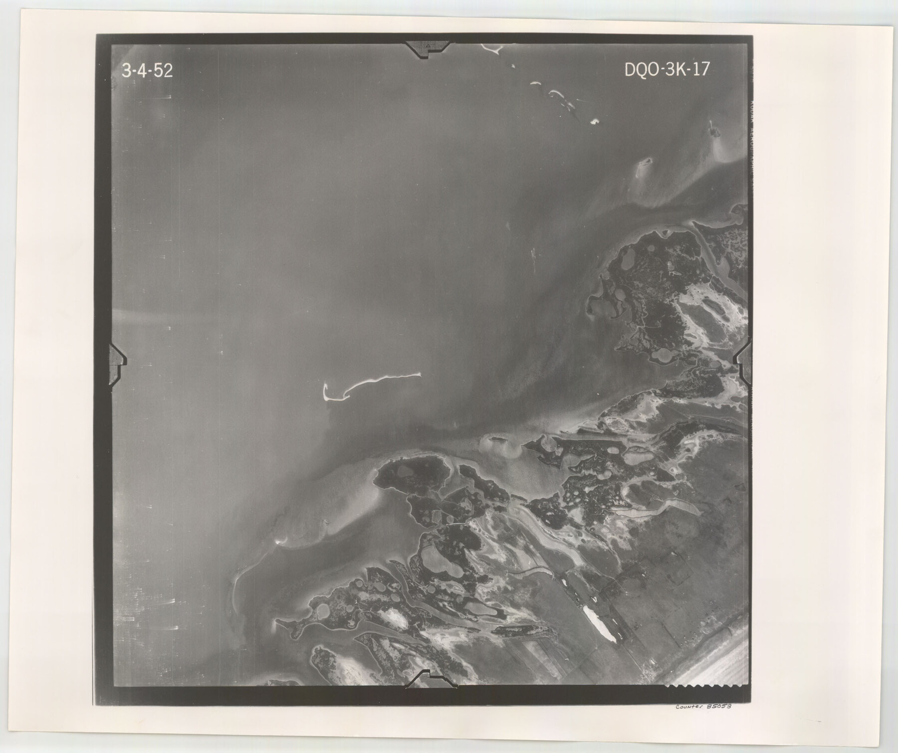
Flight Mission No. DQO-3K, Frame 17, Galveston County
DQO-3K-17
-
Map/Doc
85058
-
Collection
General Map Collection
-
Object Dates
1952/3/4 (Creation Date)
-
People and Organizations
U. S. Department of Agriculture (Publisher)
-
Counties
Galveston
-
Subjects
Aerial Photograph
-
Height x Width
18.9 x 22.5 inches
48.0 x 57.2 cm
-
Comments
Flown by Aero Exploration Company of Tulsa, Oklahoma.
Part of: General Map Collection
Reagan County

Print $40.00
- Digital $50.00
Reagan County
1915
Size 51.6 x 38.6 inches
Map/Doc 73340
Upper Galveston Bay, Houston Ship Channel, Dollar Pt. to Atkinson I.

Print $40.00
- Digital $50.00
Upper Galveston Bay, Houston Ship Channel, Dollar Pt. to Atkinson I.
1973
Size 49.8 x 36.8 inches
Map/Doc 69896
Nueces County NRC Article 33.136 Sketch 13

Print $24.00
- Digital $50.00
Nueces County NRC Article 33.136 Sketch 13
2007
Size 22.3 x 34.3 inches
Map/Doc 88809
Schleicher County Sketch File 48

Print $4.00
- Digital $50.00
Schleicher County Sketch File 48
1953
Size 11.2 x 8.7 inches
Map/Doc 36558
Webb County Rolled Sketch 36

Print $20.00
- Digital $50.00
Webb County Rolled Sketch 36
1940
Size 12.8 x 24.2 inches
Map/Doc 8191
Nueces County Rolled Sketch 100

Print $20.00
- Digital $50.00
Nueces County Rolled Sketch 100
1938
Size 37.2 x 25.2 inches
Map/Doc 9634
Aransas County Sketch File 8

Print $4.00
- Digital $50.00
Aransas County Sketch File 8
Size 11.7 x 7.9 inches
Map/Doc 13114
Val Verde County Boundary File 2

Print $4.00
- Digital $50.00
Val Verde County Boundary File 2
Size 11.4 x 8.8 inches
Map/Doc 59575
Fort Bend County Working Sketch 20

Print $20.00
- Digital $50.00
Fort Bend County Working Sketch 20
1967
Size 22.4 x 33.4 inches
Map/Doc 69226
Flight Mission No. CRK-8P, Frame 107, Refugio County

Print $20.00
- Digital $50.00
Flight Mission No. CRK-8P, Frame 107, Refugio County
1956
Size 18.4 x 22.0 inches
Map/Doc 86968
Cameron County Aerial Photograph Index Sheet 5

Print $20.00
- Digital $50.00
Cameron County Aerial Photograph Index Sheet 5
1940
Size 20.4 x 24.3 inches
Map/Doc 83681
Flight Mission No. DCL-7C, Frame 70, Kenedy County

Print $20.00
- Digital $50.00
Flight Mission No. DCL-7C, Frame 70, Kenedy County
1943
Size 15.4 x 15.3 inches
Map/Doc 86056
You may also like
Dawson County Boundary File 2

Print $18.00
- Digital $50.00
Dawson County Boundary File 2
Size 14.2 x 8.8 inches
Map/Doc 52338
Flight Mission No. CGI-4N, Frame 158, Cameron County

Print $20.00
- Digital $50.00
Flight Mission No. CGI-4N, Frame 158, Cameron County
1955
Size 18.5 x 22.2 inches
Map/Doc 84666
Swisher County Sketch File 6

Print $20.00
- Digital $50.00
Swisher County Sketch File 6
Size 15.4 x 12.1 inches
Map/Doc 12404

Glasscock County

Print $20.00
- Digital $50.00
Glasscock County
1899
Size 38.1 x 33.9 inches
Map/Doc 4707
Webb County Working Sketch 67

Print $40.00
- Digital $50.00
Webb County Working Sketch 67
1966
Size 60.9 x 43.7 inches
Map/Doc 72434
Navigation Maps of Gulf Intracoastal Waterway, Port Arthur to Brownsville, Texas

Print $4.00
- Digital $50.00
Navigation Maps of Gulf Intracoastal Waterway, Port Arthur to Brownsville, Texas
1951
Size 16.6 x 21.5 inches
Map/Doc 65440
Presidio County Rolled Sketch 83A

Print $20.00
- Digital $50.00
Presidio County Rolled Sketch 83A
1930
Size 28.2 x 27.6 inches
Map/Doc 7370
[Lgs. 195-199, 111, 112, 211-214, 678]
![90105, [Lgs. 195-199, 111, 112, 211-214, 678], Twichell Survey Records](https://historictexasmaps.com/wmedia_w700/maps/90105-1.tif.jpg)
Print $20.00
- Digital $50.00
[Lgs. 195-199, 111, 112, 211-214, 678]
Size 16.6 x 13.0 inches
Map/Doc 90105
Howard County Sketch File 15

Print $6.00
- Digital $50.00
Howard County Sketch File 15
Size 11.2 x 8.8 inches
Map/Doc 26875
Wheeler County Working Sketch 10

Print $40.00
- Digital $50.00
Wheeler County Working Sketch 10
1973
Size 72.4 x 36.6 inches
Map/Doc 72499
Sutton County Working Sketch 54

Print $20.00
- Digital $50.00
Sutton County Working Sketch 54
1957
Size 28.0 x 38.4 inches
Map/Doc 62397