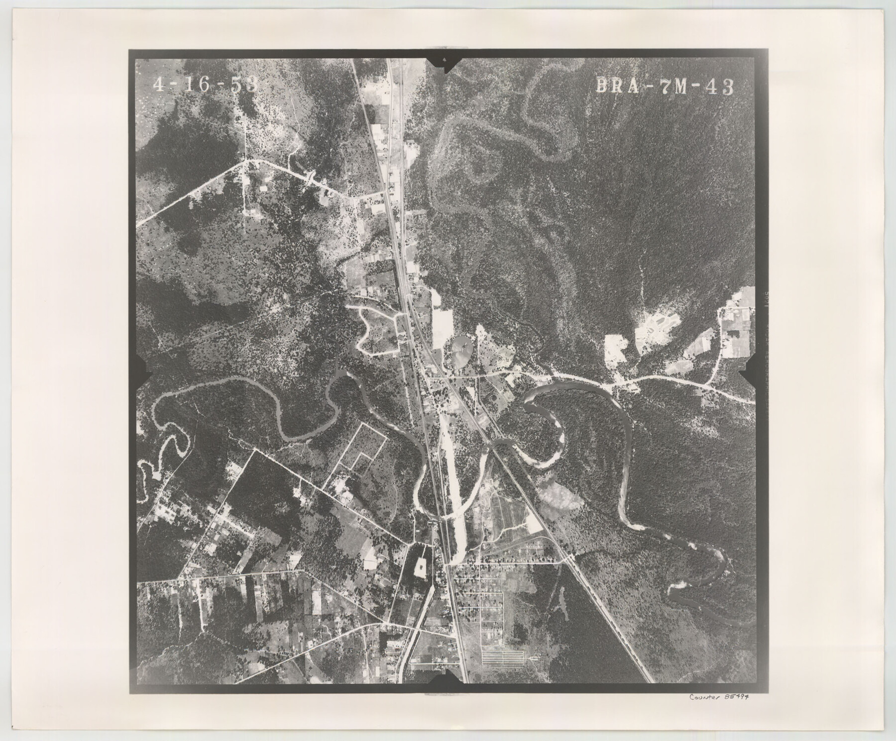
Flight Mission No. BRA-7M, Frame 43, Jefferson County
BRA-7M-43
-
Map/Doc
85494
-
Collection
General Map Collection
-
Object Dates
1953/4/16 (Creation Date)
-
People and Organizations
U. S. Department of Agriculture (Publisher)
-
Counties
Jefferson
-
Subjects
Aerial Photograph
-
Height x Width
18.6 x 22.4 inches
47.2 x 56.9 cm
-
Comments
Flown by Jack Ammann Photogrammetric Engineers of San Antonio, Texas.
Part of: General Map Collection
Edwards County Working Sketch 39

Print $20.00
- Digital $50.00
Edwards County Working Sketch 39
1948
Size 28.7 x 32.3 inches
Map/Doc 68915
Flight Mission No. BRE-2P, Frame 69, Nueces County

Print $20.00
- Digital $50.00
Flight Mission No. BRE-2P, Frame 69, Nueces County
1956
Size 18.6 x 22.5 inches
Map/Doc 86764
[Sketch for Mineral Application 19560 - 19588 - San Bernard River]
![65660, [Sketch for Mineral Application 19560 - 19588 - San Bernard River], General Map Collection](https://historictexasmaps.com/wmedia_w700/maps/65660.tif.jpg)
Print $40.00
- Digital $50.00
[Sketch for Mineral Application 19560 - 19588 - San Bernard River]
Size 98.0 x 33.0 inches
Map/Doc 65660
Cameron County Rolled Sketch Z6

Print $20.00
- Digital $50.00
Cameron County Rolled Sketch Z6
1937
Size 28.3 x 33.8 inches
Map/Doc 5404

Shelby County Working Sketch 23b

Print $20.00
- Digital $50.00
Shelby County Working Sketch 23b
1983
Size 36.6 x 24.7 inches
Map/Doc 63877
Morris County Rolled Sketch 2A

Print $20.00
- Digital $50.00
Morris County Rolled Sketch 2A
Size 24.3 x 19.2 inches
Map/Doc 10284
Duval County Sketch File 43

Print $20.00
- Digital $50.00
Duval County Sketch File 43
Size 22.9 x 21.1 inches
Map/Doc 11398
Parker County Sketch File 13

Print $4.00
- Digital $50.00
Parker County Sketch File 13
1860
Size 12.1 x 8.0 inches
Map/Doc 33546
Crosby County Boundary File 3

Print $2.00
- Digital $50.00
Crosby County Boundary File 3
Size 11.2 x 8.7 inches
Map/Doc 52002
Motley County Boundary File 2c

Print $34.00
- Digital $50.00
Motley County Boundary File 2c
Size 14.2 x 8.7 inches
Map/Doc 57533
The Coast & Bays of Western Texas

Print $20.00
- Digital $50.00
The Coast & Bays of Western Texas
1857
Size 18.2 x 23.9 inches
Map/Doc 73424
You may also like
Flight Mission No. BRA-16M, Frame 71, Jefferson County

Print $20.00
- Digital $50.00
Flight Mission No. BRA-16M, Frame 71, Jefferson County
1953
Size 18.7 x 22.3 inches
Map/Doc 85688
Anderson County Rolled Sketch 14

Print $20.00
- Digital $50.00
Anderson County Rolled Sketch 14
1997
Size 30.1 x 36.5 inches
Map/Doc 77159


Flight Mission No. BRA-8M, Frame 23, Jefferson County

Print $20.00
- Digital $50.00
Flight Mission No. BRA-8M, Frame 23, Jefferson County
1953
Size 18.7 x 22.3 inches
Map/Doc 85578
Galveston County

Print $20.00
- Digital $50.00
Galveston County
1860
Size 20.2 x 31.4 inches
Map/Doc 3575
The Republic County of Gonzales. February 2, 1842

Print $20.00
The Republic County of Gonzales. February 2, 1842
2020
Size 14.7 x 21.7 inches
Map/Doc 96158
Kerr County Sketch File 25

Print $4.00
- Digital $50.00
Kerr County Sketch File 25
1873
Size 10.0 x 8.0 inches
Map/Doc 28905
Terrell County Working Sketch 19

Print $20.00
- Digital $50.00
Terrell County Working Sketch 19
1932
Size 18.6 x 25.6 inches
Map/Doc 69801
Kaufman County Working Sketch 4

Print $40.00
- Digital $50.00
Kaufman County Working Sketch 4
1922
Size 52.1 x 36.2 inches
Map/Doc 66667
Culberson County Rolled Sketch 9

Print $20.00
- Digital $50.00
Culberson County Rolled Sketch 9
1886
Size 28.3 x 41.9 inches
Map/Doc 5646
General Highway Map Hockley County, Texas

Print $20.00
- Digital $50.00
General Highway Map Hockley County, Texas
1949
Size 25.7 x 18.8 inches
Map/Doc 92209