Jefferson County Rolled Sketch 46

Print $2.00
- Digital $50.00
Jefferson County Rolled Sketch 46
1969
Size: 12.3 x 5.9 inches
10198
Chambers County Sketch File 29

Print $20.00
- Digital $50.00
Chambers County Sketch File 29
Size: 29.0 x 34.5 inches
10332
Jefferson County Sketch File 49

Print $40.00
- Digital $50.00
Jefferson County Sketch File 49
1955
Size: 51.1 x 29.0 inches
10508
Chambers County Sketch File 24

Print $20.00
- Digital $50.00
Chambers County Sketch File 24
1909
Size: 34.1 x 14.5 inches
11065
Hardin County Sketch File 33

Print $20.00
- Digital $50.00
Hardin County Sketch File 33
Size: 25.4 x 35.4 inches
11632
Jefferson County Sketch File 15b

Print $26.00
- Digital $50.00
Jefferson County Sketch File 15b
Size: 17.4 x 33.2 inches
11869
Jefferson County Sketch File 19

Print $20.00
- Digital $50.00
Jefferson County Sketch File 19
1872
Size: 15.0 x 20.1 inches
11870
Jefferson County Sketch File 23

Print $20.00
- Digital $50.00
Jefferson County Sketch File 23
Size: 15.8 x 17.8 inches
11871
Jefferson County Sketch File 26a

Print $20.00
- Digital $50.00
Jefferson County Sketch File 26a
Size: 19.5 x 11.6 inches
11872
Jefferson County Sketch File 37

Print $20.00
- Digital $50.00
Jefferson County Sketch File 37
Size: 22.3 x 32.4 inches
11875
Jefferson County Sketch File 42

Print $20.00
- Digital $50.00
Jefferson County Sketch File 42
1945
Size: 25.5 x 35.1 inches
11876
Jefferson County Sketch File 43

Print $20.00
- Digital $50.00
Jefferson County Sketch File 43
1957
Size: 26.6 x 19.6 inches
11877
Jefferson County Sketch File 44

Print $20.00
- Digital $50.00
Jefferson County Sketch File 44
1917
Size: 22.8 x 32.9 inches
11878
Jefferson County Sketch File 45

Print $20.00
- Digital $50.00
Jefferson County Sketch File 45
1933
Size: 16.7 x 33.0 inches
11879
Jefferson County Sketch File 46

Print $20.00
- Digital $50.00
Jefferson County Sketch File 46
1933
Size: 20.8 x 31.2 inches
11880
Jefferson County Sketch File 47

Print $20.00
- Digital $50.00
Jefferson County Sketch File 47
1898
Size: 27.2 x 19.1 inches
11881
Jefferson County Sketch File 48

Print $20.00
- Digital $50.00
Jefferson County Sketch File 48
1875
Size: 19.8 x 21.0 inches
11882
Chambers County Sketch File 19

Print $26.00
- Digital $50.00
Chambers County Sketch File 19
Size: 14.1 x 8.6 inches
17578
West Half of Sabine Lake, Jefferson County, showing Subdivision for Mineral Development; do not use; see Map 25a

Print $20.00
- Digital $50.00
West Half of Sabine Lake, Jefferson County, showing Subdivision for Mineral Development; do not use; see Map 25a
1956
Size: 38.2 x 28.4 inches
1930
Revised map of west half of Sabine Lake and Sabine Pass, showing subdivision for mineral development; Jefferson and Orange Counties

Print $40.00
- Digital $50.00
Revised map of west half of Sabine Lake and Sabine Pass, showing subdivision for mineral development; Jefferson and Orange Counties
1979
Size: 72.1 x 41.5 inches
1935
Buenaventura Reyes Grants

Print $20.00
- Digital $50.00
Buenaventura Reyes Grants
1896
Size: 14.9 x 13.5 inches
2057
Hydrography of Sabine Pass and Lake, La. And Tex.

Print $40.00
- Digital $50.00
Hydrography of Sabine Pass and Lake, La. And Tex.
1885
Size: 53.2 x 32.5 inches
2085
Working Sketch Patents & Field Notes, Sabine Lake Area

Print $20.00
- Digital $50.00
Working Sketch Patents & Field Notes, Sabine Lake Area
1959
Size: 30.2 x 27.0 inches
2455
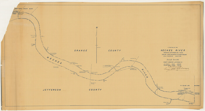
[Neches River Bed, Plat and Calculations]
Print $40.00
- Digital $50.00
[Neches River Bed, Plat and Calculations]
1928
Size: 27.3 x 51.0 inches
2466
Texas Gulf Coast Map from the Sabine River to the Rio Grande as subdivided for mineral development

Print $20.00
- Digital $50.00
Texas Gulf Coast Map from the Sabine River to the Rio Grande as subdivided for mineral development
1966
Size: 29.1 x 41.7 inches
2496
Hardin County Sketch File 7

Print $6.00
- Digital $50.00
Hardin County Sketch File 7
Size: 7.2 x 5.9 inches
25099
Hardin County Sketch File 19

Print $6.00
- Digital $50.00
Hardin County Sketch File 19
Size: 13.0 x 10.9 inches
25135
Hardin County Sketch File 20

Print $6.00
- Digital $50.00
Hardin County Sketch File 20
Size: 9.4 x 7.9 inches
25137
Jefferson County Sketch File 1

Print $2.00
- Digital $50.00
Jefferson County Sketch File 1
Size: 8.8 x 7.6 inches
28086
Jefferson County Rolled Sketch 46
Print $2.00
- Digital $50.00
Jefferson County Rolled Sketch 46
1969
-
Size
12.3 x 5.9 inches
-
Map/Doc
10198
-
Creation Date
1969
Chambers County Sketch File 29
Print $20.00
- Digital $50.00
Chambers County Sketch File 29
-
Size
29.0 x 34.5 inches
-
Map/Doc
10332
Jefferson County Sketch File 49
Print $40.00
- Digital $50.00
Jefferson County Sketch File 49
1955
-
Size
51.1 x 29.0 inches
-
Map/Doc
10508
-
Creation Date
1955
Chambers County Sketch File 24
Print $20.00
- Digital $50.00
Chambers County Sketch File 24
1909
-
Size
34.1 x 14.5 inches
-
Map/Doc
11065
-
Creation Date
1909
Hardin County Sketch File 33
Print $20.00
- Digital $50.00
Hardin County Sketch File 33
-
Size
25.4 x 35.4 inches
-
Map/Doc
11632
Jefferson County Sketch File 15b
Print $26.00
- Digital $50.00
Jefferson County Sketch File 15b
-
Size
17.4 x 33.2 inches
-
Map/Doc
11869
Jefferson County Sketch File 19
Print $20.00
- Digital $50.00
Jefferson County Sketch File 19
1872
-
Size
15.0 x 20.1 inches
-
Map/Doc
11870
-
Creation Date
1872
Jefferson County Sketch File 23
Print $20.00
- Digital $50.00
Jefferson County Sketch File 23
-
Size
15.8 x 17.8 inches
-
Map/Doc
11871
Jefferson County Sketch File 26a
Print $20.00
- Digital $50.00
Jefferson County Sketch File 26a
-
Size
19.5 x 11.6 inches
-
Map/Doc
11872
Jefferson County Sketch File 37
Print $20.00
- Digital $50.00
Jefferson County Sketch File 37
-
Size
22.3 x 32.4 inches
-
Map/Doc
11875
Jefferson County Sketch File 42
Print $20.00
- Digital $50.00
Jefferson County Sketch File 42
1945
-
Size
25.5 x 35.1 inches
-
Map/Doc
11876
-
Creation Date
1945
Jefferson County Sketch File 43
Print $20.00
- Digital $50.00
Jefferson County Sketch File 43
1957
-
Size
26.6 x 19.6 inches
-
Map/Doc
11877
-
Creation Date
1957
Jefferson County Sketch File 44
Print $20.00
- Digital $50.00
Jefferson County Sketch File 44
1917
-
Size
22.8 x 32.9 inches
-
Map/Doc
11878
-
Creation Date
1917
Jefferson County Sketch File 45
Print $20.00
- Digital $50.00
Jefferson County Sketch File 45
1933
-
Size
16.7 x 33.0 inches
-
Map/Doc
11879
-
Creation Date
1933
Jefferson County Sketch File 46
Print $20.00
- Digital $50.00
Jefferson County Sketch File 46
1933
-
Size
20.8 x 31.2 inches
-
Map/Doc
11880
-
Creation Date
1933
Jefferson County Sketch File 47
Print $20.00
- Digital $50.00
Jefferson County Sketch File 47
1898
-
Size
27.2 x 19.1 inches
-
Map/Doc
11881
-
Creation Date
1898
Jefferson County Sketch File 48
Print $20.00
- Digital $50.00
Jefferson County Sketch File 48
1875
-
Size
19.8 x 21.0 inches
-
Map/Doc
11882
-
Creation Date
1875
Jefferson Co.

Print $20.00
- Digital $50.00
Jefferson Co.
1918
-
Size
46.7 x 40.8 inches
-
Map/Doc
16860
-
Creation Date
1918
Chambers County Sketch File 19
Print $26.00
- Digital $50.00
Chambers County Sketch File 19
-
Size
14.1 x 8.6 inches
-
Map/Doc
17578
West Half of Sabine Lake, Jefferson County, showing Subdivision for Mineral Development; do not use; see Map 25a
Print $20.00
- Digital $50.00
West Half of Sabine Lake, Jefferson County, showing Subdivision for Mineral Development; do not use; see Map 25a
1956
-
Size
38.2 x 28.4 inches
-
Map/Doc
1930
-
Creation Date
1956
Revised map of west half of Sabine Lake and Sabine Pass, showing subdivision for mineral development; Jefferson and Orange Counties
Print $40.00
- Digital $50.00
Revised map of west half of Sabine Lake and Sabine Pass, showing subdivision for mineral development; Jefferson and Orange Counties
1979
-
Size
72.1 x 41.5 inches
-
Map/Doc
1935
-
Creation Date
1979
Buenaventura Reyes Grants
Print $20.00
- Digital $50.00
Buenaventura Reyes Grants
1896
-
Size
14.9 x 13.5 inches
-
Map/Doc
2057
-
Creation Date
1896
Hydrography of Sabine Pass and Lake, La. And Tex.
Print $40.00
- Digital $50.00
Hydrography of Sabine Pass and Lake, La. And Tex.
1885
-
Size
53.2 x 32.5 inches
-
Map/Doc
2085
-
Creation Date
1885
Working Sketch Patents & Field Notes, Sabine Lake Area
Print $20.00
- Digital $50.00
Working Sketch Patents & Field Notes, Sabine Lake Area
1959
-
Size
30.2 x 27.0 inches
-
Map/Doc
2455
-
Creation Date
1959
[Neches River Bed, Plat and Calculations]
Print $40.00
- Digital $50.00
[Neches River Bed, Plat and Calculations]
1928
-
Size
27.3 x 51.0 inches
-
Map/Doc
2466
-
Creation Date
1928
Texas Gulf Coast Map from the Sabine River to the Rio Grande as subdivided for mineral development
Print $20.00
- Digital $50.00
Texas Gulf Coast Map from the Sabine River to the Rio Grande as subdivided for mineral development
1966
-
Size
29.1 x 41.7 inches
-
Map/Doc
2496
-
Creation Date
1966
Hardin County Sketch File 7
Print $6.00
- Digital $50.00
Hardin County Sketch File 7
-
Size
7.2 x 5.9 inches
-
Map/Doc
25099
Hardin County Sketch File 19
Print $6.00
- Digital $50.00
Hardin County Sketch File 19
-
Size
13.0 x 10.9 inches
-
Map/Doc
25135
Hardin County Sketch File 20
Print $6.00
- Digital $50.00
Hardin County Sketch File 20
-
Size
9.4 x 7.9 inches
-
Map/Doc
25137
Jefferson County Sketch File 1
Print $2.00
- Digital $50.00
Jefferson County Sketch File 1
-
Size
8.8 x 7.6 inches
-
Map/Doc
28086