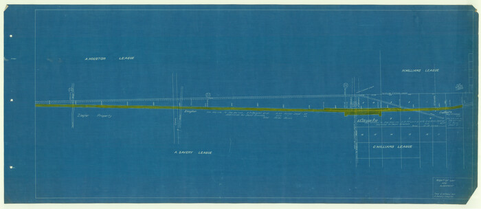
[T. & N. O. R.R. Jefferson Co. North]
Print $20.00
- Digital $50.00
[T. & N. O. R.R. Jefferson Co. North]
Size: 13.4 x 33.4 inches
64055
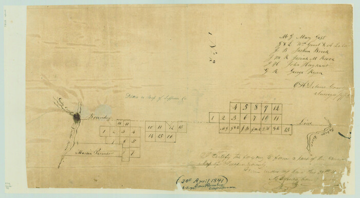
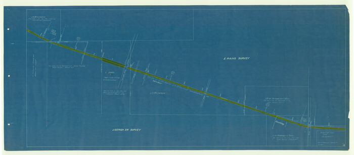
[Surveys along the boundary between Jasper and Jefferson Counties]
Print $3.00
- Digital $50.00
[Surveys along the boundary between Jasper and Jefferson Counties]
1841
Size: 9.3 x 16.9 inches
99
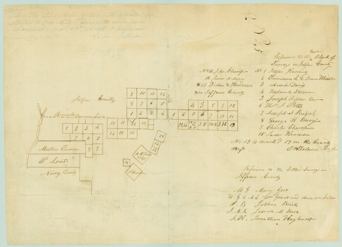
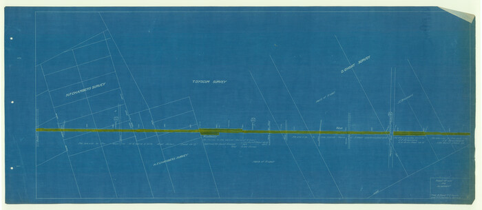
[Surveys along the Jefferson and Jasper County Boundary]
Print $3.00
- Digital $50.00
[Surveys along the Jefferson and Jasper County Boundary]
1841
Size: 11.8 x 16.3 inches
92
[Sketch for Mineral Application 14125 - Neches River, R. B. Moore]
Print $40.00
- Digital $50.00
[Sketch for Mineral Application 14125 - Neches River, R. B. Moore]
1928
Size: 26.1 x 50.0 inches
65667
[Sketch for Mineral Application 14125 - Neches River, R. B. Moore]
Print $40.00
- Digital $50.00
[Sketch for Mineral Application 14125 - Neches River, R. B. Moore]
1928
Size: 50.1 x 26.6 inches
65668
[Sketch for Mineral Application 13436 - Cut-off Bayou]
Print $20.00
- Digital $50.00
[Sketch for Mineral Application 13436 - Cut-off Bayou]
1928
Size: 21.3 x 44.3 inches
65675
[Sketch for Mineral Application 13436 - Cut-off Bayou]
Print $20.00
- Digital $50.00
[Sketch for Mineral Application 13436 - Cut-off Bayou]
1928
Size: 44.1 x 21.6 inches
65676
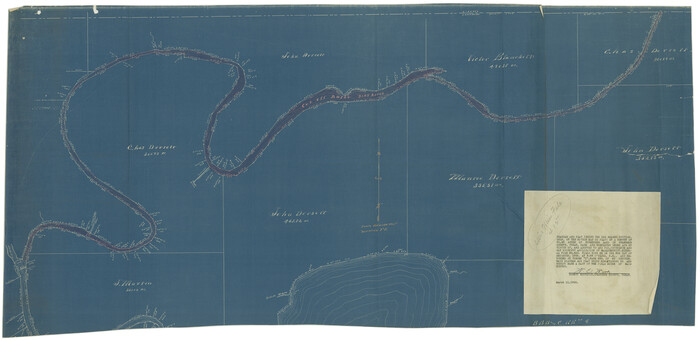
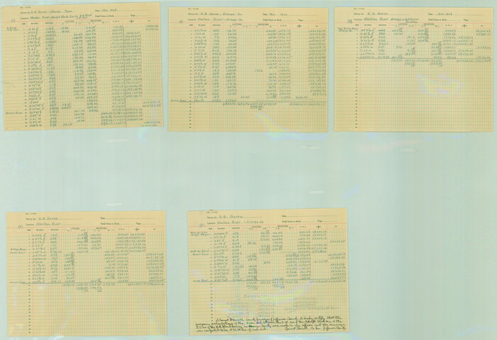
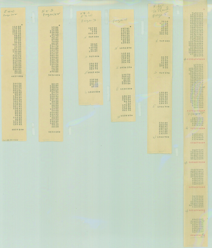
[Neches River Bed, Plat and Calculations]
Print $40.00
- Digital $50.00
[Neches River Bed, Plat and Calculations]
1928
Size: 27.3 x 51.0 inches
2466
[Neches River Bed, Plat and Calculations]
Print $20.00
- Digital $50.00
[Neches River Bed, Plat and Calculations]
1928
Size: 25.6 x 37.2 inches
77100
[Neches River Bed, Plat and Calculations]
Print $20.00
- Digital $50.00
[Neches River Bed, Plat and Calculations]
1928
Size: 23.2 x 19.8 inches
77101
[Beaumont, Sour Lake and Western Ry. Right of Way and Alignment - Frisco]
Print $20.00
- Digital $50.00
[Beaumont, Sour Lake and Western Ry. Right of Way and Alignment - Frisco]
1910
Size: 19.9 x 45.9 inches
64106
[Beaumont, Sour Lake and Western Ry. Right of Way and Alignment - Frisco]
Print $20.00
- Digital $50.00
[Beaumont, Sour Lake and Western Ry. Right of Way and Alignment - Frisco]
1910
Size: 20.4 x 46.0 inches
64107
[Beaumont, Sour Lake and Western Ry. Right of Way and Alignment - Frisco]
Print $20.00
- Digital $50.00
[Beaumont, Sour Lake and Western Ry. Right of Way and Alignment - Frisco]
1910
Size: 19.9 x 45.9 inches
64108
[Beaumont, Sour Lake and Western Ry. Right of Way and Alignment - Frisco]
Print $20.00
- Digital $50.00
[Beaumont, Sour Lake and Western Ry. Right of Way and Alignment - Frisco]
1910
Size: 20.3 x 46.2 inches
64109
[Beaumont, Sour Lake and Western Ry. Right of Way and Alignment - Frisco]
Print $20.00
- Digital $50.00
[Beaumont, Sour Lake and Western Ry. Right of Way and Alignment - Frisco]
1910
Size: 20.2 x 46.3 inches
64110
[Beaumont, Sour Lake and Western Ry. Right of Way and Alignment - Frisco]
Print $20.00
- Digital $50.00
[Beaumont, Sour Lake and Western Ry. Right of Way and Alignment - Frisco]
1910
Size: 19.8 x 45.9 inches
64111
Working Sketch Patents & Field Notes, Sabine Lake Area

Print $20.00
- Digital $50.00
Working Sketch Patents & Field Notes, Sabine Lake Area
1959
Size: 30.2 x 27.0 inches
2455
West Half of Sabine Lake, Jefferson County, showing Subdivision for Mineral Development; do not use; see Map 25a

Print $20.00
- Digital $50.00
West Half of Sabine Lake, Jefferson County, showing Subdivision for Mineral Development; do not use; see Map 25a
1956
Size: 38.2 x 28.4 inches
1930
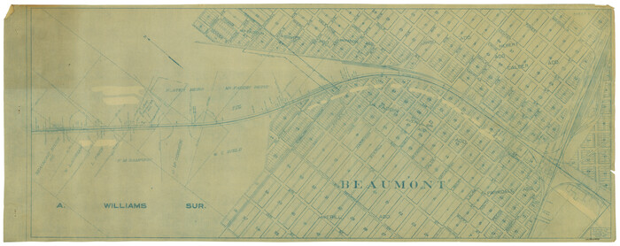
Town of Beaumont in Jefferson County, Texas

Print $20.00
Town of Beaumont in Jefferson County, Texas
1850
Size: 17.6 x 24.3 inches
76267
The Republic County of Jefferson. Spring 1842

Print $20.00
The Republic County of Jefferson. Spring 1842
2020
Size: 22.6 x 21.7 inches
96200
The Republic County of Jefferson. January 29, 1842

Print $20.00
The Republic County of Jefferson. January 29, 1842
2020
Size: 22.6 x 21.7 inches
96199
The Republic County of Jefferson. January 20, 1841

Print $20.00
The Republic County of Jefferson. January 20, 1841
2020
Size: 22.6 x 21.7 inches
96198
The Republic County of Jefferson. December 29, 1845

Print $20.00
The Republic County of Jefferson. December 29, 1845
2020
Size: 22.6 x 21.7 inches
96201
The Republic County of Jefferson. Boundaries Defined, December 21, 1837

Print $20.00
The Republic County of Jefferson. Boundaries Defined, December 21, 1837
2020
Size: 22.6 x 21.7 inches
96197
Texas Gulf Coast from the Sabine River to the Rio Grande Showing Location of Navigation Districts

Print $20.00
- Digital $50.00
Texas Gulf Coast from the Sabine River to the Rio Grande Showing Location of Navigation Districts
1954
Size: 45.0 x 43.8 inches
73596
Texas Gulf Coast Map from the Sabine River to the Rio Grande as subdivided for mineral development

Print $20.00
- Digital $50.00
Texas Gulf Coast Map from the Sabine River to the Rio Grande as subdivided for mineral development
1966
Size: 29.1 x 41.7 inches
2496
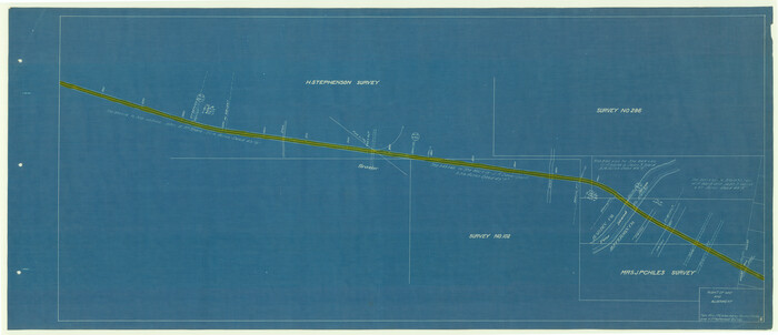
T. & N. O. R.R. Jefferson Co. North

Print $20.00
- Digital $50.00
T. & N. O. R.R. Jefferson Co. North
1917
Size: 13.4 x 33.5 inches
64056
T. & N. O. R.R. Jefferson Co. North

Print $20.00
- Digital $50.00
T. & N. O. R.R. Jefferson Co. North
1917
Size: 13.5 x 33.2 inches
64057
T. & N. O. R.R. Jefferson Co. North

Print $20.00
- Digital $50.00
T. & N. O. R.R. Jefferson Co. North
1917
Size: 13.4 x 33.5 inches
64058
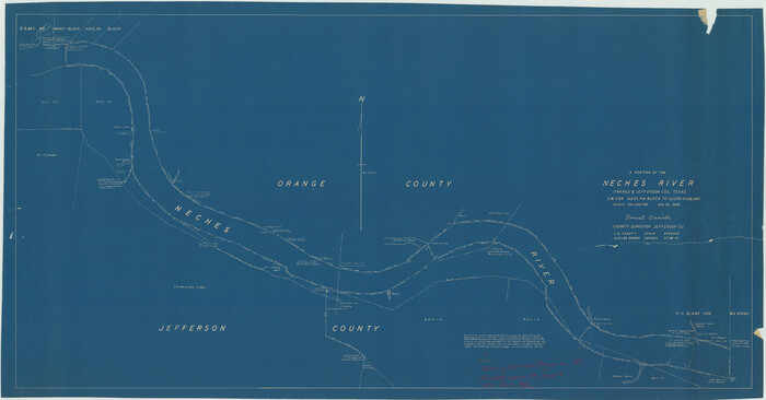
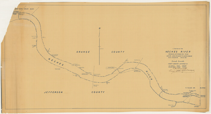
Sabine and Neches Rivers

Print $20.00
- Digital $50.00
Sabine and Neches Rivers
1925
Size: 19.6 x 44.0 inches
69816
[T. & N. O. R.R. Jefferson Co. North]
Print $20.00
- Digital $50.00
[T. & N. O. R.R. Jefferson Co. North]
-
Size
13.4 x 33.4 inches
-
Map/Doc
64055
[Surveys along the boundary between Jasper and Jefferson Counties]
Print $3.00
- Digital $50.00
[Surveys along the boundary between Jasper and Jefferson Counties]
1841
-
Size
9.3 x 16.9 inches
-
Map/Doc
99
-
Creation Date
1841
[Surveys along the Jefferson and Jasper County Boundary]
Print $3.00
- Digital $50.00
[Surveys along the Jefferson and Jasper County Boundary]
1841
-
Size
11.8 x 16.3 inches
-
Map/Doc
92
-
Creation Date
1841
[Sketch for Mineral Application 14125 - Neches River, R. B. Moore]
Print $40.00
- Digital $50.00
[Sketch for Mineral Application 14125 - Neches River, R. B. Moore]
1928
-
Size
26.1 x 50.0 inches
-
Map/Doc
65667
-
Creation Date
1928
[Sketch for Mineral Application 14125 - Neches River, R. B. Moore]
Print $40.00
- Digital $50.00
[Sketch for Mineral Application 14125 - Neches River, R. B. Moore]
1928
-
Size
50.1 x 26.6 inches
-
Map/Doc
65668
-
Creation Date
1928
[Sketch for Mineral Application 13436 - Cut-off Bayou]
Print $20.00
- Digital $50.00
[Sketch for Mineral Application 13436 - Cut-off Bayou]
1928
-
Size
21.3 x 44.3 inches
-
Map/Doc
65675
-
Creation Date
1928
[Sketch for Mineral Application 13436 - Cut-off Bayou]
Print $20.00
- Digital $50.00
[Sketch for Mineral Application 13436 - Cut-off Bayou]
1928
-
Size
44.1 x 21.6 inches
-
Map/Doc
65676
-
Creation Date
1928
[Neches River Bed, Plat and Calculations]
Print $40.00
- Digital $50.00
[Neches River Bed, Plat and Calculations]
1928
-
Size
27.3 x 51.0 inches
-
Map/Doc
2466
-
Creation Date
1928
[Neches River Bed, Plat and Calculations]
Print $20.00
- Digital $50.00
[Neches River Bed, Plat and Calculations]
1928
-
Size
25.6 x 37.2 inches
-
Map/Doc
77100
-
Creation Date
1928
[Neches River Bed, Plat and Calculations]
Print $20.00
- Digital $50.00
[Neches River Bed, Plat and Calculations]
1928
-
Size
23.2 x 19.8 inches
-
Map/Doc
77101
-
Creation Date
1928
[Beaumont, Sour Lake and Western Ry. Right of Way and Alignment - Frisco]
Print $20.00
- Digital $50.00
[Beaumont, Sour Lake and Western Ry. Right of Way and Alignment - Frisco]
1910
-
Size
19.9 x 45.9 inches
-
Map/Doc
64106
-
Creation Date
1910
[Beaumont, Sour Lake and Western Ry. Right of Way and Alignment - Frisco]
Print $20.00
- Digital $50.00
[Beaumont, Sour Lake and Western Ry. Right of Way and Alignment - Frisco]
1910
-
Size
20.4 x 46.0 inches
-
Map/Doc
64107
-
Creation Date
1910
[Beaumont, Sour Lake and Western Ry. Right of Way and Alignment - Frisco]
Print $20.00
- Digital $50.00
[Beaumont, Sour Lake and Western Ry. Right of Way and Alignment - Frisco]
1910
-
Size
19.9 x 45.9 inches
-
Map/Doc
64108
-
Creation Date
1910
[Beaumont, Sour Lake and Western Ry. Right of Way and Alignment - Frisco]
Print $20.00
- Digital $50.00
[Beaumont, Sour Lake and Western Ry. Right of Way and Alignment - Frisco]
1910
-
Size
20.3 x 46.2 inches
-
Map/Doc
64109
-
Creation Date
1910
[Beaumont, Sour Lake and Western Ry. Right of Way and Alignment - Frisco]
Print $20.00
- Digital $50.00
[Beaumont, Sour Lake and Western Ry. Right of Way and Alignment - Frisco]
1910
-
Size
20.2 x 46.3 inches
-
Map/Doc
64110
-
Creation Date
1910
[Beaumont, Sour Lake and Western Ry. Right of Way and Alignment - Frisco]
Print $20.00
- Digital $50.00
[Beaumont, Sour Lake and Western Ry. Right of Way and Alignment - Frisco]
1910
-
Size
19.8 x 45.9 inches
-
Map/Doc
64111
-
Creation Date
1910
Working Sketch Patents & Field Notes, Sabine Lake Area
Print $20.00
- Digital $50.00
Working Sketch Patents & Field Notes, Sabine Lake Area
1959
-
Size
30.2 x 27.0 inches
-
Map/Doc
2455
-
Creation Date
1959
West Half of Sabine Lake, Jefferson County, showing Subdivision for Mineral Development; do not use; see Map 25a
Print $20.00
- Digital $50.00
West Half of Sabine Lake, Jefferson County, showing Subdivision for Mineral Development; do not use; see Map 25a
1956
-
Size
38.2 x 28.4 inches
-
Map/Doc
1930
-
Creation Date
1956
Town of Beaumont in Jefferson County, Texas
Print $20.00
Town of Beaumont in Jefferson County, Texas
1850
-
Size
17.6 x 24.3 inches
-
Map/Doc
76267
-
Creation Date
1850
The Republic County of Jefferson. Spring 1842
Print $20.00
The Republic County of Jefferson. Spring 1842
2020
-
Size
22.6 x 21.7 inches
-
Map/Doc
96200
-
Creation Date
2020
The Republic County of Jefferson. January 29, 1842
Print $20.00
The Republic County of Jefferson. January 29, 1842
2020
-
Size
22.6 x 21.7 inches
-
Map/Doc
96199
-
Creation Date
2020
The Republic County of Jefferson. January 20, 1841
Print $20.00
The Republic County of Jefferson. January 20, 1841
2020
-
Size
22.6 x 21.7 inches
-
Map/Doc
96198
-
Creation Date
2020
The Republic County of Jefferson. December 29, 1845
Print $20.00
The Republic County of Jefferson. December 29, 1845
2020
-
Size
22.6 x 21.7 inches
-
Map/Doc
96201
-
Creation Date
2020
The Republic County of Jefferson. Boundaries Defined, December 21, 1837
Print $20.00
The Republic County of Jefferson. Boundaries Defined, December 21, 1837
2020
-
Size
22.6 x 21.7 inches
-
Map/Doc
96197
-
Creation Date
2020
Texas Gulf Coast from the Sabine River to the Rio Grande Showing Location of Navigation Districts
Print $20.00
- Digital $50.00
Texas Gulf Coast from the Sabine River to the Rio Grande Showing Location of Navigation Districts
1954
-
Size
45.0 x 43.8 inches
-
Map/Doc
73596
-
Creation Date
1954
Texas Gulf Coast Map from the Sabine River to the Rio Grande as subdivided for mineral development
Print $20.00
- Digital $50.00
Texas Gulf Coast Map from the Sabine River to the Rio Grande as subdivided for mineral development
1966
-
Size
29.1 x 41.7 inches
-
Map/Doc
2496
-
Creation Date
1966
T. & N. O. R.R. Jefferson Co. North
Print $20.00
- Digital $50.00
T. & N. O. R.R. Jefferson Co. North
1917
-
Size
13.4 x 33.5 inches
-
Map/Doc
64056
-
Creation Date
1917
T. & N. O. R.R. Jefferson Co. North
Print $20.00
- Digital $50.00
T. & N. O. R.R. Jefferson Co. North
1917
-
Size
13.5 x 33.2 inches
-
Map/Doc
64057
-
Creation Date
1917
T. & N. O. R.R. Jefferson Co. North
Print $20.00
- Digital $50.00
T. & N. O. R.R. Jefferson Co. North
1917
-
Size
13.4 x 33.5 inches
-
Map/Doc
64058
-
Creation Date
1917
Sabine and Neches Rivers
Print $20.00
- Digital $50.00
Sabine and Neches Rivers
1925
-
Size
19.6 x 44.0 inches
-
Map/Doc
69816
-
Creation Date
1925