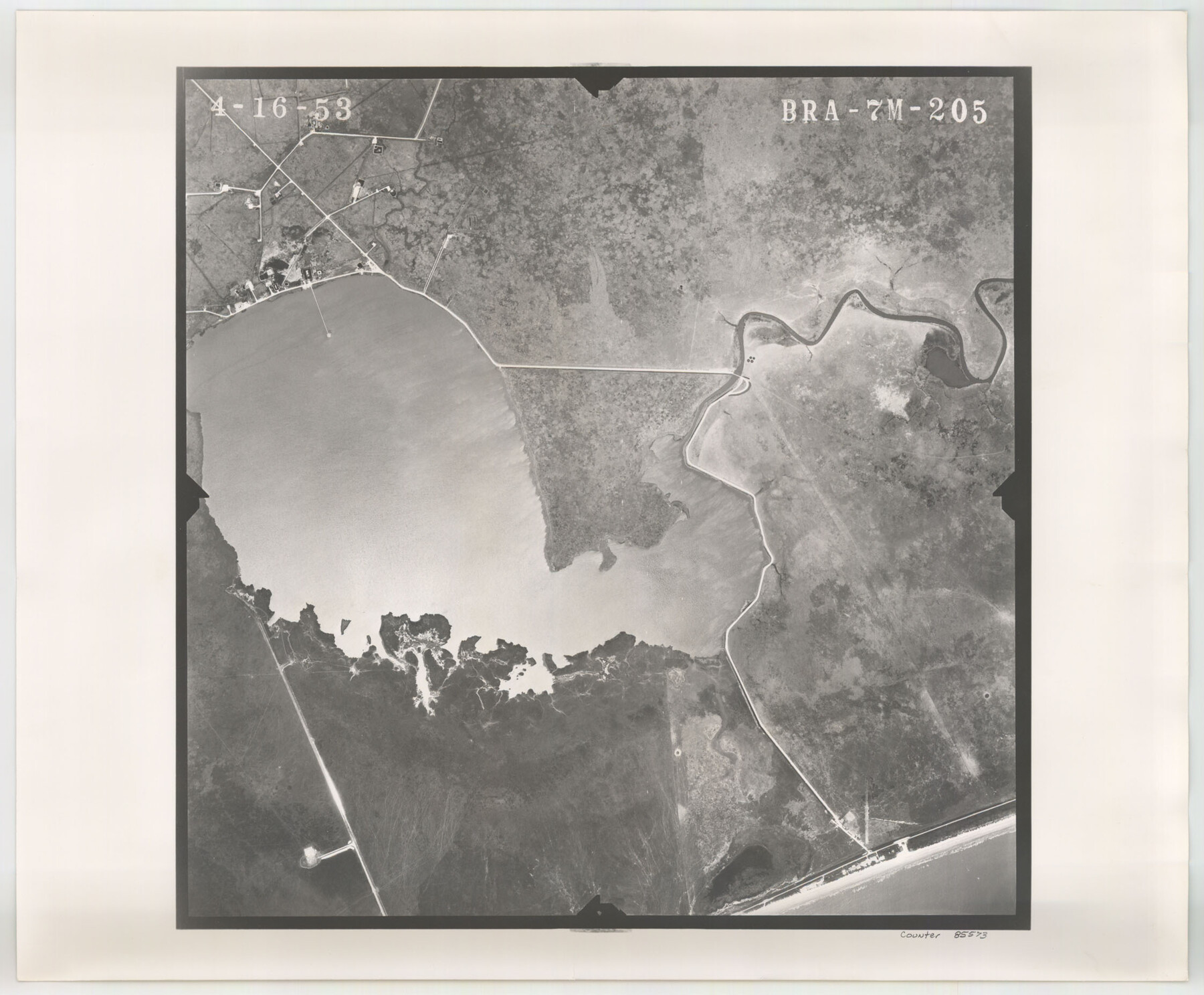
Flight Mission No. BRA-7M, Frame 205, Jefferson County
BRA-7M-205
-
Map/Doc
85573
-
Collection
General Map Collection
-
Object Dates
1953/4/16 (Creation Date)
-
People and Organizations
U. S. Department of Agriculture (Publisher)
-
Counties
Jefferson
-
Subjects
Aerial Photograph
-
Height x Width
18.5 x 22.4 inches
47.0 x 56.9 cm
-
Comments
Flown by Jack Ammann Photogrammetric Engineers of San Antonio, Texas.
Part of: General Map Collection
Montague County Sketch File 9

Print $18.00
- Digital $50.00
Montague County Sketch File 9
1872
Size 12.6 x 11.7 inches
Map/Doc 31724
[St. L. S.-W. Ry. of Texas, Map of Lufkin Branch in Smith County, Texas]
![64693, [St. L. S.-W. Ry. of Texas, Map of Lufkin Branch in Smith County, Texas], General Map Collection](https://historictexasmaps.com/wmedia_w700/maps/64693.tif.jpg)
Print $40.00
- Digital $50.00
[St. L. S.-W. Ry. of Texas, Map of Lufkin Branch in Smith County, Texas]
1912
Size 24.2 x 121.2 inches
Map/Doc 64693
Sterling County Sketch File 15

Print $8.00
- Digital $50.00
Sterling County Sketch File 15
1935
Size 11.1 x 8.8 inches
Map/Doc 37150
Mills County Sketch File 9

Print $20.00
- Digital $50.00
Mills County Sketch File 9
Size 36.0 x 29.5 inches
Map/Doc 10544
State Prison System, Cherokee County

Print $20.00
- Digital $50.00
State Prison System, Cherokee County
Size 17.9 x 13.8 inches
Map/Doc 73561
[T. & G. Ry. Main Line, Texas, Right of Way Map, Center to Gary]
![64572, [T. & G. Ry. Main Line, Texas, Right of Way Map, Center to Gary], General Map Collection](https://historictexasmaps.com/wmedia_w700/maps/64572-1.tif.jpg)
Print $40.00
- Digital $50.00
[T. & G. Ry. Main Line, Texas, Right of Way Map, Center to Gary]
1917
Size 31.9 x 104.6 inches
Map/Doc 64572
Coke County Sketch File 22

Print $20.00
- Digital $50.00
Coke County Sketch File 22
1923
Size 22.1 x 27.8 inches
Map/Doc 11111
Denton County Sketch File 15

Print $8.00
- Digital $50.00
Denton County Sketch File 15
1857
Size 13.1 x 8.2 inches
Map/Doc 20724
Wise County Rolled Sketch 9

Print $20.00
- Digital $50.00
Wise County Rolled Sketch 9
Size 35.2 x 24.2 inches
Map/Doc 93640
Zapata County

Print $40.00
- Digital $50.00
Zapata County
1901
Size 53.1 x 38.0 inches
Map/Doc 63143
Pecos County Rolled Sketch 119

Print $20.00
- Digital $50.00
Pecos County Rolled Sketch 119
1945
Size 20.5 x 21.5 inches
Map/Doc 7261
Eastland County Working Sketch 66

Print $20.00
- Digital $50.00
Eastland County Working Sketch 66
2014
Size 27.2 x 20.1 inches
Map/Doc 93708
You may also like
Madison County

Print $20.00
- Digital $50.00
Madison County
1871
Size 15.2 x 20.3 inches
Map/Doc 4587
Jefferson County Aerial Photograph Index Sheet 6

Print $20.00
- Digital $50.00
Jefferson County Aerial Photograph Index Sheet 6
1953
Size 23.3 x 17.0 inches
Map/Doc 83710
Dallas County Sketch File 20

Print $4.00
- Digital $50.00
Dallas County Sketch File 20
Size 12.2 x 7.8 inches
Map/Doc 20441
Val Verde County Sketch File XXX4

Print $4.00
- Digital $50.00
Val Verde County Sketch File XXX4
Size 12.8 x 8.4 inches
Map/Doc 39098
Atascosa County Working Sketch 33

Print $20.00
- Digital $50.00
Atascosa County Working Sketch 33
1982
Size 16.7 x 13.6 inches
Map/Doc 67229
Real County Sketch File 18

Print $28.00
- Digital $50.00
Real County Sketch File 18
1964
Size 14.3 x 8.9 inches
Map/Doc 35076
Blocks T1, T2, T3, S3, A, O5, and Capitol Leagues]
![91074, Blocks T1, T2, T3, S3, A, O5, and Capitol Leagues], Twichell Survey Records](https://historictexasmaps.com/wmedia_w700/maps/91074-1.tif.jpg)
Print $20.00
- Digital $50.00
Blocks T1, T2, T3, S3, A, O5, and Capitol Leagues]
Size 30.0 x 33.4 inches
Map/Doc 91074
Terrell County Working Sketch 72

Print $20.00
- Digital $50.00
Terrell County Working Sketch 72
1980
Size 14.3 x 24.8 inches
Map/Doc 69593
McLennan County Working Sketch 4

Print $20.00
- Digital $50.00
McLennan County Working Sketch 4
1941
Size 19.2 x 27.9 inches
Map/Doc 70697
D. B. Gardner vs. Mrs. Clara C. Starr

Print $20.00
- Digital $50.00
D. B. Gardner vs. Mrs. Clara C. Starr
Size 16.7 x 28.8 inches
Map/Doc 92149
Nolan County Sketch File 1a

Print $20.00
- Digital $50.00
Nolan County Sketch File 1a
1882
Size 20.7 x 39.4 inches
Map/Doc 10554
Sketch Showing Division Fence Shelton- Matador, Oldham County

Print $20.00
- Digital $50.00
Sketch Showing Division Fence Shelton- Matador, Oldham County
Size 21.8 x 24.5 inches
Map/Doc 91486