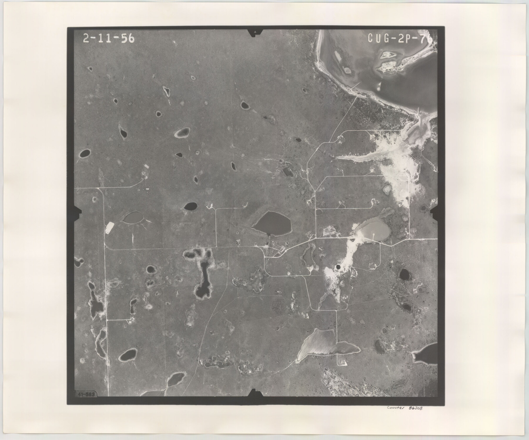
Flight Mission No. CUG-2P, Frame 76, Kleberg County
CUG-2P-76
-
Map/Doc
86208
-
Collection
General Map Collection
-
Object Dates
1956/2/11 (Creation Date)
-
People and Organizations
U. S. Department of Agriculture (Publisher)
-
Counties
Kleberg
-
Subjects
Aerial Photograph
-
Height x Width
18.4 x 22.1 inches
46.7 x 56.1 cm
-
Comments
Flown by V. L. Beavers and Associates of San Antonio, Texas.
Part of: General Map Collection
Flight Mission No. BRA-8M, Frame 83, Jefferson County

Print $20.00
- Digital $50.00
Flight Mission No. BRA-8M, Frame 83, Jefferson County
1953
Size 15.8 x 15.7 inches
Map/Doc 85603
Liberty County Sketch File 36

Print $2.00
- Digital $50.00
Liberty County Sketch File 36
Size 9.4 x 9.0 inches
Map/Doc 29973
Live Oak County Sketch File 6

Print $4.00
- Digital $50.00
Live Oak County Sketch File 6
1847
Size 9.9 x 7.8 inches
Map/Doc 30257
[Surveys along Richland Creek]
![320, [Surveys along Richland Creek], General Map Collection](https://historictexasmaps.com/wmedia_w700/maps/320.tif.jpg)
Print $2.00
- Digital $50.00
[Surveys along Richland Creek]
Size 7.2 x 6.0 inches
Map/Doc 320
Pecos County Working Sketch 67

Print $20.00
- Digital $50.00
Pecos County Working Sketch 67
1955
Size 17.7 x 18.7 inches
Map/Doc 71539
Jefferson County Rolled Sketch 3

Print $20.00
- Digital $50.00
Jefferson County Rolled Sketch 3
1909
Size 36.0 x 16.2 inches
Map/Doc 6384

Edwards County Working Sketch 37

Print $20.00
- Digital $50.00
Edwards County Working Sketch 37
1948
Size 23.1 x 35.5 inches
Map/Doc 68913
Flight Mission No. DQO-6K, Frame 31, Galveston County

Print $20.00
- Digital $50.00
Flight Mission No. DQO-6K, Frame 31, Galveston County
1952
Size 18.5 x 22.4 inches
Map/Doc 85097
Midland County Working Sketch 12

Print $20.00
- Digital $50.00
Midland County Working Sketch 12
1951
Size 23.1 x 19.0 inches
Map/Doc 70992
Marion County Sketch File 7

Print $40.00
- Digital $50.00
Marion County Sketch File 7
1866
Size 16.2 x 12.0 inches
Map/Doc 30573
Armstrong County Sketch File A-15

Print $40.00
- Digital $50.00
Armstrong County Sketch File A-15
Size 17.8 x 14.0 inches
Map/Doc 13716
You may also like
[Sketch showing Connecting Lines]
![91938, [Sketch showing Connecting Lines], Twichell Survey Records](https://historictexasmaps.com/wmedia_w700/maps/91938-1.tif.jpg)
Print $20.00
- Digital $50.00
[Sketch showing Connecting Lines]
Size 24.3 x 18.3 inches
Map/Doc 91938
Map of Jones County

Print $20.00
- Digital $50.00
Map of Jones County
1898
Size 41.2 x 40.0 inches
Map/Doc 16862
Brewster County Sketch File 16

Print $46.00
- Digital $50.00
Brewster County Sketch File 16
1936
Size 14.3 x 8.6 inches
Map/Doc 15777
McMullen County Sketch File 16

Print $24.00
- Digital $50.00
McMullen County Sketch File 16
1876
Size 5.3 x 8.3 inches
Map/Doc 31365
Val Verde County Working Sketch 121

Print $40.00
- Digital $50.00
Val Verde County Working Sketch 121
2005
Size 34.0 x 54.2 inches
Map/Doc 83590
Flight Mission No. DAG-21K, Frame 99, Matagorda County

Print $20.00
- Digital $50.00
Flight Mission No. DAG-21K, Frame 99, Matagorda County
1952
Size 17.5 x 16.3 inches
Map/Doc 86428
Flight Mission No. BRA-3M, Frame 201, Jefferson County

Print $20.00
- Digital $50.00
Flight Mission No. BRA-3M, Frame 201, Jefferson County
1953
Size 18.7 x 22.5 inches
Map/Doc 85416
Mosaic composed of aerial photographs - Texas City, Tex.

Print $20.00
- Digital $50.00
Mosaic composed of aerial photographs - Texas City, Tex.
1923
Size 15.0 x 16.8 inches
Map/Doc 97166
Coleman County Sketch File 42

Print $24.00
- Digital $50.00
Coleman County Sketch File 42
1891
Size 5.8 x 8.9 inches
Map/Doc 18763
Kimble County Sketch File 4

Print $8.00
- Digital $50.00
Kimble County Sketch File 4
1847
Size 7.9 x 12.1 inches
Map/Doc 28912
Bee County Working Sketch 33

Print $20.00
- Digital $50.00
Bee County Working Sketch 33
1980
Size 32.0 x 28.2 inches
Map/Doc 67284
[The S.K. Ry. of Texas, State Line to Pecos, Reeves Co., Texas]
![64164, [The S.K. Ry. of Texas, State Line to Pecos, Reeves Co., Texas], General Map Collection](https://historictexasmaps.com/wmedia_w700/maps/64164-1.tif.jpg)
Print $40.00
- Digital $50.00
[The S.K. Ry. of Texas, State Line to Pecos, Reeves Co., Texas]
1910
Size 18.7 x 95.8 inches
Map/Doc 64164