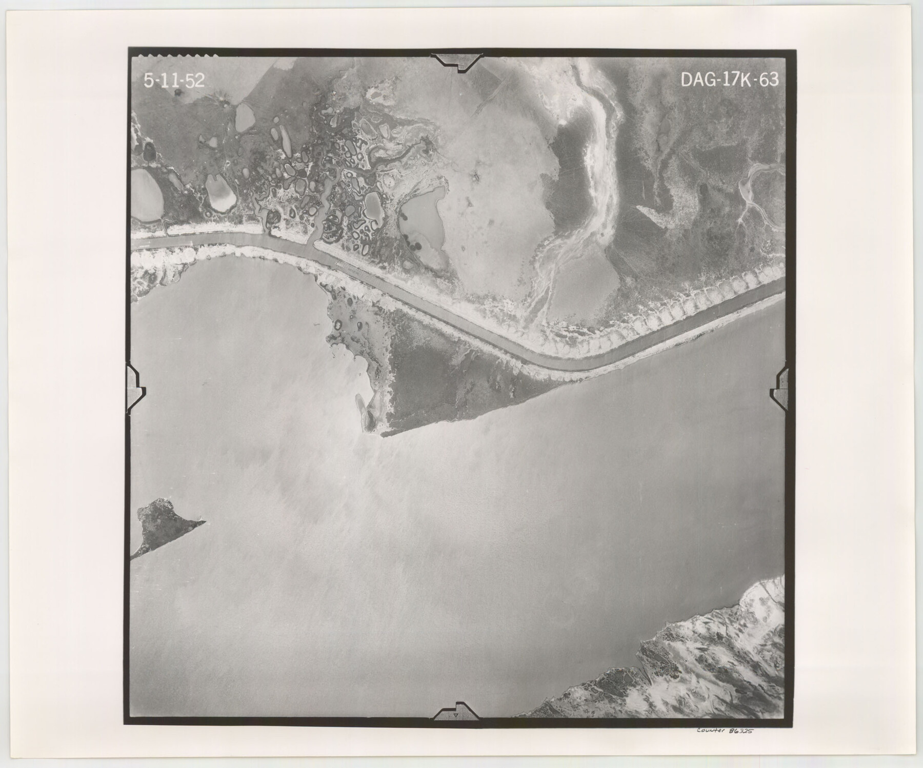
Flight Mission No. DAG-17K, Frame 63, Matagorda County
DAG-17K-63
-
Map/Doc
86325
-
Collection
General Map Collection
-
Object Dates
1952/5/11 (Creation Date)
-
People and Organizations
U. S. Department of Agriculture (Publisher)
-
Counties
Matagorda
-
Subjects
Aerial Photograph
-
Height x Width
18.6 x 22.3 inches
47.2 x 56.6 cm
-
Comments
Flown by Aero Exploration Company of Tulsa, Oklahoma.
Part of: General Map Collection
Map of the Line of the H. & Texas Cen. Railway from the Navasota River, 72 1/2 Miles from Houston, to Corsicana in Navarro Co., 211 mls from Houston

Print $40.00
- Digital $50.00
Map of the Line of the H. & Texas Cen. Railway from the Navasota River, 72 1/2 Miles from Houston, to Corsicana in Navarro Co., 211 mls from Houston
Size 39.2 x 61.4 inches
Map/Doc 64086
Armstrong County Working Sketch 1

Print $20.00
- Digital $50.00
Armstrong County Working Sketch 1
1903
Size 10.3 x 17.2 inches
Map/Doc 67232
San Patricio County Rolled Sketch 47A

Print $20.00
- Digital $50.00
San Patricio County Rolled Sketch 47A
1939
Size 27.7 x 28.5 inches
Map/Doc 7732
Eastland County Working Sketch 57

Print $20.00
- Digital $50.00
Eastland County Working Sketch 57
1985
Size 21.7 x 21.8 inches
Map/Doc 68838
Kerr County Working Sketch 10

Print $20.00
- Digital $50.00
Kerr County Working Sketch 10
1951
Size 22.3 x 16.0 inches
Map/Doc 70041
Uvalde County Working Sketch 7

Print $20.00
- Digital $50.00
Uvalde County Working Sketch 7
1942
Size 29.2 x 30.0 inches
Map/Doc 72077
Galveston County NRC Article 33.136 Sketch 70

Print $24.00
- Digital $50.00
Galveston County NRC Article 33.136 Sketch 70
2012
Size 24.0 x 24.3 inches
Map/Doc 95111
Sabine County Sketch File 4

Print $22.00
Sabine County Sketch File 4
1876
Size 8.1 x 12.8 inches
Map/Doc 35606
Morris County Rolled Sketch 2A

Print $20.00
- Digital $50.00
Morris County Rolled Sketch 2A
Size 24.2 x 19.1 inches
Map/Doc 10249
Index for Texas Railroad ROW & track maps available on microfilm at THD & Archives and Records

Print $2.00
- Digital $50.00
Index for Texas Railroad ROW & track maps available on microfilm at THD & Archives and Records
1977
Size 11.2 x 8.8 inches
Map/Doc 60757
Flight Mission No. DAG-24K, Frame 134, Matagorda County

Print $20.00
- Digital $50.00
Flight Mission No. DAG-24K, Frame 134, Matagorda County
1953
Size 17.1 x 15.6 inches
Map/Doc 86552
Atascosa County Sketch File 37

Print $40.00
- Digital $50.00
Atascosa County Sketch File 37
Size 17.6 x 12.9 inches
Map/Doc 13829
You may also like
Henderson County Working Sketch 19

Print $20.00
- Digital $50.00
Henderson County Working Sketch 19
1947
Size 18.6 x 20.3 inches
Map/Doc 66152
Val Verde County Working Sketch 89

Print $20.00
- Digital $50.00
Val Verde County Working Sketch 89
1974
Size 24.5 x 29.0 inches
Map/Doc 72224
Sutton County Sketch File 42

Print $6.00
- Digital $50.00
Sutton County Sketch File 42
1940
Size 11.2 x 8.8 inches
Map/Doc 37509
Dallam County

Print $20.00
- Digital $50.00
Dallam County
1888
Size 29.5 x 24.6 inches
Map/Doc 90654
Bosque County Sketch File 28

Print $6.00
- Digital $50.00
Bosque County Sketch File 28
1888
Size 7.3 x 10.3 inches
Map/Doc 14813
No. 3 Chart of Channel connecting Corpus Christi Bay with Aransas Bay, Texas

Print $20.00
- Digital $50.00
No. 3 Chart of Channel connecting Corpus Christi Bay with Aransas Bay, Texas
1878
Size 18.1 x 27.8 inches
Map/Doc 72780
The Republic County of Montgomery. Created, December 14, 1837

Print $20.00
The Republic County of Montgomery. Created, December 14, 1837
2020
Size 19.9 x 21.7 inches
Map/Doc 96234
Lipscomb County Boundary File 14

Print $62.00
- Digital $50.00
Lipscomb County Boundary File 14
Size 13.3 x 8.8 inches
Map/Doc 56355
Chambers County Sketch File 1

Print $4.00
- Digital $50.00
Chambers County Sketch File 1
1856
Size 7.8 x 12.2 inches
Map/Doc 17516
Dickens County Rolled Sketch 13

Print $40.00
- Digital $50.00
Dickens County Rolled Sketch 13
1950
Size 43.4 x 53.7 inches
Map/Doc 45135
Pecos County Sketch File 78

Print $6.00
- Digital $50.00
Pecos County Sketch File 78
1943
Size 11.1 x 8.8 inches
Map/Doc 33911
Randall County Rolled Sketch 8

Print $20.00
- Digital $50.00
Randall County Rolled Sketch 8
Size 25.7 x 35.6 inches
Map/Doc 7428