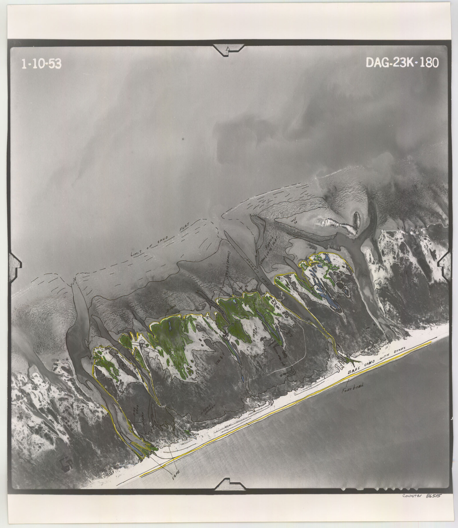
Flight Mission No. DAG-23K, Frame 180, Matagorda County
DAG-23K-180
-
Map/Doc
86515
-
Collection
General Map Collection
-
Object Dates
1953/1/10 (Creation Date)
-
People and Organizations
U. S. Department of Agriculture (Publisher)
-
Counties
Matagorda
-
Subjects
Aerial Photograph
-
Height x Width
18.4 x 16.0 inches
46.7 x 40.6 cm
-
Comments
Flown by Aero Exploration Company of Tulsa, Oklahoma.
Part of: General Map Collection
Flight Mission No. BRE-2P, Frame 44, Nueces County

Print $20.00
- Digital $50.00
Flight Mission No. BRE-2P, Frame 44, Nueces County
1956
Size 18.7 x 22.9 inches
Map/Doc 86746
Presidio County Boundary File 4

Print $8.00
- Digital $50.00
Presidio County Boundary File 4
Size 13.9 x 8.6 inches
Map/Doc 58083
Brazos Santiago, Texas

Print $20.00
- Digital $50.00
Brazos Santiago, Texas
1900
Size 18.2 x 27.1 inches
Map/Doc 73034
Land of the Maya, a Traveler's Map

Land of the Maya, a Traveler's Map
Size 27.2 x 20.5 inches
Map/Doc 95933
Flight Mission No. DQN-6K, Frame 68, Calhoun County

Print $20.00
- Digital $50.00
Flight Mission No. DQN-6K, Frame 68, Calhoun County
1953
Size 18.5 x 22.1 inches
Map/Doc 84440
Live Oak County Sketch File 34

Print $28.00
- Digital $50.00
Live Oak County Sketch File 34
1963
Size 31.0 x 23.9 inches
Map/Doc 12011
Travis County State Real Property Sketch 8

Print $20.00
- Digital $50.00
Travis County State Real Property Sketch 8
1996
Size 30.5 x 42.6 inches
Map/Doc 77192
McMullen County Sketch File 34

Print $25.00
- Digital $50.00
McMullen County Sketch File 34
Size 10.5 x 9.2 inches
Map/Doc 31400
Plan B, Part 3rd Shewing that portion of the boundary between Texas and the United States, included between Logan's Ferry on the River Sabine and the intersection of the 32nd degree of N. Latitude with the western bank of the said river

Print $20.00
- Digital $50.00
Plan B, Part 3rd Shewing that portion of the boundary between Texas and the United States, included between Logan's Ferry on the River Sabine and the intersection of the 32nd degree of N. Latitude with the western bank of the said river
1842
Size 19.4 x 27.2 inches
Map/Doc 65411

Zavala County Rolled Sketch 16

Print $20.00
- Digital $50.00
Zavala County Rolled Sketch 16
Size 19.4 x 25.4 inches
Map/Doc 8321
Supplemental Plat of a portion of T. 5S., R. 13W., Indian Mer., Oklahoma

Print $4.00
- Digital $50.00
Supplemental Plat of a portion of T. 5S., R. 13W., Indian Mer., Oklahoma
1922
Size 18.3 x 24.4 inches
Map/Doc 75154
You may also like
Rockwall County Sketch File 5

Print $6.00
Rockwall County Sketch File 5
1861
Size 13.0 x 8.3 inches
Map/Doc 35422
Brewster County Sketch File 41

Print $12.00
- Digital $50.00
Brewster County Sketch File 41
Size 6.9 x 14.5 inches
Map/Doc 16304
Culberson County Working Sketch 39

Print $40.00
- Digital $50.00
Culberson County Working Sketch 39
1966
Size 37.9 x 82.7 inches
Map/Doc 68492
Map of the country adjacent to the left bank of the Rio Grande below Matamoros

Print $20.00
- Digital $50.00
Map of the country adjacent to the left bank of the Rio Grande below Matamoros
1847
Size 18.3 x 28.2 inches
Map/Doc 72871
Kent County Boundary File 4a

Print $18.00
- Digital $50.00
Kent County Boundary File 4a
Size 14.2 x 8.5 inches
Map/Doc 55838
Milam County Working Sketch 2

Print $20.00
- Digital $50.00
Milam County Working Sketch 2
1937
Size 20.2 x 20.5 inches
Map/Doc 71017
Gregg County Boundary File 6

Print $6.00
- Digital $50.00
Gregg County Boundary File 6
Size 8.5 x 5.8 inches
Map/Doc 54001
Flight Mission No. CUG-3P, Frame 80, Kleberg County

Print $20.00
- Digital $50.00
Flight Mission No. CUG-3P, Frame 80, Kleberg County
1956
Size 18.7 x 22.4 inches
Map/Doc 86255
Lampasas County Working Sketch 5

Print $20.00
- Digital $50.00
Lampasas County Working Sketch 5
1947
Size 25.6 x 31.8 inches
Map/Doc 70282
Menard County Working Sketch 12

Print $20.00
- Digital $50.00
Menard County Working Sketch 12
1939
Size 24.7 x 30.0 inches
Map/Doc 70959
Eastland County Sketch File 10

Print $42.00
- Digital $50.00
Eastland County Sketch File 10
Size 7.0 x 7.8 inches
Map/Doc 21582
Aransas County Rolled Sketch 27E

Print $20.00
- Digital $50.00
Aransas County Rolled Sketch 27E
1958
Size 30.2 x 30.9 inches
Map/Doc 8419