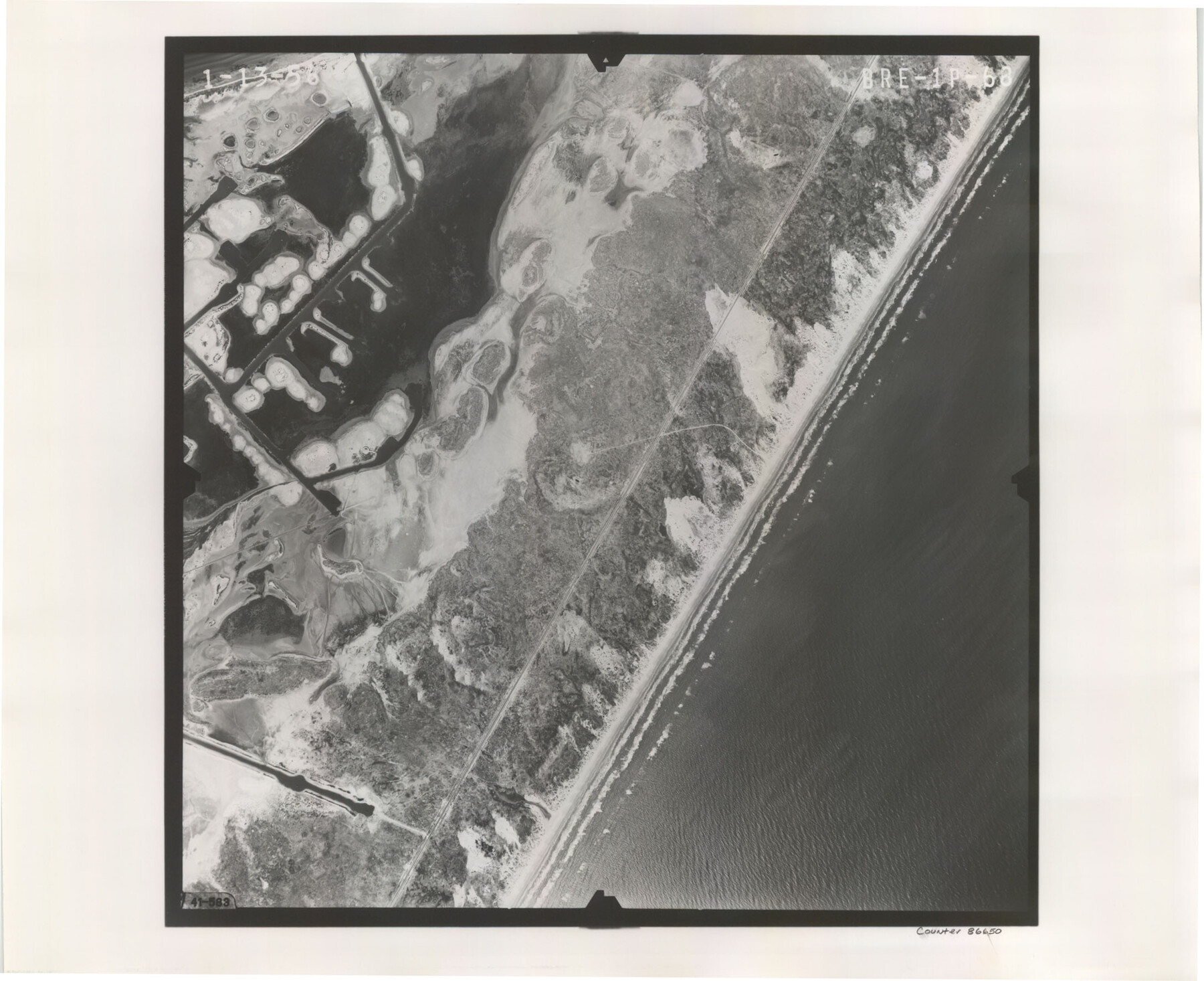
Flight Mission No. BRE-1P, Frame 68, Nueces County
BRE-1P-68
-
Map/Doc
86650
-
Collection
General Map Collection
-
Object Dates
1956/1/13 (Creation Date)
-
People and Organizations
U. S. Department of Agriculture (Publisher)
-
Counties
Nueces
-
Subjects
Aerial Photograph
-
Height x Width
17.7 x 21.8 inches
45.0 x 55.4 cm
-
Comments
Flown by V. L. Beavers and Associates of San Antonio, Texas.
Part of: General Map Collection
Treaty to Resolve Pending Boundary Differences and Maintain the Rio Grande and Colorado River as the International Boundary Between the United States of American and Mexico

Print $20.00
- Digital $50.00
Treaty to Resolve Pending Boundary Differences and Maintain the Rio Grande and Colorado River as the International Boundary Between the United States of American and Mexico
1970
Size 11.0 x 35.2 inches
Map/Doc 83105
Flight Mission No. BRA-7M, Frame 122, Jefferson County

Print $20.00
- Digital $50.00
Flight Mission No. BRA-7M, Frame 122, Jefferson County
1953
Size 18.7 x 22.3 inches
Map/Doc 85516
Reeves County Working Sketch 19

Print $20.00
- Digital $50.00
Reeves County Working Sketch 19
1962
Size 42.3 x 42.7 inches
Map/Doc 63462
Chambers County Rolled Sketch 25A

Print $20.00
- Digital $50.00
Chambers County Rolled Sketch 25A
1944
Size 41.2 x 34.5 inches
Map/Doc 8617
Cameron County Boundary File 3

Print $26.00
- Digital $50.00
Cameron County Boundary File 3
Size 14.4 x 8.4 inches
Map/Doc 51097
Henderson County Rolled Sketch 11

Print $20.00
- Digital $50.00
Henderson County Rolled Sketch 11
1915
Size 29.4 x 42.5 inches
Map/Doc 75956
Burleson County Working Sketch 35

Print $3.00
- Digital $50.00
Burleson County Working Sketch 35
1981
Size 16.4 x 8.7 inches
Map/Doc 67754
Roberts County Sketch File 6

Print $6.00
- Digital $50.00
Roberts County Sketch File 6
1935
Size 10.8 x 14.5 inches
Map/Doc 35314
Harbor of Brazos Santiago, Texas

Print $20.00
- Digital $50.00
Harbor of Brazos Santiago, Texas
1887
Size 27.0 x 18.3 inches
Map/Doc 72993
Wise County Working Sketch 7

Print $20.00
- Digital $50.00
Wise County Working Sketch 7
1950
Size 26.2 x 24.8 inches
Map/Doc 72621
Hansford County Sketch File 7

Print $4.00
- Digital $50.00
Hansford County Sketch File 7
1927
Size 12.2 x 8.8 inches
Map/Doc 24958
Carta Hidrografica

Print $20.00
- Digital $50.00
Carta Hidrografica
1897
Size 26.0 x 34.3 inches
Map/Doc 96803
You may also like
Webb County Sketch File 58

Print $10.00
- Digital $50.00
Webb County Sketch File 58
1942
Size 14.4 x 8.9 inches
Map/Doc 39846
[Sketch showing J.S. Brooks, W.B. Aldredge, Madison County School Land and Others]
![89730, [Sketch showing J.S. Brooks, W.B. Aldredge, Madison County School Land and Others], Twichell Survey Records](https://historictexasmaps.com/wmedia_w700/maps/89730-1.tif.jpg)
Print $20.00
- Digital $50.00
[Sketch showing J.S. Brooks, W.B. Aldredge, Madison County School Land and Others]
Size 37.1 x 39.9 inches
Map/Doc 89730
Surveyors report on resurvey of Capitol Leagues in three parts, also copy of judgement of the District Court, Travis County

Print $20.00
- Digital $50.00
Surveyors report on resurvey of Capitol Leagues in three parts, also copy of judgement of the District Court, Travis County
Size 12.3 x 15.8 inches
Map/Doc 62579
Hartley County

Print $20.00
- Digital $50.00
Hartley County
1878
Size 19.7 x 24.4 inches
Map/Doc 3638
Martin County Sketch File 15

Print $4.00
- Digital $50.00
Martin County Sketch File 15
Size 11.9 x 8.3 inches
Map/Doc 30674
Uvalde County Rolled Sketch 24

Print $20.00
- Digital $50.00
Uvalde County Rolled Sketch 24
2014
Size 16.2 x 16.1 inches
Map/Doc 93722
General Highway Map, Van Zandt County, Texas

Print $20.00
General Highway Map, Van Zandt County, Texas
1936
Size 18.2 x 25.1 inches
Map/Doc 79267
Flight Mission No. DIX-3P, Frame 165, Aransas County

Print $20.00
- Digital $50.00
Flight Mission No. DIX-3P, Frame 165, Aransas County
1956
Size 17.8 x 18.4 inches
Map/Doc 83771
Irion County Working Sketch 6

Print $20.00
- Digital $50.00
Irion County Working Sketch 6
1935
Size 16.6 x 30.8 inches
Map/Doc 66415

Denton County Working Sketch 33

Print $20.00
- Digital $50.00
Denton County Working Sketch 33
2002
Size 35.3 x 46.1 inches
Map/Doc 78203
Jasper County Sketch File 32

Print $20.00
- Digital $50.00
Jasper County Sketch File 32
1906
Size 28.0 x 22.3 inches
Map/Doc 11853