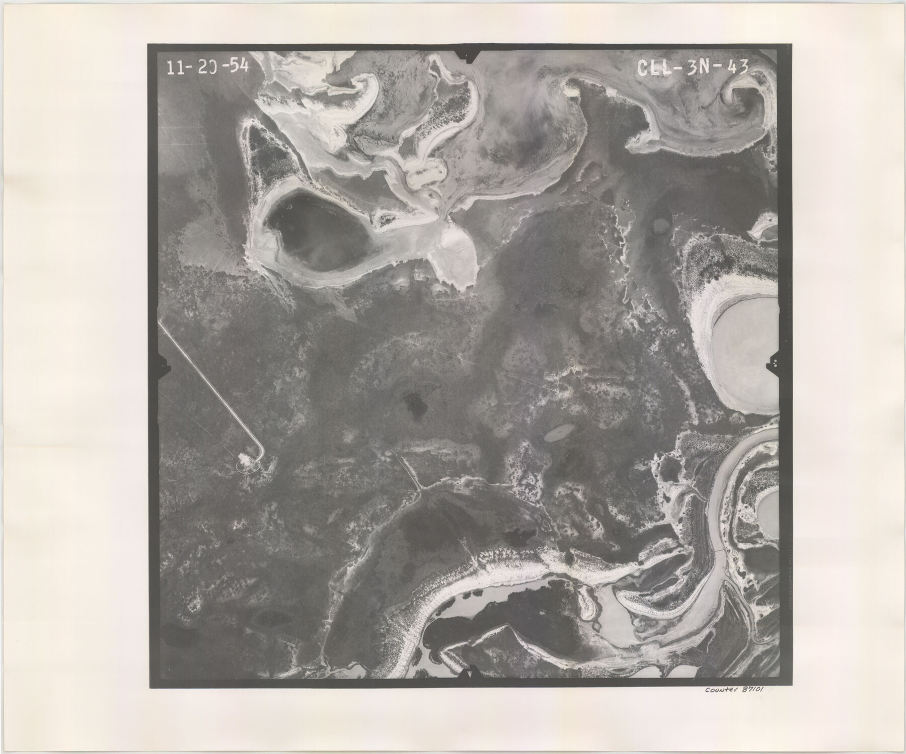
Flight Mission No. CLL-3N, Frame 43, Willacy County
CLL-3N-43
-
Map/Doc
87101
-
Collection
General Map Collection
-
Object Dates
1954/11/20 (Creation Date)
-
People and Organizations
U. S. Department of Agriculture (Publisher)
-
Counties
Willacy
-
Subjects
Aerial Photograph
-
Height x Width
18.3 x 22.0 inches
46.5 x 55.9 cm
-
Comments
Flown by Puckett Aerial Surveys, Inc. of Jackson, Mississippi.
Part of: General Map Collection
DeWitt County Working Sketch 5

Print $20.00
- Digital $50.00
DeWitt County Working Sketch 5
1977
Size 34.6 x 36.8 inches
Map/Doc 68595
Presidio County Rolled Sketch 147

Print $20.00
- Digital $50.00
Presidio County Rolled Sketch 147
2019
Size 35.2 x 24.1 inches
Map/Doc 95703
Edwards County Sketch File 26

Print $4.00
- Digital $50.00
Edwards County Sketch File 26
1910
Size 11.5 x 9.2 inches
Map/Doc 21753
Nueces County Aerial Photograph Index Sheet 21

Print $20.00
- Digital $50.00
Nueces County Aerial Photograph Index Sheet 21
1938
Size 24.3 x 20.2 inches
Map/Doc 86842
Houston County Working Sketch 30

Print $20.00
- Digital $50.00
Houston County Working Sketch 30
1990
Size 36.9 x 37.0 inches
Map/Doc 66260
Texas map showing principal forts

Print $20.00
- Digital $50.00
Texas map showing principal forts
1852
Size 34.7 x 25.1 inches
Map/Doc 2125
Real County Working Sketch 82

Print $20.00
- Digital $50.00
Real County Working Sketch 82
1985
Size 24.9 x 23.5 inches
Map/Doc 71974
Flight Mission No. DCL-6C, Frame 26, Kenedy County

Print $20.00
- Digital $50.00
Flight Mission No. DCL-6C, Frame 26, Kenedy County
1943
Size 18.7 x 22.5 inches
Map/Doc 85883

Chambers County NRC Article 33.136 Location Key Sheet

Print $20.00
- Digital $50.00
Chambers County NRC Article 33.136 Location Key Sheet
1982
Size 27.0 x 22.0 inches
Map/Doc 87908
Harris County Rolled Sketch 101

Print $20.00
- Digital $50.00
Harris County Rolled Sketch 101
2004
Size 24.3 x 36.2 inches
Map/Doc 83063
Tarrant County Sketch File 8

Print $4.00
- Digital $50.00
Tarrant County Sketch File 8
1858
Size 8.1 x 10.1 inches
Map/Doc 37687
You may also like
Lipscomb County Rolled Sketch 4

Print $40.00
- Digital $50.00
Lipscomb County Rolled Sketch 4
Size 100.5 x 22.4 inches
Map/Doc 9450
Duval County Sketch File 40b

Print $20.00
- Digital $50.00
Duval County Sketch File 40b
Size 28.0 x 31.4 inches
Map/Doc 11396
[Surveys along San Cristoval Creek]
![300, [Surveys along San Cristoval Creek], General Map Collection](https://historictexasmaps.com/wmedia_w700/maps/300.tif.jpg)
Print $2.00
- Digital $50.00
[Surveys along San Cristoval Creek]
1842
Size 9.0 x 9.3 inches
Map/Doc 300
Presidio County Rolled Sketch 101

Print $20.00
- Digital $50.00
Presidio County Rolled Sketch 101
1954
Size 25.3 x 33.4 inches
Map/Doc 7383
Young County Working Sketch 28

Print $20.00
- Digital $50.00
Young County Working Sketch 28
1985
Size 29.9 x 26.0 inches
Map/Doc 62051
Proceedings of The International (Water) Boundary Commission United States and Mexico Treaties of 1884 and 1889, Volume 1

Proceedings of The International (Water) Boundary Commission United States and Mexico Treaties of 1884 and 1889, Volume 1
Map/Doc 83144
Culberson County Working Sketch 29

Print $40.00
- Digital $50.00
Culberson County Working Sketch 29
1957
Size 21.8 x 117.6 inches
Map/Doc 68482
Cochran County

Print $20.00
- Digital $50.00
Cochran County
1913
Size 28.2 x 20.8 inches
Map/Doc 4911
Throckmorton County Sketch File 4

Print $40.00
- Digital $50.00
Throckmorton County Sketch File 4
Size 15.1 x 15.2 inches
Map/Doc 38054
Flight Mission No. BRE-2P, Frame 133, Nueces County

Print $20.00
- Digital $50.00
Flight Mission No. BRE-2P, Frame 133, Nueces County
1956
Size 18.5 x 22.5 inches
Map/Doc 86806
Willie Winn Tract

Print $20.00
- Digital $50.00
Willie Winn Tract
1903
Size 13.2 x 14.1 inches
Map/Doc 92286
Culberson County Rolled Sketch 58

Print $40.00
- Digital $50.00
Culberson County Rolled Sketch 58
1979
Size 37.8 x 52.6 inches
Map/Doc 8759