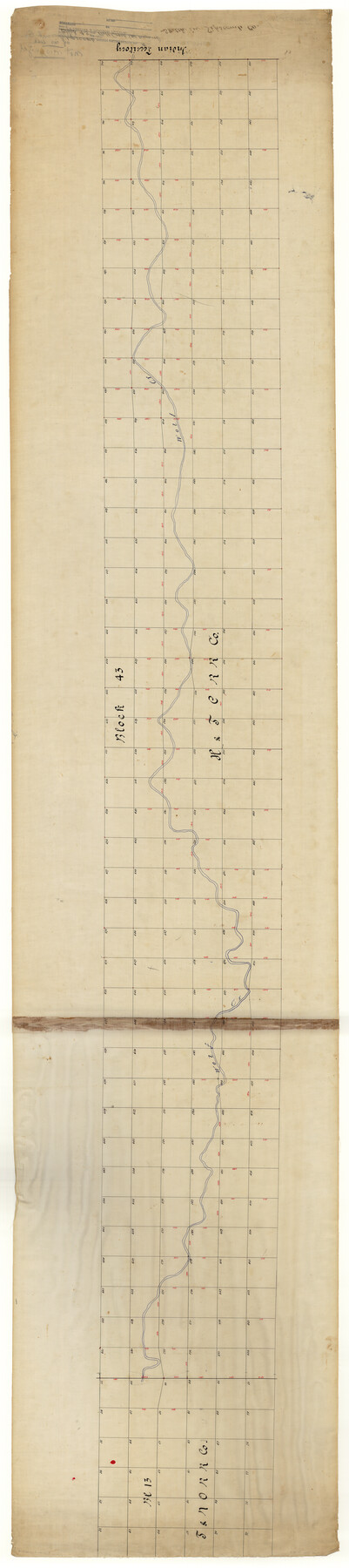
Lipscomb County Rolled Sketch 4
[Part of H. & T. C. R.R. Co. Block 43 on Wolf Creek]
-
Map/Doc
9450
-
Collection
General Map Collection
-
Counties
Lipscomb Ochiltree
-
Subjects
Surveying Rolled Sketch
-
Height x Width
100.5 x 22.4 inches
255.3 x 56.9 cm
-
Medium
linen, manuscript
Part of: General Map Collection
Delta County Sketch File 6

Print $20.00
- Digital $50.00
Delta County Sketch File 6
Size 18.3 x 22.4 inches
Map/Doc 11310
Garza County Sketch File H

Print $20.00
- Digital $50.00
Garza County Sketch File H
Size 43.1 x 38.7 inches
Map/Doc 10472
Dimmit County Working Sketch 34

Print $20.00
- Digital $50.00
Dimmit County Working Sketch 34
1959
Size 22.8 x 17.0 inches
Map/Doc 68695
Scurry County Rolled Sketch 6

Print $20.00
- Digital $50.00
Scurry County Rolled Sketch 6
1944
Size 29.0 x 28.8 inches
Map/Doc 7766
[Grid Map Showing Texas, Louisiana, Arkansas, Mississippi and portions of New Mexico, Oklahoma and Tennessee]
![4668, [Grid Map Showing Texas, Louisiana, Arkansas, Mississippi and portions of New Mexico, Oklahoma and Tennessee], General Map Collection](https://historictexasmaps.com/wmedia_w700/maps/4668.tif.jpg)
Print $20.00
- Digital $50.00
[Grid Map Showing Texas, Louisiana, Arkansas, Mississippi and portions of New Mexico, Oklahoma and Tennessee]
1940
Size 36.4 x 47.3 inches
Map/Doc 4668
Flight Mission No. BQR-22K, Frame 45, Brazoria County

Print $20.00
- Digital $50.00
Flight Mission No. BQR-22K, Frame 45, Brazoria County
1953
Size 18.7 x 22.4 inches
Map/Doc 84129
Howard County Working Sketch 2

Print $20.00
- Digital $50.00
Howard County Working Sketch 2
1903
Size 21.7 x 20.9 inches
Map/Doc 66268
Nueces County Working Sketch 10

Print $20.00
- Digital $50.00
Nueces County Working Sketch 10
1963
Size 26.7 x 27.7 inches
Map/Doc 71312
Hays County Sketch File 33

Print $40.00
- Digital $50.00
Hays County Sketch File 33
1944
Size 16.4 x 15.1 inches
Map/Doc 26268
Fort Bend County Boundary File 3

Print $2.00
- Digital $50.00
Fort Bend County Boundary File 3
Size 8.8 x 11.3 inches
Map/Doc 53566
Hays County Working Sketch 5

Print $20.00
- Digital $50.00
Hays County Working Sketch 5
1929
Size 28.2 x 29.6 inches
Map/Doc 66079
[Surveys along Green's Creek and the North Bosque River]
![69756, [Surveys along Green's Creek and the North Bosque River], General Map Collection](https://historictexasmaps.com/wmedia_w700/maps/69756.tif.jpg)
Print $2.00
- Digital $50.00
[Surveys along Green's Creek and the North Bosque River]
1846
Size 11.9 x 8.1 inches
Map/Doc 69756
You may also like
Visitor's Guide to the Aztec World

Visitor's Guide to the Aztec World
1980
Size 20.3 x 25.9 inches
Map/Doc 96833
Bandera County Working Sketch 18

Print $20.00
- Digital $50.00
Bandera County Working Sketch 18
1946
Size 25.6 x 26.5 inches
Map/Doc 67614
Scurry County Rolled Sketch 2A

Print $20.00
- Digital $50.00
Scurry County Rolled Sketch 2A
Size 25.6 x 24.2 inches
Map/Doc 7764
Medina County Working Sketch 9

Print $20.00
- Digital $50.00
Medina County Working Sketch 9
1959
Size 25.3 x 38.8 inches
Map/Doc 70924
Reagan County Working Sketch 1

Print $20.00
- Digital $50.00
Reagan County Working Sketch 1
1886
Size 25.0 x 27.3 inches
Map/Doc 71841
Map of the Houston & Great Northern Railroad

Print $40.00
- Digital $50.00
Map of the Houston & Great Northern Railroad
1871
Size 29.3 x 122.1 inches
Map/Doc 64551
[Surveys along Seco Creek]
![268, [Surveys along Seco Creek], General Map Collection](https://historictexasmaps.com/wmedia_w700/maps/268.tif.jpg)
Print $3.00
- Digital $50.00
[Surveys along Seco Creek]
1847
Size 14.6 x 9.8 inches
Map/Doc 268
Milam County Sketch File 3

Print $4.00
- Digital $50.00
Milam County Sketch File 3
1853
Size 12.9 x 8.1 inches
Map/Doc 31628
Armstrong County

Print $20.00
- Digital $50.00
Armstrong County
1933
Size 43.2 x 41.2 inches
Map/Doc 95420
Dimmit County Working Sketch 39

Print $20.00
- Digital $50.00
Dimmit County Working Sketch 39
1967
Size 25.5 x 30.0 inches
Map/Doc 68700
Frio County Sketch File 13

Print $10.00
- Digital $50.00
Frio County Sketch File 13
1948
Size 11.3 x 8.8 inches
Map/Doc 23136
Reeves County Working Sketch 27

Print $20.00
- Digital $50.00
Reeves County Working Sketch 27
1967
Size 40.2 x 43.0 inches
Map/Doc 63470