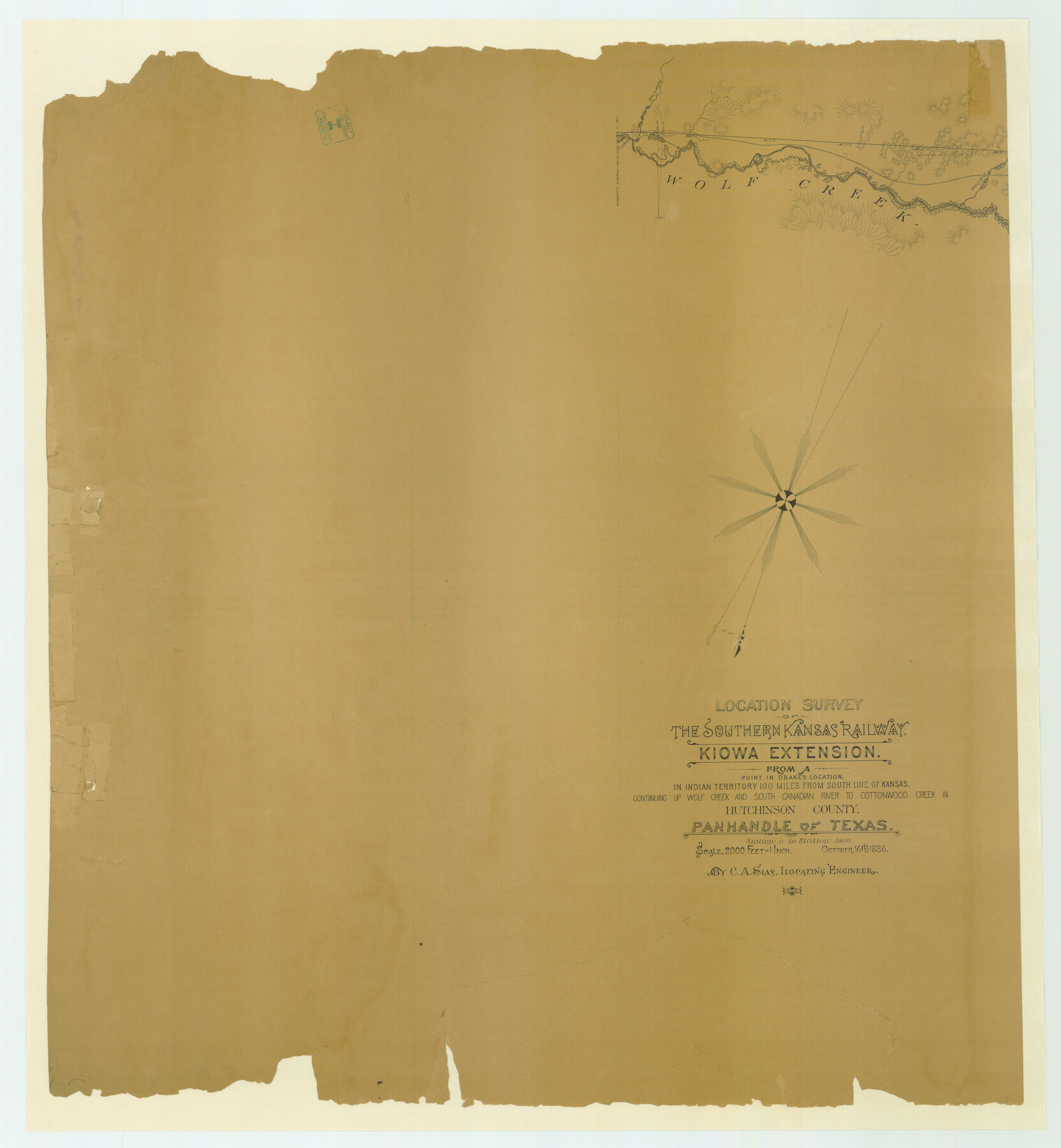
Location Survey of the Southern Kansas Railway, Kiowa Extension from a point in Drake's Location, in Indian Territory 100 miles from south line of Kansas, continuing up Wolf Creek and South Canadian River to Cottonwood Creek in Hutchinson County
Panhandle of Texas, Station 0 to Station 5930
-
Map/Doc
88838
-
Collection
General Map Collection
-
Object Dates
1886/10/16 (Creation Date)
-
People and Organizations
C.A. Sias (Surveyor/Engineer)
-
Subjects
Railroads
-
Height x Width
38.9 x 36.0 inches
98.8 x 91.4 cm
-
Medium
paper, manuscript
-
Scale
2000 feet = 1 inch
-
Comments
Compliments of Wolf Creek Heritage Museum, Lipscomb, Texas. See 88838 through 88845 for all segments of this map. 88837 is a digital composite of sheets 1-8.
-
Features
SK
Willow Creek
Wolf Creek
Rock Creek
Part of: General Map Collection
Pecos County Working Sketch 52

Print $20.00
- Digital $50.00
Pecos County Working Sketch 52
1948
Size 46.8 x 32.5 inches
Map/Doc 71524
Jefferson County NRC Article 33.136 Sketch 5

Print $4.00
- Digital $50.00
Jefferson County NRC Article 33.136 Sketch 5
2005
Size 14.1 x 8.8 inches
Map/Doc 83170
Knox County Rolled Sketch 7

Print $20.00
- Digital $50.00
Knox County Rolled Sketch 7
Size 25.5 x 39.9 inches
Map/Doc 6556
Ellis County Sketch File 14

Print $40.00
- Digital $50.00
Ellis County Sketch File 14
1861
Size 12.9 x 16.1 inches
Map/Doc 21854
Map of the City of Corsicana (Navarro County) Texas

Print $40.00
- Digital $50.00
Map of the City of Corsicana (Navarro County) Texas
1963
Size 36.7 x 87.5 inches
Map/Doc 93675
Dickens County Rolled Sketch N

Print $20.00
- Digital $50.00
Dickens County Rolled Sketch N
1909
Size 21.2 x 30.6 inches
Map/Doc 5714
Dimmit County Sketch File 29

Print $40.00
- Digital $50.00
Dimmit County Sketch File 29
1877
Size 26.5 x 22.1 inches
Map/Doc 11351
South Part of Brewster Co.

Print $40.00
- Digital $50.00
South Part of Brewster Co.
1955
Size 48.8 x 40.0 inches
Map/Doc 66736

Atascosa County Sketch File 28

Print $40.00
- Digital $50.00
Atascosa County Sketch File 28
1878
Size 27.9 x 21.7 inches
Map/Doc 10862
Coast Chart No. 210 - Aransas Pass and Corpus Christi Bay with the coast to latitude 27° 12', Texas

Print $20.00
- Digital $50.00
Coast Chart No. 210 - Aransas Pass and Corpus Christi Bay with the coast to latitude 27° 12', Texas
1887
Size 30.4 x 24.0 inches
Map/Doc 73444
Sutton County Sketch File 7

Print $4.00
- Digital $50.00
Sutton County Sketch File 7
Size 10.6 x 8.7 inches
Map/Doc 37365
You may also like
Photostat of section of hydrographic surveys H-5399, H-4822, H-470

Print $2.00
- Digital $50.00
Photostat of section of hydrographic surveys H-5399, H-4822, H-470
1933
Size 10.6 x 8.1 inches
Map/Doc 61155
Polk County Working Sketch 9

Print $20.00
- Digital $50.00
Polk County Working Sketch 9
1934
Size 22.7 x 30.8 inches
Map/Doc 71624
Flight Mission No. BRE-2P, Frame 34, Nueces County

Print $20.00
- Digital $50.00
Flight Mission No. BRE-2P, Frame 34, Nueces County
1956
Size 18.7 x 22.6 inches
Map/Doc 86736
San Augustine County Working Sketch 10

Print $20.00
- Digital $50.00
San Augustine County Working Sketch 10
1935
Size 35.0 x 32.2 inches
Map/Doc 63697
Lubbock County

Print $20.00
- Digital $50.00
Lubbock County
1968
Size 44.2 x 35.8 inches
Map/Doc 95576
Newton County Sketch File 17

Print $3.00
- Digital $50.00
Newton County Sketch File 17
1884
Size 15.5 x 10.6 inches
Map/Doc 32392
Liberty County Sketch File 36

Print $2.00
- Digital $50.00
Liberty County Sketch File 36
Size 9.4 x 9.0 inches
Map/Doc 29973
Hartley County Boundary File 1

Print $64.00
- Digital $50.00
Hartley County Boundary File 1
Size 8.8 x 25.8 inches
Map/Doc 54423
Navigation Maps of Gulf Intracoastal Waterway, Port Arthur to Brownsville, Texas

Print $4.00
- Digital $50.00
Navigation Maps of Gulf Intracoastal Waterway, Port Arthur to Brownsville, Texas
1951
Size 16.6 x 21.6 inches
Map/Doc 65432
Nacogdoches County Working Sketch 10

Print $20.00
- Digital $50.00
Nacogdoches County Working Sketch 10
1981
Size 19.0 x 17.6 inches
Map/Doc 71226
Correct Map of Texas

Print $20.00
- Digital $50.00
Correct Map of Texas
1873
Size 21.3 x 16.9 inches
Map/Doc 95776
Bee County Working Sketch 18

Print $20.00
- Digital $50.00
Bee County Working Sketch 18
1980
Size 19.5 x 18.5 inches
Map/Doc 67268