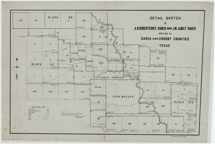
[Blocks 24, B9, 3KA]
54-4
- 
                          Map/Doc90326
- 
                            CollectionTwichell Survey Records
- 
                            CountiesCrosby Garza
- 
                            Height x Width18.2 x 14.0 inches46.2 x 35.6 cm
Part of: Twichell Survey Records
            [W. T. Brewer: M. McDonald, Ralph Gilpin, A. Vanhooser, John Baker, John R. Taylor Surveys]
            
                                    ![90961, [W. T. Brewer: M. McDonald, Ralph Gilpin, A. Vanhooser, John Baker, John R. Taylor Surveys], Twichell Survey Records](https://historictexasmaps.com/wmedia_w700/maps/90961-1.tif.jpg) 


    ![90961, [W. T. Brewer: M. McDonald, Ralph Gilpin, A. Vanhooser, John Baker, John R. Taylor Surveys], Twichell Survey Records](https://historictexasmaps.com/wmedia_w700/maps/90961-1.tif.jpg) 
                                
            
                                            Print $2.00                    
                                             -                         Digital $50.00                                    
                [W. T. Brewer: M. McDonald, Ralph Gilpin, A. Vanhooser, John Baker, John R. Taylor Surveys]
Size 8.8 x 11.2 inches
                                Map/Doc 90961
            
            [Block C41 and vicinity]
            
                                    ![92624, [Block C41 and vicinity], Twichell Survey Records](https://historictexasmaps.com/wmedia_w700/maps/92624-1.tif.jpg) 


    ![92624, [Block C41 and vicinity], Twichell Survey Records](https://historictexasmaps.com/wmedia_w700/maps/92624-1.tif.jpg) 
                                
            
                                            Print $20.00                    
                                             -                         Digital $50.00                                    
                [Block C41 and vicinity]
1951
Size 24.8 x 19.0 inches
                                Map/Doc 92624
            
            [South Part of Glasscock County]
            
                                    ![90782, [South Part of Glasscock County], Twichell Survey Records](https://historictexasmaps.com/wmedia_w700/maps/90782-1.tif.jpg) 


    ![90782, [South Part of Glasscock County], Twichell Survey Records](https://historictexasmaps.com/wmedia_w700/maps/90782-1.tif.jpg) 
                                
            
                                            Print $20.00                    
                                             -                         Digital $50.00                                    
                [South Part of Glasscock County]
Size 34.0 x 23.2 inches
                                Map/Doc 90782
            
            [Northwest 1/4 of County]
            
                                    ![90824, [Northwest 1/4 of County], Twichell Survey Records](https://historictexasmaps.com/wmedia_w700/maps/90824-2.tif.jpg) 


    ![90824, [Northwest 1/4 of County], Twichell Survey Records](https://historictexasmaps.com/wmedia_w700/maps/90824-2.tif.jpg) 
                                
            
                                            Print $20.00                    
                                             -                         Digital $50.00                                    
                [Northwest 1/4 of County]
Size 19.1 x 23.3 inches
                                Map/Doc 90824
            
            Map of Public Roads in Terry County, Texas


                                            Print $2.00                    
                                             -                         Digital $50.00                                    
                Map of Public Roads in Terry County, Texas
1951
Size 9.1 x 11.6 inches
                                Map/Doc 91937
            
            [E. L. & R. R. RR. Co. Blocks 10 and 32, T. & P. R.R. Co. Blocks 30 and 31, Tsp 6N]
            
                                    ![90216, [E. L. & R. R. RR. Co. Blocks 10 and 32, T. & P. R.R. Co. Blocks 30 and 31, Tsp 6N], Twichell Survey Records](https://historictexasmaps.com/wmedia_w700/maps/90216-1.tif.jpg) 


    ![90216, [E. L. & R. R. RR. Co. Blocks 10 and 32, T. & P. R.R. Co. Blocks 30 and 31, Tsp 6N], Twichell Survey Records](https://historictexasmaps.com/wmedia_w700/maps/90216-1.tif.jpg) 
                                
            
                                            Print $20.00                    
                                             -                         Digital $50.00                                    
                [E. L. & R. R. RR. Co. Blocks 10 and 32, T. & P. R.R. Co. Blocks 30 and 31, Tsp 6N]
Size 21.7 x 17.7 inches
                                Map/Doc 90216
            
            [Pencil sketch of Wm. Rivers survey]
            
                                    ![91969, [Pencil sketch of Wm. Rivers survey], Twichell Survey Records](https://historictexasmaps.com/wmedia_w700/maps/91969-1.tif.jpg) 


    ![91969, [Pencil sketch of Wm. Rivers survey], Twichell Survey Records](https://historictexasmaps.com/wmedia_w700/maps/91969-1.tif.jpg) 
                                
            
                                            Print $3.00                    
                                             -                         Digital $50.00                                    
                [Pencil sketch of Wm. Rivers survey]
Size 9.9 x 16.1 inches
                                Map/Doc 91969
            
            Roberts Addition to the City of Morton


                                            Print $3.00                    
                                             -                         Digital $50.00                                    
                Roberts Addition to the City of Morton
1958
Size 11.8 x 11.4 inches
                                Map/Doc 92540
            
            Map Showing the Location of Murray Farms


                                            Print $20.00                    
                                             -                         Digital $50.00                                    
                Map Showing the Location of Murray Farms
Size 13.6 x 17.7 inches
                                Map/Doc 92832
            
            [Surveys Adjacent to W. D. Twichell's near Palo Pinto Creek]
            
                                    ![92102, [Surveys Adjacent to W. D. Twichell's near Palo Pinto Creek], Twichell Survey Records](https://historictexasmaps.com/wmedia_w700/maps/92102-1.tif.jpg) 


    ![92102, [Surveys Adjacent to W. D. Twichell's near Palo Pinto Creek], Twichell Survey Records](https://historictexasmaps.com/wmedia_w700/maps/92102-1.tif.jpg) 
                                
            
                                            Print $2.00                    
                                             -                         Digital $50.00                                    
                [Surveys Adjacent to W. D. Twichell's near Palo Pinto Creek]
Size 8.4 x 6.2 inches
                                Map/Doc 92102
            
            [Sketch showing surveys 9, 10, 15, 65 and 96]
            
                                    ![91759, [Sketch showing surveys 9, 10, 15, 65 and 96], Twichell Survey Records](https://historictexasmaps.com/wmedia_w700/maps/91759-1.tif.jpg) 


    ![91759, [Sketch showing surveys 9, 10, 15, 65 and 96], Twichell Survey Records](https://historictexasmaps.com/wmedia_w700/maps/91759-1.tif.jpg) 
                                
            
                                            Print $20.00                    
                                             -                         Digital $50.00                                    
                [Sketch showing surveys 9, 10, 15, 65 and 96]
1919
Size 17.9 x 17.1 inches
                                Map/Doc 91759
            
            [I. M. Bolton, L. S. Thacker, and R. C. Poteet Subdivisions]
            
                                    ![92579, [I. M. Bolton, L. S. Thacker, and R. C. Poteet Subdivisions], Twichell Survey Records](https://historictexasmaps.com/wmedia_w700/maps/92579-1.tif.jpg) 


    ![92579, [I. M. Bolton, L. S. Thacker, and R. C. Poteet Subdivisions], Twichell Survey Records](https://historictexasmaps.com/wmedia_w700/maps/92579-1.tif.jpg) 
                                
            
                                            Print $20.00                    
                                             -                         Digital $50.00                                    
                [I. M. Bolton, L. S. Thacker, and R. C. Poteet Subdivisions]
1924
Size 18.3 x 24.8 inches
                                Map/Doc 92579
            You may also like
            Flight Mission No. DQN-7K, Frame 14, Calhoun County


                                            Print $20.00                    
                                             -                         Digital $50.00                                    
                Flight Mission No. DQN-7K, Frame 14, Calhoun County
1953
Size 17.2 x 19.1 inches
                                Map/Doc 84465
            
            Harris County Sketch File 98


                                            Print $50.00                    
                                             -                         Digital $50.00                                    
                Harris County Sketch File 98
Size 11.2 x 9.1 inches
                                Map/Doc 25653
            
            Map No. 2 - Surveys Corrected in 1882 as they appear on the ground


                                            Print $20.00                    
                                             -                         Digital $50.00                                    
                Map No. 2 - Surveys Corrected in 1882 as they appear on the ground
1882
Size 30.7 x 19.2 inches
                                Map/Doc 91925
            
            Hutchinson County Working Sketch 12


                                            Print $20.00                    
                                             -                         Digital $50.00                                    
                Hutchinson County Working Sketch 12
1925
Size 20.6 x 29.9 inches
                                Map/Doc 66370
            
            Map of Kinney County


                                            Print $20.00                    
                                             -                         Digital $50.00                                    
                Map of Kinney County
1876
Size 24.0 x 32.4 inches
                                Map/Doc 3775
            
            Motley County Sketch File 2-D


                                            Print $40.00                    
                                             -                         Digital $50.00                                    
                Motley County Sketch File 2-D
1903
Size 16.3 x 24.7 inches
                                Map/Doc 42134
            
            Nueces County Sketch File 6


                                            Print $20.00                    
                                             -                         Digital $50.00                                    
                Nueces County Sketch File 6
Size 15.0 x 22.2 inches
                                Map/Doc 42175
            
            Crockett County Rolled Sketch 65


                                            Print $20.00                    
                                             -                         Digital $50.00                                    
                Crockett County Rolled Sketch 65
1948
Size 13.4 x 27.5 inches
                                Map/Doc 5608
            
            Township No. 2 South Range No. 23 West of the Indian Meridian


                                            Print $20.00                    
                                             -                         Digital $50.00                                    
                Township No. 2 South Range No. 23 West of the Indian Meridian
1875
Size 19.3 x 24.4 inches
                                Map/Doc 75175
            
            Section 10, Block Z, Cochran County, Texas


                                            Print $20.00                    
                                             -                         Digital $50.00                                    
                Section 10, Block Z, Cochran County, Texas
1952
Size 12.2 x 17.0 inches
                                Map/Doc 92521
            
            Map of the Navosoto [sp.] River, Washington County
            
                                    ![64, Map of the Navosoto [sp.] River, Washington County, General Map Collection](https://historictexasmaps.com/wmedia_w700/maps/64.tif.jpg) 


    ![64, Map of the Navosoto [sp.] River, Washington County, General Map Collection](https://historictexasmaps.com/wmedia_w700/maps/64.tif.jpg) 
                                
            
                                            Print $20.00                    
                                             -                         Digital $50.00                                    
                Map of the Navosoto [sp.] River, Washington County
1842
Size 15.7 x 14.2 inches
                                Map/Doc 64
            
            Shackelford County Boundary File 79


                                            Print $26.00                    
                                             -                         Digital $50.00                                    
                Shackelford County Boundary File 79
Size 9.5 x 4.0 inches
                                Map/Doc 58737
            ![90326, [Blocks 24, B9, 3KA], Twichell Survey Records](https://historictexasmaps.com/wmedia_w1800h1800/maps/90326-1.tif.jpg)