![90609, [Block K11], Twichell Survey Records](https://historictexasmaps.com/wmedia_w1800h1800/maps/90609-1.tif.jpg)
[Block K11]
59-21
-
Map/Doc
90609
-
Collection
Twichell Survey Records
-
Counties
Deaf Smith Oldham
-
Height x Width
20.9 x 16.0 inches
53.1 x 40.6 cm
Part of: Twichell Survey Records
A.W. Hudson Crosby County RR Line

Print $40.00
- Digital $50.00
A.W. Hudson Crosby County RR Line
Size 67.8 x 42.9 inches
Map/Doc 89760
Laneer vs. Bivins, Potter County, Texas

Print $20.00
- Digital $50.00
Laneer vs. Bivins, Potter County, Texas
Size 21.7 x 19.0 inches
Map/Doc 93103
[Borden County Lines - Description of County Line Markers]
![90215, [Borden County Lines - Description of County Line Markers], Twichell Survey Records](https://historictexasmaps.com/wmedia_w700/maps/90215-1.tif.jpg)
Print $3.00
- Digital $50.00
[Borden County Lines - Description of County Line Markers]
Size 14.4 x 10.1 inches
Map/Doc 90215
Wm. D. Green's Subdivision of Part of Leagues 1,2,3, and 4 Wilson County School Land

Print $20.00
- Digital $50.00
Wm. D. Green's Subdivision of Part of Leagues 1,2,3, and 4 Wilson County School Land
Size 16.5 x 19.4 inches
Map/Doc 92959
Kaufman County, 1887

Print $20.00
- Digital $50.00
Kaufman County, 1887
1887
Size 42.6 x 46.1 inches
Map/Doc 89701
[J. B. Sneed, S. Robinson, and vicinity]
![91041, [J. B. Sneed, S. Robinson, and vicinity], Twichell Survey Records](https://historictexasmaps.com/wmedia_w700/maps/91041-1.tif.jpg)
Print $20.00
- Digital $50.00
[J. B. Sneed, S. Robinson, and vicinity]
Size 32.4 x 12.8 inches
Map/Doc 91041
G&H Blocks Gaines Co. Resurvey 1915

Print $40.00
- Digital $50.00
G&H Blocks Gaines Co. Resurvey 1915
1915
Size 56.8 x 31.3 inches
Map/Doc 89632
Map Showing Section Lines and Corporation Lines of the City of Lubbock

Print $20.00
- Digital $50.00
Map Showing Section Lines and Corporation Lines of the City of Lubbock
1921
Size 27.5 x 25.2 inches
Map/Doc 92749
[Blocks M-22 and M-25 and vicinity]
![91138, [Blocks M-22 and M-25 and vicinity], Twichell Survey Records](https://historictexasmaps.com/wmedia_w700/maps/91138-1.tif.jpg)
Print $20.00
- Digital $50.00
[Blocks M-22 and M-25 and vicinity]
Size 18.7 x 16.6 inches
Map/Doc 91138
Hartley County

Print $20.00
- Digital $50.00
Hartley County
1882
Size 30.2 x 19.3 inches
Map/Doc 90708

Topographic Map, Low Rent Housing Project Texas 18-1, Housing Authority of the City of Lubbock (Plan No. 2)

Print $20.00
- Digital $50.00
Topographic Map, Low Rent Housing Project Texas 18-1, Housing Authority of the City of Lubbock (Plan No. 2)
1941
Size 42.4 x 27.2 inches
Map/Doc 92757
You may also like
Maverick County Sketch File 26

Print $14.00
- Digital $50.00
Maverick County Sketch File 26
1955
Size 11.3 x 8.7 inches
Map/Doc 31153
Plan de la Villa de Austin

Print $20.00
- Digital $50.00
Plan de la Villa de Austin
1828
Size 18.5 x 12.5 inches
Map/Doc 94116
Hutchinson County Rolled Sketch 12

Print $20.00
- Digital $50.00
Hutchinson County Rolled Sketch 12
Size 26.1 x 41.4 inches
Map/Doc 6282
Frio County Working Sketch 22

Print $20.00
- Digital $50.00
Frio County Working Sketch 22
1990
Size 24.9 x 33.9 inches
Map/Doc 69296
Wheeler County Working Sketch 6

Print $40.00
- Digital $50.00
Wheeler County Working Sketch 6
1972
Size 49.8 x 47.4 inches
Map/Doc 72495
General Highway Map, La Salle County, Texas

Print $20.00
General Highway Map, La Salle County, Texas
1961
Size 18.2 x 25.0 inches
Map/Doc 79564
Kimble County Working Sketch 1

Print $20.00
- Digital $50.00
Kimble County Working Sketch 1
Size 14.7 x 18.3 inches
Map/Doc 70069
Tyler County Working Sketch 26
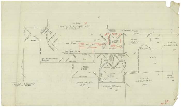
Print $20.00
- Digital $50.00
Tyler County Working Sketch 26
Size 27.7 x 46.3 inches
Map/Doc 69496
Panola County Working Sketch 32

Print $20.00
- Digital $50.00
Panola County Working Sketch 32
1982
Map/Doc 71441
A Map of North America, constructed according to the latest information

Print $40.00
- Digital $50.00
A Map of North America, constructed according to the latest information
1822
Size 44.4 x 59.6 inches
Map/Doc 93845
Medina County Working Sketch 9

Print $20.00
- Digital $50.00
Medina County Working Sketch 9
1959
Size 25.3 x 38.8 inches
Map/Doc 70924
La Salle County Rolled Sketch 6

Print $40.00
- Digital $50.00
La Salle County Rolled Sketch 6
1941
Size 43.0 x 66.0 inches
Map/Doc 10738