![91902, [T. & N. O. RR. Block 1T], Twichell Survey Records](https://historictexasmaps.com/wmedia_w1800h1800/maps/91902-1.tif.jpg)
[T. & N. O. RR. Block 1T]
211-2
-
Map/Doc
91902
-
Collection
Twichell Survey Records
-
Counties
Sherman Dallam
-
Height x Width
14.9 x 20.0 inches
37.9 x 50.8 cm
Part of: Twichell Survey Records
[Leagues 116 through 161, Leagues 165, 181, and 182]
![92484, [Leagues 116 through 161, Leagues 165, 181, and 182], Twichell Survey Records](https://historictexasmaps.com/wmedia_w700/maps/92484-1.tif.jpg)
Print $20.00
- Digital $50.00
[Leagues 116 through 161, Leagues 165, 181, and 182]
Size 17.8 x 23.7 inches
Map/Doc 92484
[John Gibbs and surrounding surveys]
![91161, [John Gibbs and surrounding surveys], Twichell Survey Records](https://historictexasmaps.com/wmedia_w700/maps/91161-1.tif.jpg)
Print $20.00
- Digital $50.00
[John Gibbs and surrounding surveys]
Size 18.8 x 22.8 inches
Map/Doc 91161
Map Showing East Part Pecos County, Texas with Blocks 194 and 178 Constructed and Adjusted to the Ground Distance from NE 36 Block 12 H&GN to Pecos Spring and by Original Field Note Calls from Pecos Spring to NE 75 Blk. 1 I&GN

Print $40.00
- Digital $50.00
Map Showing East Part Pecos County, Texas with Blocks 194 and 178 Constructed and Adjusted to the Ground Distance from NE 36 Block 12 H&GN to Pecos Spring and by Original Field Note Calls from Pecos Spring to NE 75 Blk. 1 I&GN
Size 45.0 x 51.4 inches
Map/Doc 89838
[State Capitol Leagues, County School Leagues, and vicinity]
![92535, [State Capitol Leagues, County School Leagues, and vicinity], Twichell Survey Records](https://historictexasmaps.com/wmedia_w700/maps/92535-1.tif.jpg)
Print $20.00
- Digital $50.00
[State Capitol Leagues, County School Leagues, and vicinity]
1913
Size 20.8 x 27.6 inches
Map/Doc 92535
[Additions Surrounding Fort Worth & Denver Railroad Fork]
![92840, [Additions Surrounding Fort Worth & Denver Railroad Fork], Twichell Survey Records](https://historictexasmaps.com/wmedia_w700/maps/92840-1.tif.jpg)
Print $20.00
- Digital $50.00
[Additions Surrounding Fort Worth & Denver Railroad Fork]
Size 32.2 x 32.1 inches
Map/Doc 92840
Howard McCauley Irrigated Farm North Half Section 2, Block D4

Print $20.00
- Digital $50.00
Howard McCauley Irrigated Farm North Half Section 2, Block D4
1946
Size 32.0 x 19.4 inches
Map/Doc 92342
[Lgs. 209-212, 182, 183, 195-200 with notes]
![90158, [Lgs. 209-212, 182, 183, 195-200 with notes], Twichell Survey Records](https://historictexasmaps.com/wmedia_w700/maps/90158-1.tif.jpg)
Print $20.00
- Digital $50.00
[Lgs. 209-212, 182, 183, 195-200 with notes]
Size 17.0 x 15.8 inches
Map/Doc 90158
[Surveys in the vicinity of the Martina Olivares survey]
![90891, [Surveys in the vicinity of the Martina Olivares survey], Twichell Survey Records](https://historictexasmaps.com/wmedia_w700/maps/90891-1.tif.jpg)
Print $3.00
- Digital $50.00
[Surveys in the vicinity of the Martina Olivares survey]
1911
Size 10.3 x 16.9 inches
Map/Doc 90891
[Blocks B-27, B-28, B-29, B-19]
![90465, [Blocks B-27, B-28, B-29, B-19], Twichell Survey Records](https://historictexasmaps.com/wmedia_w700/maps/90465-1.tif.jpg)
Print $20.00
- Digital $50.00
[Blocks B-27, B-28, B-29, B-19]
Size 31.4 x 22.2 inches
Map/Doc 90465
[Blks. B9, J, D19, John Walker]
![90482, [Blks. B9, J, D19, John Walker], Twichell Survey Records](https://historictexasmaps.com/wmedia_w700/maps/90482-1.tif.jpg)
Print $20.00
- Digital $50.00
[Blks. B9, J, D19, John Walker]
Size 27.8 x 15.9 inches
Map/Doc 90482
[H. & G. N. Block 1]
![90810, [H. & G. N. Block 1], Twichell Survey Records](https://historictexasmaps.com/wmedia_w700/maps/90810-2.tif.jpg)
Print $3.00
- Digital $50.00
[H. & G. N. Block 1]
Size 11.4 x 12.9 inches
Map/Doc 90810
[S. M. Walker, D. P. Allen, J. C. Guinn, J. R. Lamar and surrounding surveys]
![90335, [S. M. Walker, D. P. Allen, J. C. Guinn, J. R. Lamar and surrounding surveys], Twichell Survey Records](https://historictexasmaps.com/wmedia_w700/maps/90335-1.tif.jpg)
Print $3.00
- Digital $50.00
[S. M. Walker, D. P. Allen, J. C. Guinn, J. R. Lamar and surrounding surveys]
1912
Size 9.8 x 11.3 inches
Map/Doc 90335
You may also like
Bandera County Sketch File 32

Print $52.00
- Digital $50.00
Bandera County Sketch File 32
1966
Size 23.6 x 20.0 inches
Map/Doc 10901
Lipscomb County

Print $20.00
- Digital $50.00
Lipscomb County
1889
Size 23.5 x 18.5 inches
Map/Doc 3817

Donley County Sketch File 18 (2a)

Print $2.00
- Digital $50.00
Donley County Sketch File 18 (2a)
Size 10.3 x 8.0 inches
Map/Doc 21255
San Jacinto County

Print $20.00
- Digital $50.00
San Jacinto County
1949
Size 43.5 x 39.1 inches
Map/Doc 77415
Duval County Sketch File 8d

Print $4.00
- Digital $50.00
Duval County Sketch File 8d
1869
Size 10.8 x 8.9 inches
Map/Doc 21302
Map of Concho County
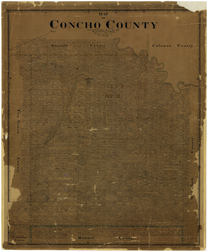
Print $20.00
- Digital $50.00
Map of Concho County
1897
Size 47.0 x 39.5 inches
Map/Doc 4733
Edwards County Working Sketch 43

Print $20.00
- Digital $50.00
Edwards County Working Sketch 43
1950
Size 20.3 x 27.7 inches
Map/Doc 68919
Map of XIT Lands, vicinity of Farwell, Texas

Print $20.00
- Digital $50.00
Map of XIT Lands, vicinity of Farwell, Texas
Size 19.6 x 30.8 inches
Map/Doc 91654
Matagorda County Working Sketch 6

Print $20.00
- Digital $50.00
Matagorda County Working Sketch 6
1950
Size 24.2 x 41.5 inches
Map/Doc 70864
Williamson County Sketch File 9

Print $20.00
- Digital $50.00
Williamson County Sketch File 9
1850
Size 17.4 x 21.6 inches
Map/Doc 12692
Right of Way and Track Map of The Missouri, Kansas & Texas Railway of Texas

Print $40.00
- Digital $50.00
Right of Way and Track Map of The Missouri, Kansas & Texas Railway of Texas
1918
Size 25.4 x 75.5 inches
Map/Doc 64533