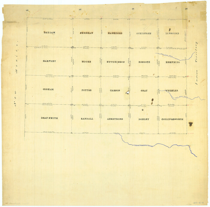
Lipscomb County Sketch File 1

Print $40.00
- Digital $50.00
Lipscomb County Sketch File 1
Size: 51.7 x 14.2 inches
10525
Moore County Sketch File 7

Print $20.00
- Digital $50.00
Moore County Sketch File 7
Size: 24.6 x 45.8 inches
10553
Sherman County Rolled Sketch 12

Print $40.00
- Digital $50.00
Sherman County Rolled Sketch 12
1951
Size: 63.9 x 11.3 inches
10611
Sherman County Rolled Sketch 6

Print $20.00
- Digital $50.00
Sherman County Rolled Sketch 6
1919
Size: 37.3 x 36.0 inches
10731
Capitol Land Reservation

Print $40.00
- Digital $50.00
Capitol Land Reservation
1880
Size: 115.6 x 36.6 inches
10785
Dallam County Sketch File 13

Print $20.00
- Digital $50.00
Dallam County Sketch File 13
Size: 22.2 x 20.3 inches
11280
Hartley County Sketch File 12

Print $20.00
- Digital $50.00
Hartley County Sketch File 12
1906
Size: 16.3 x 12.4 inches
11736
Sherman County Sketch File 1

Print $20.00
- Digital $50.00
Sherman County Sketch File 1
1923
Size: 25.3 x 25.4 inches
12322
Sherman County Sketch File 2

Print $20.00
- Digital $50.00
Sherman County Sketch File 2
Size: 19.5 x 36.3 inches
12323
[Young Territory]

Print $40.00
- Digital $50.00
[Young Territory]
1875
Size: 49.0 x 87.4 inches
16784
Map of Sherman County

Print $20.00
- Digital $50.00
Map of Sherman County
1902
Size: 40.9 x 36.6 inches
16815
Texas Panhandle North Boundary Line

Print $40.00
- Digital $50.00
Texas Panhandle North Boundary Line
1898
Size: 13.4 x 125.2 inches
1738
Map of the Capitol Land Reservation

Print $20.00
- Digital $50.00
Map of the Capitol Land Reservation
1880
Size: 43.5 x 34.6 inches
1751
[Map Showing Panhandle Counties in Texas]
Print $20.00
- Digital $50.00
[Map Showing Panhandle Counties in Texas]
1876
Size: 27.3 x 27.9 inches
2087
Hansford County Sketch File 9

Print $33.00
- Digital $50.00
Hansford County Sketch File 9
1928
Size: 11.1 x 8.8 inches
24963
Hutchinson County Sketch File 23

Print $22.00
- Digital $50.00
Hutchinson County Sketch File 23
1913
Size: 11.2 x 8.8 inches
27245
Moore County Sketch File 2

Print $36.00
- Digital $50.00
Moore County Sketch File 2
Size: 14.2 x 8.6 inches
31929
Moore County Sketch File 5

Print $22.00
- Digital $50.00
Moore County Sketch File 5
Size: 9.0 x 12.6 inches
31937
Sherman County Sketch File 3

Print $26.00
- Digital $50.00
Sherman County Sketch File 3
1925
Size: 7.7 x 8.9 inches
36675
Sherman County Sketch File 4

Print $4.00
- Digital $50.00
Sherman County Sketch File 4
1925
Size: 8.7 x 5.8 inches
36688
Sherman County Sketch File B

Print $6.00
- Digital $50.00
Sherman County Sketch File B
1919
Size: 14.4 x 8.8 inches
36691
Sherman County Sketch File C

Print $54.00
- Digital $50.00
Sherman County Sketch File C
1918
Size: 11.4 x 8.8 inches
36694
Sherman County Sketch File D

Print $5.00
- Digital $50.00
Sherman County Sketch File D
1959
Size: 10.6 x 8.9 inches
36721
Sherman County Sketch File 5

Print $2.00
- Digital $50.00
Sherman County Sketch File 5
1993
Size: 14.6 x 9.0 inches
36723
Sherman County Sketch File 6

Print $2.00
- Digital $50.00
Sherman County Sketch File 6
1993
Size: 14.6 x 9.1 inches
36724
Sherman County Sketch File 7

Print $2.00
- Digital $50.00
Sherman County Sketch File 7
1993
Size: 14.6 x 9.0 inches
36725
Sherman County Sketch File 8

Print $61.00
- Digital $50.00
Sherman County Sketch File 8
1993
Size: 11.4 x 8.9 inches
36726
Sherman County Sketch File A

Print $4.00
- Digital $50.00
Sherman County Sketch File A
1917
Size: 11.2 x 8.8 inches
44250
Lipscomb County Sketch File 1
Print $40.00
- Digital $50.00
Lipscomb County Sketch File 1
-
Size
51.7 x 14.2 inches
-
Map/Doc
10525
Moore County Sketch File 7
Print $20.00
- Digital $50.00
Moore County Sketch File 7
-
Size
24.6 x 45.8 inches
-
Map/Doc
10553
Sherman County Rolled Sketch 12
Print $40.00
- Digital $50.00
Sherman County Rolled Sketch 12
1951
-
Size
63.9 x 11.3 inches
-
Map/Doc
10611
-
Creation Date
1951
Sherman County Rolled Sketch 6
Print $20.00
- Digital $50.00
Sherman County Rolled Sketch 6
1919
-
Size
37.3 x 36.0 inches
-
Map/Doc
10731
-
Creation Date
1919
Capitol Land Reservation
Print $40.00
- Digital $50.00
Capitol Land Reservation
1880
-
Size
115.6 x 36.6 inches
-
Map/Doc
10785
-
Creation Date
1880
Dallam County Sketch File 13
Print $20.00
- Digital $50.00
Dallam County Sketch File 13
-
Size
22.2 x 20.3 inches
-
Map/Doc
11280
Hartley County Sketch File 12
Print $20.00
- Digital $50.00
Hartley County Sketch File 12
1906
-
Size
16.3 x 12.4 inches
-
Map/Doc
11736
-
Creation Date
1906
Sherman County Sketch File 1
Print $20.00
- Digital $50.00
Sherman County Sketch File 1
1923
-
Size
25.3 x 25.4 inches
-
Map/Doc
12322
-
Creation Date
1923
Sherman County Sketch File 2
Print $20.00
- Digital $50.00
Sherman County Sketch File 2
-
Size
19.5 x 36.3 inches
-
Map/Doc
12323
[Young Territory]
Print $40.00
- Digital $50.00
[Young Territory]
1875
-
Size
49.0 x 87.4 inches
-
Map/Doc
16784
-
Creation Date
1875
Map of Sherman County
Print $20.00
- Digital $50.00
Map of Sherman County
1902
-
Size
40.9 x 36.6 inches
-
Map/Doc
16815
-
Creation Date
1902
Texas Panhandle North Boundary Line
Print $40.00
- Digital $50.00
Texas Panhandle North Boundary Line
1898
-
Size
13.4 x 125.2 inches
-
Map/Doc
1738
-
Creation Date
1898
Map of the Capitol Land Reservation
Print $20.00
- Digital $50.00
Map of the Capitol Land Reservation
1880
-
Size
43.5 x 34.6 inches
-
Map/Doc
1751
-
Creation Date
1880
[Map Showing Panhandle Counties in Texas]
Print $20.00
- Digital $50.00
[Map Showing Panhandle Counties in Texas]
1876
-
Size
27.3 x 27.9 inches
-
Map/Doc
2087
-
Creation Date
1876
Hansford County Sketch File 9
Print $33.00
- Digital $50.00
Hansford County Sketch File 9
1928
-
Size
11.1 x 8.8 inches
-
Map/Doc
24963
-
Creation Date
1928
Hutchinson County Sketch File 23
Print $22.00
- Digital $50.00
Hutchinson County Sketch File 23
1913
-
Size
11.2 x 8.8 inches
-
Map/Doc
27245
-
Creation Date
1913
Moore County Sketch File 2
Print $36.00
- Digital $50.00
Moore County Sketch File 2
-
Size
14.2 x 8.6 inches
-
Map/Doc
31929
Moore County Sketch File 5
Print $22.00
- Digital $50.00
Moore County Sketch File 5
-
Size
9.0 x 12.6 inches
-
Map/Doc
31937
Sherman County Sketch File 3
Print $26.00
- Digital $50.00
Sherman County Sketch File 3
1925
-
Size
7.7 x 8.9 inches
-
Map/Doc
36675
-
Creation Date
1925
Sherman County Sketch File 4
Print $4.00
- Digital $50.00
Sherman County Sketch File 4
1925
-
Size
8.7 x 5.8 inches
-
Map/Doc
36688
-
Creation Date
1925
Sherman County Sketch File B
Print $6.00
- Digital $50.00
Sherman County Sketch File B
1919
-
Size
14.4 x 8.8 inches
-
Map/Doc
36691
-
Creation Date
1919
Sherman County Sketch File C
Print $54.00
- Digital $50.00
Sherman County Sketch File C
1918
-
Size
11.4 x 8.8 inches
-
Map/Doc
36694
-
Creation Date
1918
Sherman County Sketch File D
Print $5.00
- Digital $50.00
Sherman County Sketch File D
1959
-
Size
10.6 x 8.9 inches
-
Map/Doc
36721
-
Creation Date
1959
Sherman County Sketch File 5
Print $2.00
- Digital $50.00
Sherman County Sketch File 5
1993
-
Size
14.6 x 9.0 inches
-
Map/Doc
36723
-
Creation Date
1993
Sherman County Sketch File 6
Print $2.00
- Digital $50.00
Sherman County Sketch File 6
1993
-
Size
14.6 x 9.1 inches
-
Map/Doc
36724
-
Creation Date
1993
Sherman County Sketch File 7
Print $2.00
- Digital $50.00
Sherman County Sketch File 7
1993
-
Size
14.6 x 9.0 inches
-
Map/Doc
36725
-
Creation Date
1993
Sherman County Sketch File 8
Print $61.00
- Digital $50.00
Sherman County Sketch File 8
1993
-
Size
11.4 x 8.9 inches
-
Map/Doc
36726
-
Creation Date
1993
Sherman County

Print $20.00
- Digital $50.00
Sherman County
1889
-
Size
22.3 x 19.0 inches
-
Map/Doc
4036
-
Creation Date
1889
Sherman County

Print $20.00
- Digital $50.00
Sherman County
1878
-
Size
19.7 x 17.6 inches
-
Map/Doc
4037
-
Creation Date
1878
Sherman County Sketch File A
Print $4.00
- Digital $50.00
Sherman County Sketch File A
1917
-
Size
11.2 x 8.8 inches
-
Map/Doc
44250
-
Creation Date
1917