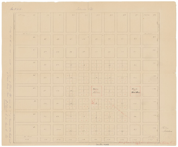
Rhoades Heights, North Part of West Half, Section 8, Block E
-
Map/Doc
92759
-
Collection
Twichell Survey Records
-
People and Organizations
Sylvan Sanders (Surveyor/Engineer)
-
Counties
Lubbock
-
Height x Width
29.2 x 13.5 inches
74.2 x 34.3 cm
Part of: Twichell Survey Records
[T. & N. O. Blks. 9T and 10T and surrounding areas]
![90413, [T. & N. O. Blks. 9T and 10T and surrounding areas], Twichell Survey Records](https://historictexasmaps.com/wmedia_w700/maps/90413-1.tif.jpg)
Print $20.00
- Digital $50.00
[T. & N. O. Blks. 9T and 10T and surrounding areas]
Size 14.6 x 21.0 inches
Map/Doc 90413
[North Part of Block G]
![92637, [North Part of Block G], Twichell Survey Records](https://historictexasmaps.com/wmedia_w700/maps/92637-1.tif.jpg)
Print $20.00
- Digital $50.00
[North Part of Block G]
Size 24.1 x 19.7 inches
Map/Doc 92637
[Area Surrounding Charles Ragsdale, M. George, and H. Ward Surveys]
![91535, [Area Surrounding Charles Ragsdale, M. George, and H. Ward Surveys], Twichell Survey Records](https://historictexasmaps.com/wmedia_w700/maps/91535-1.tif.jpg)
Print $20.00
- Digital $50.00
[Area Surrounding Charles Ragsdale, M. George, and H. Ward Surveys]
Size 20.0 x 23.3 inches
Map/Doc 91535
[Sketch of surveys around W.T. Brewer]
![89926, [Sketch of surveys around W.T. Brewer], Twichell Survey Records](https://historictexasmaps.com/wmedia_w700/maps/89926-1.tif.jpg)
Print $40.00
- Digital $50.00
[Sketch of surveys around W.T. Brewer]
Size 37.0 x 48.7 inches
Map/Doc 89926
General Highway Map, Lubbock County

Print $20.00
- Digital $50.00
General Highway Map, Lubbock County
1947
Size 25.1 x 18.9 inches
Map/Doc 92718
Map of Abernathy Located on Section 12, Block CK, Hale and Lubbock Counties, Texas

Print $20.00
- Digital $50.00
Map of Abernathy Located on Section 12, Block CK, Hale and Lubbock Counties, Texas
Size 29.9 x 33.0 inches
Map/Doc 92666
Map of Deaf Smith County, Texas

Print $2.00
- Digital $50.00
Map of Deaf Smith County, Texas
Size 11.6 x 8.9 inches
Map/Doc 90509
Detail Sketch of A.B. Robertson's Ranch and J.W. James' Ranch situated in Garza and Crosby Counties, Texas

Print $40.00
- Digital $50.00
Detail Sketch of A.B. Robertson's Ranch and J.W. James' Ranch situated in Garza and Crosby Counties, Texas
Size 51.7 x 34.3 inches
Map/Doc 89754
[T. & P. Block 44, Township 1S]
![90818, [T. & P. Block 44, Township 1S], Twichell Survey Records](https://historictexasmaps.com/wmedia_w700/maps/90818-2.tif.jpg)
Print $3.00
- Digital $50.00
[T. & P. Block 44, Township 1S]
Size 9.3 x 11.9 inches
Map/Doc 90818
Cochran County, Texas

Print $40.00
- Digital $50.00
Cochran County, Texas
Size 38.1 x 48.3 inches
Map/Doc 89870
[Sketch of part of G. & M. Block 5]
![93061, [Sketch of part of G. & M. Block 5], Twichell Survey Records](https://historictexasmaps.com/wmedia_w700/maps/93061-1.tif.jpg)
Print $20.00
- Digital $50.00
[Sketch of part of G. & M. Block 5]
Size 18.2 x 8.9 inches
Map/Doc 93061
[Capitol Lands, Block B6]
![91402, [Capitol Lands, Block B6], Twichell Survey Records](https://historictexasmaps.com/wmedia_w700/maps/91402-1.tif.jpg)
Print $20.00
- Digital $50.00
[Capitol Lands, Block B6]
Size 22.7 x 27.4 inches
Map/Doc 91402
You may also like
Oldham County Working Sketch 6

Print $40.00
- Digital $50.00
Oldham County Working Sketch 6
1981
Size 32.4 x 50.4 inches
Map/Doc 71328
El Paso County Sketch File 14

Print $20.00
- Digital $50.00
El Paso County Sketch File 14
1922
Size 24.0 x 17.2 inches
Map/Doc 11452
Eberstadt and Brock's Subdivisions of the West Half of Survey 187 Block 2 A. B. & M., Randall County Texas

Print $20.00
- Digital $50.00
Eberstadt and Brock's Subdivisions of the West Half of Survey 187 Block 2 A. B. & M., Randall County Texas
Size 17.7 x 29.6 inches
Map/Doc 91748
Flight Mission No. BRA-7M, Frame 18, Jefferson County

Print $20.00
- Digital $50.00
Flight Mission No. BRA-7M, Frame 18, Jefferson County
1953
Size 18.5 x 22.3 inches
Map/Doc 85469
Special Map of the Great Southwest for Burke's Texas Almanac

Print $20.00
Special Map of the Great Southwest for Burke's Texas Almanac
1885
Size 42.1 x 28.5 inches
Map/Doc 76214
Presidio County Working Sketch 112

Print $20.00
- Digital $50.00
Presidio County Working Sketch 112
1979
Size 41.7 x 35.6 inches
Map/Doc 71789
![91464, [Block B7], Twichell Survey Records](https://historictexasmaps.com/wmedia_w700/maps/91464-1.tif.jpg)
Hidalgo County Sketch File 16

Print $12.00
- Digital $50.00
Hidalgo County Sketch File 16
1914
Size 11.2 x 8.9 inches
Map/Doc 26437
Webb County Working Sketch 9

Print $20.00
- Digital $50.00
Webb County Working Sketch 9
1911
Size 17.2 x 30.8 inches
Map/Doc 72374
Presidio County Working Sketch 93

Print $20.00
- Digital $50.00
Presidio County Working Sketch 93
1976
Size 27.7 x 27.3 inches
Map/Doc 71770
Outer Continental Shelf Leasing Maps (Louisiana Offshore Operations)

Print $20.00
- Digital $50.00
Outer Continental Shelf Leasing Maps (Louisiana Offshore Operations)
1954
Size 25.5 x 15.3 inches
Map/Doc 76093