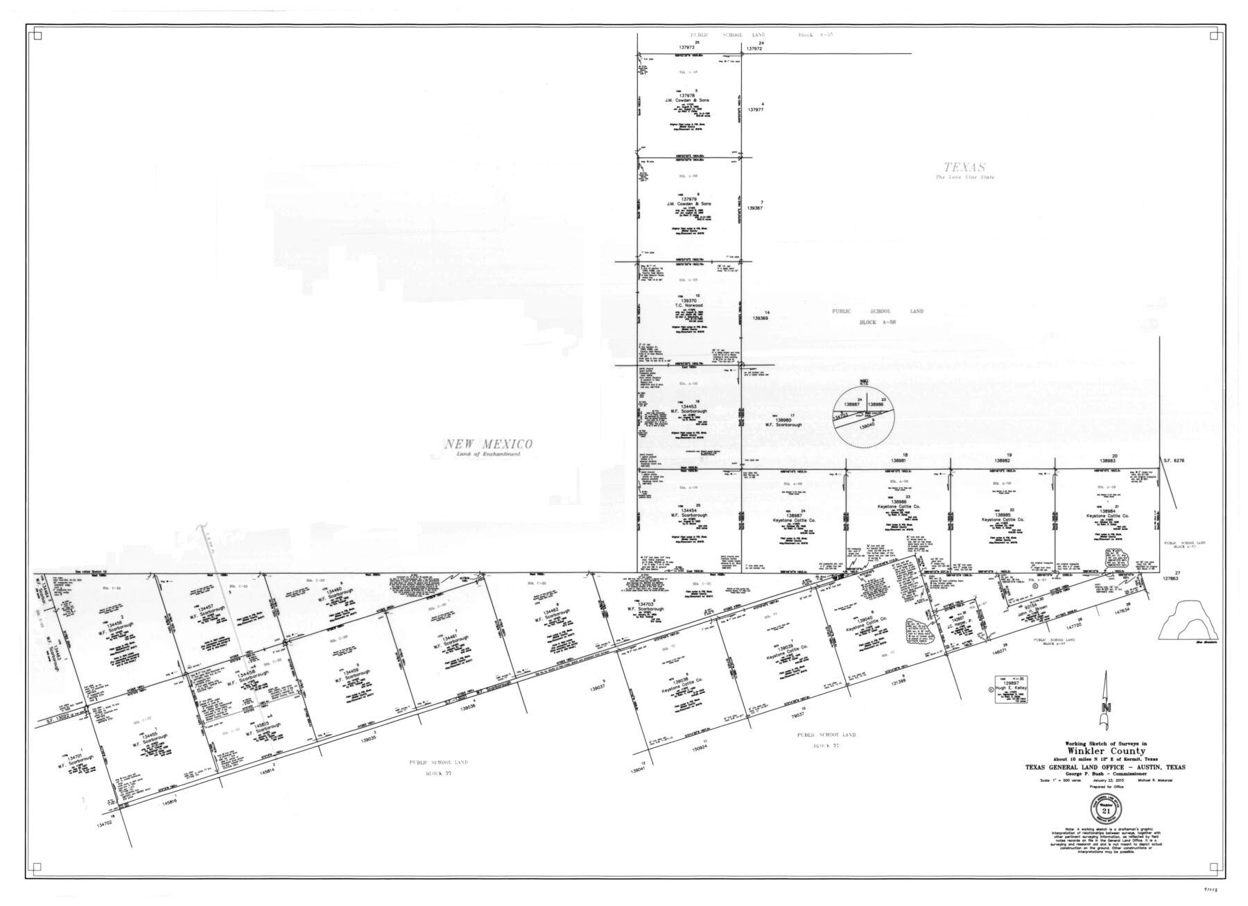
Winkler County Working Sketch 21
-
Map/Doc
93728
-
Collection
General Map Collection
-
Object Dates
1/23/2015 (Creation Date)
-
People and Organizations
Michael R. Mokarzel (Draftsman)
-
Counties
Winkler
-
Subjects
Surveying Working Sketch
-
Height x Width
33.2 x 45.7 inches
84.3 x 116.1 cm
-
Scale
1" = 500 varas
Part of: General Map Collection
Glasscock County Sketch File 10

Print $6.00
- Digital $50.00
Glasscock County Sketch File 10
1935
Size 11.6 x 12.8 inches
Map/Doc 24172
Harris County Rolled Sketch 45

Print $20.00
- Digital $50.00
Harris County Rolled Sketch 45
Size 20.2 x 21.0 inches
Map/Doc 6103
Houston & Texas Central Railway Through Bastrop County

Print $40.00
- Digital $50.00
Houston & Texas Central Railway Through Bastrop County
1916
Size 21.3 x 116.5 inches
Map/Doc 64418
Atascosa County Sketch File 41a

Print $10.00
- Digital $50.00
Atascosa County Sketch File 41a
1956
Size 9.3 x 7.4 inches
Map/Doc 13841
San Saba County Working Sketch 11

Print $20.00
- Digital $50.00
San Saba County Working Sketch 11
1989
Size 30.3 x 38.2 inches
Map/Doc 63799
Palestine, Texas

Print $20.00
- Digital $50.00
Palestine, Texas
1942
Size 39.3 x 36.1 inches
Map/Doc 4834
Polk County Boundary File 2

Print $8.00
- Digital $50.00
Polk County Boundary File 2
Size 14.2 x 8.7 inches
Map/Doc 57924
Baylor County Sketch File 10A

Print $40.00
- Digital $50.00
Baylor County Sketch File 10A
Size 19.6 x 29.0 inches
Map/Doc 10905
Hansford County Sketch File 6

Print $8.00
- Digital $50.00
Hansford County Sketch File 6
1926
Size 13.6 x 9.0 inches
Map/Doc 24954
Map of Texas Gulf Coast and Continental Shelf showing Natural Gas Pipe Lines

Print $40.00
- Digital $50.00
Map of Texas Gulf Coast and Continental Shelf showing Natural Gas Pipe Lines
1983
Size 40.9 x 59.1 inches
Map/Doc 75969

Andrews County Sketch File 10

Print $40.00
- Digital $50.00
Andrews County Sketch File 10
1950
Size 27.4 x 18.2 inches
Map/Doc 10810
You may also like
Outer Continental Shelf Leasing Maps (Louisiana Offshore Operations)

Print $20.00
- Digital $50.00
Outer Continental Shelf Leasing Maps (Louisiana Offshore Operations)
1954
Size 20.4 x 13.1 inches
Map/Doc 76098
Hardeman County Rolled Sketch 22

Print $20.00
- Digital $50.00
Hardeman County Rolled Sketch 22
Size 25.8 x 18.6 inches
Map/Doc 6073
Ector County Working Sketch Graphic Index - sheet B

Print $20.00
- Digital $50.00
Ector County Working Sketch Graphic Index - sheet B
1943
Size 43.9 x 37.7 inches
Map/Doc 76531
[Connecting lines through Blocks A2, 29, I, GG, I. & G. N. Block 1 and Archer County School Land]
![91646, [Connecting lines through Blocks A2, 29, I, GG, I. & G. N. Block 1 and Archer County School Land], Twichell Survey Records](https://historictexasmaps.com/wmedia_w700/maps/91646-1.tif.jpg)
Print $20.00
- Digital $50.00
[Connecting lines through Blocks A2, 29, I, GG, I. & G. N. Block 1 and Archer County School Land]
Size 26.2 x 18.8 inches
Map/Doc 91646

Kent County Rolled Sketch 6

Print $20.00
- Digital $50.00
Kent County Rolled Sketch 6
Size 39.0 x 36.5 inches
Map/Doc 6476
Montgomery County Rolled Sketch 15

Print $40.00
- Digital $50.00
Montgomery County Rolled Sketch 15
1932
Size 23.7 x 49.0 inches
Map/Doc 9527
Hidalgo County Rolled Sketch 13

Print $20.00
- Digital $50.00
Hidalgo County Rolled Sketch 13
1960
Size 19.0 x 31.4 inches
Map/Doc 6212
Corpus Christi Bay

Print $20.00
- Digital $50.00
Corpus Christi Bay
1971
Size 36.2 x 47.6 inches
Map/Doc 73473
Sketch D Showing the progress of Section IV 1845 to 1852

Print $20.00
- Digital $50.00
Sketch D Showing the progress of Section IV 1845 to 1852
1852
Size 22.8 x 13.0 inches
Map/Doc 97208
Texas Boundary Line

Print $20.00
- Digital $50.00
Texas Boundary Line
Size 21.2 x 11.8 inches
Map/Doc 92068
Duval County Sketch File 43

Print $20.00
- Digital $50.00
Duval County Sketch File 43
Size 22.9 x 21.1 inches
Map/Doc 11398