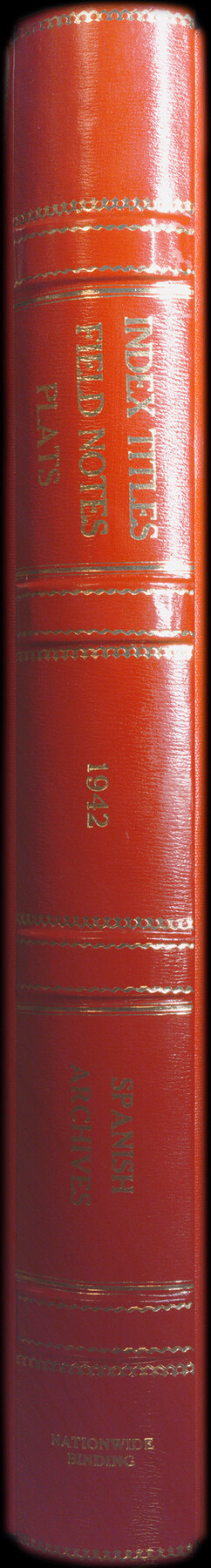
Index to Titles, Field Notes, and Plats in the Spanish Archives
-
Map/Doc
94524
-
Collection
Historical Volumes
-
Object Dates
1942/9/25 (Creation Date)
-
People and Organizations
Lurline Gafford (Spanish Translator)
-
Subjects
Bound Volume Colony Mexican Texas
-
Height x Width
17.5 x 10.1 inches
44.5 x 25.7 cm
-
Medium
paper, bound volume
-
Comments
Copied from the index made in 1880 and corrected by Lurline Gafford, GLO Spanish Translator
Part of: Historical Volumes
Acts of the Visit of the Royal Commissioners (sometimes referred to as the “Visita General”) - Camargo

Acts of the Visit of the Royal Commissioners (sometimes referred to as the “Visita General”) - Camargo
1767
Size 14.3 x 9.5 inches
Map/Doc 94254
Political Chief of Nacogdoches Correspondence with Various People (PCCVP)

Political Chief of Nacogdoches Correspondence with Various People (PCCVP)
Size 12.5 x 9.0 inches
Map/Doc 94264
Reference Book of Burnet's, [Vehlein's] & Zavala's Colonies
![94554, Reference Book of Burnet's, [Vehlein's] & Zavala's Colonies, Historical Volumes](https://historictexasmaps.com/wmedia_w700/pdf_converted_jpg/qi_pdf_thumbnail_39143.jpg)
Reference Book of Burnet's, [Vehlein's] & Zavala's Colonies
Map/Doc 94554
English Field Notes of the Spanish Archives - Books DBE, WBPS, GAN, WB3, and X

English Field Notes of the Spanish Archives - Books DBE, WBPS, GAN, WB3, and X
1835
Map/Doc 96546
Record of Spanish Titles, Vol. V

Record of Spanish Titles, Vol. V
1845
Size 16.4 x 12.3 inches
Map/Doc 94530
Acts of the Visit of the Royal Commissioners (sometimes referred to as the “Visita General”) - Revilla [Guerrero]

Acts of the Visit of the Royal Commissioners (sometimes referred to as the “Visita General”) - Revilla [Guerrero]
1767
Size 14.1 x 9.5 inches
Map/Doc 94255

English Field Notes of the Spanish Archives - Book 5

English Field Notes of the Spanish Archives - Book 5
1835
Map/Doc 96531

English Field Notes of the Spanish Archives - Books DB3 & WR

English Field Notes of the Spanish Archives - Books DB3 & WR
1835
Map/Doc 96548
Index to Titles, Field, Notes, and Plats, A-Z

Index to Titles, Field, Notes, and Plats, A-Z
Size 17.0 x 12.1 inches
Map/Doc 94525
Record of Spanish Titles, Vol. I

Record of Spanish Titles, Vol. I
1845
Size 19.2 x 13.9 inches
Map/Doc 94526
You may also like
Williamson County Rolled Sketch 10

Print $20.00
- Digital $50.00
Williamson County Rolled Sketch 10
1975
Size 24.8 x 19.2 inches
Map/Doc 8267
Live Oak County Sketch File 25

Print $16.00
- Digital $50.00
Live Oak County Sketch File 25
1919
Size 9.0 x 8.5 inches
Map/Doc 30301
Brazoria County Sketch File 36

Print $40.00
- Digital $50.00
Brazoria County Sketch File 36
1933
Size 34.6 x 45.6 inches
Map/Doc 10325
Bosque County Sketch File 22

Print $4.00
- Digital $50.00
Bosque County Sketch File 22
1863
Size 13.8 x 8.5 inches
Map/Doc 14804
Brewster County Rolled Sketch 24D

Print $20.00
- Digital $50.00
Brewster County Rolled Sketch 24D
1909
Size 14.6 x 17.4 inches
Map/Doc 5211
Harris County Historic Topographic 12

Print $20.00
- Digital $50.00
Harris County Historic Topographic 12
1915
Size 19.5 x 23.5 inches
Map/Doc 65822
Orange County NRC Article 33.136 Location Key Sheet

Print $20.00
- Digital $50.00
Orange County NRC Article 33.136 Location Key Sheet
1974
Size 27.0 x 23.0 inches
Map/Doc 87911
[C. C. Slaughter Block 1, T. T. RR. Co. Block 2]
![90621, [C. C. Slaughter Block 1, T. T. RR. Co. Block 2], Twichell Survey Records](https://historictexasmaps.com/wmedia_w700/maps/90621-1.tif.jpg)
Print $2.00
- Digital $50.00
[C. C. Slaughter Block 1, T. T. RR. Co. Block 2]
Size 8.6 x 11.5 inches
Map/Doc 90621
Dallam County

Print $20.00
- Digital $50.00
Dallam County
1926
Size 34.0 x 41.0 inches
Map/Doc 77257
Goliad County Sketch File 25

Print $6.00
- Digital $50.00
Goliad County Sketch File 25
1856
Size 12.3 x 7.8 inches
Map/Doc 24305
[Blocks L. E. and B8]
![90666, [Blocks L. E. and B8], Twichell Survey Records](https://historictexasmaps.com/wmedia_w700/maps/90666-2.tif.jpg)
Print $20.00
- Digital $50.00
[Blocks L. E. and B8]
Size 18.4 x 13.6 inches
Map/Doc 90666
Comal County Sketch File 8

Print $6.00
- Digital $50.00
Comal County Sketch File 8
1849
Size 12.6 x 10.8 inches
Map/Doc 19013