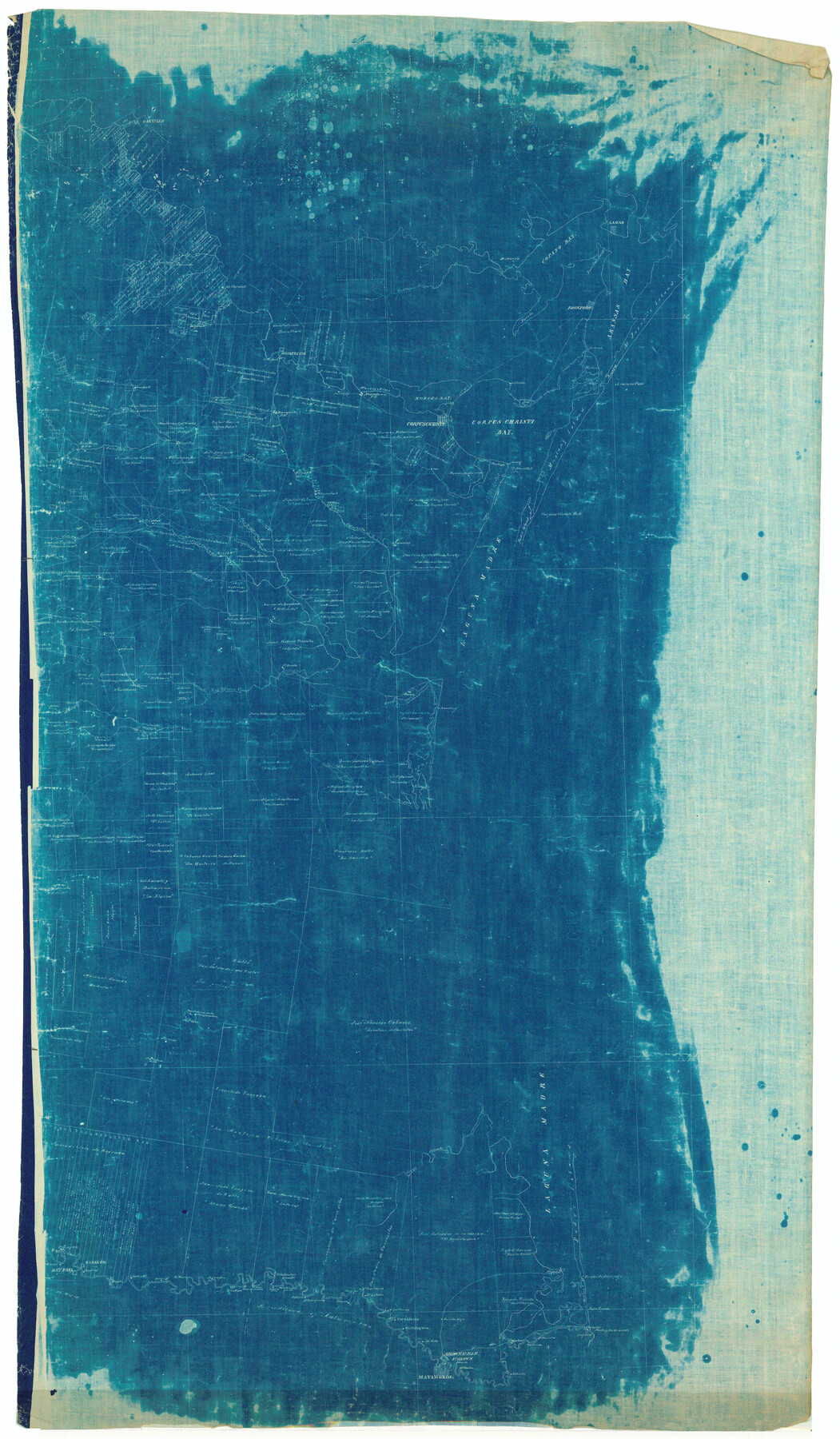
San Patricio County Rolled Sketch 7A
Map of San Patricio District [east part]
-
Map/Doc
9884
-
Collection
General Map Collection
-
Object Dates
1870 (Creation Date)
-
People and Organizations
Felix A. von Bluecher (Surveyor/Engineer)
-
Counties
San Patricio
-
Subjects
Surveying Rolled Sketch
-
Height x Width
46.8 x 27.3 inches
118.9 x 69.3 cm
-
Medium
blueprint/diazo
Part of: General Map Collection
The Making of America - Texas

The Making of America - Texas
1986
Size 20.7 x 27.3 inches
Map/Doc 96825
Pecos County Working Sketch 125

Print $40.00
- Digital $50.00
Pecos County Working Sketch 125
1974
Size 53.4 x 37.0 inches
Map/Doc 71598
Terry County Sketch File 15

Print $10.00
- Digital $50.00
Terry County Sketch File 15
1944
Size 11.3 x 8.9 inches
Map/Doc 38034
Cass County Working Sketch 23

Print $40.00
- Digital $50.00
Cass County Working Sketch 23
1966
Size 56.8 x 37.1 inches
Map/Doc 67926
Zavala County Sketch File 39

Print $4.00
- Digital $50.00
Zavala County Sketch File 39
1884
Size 14.4 x 8.7 inches
Map/Doc 41404
Kent County Sketch File 4

Print $20.00
- Digital $50.00
Kent County Sketch File 4
Size 27.5 x 28.3 inches
Map/Doc 11912
Lubbock County Sketch File 13

Print $20.00
- Digital $50.00
Lubbock County Sketch File 13
1952
Size 20.4 x 14.5 inches
Map/Doc 12018
Brazoria County Working Sketch 10

Print $20.00
- Digital $50.00
Brazoria County Working Sketch 10
1935
Size 16.2 x 25.2 inches
Map/Doc 67495
Brown County Sketch File 15

Print $4.00
- Digital $50.00
Brown County Sketch File 15
1857
Size 12.2 x 8.0 inches
Map/Doc 16610
Uvalde County Sketch File 26-2

Print $6.00
- Digital $50.00
Uvalde County Sketch File 26-2
1942
Size 11.4 x 9.0 inches
Map/Doc 39020
Montgomery County Rolled Sketch 37

Print $40.00
- Digital $50.00
Montgomery County Rolled Sketch 37
Size 44.3 x 52.7 inches
Map/Doc 9544
South Part Crockett County

Print $40.00
- Digital $50.00
South Part Crockett County
1977
Size 39.1 x 51.2 inches
Map/Doc 95471
You may also like
Hunt County Sketch File 3

Print $4.00
- Digital $50.00
Hunt County Sketch File 3
1856
Size 6.0 x 8.1 inches
Map/Doc 27085
Baylor County Sketch File 11A

Print $40.00
- Digital $50.00
Baylor County Sketch File 11A
Size 33.9 x 32.0 inches
Map/Doc 10322
Jasper County Working Sketch 17

Print $20.00
- Digital $50.00
Jasper County Working Sketch 17
1934
Size 18.1 x 24.2 inches
Map/Doc 66479
Map of Taylor County

Print $20.00
- Digital $50.00
Map of Taylor County
1858
Size 24.0 x 25.3 inches
Map/Doc 4070
Amistad International Reservoir on Rio Grande 65

Print $20.00
- Digital $50.00
Amistad International Reservoir on Rio Grande 65
1949
Size 28.2 x 39.8 inches
Map/Doc 73350
Trinity County Sketch File 34

Print $20.00
- Digital $50.00
Trinity County Sketch File 34
Size 15.9 x 20.3 inches
Map/Doc 12491
Flight Mission No. CGN-3P, Frame 140, San Patricio County

Print $20.00
- Digital $50.00
Flight Mission No. CGN-3P, Frame 140, San Patricio County
1956
Size 18.5 x 22.3 inches
Map/Doc 86984
Motley County Sketch File 7 (S)

Print $4.00
- Digital $50.00
Motley County Sketch File 7 (S)
Size 8.1 x 9.6 inches
Map/Doc 32149
Shallowater Well Field Survey

Print $40.00
- Digital $50.00
Shallowater Well Field Survey
Size 61.8 x 43.7 inches
Map/Doc 89900
Outer Continental Shelf Leasing Maps (Texas Offshore Operations)

Print $20.00
- Digital $50.00
Outer Continental Shelf Leasing Maps (Texas Offshore Operations)
Size 17.3 x 16.7 inches
Map/Doc 75841
Midland County Boundary File 1a

Print $4.00
- Digital $50.00
Midland County Boundary File 1a
Size 9.5 x 6.0 inches
Map/Doc 57160
Frio County Working Sketch 9

Print $20.00
- Digital $50.00
Frio County Working Sketch 9
1949
Size 30.1 x 25.6 inches
Map/Doc 69283