Dallas County Sketch File 3

Print $20.00
- Digital $50.00
Dallas County Sketch File 3
1855
Size: 22.4 x 14.0 inches
11282
Kaufman County Sketch File 10a

Print $20.00
- Digital $50.00
Kaufman County Sketch File 10a
1871
Size: 18.3 x 14.6 inches
11906
Kaufman County Sketch File 20

Print $20.00
- Digital $50.00
Kaufman County Sketch File 20
1950
Size: 23.2 x 34.8 inches
11908
Dallas County Sketch File 5

Print $18.00
- Digital $50.00
Dallas County Sketch File 5
1858
Size: 10.5 x 8.4 inches
20400
Dallas County Sketch File 14

Print $22.00
- Digital $50.00
Dallas County Sketch File 14
1859
Size: 8.2 x 7.6 inches
20428
Dallas County Sketch File 23

Print $6.00
- Digital $50.00
Dallas County Sketch File 23
1860
Size: 14.5 x 8.8 inches
20456
Dallas County Sketch File 24

Print $4.00
- Digital $50.00
Dallas County Sketch File 24
1860
Size: 14.9 x 8.4 inches
20459
Ellis County Sketch File 20

Print $19.00
- Digital $50.00
Ellis County Sketch File 20
1869
Size: 12.8 x 8.2 inches
21869
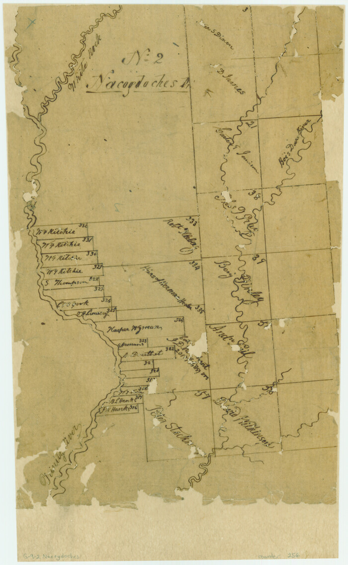
[Surveys along the Trinity River, Bois d'Arc Creek and White Rock Lake]
Print $2.00
- Digital $50.00
[Surveys along the Trinity River, Bois d'Arc Creek and White Rock Lake]
Size: 10.8 x 6.7 inches
256
Hunt County Sketch File 1

Print $4.00
- Digital $50.00
Hunt County Sketch File 1
1853
Size: 7.6 x 5.1 inches
27081
Hunt County Sketch File 8

Print $4.00
- Digital $50.00
Hunt County Sketch File 8
1848
Size: 8.2 x 12.7 inches
27097
Hunt County Sketch File 17

Print $8.00
- Digital $50.00
Hunt County Sketch File 17
1861
Size: 10.6 x 8.2 inches
27114
Hunt County Sketch File 43

Print $6.00
- Digital $50.00
Hunt County Sketch File 43
1851
Size: 8.4 x 13.0 inches
27165
Kaufman County Sketch File 1

Print $4.00
- Digital $50.00
Kaufman County Sketch File 1
Size: 8.3 x 8.3 inches
28624
Kaufman County Sketch File 2

Print $6.00
- Digital $50.00
Kaufman County Sketch File 2
Size: 8.7 x 10.3 inches
28626
Kaufman County Sketch File A

Print $4.00
- Digital $50.00
Kaufman County Sketch File A
1879
Size: 14.1 x 8.8 inches
28630
Kaufman County Sketch File 5

Print $22.00
- Digital $50.00
Kaufman County Sketch File 5
1849
Size: 7.6 x 12.6 inches
28632
Kaufman County Sketch File 6

Print $4.00
- Digital $50.00
Kaufman County Sketch File 6
1847
Size: 8.2 x 10.0 inches
28634
Kaufman County Sketch File 7

Print $5.00
- Digital $50.00
Kaufman County Sketch File 7
1847
Size: 8.3 x 10.1 inches
28636
Kaufman County Sketch File 8

Print $4.00
- Digital $50.00
Kaufman County Sketch File 8
1851
Size: 13.3 x 9.2 inches
28638
Kaufman County Sketch File 9

Print $8.00
- Digital $50.00
Kaufman County Sketch File 9
1851
Size: 9.7 x 7.9 inches
28640
Kaufman County Sketch File 10

Print $4.00
- Digital $50.00
Kaufman County Sketch File 10
1873
Size: 10.2 x 8.2 inches
28643
Kaufman County Sketch File 11

Print $4.00
- Digital $50.00
Kaufman County Sketch File 11
1874
Size: 10.2 x 8.4 inches
28645
Kaufman County Sketch File 12

Print $4.00
- Digital $50.00
Kaufman County Sketch File 12
1862
Size: 12.9 x 8.2 inches
28647
Kaufman County Sketch File 14

Print $4.00
- Digital $50.00
Kaufman County Sketch File 14
Size: 10.1 x 8.1 inches
28649
Kaufman County Sketch File 15

Print $26.00
- Digital $50.00
Kaufman County Sketch File 15
Size: 8.5 x 8.2 inches
28651
Kaufman County Sketch File 16

Print $4.00
- Digital $50.00
Kaufman County Sketch File 16
Size: 10.1 x 8.1 inches
28655
Kaufman County Sketch File 17

Print $4.00
- Digital $50.00
Kaufman County Sketch File 17
1873
Size: 8.0 x 6.1 inches
28657
Dallas County Sketch File 3
Print $20.00
- Digital $50.00
Dallas County Sketch File 3
1855
-
Size
22.4 x 14.0 inches
-
Map/Doc
11282
-
Creation Date
1855
Kaufman County Sketch File 10a
Print $20.00
- Digital $50.00
Kaufman County Sketch File 10a
1871
-
Size
18.3 x 14.6 inches
-
Map/Doc
11906
-
Creation Date
1871
Kaufman County Sketch File 20
Print $20.00
- Digital $50.00
Kaufman County Sketch File 20
1950
-
Size
23.2 x 34.8 inches
-
Map/Doc
11908
-
Creation Date
1950
Kaufman Co.

Print $20.00
- Digital $50.00
Kaufman Co.
1887
-
Size
42.9 x 32.9 inches
-
Map/Doc
16863
-
Creation Date
1887
Kaufman County

Print $20.00
- Digital $50.00
Kaufman County
1942
-
Size
46.6 x 38.2 inches
-
Map/Doc
1871
-
Creation Date
1942
Dallas County Sketch File 5
Print $18.00
- Digital $50.00
Dallas County Sketch File 5
1858
-
Size
10.5 x 8.4 inches
-
Map/Doc
20400
-
Creation Date
1858
Dallas County Sketch File 14
Print $22.00
- Digital $50.00
Dallas County Sketch File 14
1859
-
Size
8.2 x 7.6 inches
-
Map/Doc
20428
-
Creation Date
1859
Dallas County Sketch File 23
Print $6.00
- Digital $50.00
Dallas County Sketch File 23
1860
-
Size
14.5 x 8.8 inches
-
Map/Doc
20456
-
Creation Date
1860
Dallas County Sketch File 24
Print $4.00
- Digital $50.00
Dallas County Sketch File 24
1860
-
Size
14.9 x 8.4 inches
-
Map/Doc
20459
-
Creation Date
1860
Ellis County Sketch File 20
Print $19.00
- Digital $50.00
Ellis County Sketch File 20
1869
-
Size
12.8 x 8.2 inches
-
Map/Doc
21869
-
Creation Date
1869
[Surveys along the Trinity River, Bois d'Arc Creek and White Rock Lake]
Print $2.00
- Digital $50.00
[Surveys along the Trinity River, Bois d'Arc Creek and White Rock Lake]
-
Size
10.8 x 6.7 inches
-
Map/Doc
256
Hunt County Sketch File 1
Print $4.00
- Digital $50.00
Hunt County Sketch File 1
1853
-
Size
7.6 x 5.1 inches
-
Map/Doc
27081
-
Creation Date
1853
Hunt County Sketch File 8
Print $4.00
- Digital $50.00
Hunt County Sketch File 8
1848
-
Size
8.2 x 12.7 inches
-
Map/Doc
27097
-
Creation Date
1848
Hunt County Sketch File 17
Print $8.00
- Digital $50.00
Hunt County Sketch File 17
1861
-
Size
10.6 x 8.2 inches
-
Map/Doc
27114
-
Creation Date
1861
Hunt County Sketch File 43
Print $6.00
- Digital $50.00
Hunt County Sketch File 43
1851
-
Size
8.4 x 13.0 inches
-
Map/Doc
27165
-
Creation Date
1851
Kaufman County Sketch File 1
Print $4.00
- Digital $50.00
Kaufman County Sketch File 1
-
Size
8.3 x 8.3 inches
-
Map/Doc
28624
Kaufman County Sketch File 2
Print $6.00
- Digital $50.00
Kaufman County Sketch File 2
-
Size
8.7 x 10.3 inches
-
Map/Doc
28626
Kaufman County Sketch File A
Print $4.00
- Digital $50.00
Kaufman County Sketch File A
1879
-
Size
14.1 x 8.8 inches
-
Map/Doc
28630
-
Creation Date
1879
Kaufman County Sketch File 5
Print $22.00
- Digital $50.00
Kaufman County Sketch File 5
1849
-
Size
7.6 x 12.6 inches
-
Map/Doc
28632
-
Creation Date
1849
Kaufman County Sketch File 6
Print $4.00
- Digital $50.00
Kaufman County Sketch File 6
1847
-
Size
8.2 x 10.0 inches
-
Map/Doc
28634
-
Creation Date
1847
Kaufman County Sketch File 7
Print $5.00
- Digital $50.00
Kaufman County Sketch File 7
1847
-
Size
8.3 x 10.1 inches
-
Map/Doc
28636
-
Creation Date
1847
Kaufman County Sketch File 8
Print $4.00
- Digital $50.00
Kaufman County Sketch File 8
1851
-
Size
13.3 x 9.2 inches
-
Map/Doc
28638
-
Creation Date
1851
Kaufman County Sketch File 9
Print $8.00
- Digital $50.00
Kaufman County Sketch File 9
1851
-
Size
9.7 x 7.9 inches
-
Map/Doc
28640
-
Creation Date
1851
Kaufman County Sketch File 10
Print $4.00
- Digital $50.00
Kaufman County Sketch File 10
1873
-
Size
10.2 x 8.2 inches
-
Map/Doc
28643
-
Creation Date
1873
Kaufman County Sketch File 11
Print $4.00
- Digital $50.00
Kaufman County Sketch File 11
1874
-
Size
10.2 x 8.4 inches
-
Map/Doc
28645
-
Creation Date
1874
Kaufman County Sketch File 12
Print $4.00
- Digital $50.00
Kaufman County Sketch File 12
1862
-
Size
12.9 x 8.2 inches
-
Map/Doc
28647
-
Creation Date
1862
Kaufman County Sketch File 14
Print $4.00
- Digital $50.00
Kaufman County Sketch File 14
-
Size
10.1 x 8.1 inches
-
Map/Doc
28649
Kaufman County Sketch File 15
Print $26.00
- Digital $50.00
Kaufman County Sketch File 15
-
Size
8.5 x 8.2 inches
-
Map/Doc
28651
Kaufman County Sketch File 16
Print $4.00
- Digital $50.00
Kaufman County Sketch File 16
-
Size
10.1 x 8.1 inches
-
Map/Doc
28655
Kaufman County Sketch File 17
Print $4.00
- Digital $50.00
Kaufman County Sketch File 17
1873
-
Size
8.0 x 6.1 inches
-
Map/Doc
28657
-
Creation Date
1873