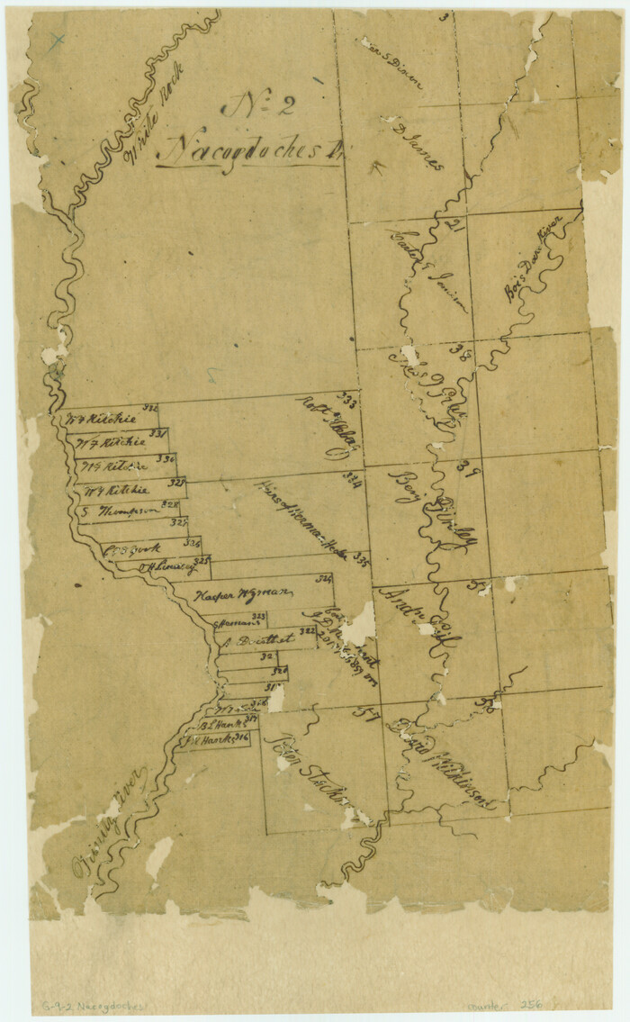
[Surveys along the Trinity River, Bois d'Arc Creek and White Rock Lake]
Print $2.00
- Digital $50.00
[Surveys along the Trinity River, Bois d'Arc Creek and White Rock Lake]
Size: 10.8 x 6.7 inches
256
Kaufman County Sketch File 1

Print $4.00
- Digital $50.00
Kaufman County Sketch File 1
Size: 8.3 x 8.3 inches
28624
Kaufman County Sketch File 2

Print $6.00
- Digital $50.00
Kaufman County Sketch File 2
Size: 8.7 x 10.3 inches
28626
Kaufman County Sketch File 14

Print $4.00
- Digital $50.00
Kaufman County Sketch File 14
Size: 10.1 x 8.1 inches
28649
Kaufman County Sketch File 15

Print $26.00
- Digital $50.00
Kaufman County Sketch File 15
Size: 8.5 x 8.2 inches
28651
Kaufman County Sketch File 16

Print $4.00
- Digital $50.00
Kaufman County Sketch File 16
Size: 10.1 x 8.1 inches
28655
Rockwall County Sketch File 1

Print $22.00
Rockwall County Sketch File 1
Size: 14.5 x 16.1 inches
35413
Van Zandt County Sketch File 5

Print $22.00
- Digital $50.00
Van Zandt County Sketch File 5
Size: 20.5 x 6.3 inches
39371
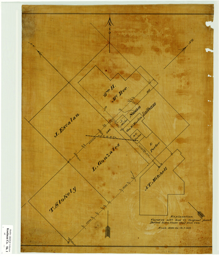
[Sketch Showing L. Gonzales, Wm. H. McBee and adjacent surveys, Kaufman County, Texas]
Print $20.00
- Digital $50.00
[Sketch Showing L. Gonzales, Wm. H. McBee and adjacent surveys, Kaufman County, Texas]
Size: 23.2 x 19.8 inches
5071
Kaufman County Boundary File 1

Print $8.00
- Digital $50.00
Kaufman County Boundary File 1
Size: 7.7 x 3.6 inches
55903
Kaufman County Boundary File 1a

Print $8.00
- Digital $50.00
Kaufman County Boundary File 1a
Size: 14.1 x 8.6 inches
55907
Kaufman County Boundary File 2

Print $22.00
- Digital $50.00
Kaufman County Boundary File 2
Size: 14.1 x 8.6 inches
55911
Kaufman County Boundary File 3

Print $14.00
- Digital $50.00
Kaufman County Boundary File 3
Size: 12.7 x 8.2 inches
55922
Kaufman County Boundary File 3a

Print $28.00
- Digital $50.00
Kaufman County Boundary File 3a
Size: 14.2 x 8.6 inches
55929
Kaufman County Boundary File 4

Print $52.00
- Digital $50.00
Kaufman County Boundary File 4
Size: 7.6 x 8.7 inches
55934
Kaufman County Boundary File 5

Print $37.00
- Digital $50.00
Kaufman County Boundary File 5
Size: 13.4 x 8.7 inches
55942
Kaufman County Boundary File 5a

Print $28.00
- Digital $50.00
Kaufman County Boundary File 5a
Size: 14.2 x 8.8 inches
55951
Kaufman County Boundary File 6

Print $14.00
- Digital $50.00
Kaufman County Boundary File 6
Size: 11.2 x 8.7 inches
55956
Kaufman County Boundary File 6a

Print $6.00
- Digital $50.00
Kaufman County Boundary File 6a
Size: 14.0 x 8.5 inches
55963
Kaufman County Boundary File 6b

Print $6.00
- Digital $50.00
Kaufman County Boundary File 6b
Size: 14.2 x 8.5 inches
55966
Kaufman County Boundary File 7

Print $16.00
- Digital $50.00
Kaufman County Boundary File 7
Size: 13.9 x 8.7 inches
55969
Kaufman County Boundary File 8

Print $10.00
- Digital $50.00
Kaufman County Boundary File 8
Size: 11.2 x 8.7 inches
55977
Map of the Recognised Line, M. El. P. & P. RR. from Texas & Arkansas State Line to Milam & Bexar Land District Line

Print $40.00
- Digital $50.00
Map of the Recognised Line, M. El. P. & P. RR. from Texas & Arkansas State Line to Milam & Bexar Land District Line
Size: 15.3 x 89.4 inches
64638
Combination Map of Henderson, Kaufman, Rains, Van Zandt, Hunt & Rockwall Counties

Print $40.00
- Digital $50.00
Combination Map of Henderson, Kaufman, Rains, Van Zandt, Hunt & Rockwall Counties
Size: 42.6 x 64.8 inches
89810
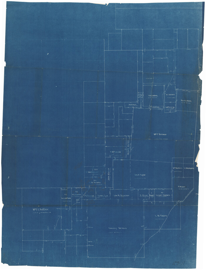
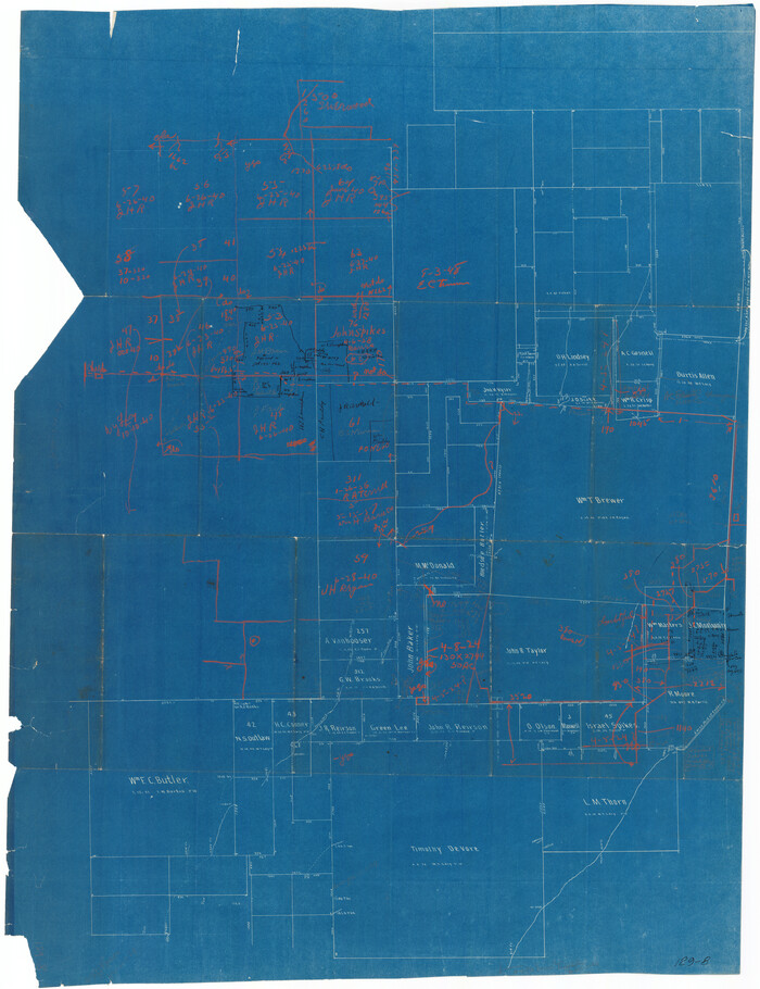
[Sketch of surveys around W.T. Brewer]
Print $40.00
- Digital $50.00
[Sketch of surveys around W.T. Brewer]
Size: 37.0 x 48.7 inches
89926
[Southeast part of County]
Print $40.00
- Digital $50.00
[Southeast part of County]
Size: 37.1 x 48.2 inches
89956
[Northeast part of County]
Print $20.00
- Digital $50.00
[Northeast part of County]
Size: 37.1 x 42.9 inches
89957
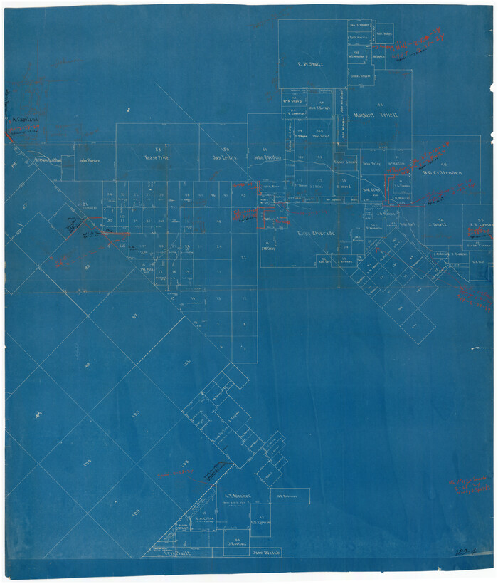
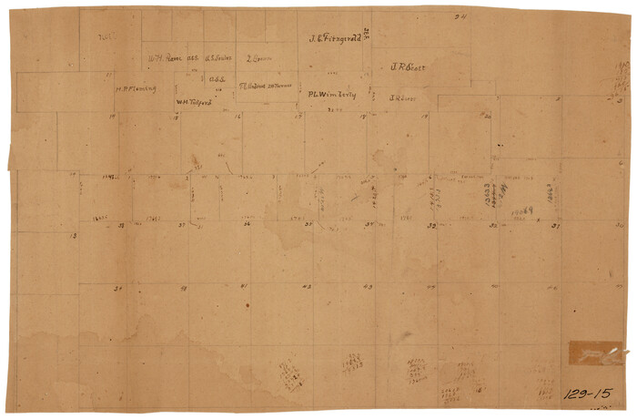
[H. P. Fleming, J. E. Fitzgerald, J. R. Scott and surrounding surveys]
Print $20.00
- Digital $50.00
[H. P. Fleming, J. E. Fitzgerald, J. R. Scott and surrounding surveys]
Size: 19.7 x 12.9 inches
90954
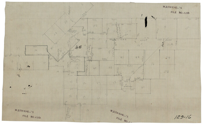
[Working Sketch Survey 46]
Print $20.00
- Digital $50.00
[Working Sketch Survey 46]
Size: 19.0 x 11.8 inches
90955
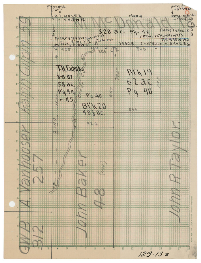
[W. T. Brewer: M. McDonald, Ralph Gilpin, A. Vanhooser, John Baker, John R. Taylor Surveys]
Print $2.00
- Digital $50.00
[W. T. Brewer: M. McDonald, Ralph Gilpin, A. Vanhooser, John Baker, John R. Taylor Surveys]
Size: 8.7 x 11.3 inches
90957
[Surveys along the Trinity River, Bois d'Arc Creek and White Rock Lake]
Print $2.00
- Digital $50.00
[Surveys along the Trinity River, Bois d'Arc Creek and White Rock Lake]
-
Size
10.8 x 6.7 inches
-
Map/Doc
256
Kaufman County Sketch File 1
Print $4.00
- Digital $50.00
Kaufman County Sketch File 1
-
Size
8.3 x 8.3 inches
-
Map/Doc
28624
Kaufman County Sketch File 2
Print $6.00
- Digital $50.00
Kaufman County Sketch File 2
-
Size
8.7 x 10.3 inches
-
Map/Doc
28626
Kaufman County Sketch File 14
Print $4.00
- Digital $50.00
Kaufman County Sketch File 14
-
Size
10.1 x 8.1 inches
-
Map/Doc
28649
Kaufman County Sketch File 15
Print $26.00
- Digital $50.00
Kaufman County Sketch File 15
-
Size
8.5 x 8.2 inches
-
Map/Doc
28651
Kaufman County Sketch File 16
Print $4.00
- Digital $50.00
Kaufman County Sketch File 16
-
Size
10.1 x 8.1 inches
-
Map/Doc
28655
Rockwall County Sketch File 1
Print $22.00
Rockwall County Sketch File 1
-
Size
14.5 x 16.1 inches
-
Map/Doc
35413
Van Zandt County Sketch File 5
Print $22.00
- Digital $50.00
Van Zandt County Sketch File 5
-
Size
20.5 x 6.3 inches
-
Map/Doc
39371
[Sketch Showing L. Gonzales, Wm. H. McBee and adjacent surveys, Kaufman County, Texas]
Print $20.00
- Digital $50.00
[Sketch Showing L. Gonzales, Wm. H. McBee and adjacent surveys, Kaufman County, Texas]
-
Size
23.2 x 19.8 inches
-
Map/Doc
5071
Kaufman County Boundary File 1
Print $8.00
- Digital $50.00
Kaufman County Boundary File 1
-
Size
7.7 x 3.6 inches
-
Map/Doc
55903
Kaufman County Boundary File 1a
Print $8.00
- Digital $50.00
Kaufman County Boundary File 1a
-
Size
14.1 x 8.6 inches
-
Map/Doc
55907
Kaufman County Boundary File 2
Print $22.00
- Digital $50.00
Kaufman County Boundary File 2
-
Size
14.1 x 8.6 inches
-
Map/Doc
55911
Kaufman County Boundary File 3
Print $14.00
- Digital $50.00
Kaufman County Boundary File 3
-
Size
12.7 x 8.2 inches
-
Map/Doc
55922
Kaufman County Boundary File 3a
Print $28.00
- Digital $50.00
Kaufman County Boundary File 3a
-
Size
14.2 x 8.6 inches
-
Map/Doc
55929
Kaufman County Boundary File 4
Print $52.00
- Digital $50.00
Kaufman County Boundary File 4
-
Size
7.6 x 8.7 inches
-
Map/Doc
55934
Kaufman County Boundary File 5
Print $37.00
- Digital $50.00
Kaufman County Boundary File 5
-
Size
13.4 x 8.7 inches
-
Map/Doc
55942
Kaufman County Boundary File 5a
Print $28.00
- Digital $50.00
Kaufman County Boundary File 5a
-
Size
14.2 x 8.8 inches
-
Map/Doc
55951
Kaufman County Boundary File 6
Print $14.00
- Digital $50.00
Kaufman County Boundary File 6
-
Size
11.2 x 8.7 inches
-
Map/Doc
55956
Kaufman County Boundary File 6a
Print $6.00
- Digital $50.00
Kaufman County Boundary File 6a
-
Size
14.0 x 8.5 inches
-
Map/Doc
55963
Kaufman County Boundary File 6b
Print $6.00
- Digital $50.00
Kaufman County Boundary File 6b
-
Size
14.2 x 8.5 inches
-
Map/Doc
55966
Kaufman County Boundary File 7
Print $16.00
- Digital $50.00
Kaufman County Boundary File 7
-
Size
13.9 x 8.7 inches
-
Map/Doc
55969
Kaufman County Boundary File 8
Print $10.00
- Digital $50.00
Kaufman County Boundary File 8
-
Size
11.2 x 8.7 inches
-
Map/Doc
55977
Map of the Recognised Line, M. El. P. & P. RR. from Texas & Arkansas State Line to Milam & Bexar Land District Line
Print $40.00
- Digital $50.00
Map of the Recognised Line, M. El. P. & P. RR. from Texas & Arkansas State Line to Milam & Bexar Land District Line
-
Size
15.3 x 89.4 inches
-
Map/Doc
64638
Combination Map of Henderson, Kaufman, Rains, Van Zandt, Hunt & Rockwall Counties
Print $40.00
- Digital $50.00
Combination Map of Henderson, Kaufman, Rains, Van Zandt, Hunt & Rockwall Counties
-
Size
42.6 x 64.8 inches
-
Map/Doc
89810
[Sketch of surveys around W.T. Brewer]
Print $40.00
- Digital $50.00
[Sketch of surveys around W.T. Brewer]
-
Size
37.0 x 48.7 inches
-
Map/Doc
89926
[Southeast part of County]
Print $40.00
- Digital $50.00
[Southeast part of County]
-
Size
37.1 x 48.2 inches
-
Map/Doc
89956
[Northeast part of County]
Print $20.00
- Digital $50.00
[Northeast part of County]
-
Size
37.1 x 42.9 inches
-
Map/Doc
89957
[H. P. Fleming, J. E. Fitzgerald, J. R. Scott and surrounding surveys]
Print $20.00
- Digital $50.00
[H. P. Fleming, J. E. Fitzgerald, J. R. Scott and surrounding surveys]
-
Size
19.7 x 12.9 inches
-
Map/Doc
90954
[Working Sketch Survey 46]
Print $20.00
- Digital $50.00
[Working Sketch Survey 46]
-
Size
19.0 x 11.8 inches
-
Map/Doc
90955
[W. T. Brewer: M. McDonald, Ralph Gilpin, A. Vanhooser, John Baker, John R. Taylor Surveys]
Print $2.00
- Digital $50.00
[W. T. Brewer: M. McDonald, Ralph Gilpin, A. Vanhooser, John Baker, John R. Taylor Surveys]
-
Size
8.7 x 11.3 inches
-
Map/Doc
90957