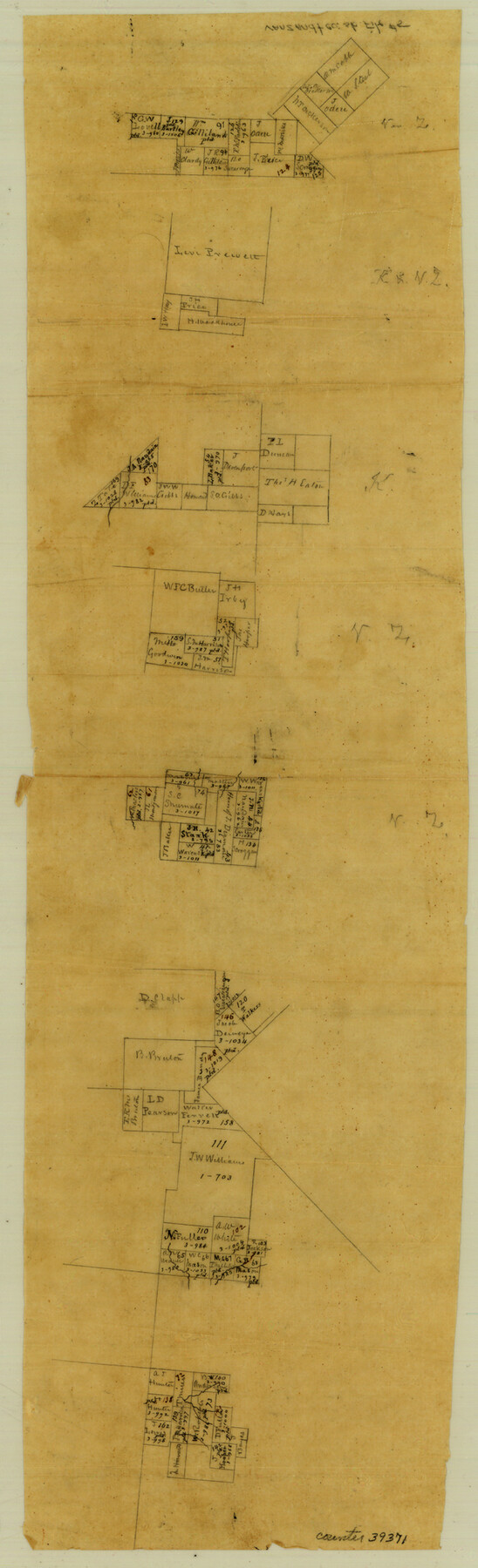
Van Zandt County Sketch File 5
[Sketches of multiple areas in Van Zandt and Kaufman Counties]
-
Map/Doc
39371
-
Collection
General Map Collection
-
Counties
Van Zandt Kaufman
-
Subjects
Surveying Sketch File
-
Height x Width
20.5 x 6.3 inches
52.1 x 16.0 cm
-
Medium
paper, manuscript
Part of: General Map Collection
Map of Jasper County

Print $40.00
- Digital $50.00
Map of Jasper County
1898
Size 48.6 x 39.2 inches
Map/Doc 4990
Flight Mission No. BRA-8M, Frame 120, Jefferson County

Print $20.00
- Digital $50.00
Flight Mission No. BRA-8M, Frame 120, Jefferson County
1953
Size 18.6 x 22.5 inches
Map/Doc 85616
Freestone County Working Sketch 2

Print $20.00
- Digital $50.00
Freestone County Working Sketch 2
1913
Size 23.1 x 28.2 inches
Map/Doc 69244
Coryell County Sketch File 9

Print $4.00
- Digital $50.00
Coryell County Sketch File 9
1858
Size 7.2 x 8.2 inches
Map/Doc 19359
Midland County Rolled Sketch REE

Print $20.00
- Digital $50.00
Midland County Rolled Sketch REE
1937
Size 27.1 x 24.3 inches
Map/Doc 6771
Tom Green County
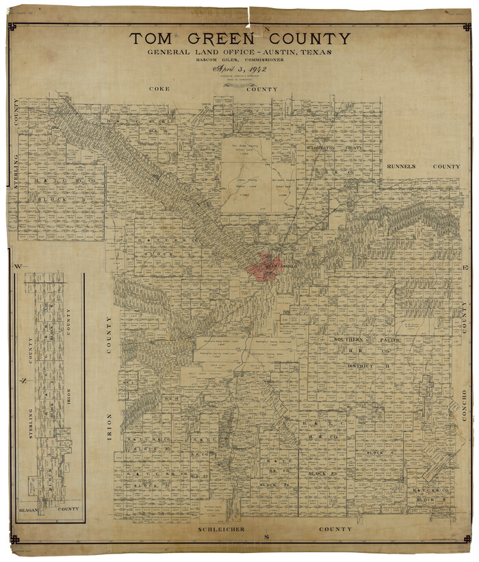
Print $40.00
- Digital $50.00
Tom Green County
1942
Size 55.4 x 47.6 inches
Map/Doc 63073
Intracoastal Waterway in Texas - Corpus Christi to Point Isabel including Arroyo Colorado to Mo. Pac. R.R. Bridge Near Harlingen

Print $20.00
- Digital $50.00
Intracoastal Waterway in Texas - Corpus Christi to Point Isabel including Arroyo Colorado to Mo. Pac. R.R. Bridge Near Harlingen
1933
Size 28.0 x 40.8 inches
Map/Doc 61850
Hall County Rolled Sketch 6

Print $20.00
- Digital $50.00
Hall County Rolled Sketch 6
Size 24.9 x 41.2 inches
Map/Doc 6050
Tarrant County Sketch File 8

Print $4.00
- Digital $50.00
Tarrant County Sketch File 8
1858
Size 8.1 x 10.1 inches
Map/Doc 37687
Potter County Boundary File 4

Print $30.00
- Digital $50.00
Potter County Boundary File 4
Size 14.6 x 9.3 inches
Map/Doc 57997
Sulphur River, Terry Lake Sheet

Print $20.00
- Digital $50.00
Sulphur River, Terry Lake Sheet
1919
Size 15.7 x 18.3 inches
Map/Doc 78337
Flight Mission No. BRA-7M, Frame 26, Jefferson County

Print $20.00
- Digital $50.00
Flight Mission No. BRA-7M, Frame 26, Jefferson County
1953
Size 18.4 x 22.2 inches
Map/Doc 85477
You may also like
United States - Gulf Coast - Galveston to Rio Grande

Print $20.00
- Digital $50.00
United States - Gulf Coast - Galveston to Rio Grande
1919
Size 26.7 x 18.3 inches
Map/Doc 72746
Roberts County Rolled Sketch 3

Print $40.00
- Digital $50.00
Roberts County Rolled Sketch 3
Size 38.0 x 49.7 inches
Map/Doc 8354
Colton's new map of the state of Texas, the Indian Territory and adjoining portions of New Mexico, Louisiana, and Arkansas

Print $20.00
Colton's new map of the state of Texas, the Indian Territory and adjoining portions of New Mexico, Louisiana, and Arkansas
1872
Size 31.1 x 36.6 inches
Map/Doc 93579
Flight Mission No. DQN-1K, Frame 73, Calhoun County

Print $20.00
- Digital $50.00
Flight Mission No. DQN-1K, Frame 73, Calhoun County
1953
Size 18.5 x 22.2 inches
Map/Doc 84160
La Salle County Sketch File 49

Print $20.00
- Digital $50.00
La Salle County Sketch File 49
1942
Size 47.7 x 14.9 inches
Map/Doc 10519
Map of Asylum Lands

Print $20.00
- Digital $50.00
Map of Asylum Lands
1857
Size 22.0 x 29.1 inches
Map/Doc 2214
Map of Bailey County, Texas

Print $20.00
- Digital $50.00
Map of Bailey County, Texas
1912
Size 15.8 x 19.8 inches
Map/Doc 90248

Crosby County Sketch File 24

Print $4.00
- Digital $50.00
Crosby County Sketch File 24
Size 7.3 x 8.8 inches
Map/Doc 20091
Flight Mission No. CRC-5R, Frame 40, Chambers County

Print $20.00
- Digital $50.00
Flight Mission No. CRC-5R, Frame 40, Chambers County
1956
Size 18.6 x 22.4 inches
Map/Doc 84959
Frio County Working Sketch 26

Print $20.00
- Digital $50.00
Frio County Working Sketch 26
2001
Size 38.0 x 42.7 inches
Map/Doc 69300
Pecos County Rolled Sketch 146

Print $20.00
- Digital $50.00
Pecos County Rolled Sketch 146
Size 40.8 x 32.5 inches
Map/Doc 9734