Van Zandt County Rolled Sketch 6

Print $6.00
- Digital $50.00
Van Zandt County Rolled Sketch 6
1946
Size: 33.5 x 34.2 inches
10091
Van Zandt County Rolled Sketch 10

Print $20.00
- Digital $50.00
Van Zandt County Rolled Sketch 10
1989
Size: 33.7 x 40.6 inches
10092
Van Zandt County Rolled Sketch 6

Print $3.00
- Digital $50.00
Van Zandt County Rolled Sketch 6
1946
Size: 9.3 x 11.3 inches
10311
Van Zandt County Rolled Sketch 4

Print $20.00
- Digital $50.00
Van Zandt County Rolled Sketch 4
1946
Size: 34.7 x 35.5 inches
10645
Rains County Sketch File 10

Print $20.00
- Digital $50.00
Rains County Sketch File 10
Size: 20.9 x 15.7 inches
12203
Rains County Sketch File 11

Print $20.00
- Digital $50.00
Rains County Sketch File 11
Size: 21.1 x 15.5 inches
12204
Map of Van Zandt County

Print $20.00
- Digital $50.00
Map of Van Zandt County
1853
Size: 19.4 x 20.6 inches
16957
Hunt County Sketch File 1

Print $4.00
- Digital $50.00
Hunt County Sketch File 1
1853
Size: 7.6 x 5.1 inches
27081
Hunt County Sketch File 38

Print $6.00
- Digital $50.00
Hunt County Sketch File 38
Size: 11.0 x 10.8 inches
27157
[Surveys in the Nacogdoches District, from the Sabine River to Cowleach Fork]
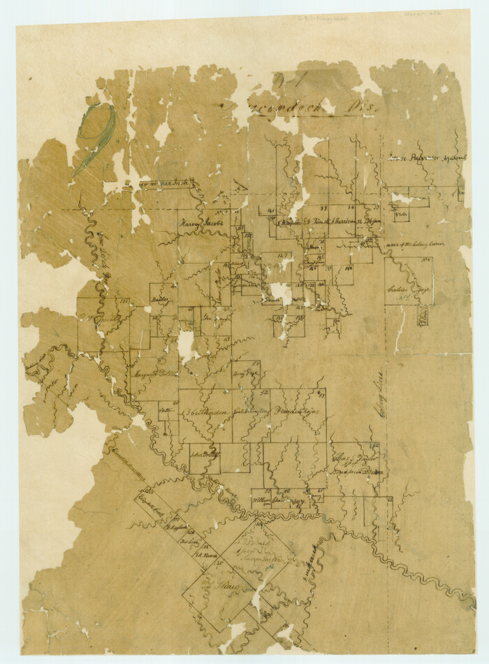
Print $3.00
- Digital $50.00
[Surveys in the Nacogdoches District, from the Sabine River to Cowleach Fork]
Size: 15.6 x 11.5 inches
282
Kaufman County Sketch File 1

Print $4.00
- Digital $50.00
Kaufman County Sketch File 1
Size: 8.3 x 8.3 inches
28624
Kaufman County Sketch File 5

Print $22.00
- Digital $50.00
Kaufman County Sketch File 5
1849
Size: 7.6 x 12.6 inches
28632
Kaufman County Sketch File 7

Print $5.00
- Digital $50.00
Kaufman County Sketch File 7
1847
Size: 8.3 x 10.1 inches
28636
Kaufman County Sketch File 10

Print $4.00
- Digital $50.00
Kaufman County Sketch File 10
1873
Size: 10.2 x 8.2 inches
28643
Kaufman County Sketch File 16

Print $4.00
- Digital $50.00
Kaufman County Sketch File 16
Size: 10.1 x 8.1 inches
28655
Rains County Sketch File 9

Print $20.00
- Digital $50.00
Rains County Sketch File 9
Size: 14.2 x 16.3 inches
34960
Smith County Sketch File 1

Print $4.00
- Digital $50.00
Smith County Sketch File 1
Size: 9.0 x 10.5 inches
36746
Smith County Sketch File 8

Print $4.00
- Digital $50.00
Smith County Sketch File 8
1848
Size: 12.8 x 8.1 inches
36761
Smith County Sketch File 12

Print $4.00
- Digital $50.00
Smith County Sketch File 12
1859
Size: 8.3 x 12.0 inches
36769
Smith County Sketch File 19

Print $42.00
- Digital $50.00
Smith County Sketch File 19
1850
Size: 8.1 x 13.0 inches
36794
Van Zandt County Sketch File 2

Print $9.00
- Digital $50.00
Van Zandt County Sketch File 2
1852
Size: 12.9 x 4.9 inches
39359
Van Zandt County Sketch File 2a

Print $42.00
- Digital $50.00
Van Zandt County Sketch File 2a
Size: 12.2 x 12.0 inches
39363
Van Zandt County Sketch File 3

Print $8.00
- Digital $50.00
Van Zandt County Sketch File 3
1858
Size: 8.3 x 8.0 inches
39366
Van Zandt County Sketch File 4

Print $6.00
- Digital $50.00
Van Zandt County Sketch File 4
1858
Size: 10.7 x 11.1 inches
39369
Van Zandt County Sketch File 5

Print $22.00
- Digital $50.00
Van Zandt County Sketch File 5
Size: 20.5 x 6.3 inches
39371
Van Zandt County Sketch File 6

Print $4.00
- Digital $50.00
Van Zandt County Sketch File 6
1848
Size: 9.7 x 7.9 inches
39373
Van Zandt County Sketch File 7

Print $8.00
- Digital $50.00
Van Zandt County Sketch File 7
1849
Size: 5.2 x 7.4 inches
39375
Van Zandt County Sketch File 8

Print $10.00
- Digital $50.00
Van Zandt County Sketch File 8
1851
Size: 9.7 x 7.9 inches
39379
Van Zandt County Sketch File 9

Print $18.00
- Digital $50.00
Van Zandt County Sketch File 9
1859
Size: 12.9 x 8.4 inches
39384
Van Zandt County Rolled Sketch 6
Print $6.00
- Digital $50.00
Van Zandt County Rolled Sketch 6
1946
-
Size
33.5 x 34.2 inches
-
Map/Doc
10091
-
Creation Date
1946
Van Zandt County Rolled Sketch 10
Print $20.00
- Digital $50.00
Van Zandt County Rolled Sketch 10
1989
-
Size
33.7 x 40.6 inches
-
Map/Doc
10092
-
Creation Date
1989
Van Zandt County Rolled Sketch 6
Print $3.00
- Digital $50.00
Van Zandt County Rolled Sketch 6
1946
-
Size
9.3 x 11.3 inches
-
Map/Doc
10311
-
Creation Date
1946
Van Zandt County Rolled Sketch 4
Print $20.00
- Digital $50.00
Van Zandt County Rolled Sketch 4
1946
-
Size
34.7 x 35.5 inches
-
Map/Doc
10645
-
Creation Date
1946
Rains County Sketch File 10
Print $20.00
- Digital $50.00
Rains County Sketch File 10
-
Size
20.9 x 15.7 inches
-
Map/Doc
12203
Rains County Sketch File 11
Print $20.00
- Digital $50.00
Rains County Sketch File 11
-
Size
21.1 x 15.5 inches
-
Map/Doc
12204
Van Zandt County

Print $20.00
- Digital $50.00
Van Zandt County
1921
-
Size
45.5 x 41.0 inches
-
Map/Doc
16914
-
Creation Date
1921
Map of Van Zandt County
Print $20.00
- Digital $50.00
Map of Van Zandt County
1853
-
Size
19.4 x 20.6 inches
-
Map/Doc
16957
-
Creation Date
1853
Hunt County Sketch File 1
Print $4.00
- Digital $50.00
Hunt County Sketch File 1
1853
-
Size
7.6 x 5.1 inches
-
Map/Doc
27081
-
Creation Date
1853
Hunt County Sketch File 38
Print $6.00
- Digital $50.00
Hunt County Sketch File 38
-
Size
11.0 x 10.8 inches
-
Map/Doc
27157
[Surveys in the Nacogdoches District, from the Sabine River to Cowleach Fork]
Print $3.00
- Digital $50.00
[Surveys in the Nacogdoches District, from the Sabine River to Cowleach Fork]
-
Size
15.6 x 11.5 inches
-
Map/Doc
282
Kaufman County Sketch File 1
Print $4.00
- Digital $50.00
Kaufman County Sketch File 1
-
Size
8.3 x 8.3 inches
-
Map/Doc
28624
Kaufman County Sketch File 5
Print $22.00
- Digital $50.00
Kaufman County Sketch File 5
1849
-
Size
7.6 x 12.6 inches
-
Map/Doc
28632
-
Creation Date
1849
Kaufman County Sketch File 7
Print $5.00
- Digital $50.00
Kaufman County Sketch File 7
1847
-
Size
8.3 x 10.1 inches
-
Map/Doc
28636
-
Creation Date
1847
Kaufman County Sketch File 10
Print $4.00
- Digital $50.00
Kaufman County Sketch File 10
1873
-
Size
10.2 x 8.2 inches
-
Map/Doc
28643
-
Creation Date
1873
Kaufman County Sketch File 16
Print $4.00
- Digital $50.00
Kaufman County Sketch File 16
-
Size
10.1 x 8.1 inches
-
Map/Doc
28655
Rains County Sketch File 9
Print $20.00
- Digital $50.00
Rains County Sketch File 9
-
Size
14.2 x 16.3 inches
-
Map/Doc
34960
Smith County Sketch File 1
Print $4.00
- Digital $50.00
Smith County Sketch File 1
-
Size
9.0 x 10.5 inches
-
Map/Doc
36746
Smith County Sketch File 8
Print $4.00
- Digital $50.00
Smith County Sketch File 8
1848
-
Size
12.8 x 8.1 inches
-
Map/Doc
36761
-
Creation Date
1848
Smith County Sketch File 12
Print $4.00
- Digital $50.00
Smith County Sketch File 12
1859
-
Size
8.3 x 12.0 inches
-
Map/Doc
36769
-
Creation Date
1859
Smith County Sketch File 19
Print $42.00
- Digital $50.00
Smith County Sketch File 19
1850
-
Size
8.1 x 13.0 inches
-
Map/Doc
36794
-
Creation Date
1850
Van Zandt County Sketch File 2
Print $9.00
- Digital $50.00
Van Zandt County Sketch File 2
1852
-
Size
12.9 x 4.9 inches
-
Map/Doc
39359
-
Creation Date
1852
Van Zandt County Sketch File 2a
Print $42.00
- Digital $50.00
Van Zandt County Sketch File 2a
-
Size
12.2 x 12.0 inches
-
Map/Doc
39363
Van Zandt County Sketch File 3
Print $8.00
- Digital $50.00
Van Zandt County Sketch File 3
1858
-
Size
8.3 x 8.0 inches
-
Map/Doc
39366
-
Creation Date
1858
Van Zandt County Sketch File 4
Print $6.00
- Digital $50.00
Van Zandt County Sketch File 4
1858
-
Size
10.7 x 11.1 inches
-
Map/Doc
39369
-
Creation Date
1858
Van Zandt County Sketch File 5
Print $22.00
- Digital $50.00
Van Zandt County Sketch File 5
-
Size
20.5 x 6.3 inches
-
Map/Doc
39371
Van Zandt County Sketch File 6
Print $4.00
- Digital $50.00
Van Zandt County Sketch File 6
1848
-
Size
9.7 x 7.9 inches
-
Map/Doc
39373
-
Creation Date
1848
Van Zandt County Sketch File 7
Print $8.00
- Digital $50.00
Van Zandt County Sketch File 7
1849
-
Size
5.2 x 7.4 inches
-
Map/Doc
39375
-
Creation Date
1849
Van Zandt County Sketch File 8
Print $10.00
- Digital $50.00
Van Zandt County Sketch File 8
1851
-
Size
9.7 x 7.9 inches
-
Map/Doc
39379
-
Creation Date
1851
Van Zandt County Sketch File 9
Print $18.00
- Digital $50.00
Van Zandt County Sketch File 9
1859
-
Size
12.9 x 8.4 inches
-
Map/Doc
39384
-
Creation Date
1859