[Texas & Pacific Railway, Longview to Dallas]
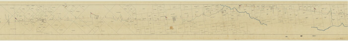
Print $40.00
- Digital $50.00
[Texas & Pacific Railway, Longview to Dallas]
1873
Size: 14.5 x 121.6 inches
64098
[Surveys in the Nacogdoches District, from the Sabine River to Cowleach Fork]
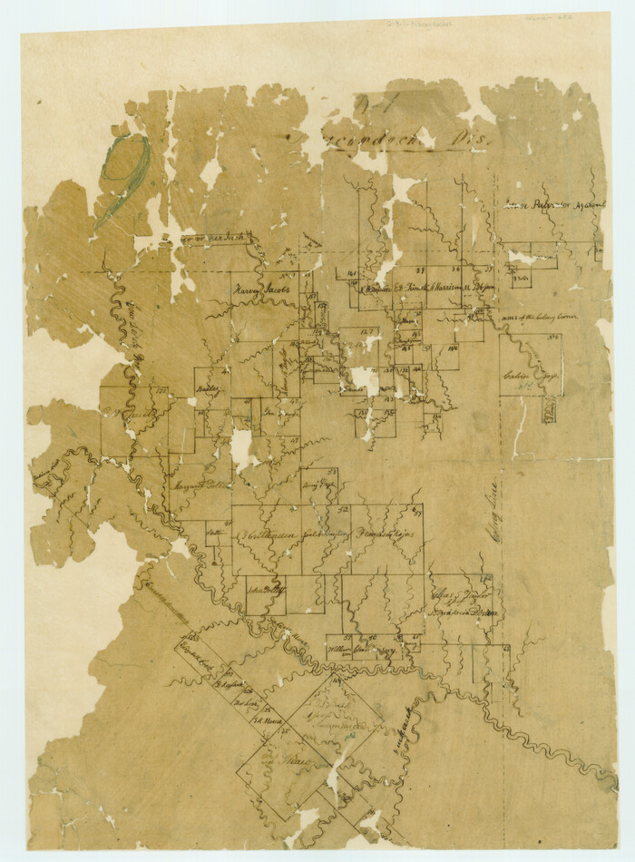
Print $3.00
- Digital $50.00
[Surveys in the Nacogdoches District, from the Sabine River to Cowleach Fork]
Size: 15.6 x 11.5 inches
282
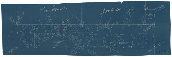
[Surveys South of Levi Pruitt]
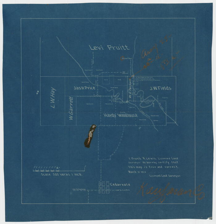
Print $3.00
- Digital $50.00
[Surveys South of Levi Pruitt]
1924
Size: 11.3 x 11.6 inches
92092
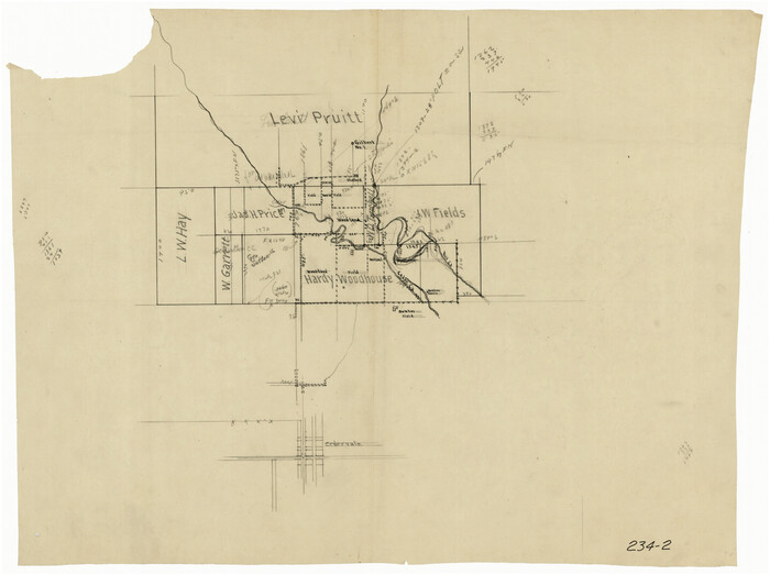
[Surveys South of Levi Pruitt and Jno. Welch]
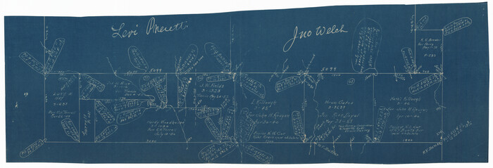
Print $20.00
- Digital $50.00
[Surveys South of Levi Pruitt and Jno. Welch]
Size: 18.2 x 6.3 inches
92091
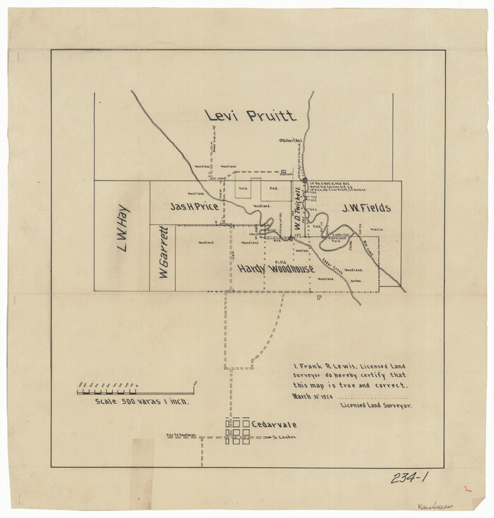
[Sketch of area just south of Levi Pruitt survey]
Print $20.00
- Digital $50.00
[Sketch of area just south of Levi Pruitt survey]
Size: 24.9 x 18.6 inches
91854
[Sketch of area just south of Levi Pruitt survey]
Print $20.00
- Digital $50.00
[Sketch of area just south of Levi Pruitt survey]
1924
Size: 17.0 x 17.8 inches
91855
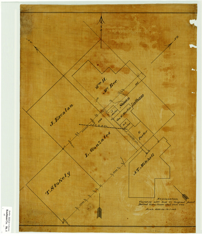
[Sketch Showing L. Gonzales, Wm. H. McBee and adjacent surveys, Kaufman County, Texas]
Print $20.00
- Digital $50.00
[Sketch Showing L. Gonzales, Wm. H. McBee and adjacent surveys, Kaufman County, Texas]
Size: 23.2 x 19.8 inches
5071
[Pencil sketch in vicinity of H. G. Sims, David F. Weff, B. Allen surveys]
Print $20.00
- Digital $50.00
[Pencil sketch in vicinity of H. G. Sims, David F. Weff, B. Allen surveys]
1924
Size: 18.9 x 18.2 inches
91853
[Northeast part of County]
Print $20.00
- Digital $50.00
[Northeast part of County]
Size: 37.1 x 42.9 inches
89957
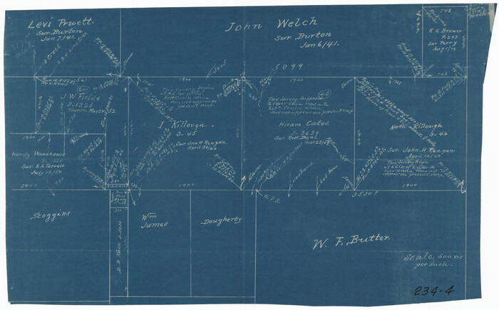
[I. Killough and Hiram Cates surveys and vicinity]
Print $3.00
- Digital $50.00
[I. Killough and Hiram Cates surveys and vicinity]
Size: 16.9 x 10.5 inches
91845
[I. Killough and Hiram Cates surveys and vicinity]
Print $20.00
- Digital $50.00
[I. Killough and Hiram Cates surveys and vicinity]
Size: 27.5 x 9.2 inches
91851
VanZandt County Showing the Located Route of the Texas and Pacific R.R.

Print $20.00
- Digital $50.00
VanZandt County Showing the Located Route of the Texas and Pacific R.R.
1872
Size: 24.5 x 22.3 inches
64136
Van Zandt County Working Sketch Graphic Index

Print $20.00
- Digital $50.00
Van Zandt County Working Sketch Graphic Index
1972
Size: 46.2 x 40.7 inches
76727
Van Zandt County Working Sketch 9

Print $20.00
- Digital $50.00
Van Zandt County Working Sketch 9
1982
Size: 12.6 x 11.7 inches
72259
Van Zandt County Working Sketch 8

Print $3.00
- Digital $50.00
Van Zandt County Working Sketch 8
1982
Size: 15.6 x 9.2 inches
72258
Van Zandt County Working Sketch 7

Print $20.00
- Digital $50.00
Van Zandt County Working Sketch 7
1953
Size: 17.7 x 18.1 inches
72257
Van Zandt County Working Sketch 6b

Print $40.00
- Digital $50.00
Van Zandt County Working Sketch 6b
1941
Size: 54.7 x 43.5 inches
72256
Van Zandt County Working Sketch 6a

Print $40.00
- Digital $50.00
Van Zandt County Working Sketch 6a
1941
Size: 57.2 x 25.7 inches
69762
Van Zandt County Working Sketch 6a

Print $40.00
- Digital $50.00
Van Zandt County Working Sketch 6a
1941
Size: 57.6 x 30.1 inches
72255
Van Zandt County Working Sketch 5

Print $20.00
- Digital $50.00
Van Zandt County Working Sketch 5
1940
Size: 37.2 x 25.5 inches
72254
Van Zandt County Working Sketch 4

Print $20.00
- Digital $50.00
Van Zandt County Working Sketch 4
1929
Size: 16.3 x 26.8 inches
72253
Van Zandt County Working Sketch 3

Print $20.00
- Digital $50.00
Van Zandt County Working Sketch 3
1923
Size: 20.1 x 16.4 inches
72252
Van Zandt County Working Sketch 20

Print $20.00
- Digital $50.00
Van Zandt County Working Sketch 20
1992
Size: 30.4 x 34.7 inches
72270
Van Zandt County Working Sketch 2

Print $20.00
- Digital $50.00
Van Zandt County Working Sketch 2
1910
Size: 17.8 x 11.6 inches
72251
Van Zandt County Working Sketch 19

Print $20.00
- Digital $50.00
Van Zandt County Working Sketch 19
Size: 43.3 x 32.8 inches
72269
Van Zandt County Working Sketch 18

Print $20.00
- Digital $50.00
Van Zandt County Working Sketch 18
Size: 12.5 x 18.2 inches
72268
Van Zandt County Working Sketch 17

Print $20.00
- Digital $50.00
Van Zandt County Working Sketch 17
Size: 17.5 x 19.1 inches
72267
Van Zandt County Working Sketch 16

Print $20.00
- Digital $50.00
Van Zandt County Working Sketch 16
1991
Size: 40.5 x 34.0 inches
72266
Van Zandt County Working Sketch 15

Print $20.00
- Digital $50.00
Van Zandt County Working Sketch 15
1982
Size: 30.9 x 39.0 inches
72265
Van Zandt County Working Sketch 14

Print $20.00
- Digital $50.00
Van Zandt County Working Sketch 14
1982
Size: 13.2 x 11.5 inches
72264
[Texas & Pacific Railway, Longview to Dallas]
Print $40.00
- Digital $50.00
[Texas & Pacific Railway, Longview to Dallas]
1873
-
Size
14.5 x 121.6 inches
-
Map/Doc
64098
-
Creation Date
1873
[Surveys in the Nacogdoches District, from the Sabine River to Cowleach Fork]
Print $3.00
- Digital $50.00
[Surveys in the Nacogdoches District, from the Sabine River to Cowleach Fork]
-
Size
15.6 x 11.5 inches
-
Map/Doc
282
[Surveys South of Levi Pruitt]
Print $3.00
- Digital $50.00
[Surveys South of Levi Pruitt]
1924
-
Size
11.3 x 11.6 inches
-
Map/Doc
92092
-
Creation Date
1924
[Surveys South of Levi Pruitt and Jno. Welch]
Print $20.00
- Digital $50.00
[Surveys South of Levi Pruitt and Jno. Welch]
-
Size
18.2 x 6.3 inches
-
Map/Doc
92091
[Sketch of area just south of Levi Pruitt survey]
Print $20.00
- Digital $50.00
[Sketch of area just south of Levi Pruitt survey]
-
Size
24.9 x 18.6 inches
-
Map/Doc
91854
[Sketch of area just south of Levi Pruitt survey]
Print $20.00
- Digital $50.00
[Sketch of area just south of Levi Pruitt survey]
1924
-
Size
17.0 x 17.8 inches
-
Map/Doc
91855
-
Creation Date
1924
[Sketch Showing L. Gonzales, Wm. H. McBee and adjacent surveys, Kaufman County, Texas]
Print $20.00
- Digital $50.00
[Sketch Showing L. Gonzales, Wm. H. McBee and adjacent surveys, Kaufman County, Texas]
-
Size
23.2 x 19.8 inches
-
Map/Doc
5071
[Pencil sketch in vicinity of H. G. Sims, David F. Weff, B. Allen surveys]
Print $20.00
- Digital $50.00
[Pencil sketch in vicinity of H. G. Sims, David F. Weff, B. Allen surveys]
1924
-
Size
18.9 x 18.2 inches
-
Map/Doc
91853
-
Creation Date
1924
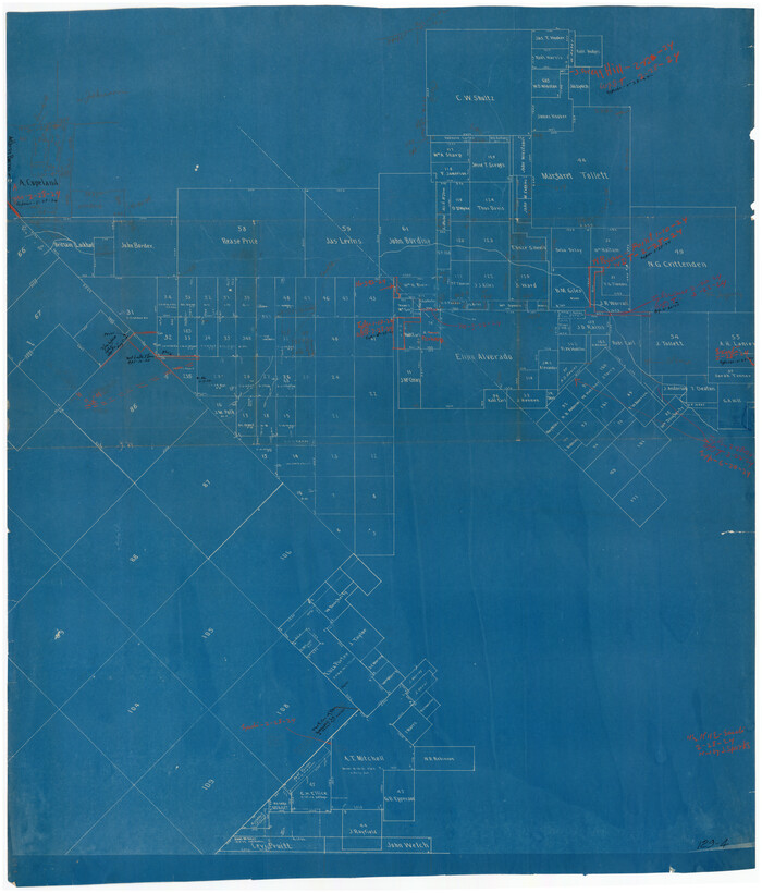
[Northeast part of County]
Print $20.00
- Digital $50.00
[Northeast part of County]
-
Size
37.1 x 42.9 inches
-
Map/Doc
89957
[I. Killough and Hiram Cates surveys and vicinity]
Print $3.00
- Digital $50.00
[I. Killough and Hiram Cates surveys and vicinity]
-
Size
16.9 x 10.5 inches
-
Map/Doc
91845
[I. Killough and Hiram Cates surveys and vicinity]
Print $20.00
- Digital $50.00
[I. Killough and Hiram Cates surveys and vicinity]
-
Size
27.5 x 9.2 inches
-
Map/Doc
91851
VanZandt County Showing the Located Route of the Texas and Pacific R.R.
Print $20.00
- Digital $50.00
VanZandt County Showing the Located Route of the Texas and Pacific R.R.
1872
-
Size
24.5 x 22.3 inches
-
Map/Doc
64136
-
Creation Date
1872
Van Zandt County Working Sketch Graphic Index
Print $20.00
- Digital $50.00
Van Zandt County Working Sketch Graphic Index
1972
-
Size
46.2 x 40.7 inches
-
Map/Doc
76727
-
Creation Date
1972
Van Zandt County Working Sketch 9
Print $20.00
- Digital $50.00
Van Zandt County Working Sketch 9
1982
-
Size
12.6 x 11.7 inches
-
Map/Doc
72259
-
Creation Date
1982
Van Zandt County Working Sketch 8
Print $3.00
- Digital $50.00
Van Zandt County Working Sketch 8
1982
-
Size
15.6 x 9.2 inches
-
Map/Doc
72258
-
Creation Date
1982
Van Zandt County Working Sketch 7
Print $20.00
- Digital $50.00
Van Zandt County Working Sketch 7
1953
-
Size
17.7 x 18.1 inches
-
Map/Doc
72257
-
Creation Date
1953
Van Zandt County Working Sketch 6b
Print $40.00
- Digital $50.00
Van Zandt County Working Sketch 6b
1941
-
Size
54.7 x 43.5 inches
-
Map/Doc
72256
-
Creation Date
1941
Van Zandt County Working Sketch 6a
Print $40.00
- Digital $50.00
Van Zandt County Working Sketch 6a
1941
-
Size
57.2 x 25.7 inches
-
Map/Doc
69762
-
Creation Date
1941
Van Zandt County Working Sketch 6a
Print $40.00
- Digital $50.00
Van Zandt County Working Sketch 6a
1941
-
Size
57.6 x 30.1 inches
-
Map/Doc
72255
-
Creation Date
1941
Van Zandt County Working Sketch 5
Print $20.00
- Digital $50.00
Van Zandt County Working Sketch 5
1940
-
Size
37.2 x 25.5 inches
-
Map/Doc
72254
-
Creation Date
1940
Van Zandt County Working Sketch 4
Print $20.00
- Digital $50.00
Van Zandt County Working Sketch 4
1929
-
Size
16.3 x 26.8 inches
-
Map/Doc
72253
-
Creation Date
1929
Van Zandt County Working Sketch 3
Print $20.00
- Digital $50.00
Van Zandt County Working Sketch 3
1923
-
Size
20.1 x 16.4 inches
-
Map/Doc
72252
-
Creation Date
1923
Van Zandt County Working Sketch 20
Print $20.00
- Digital $50.00
Van Zandt County Working Sketch 20
1992
-
Size
30.4 x 34.7 inches
-
Map/Doc
72270
-
Creation Date
1992
Van Zandt County Working Sketch 2
Print $20.00
- Digital $50.00
Van Zandt County Working Sketch 2
1910
-
Size
17.8 x 11.6 inches
-
Map/Doc
72251
-
Creation Date
1910
Van Zandt County Working Sketch 19
Print $20.00
- Digital $50.00
Van Zandt County Working Sketch 19
-
Size
43.3 x 32.8 inches
-
Map/Doc
72269
Van Zandt County Working Sketch 18
Print $20.00
- Digital $50.00
Van Zandt County Working Sketch 18
-
Size
12.5 x 18.2 inches
-
Map/Doc
72268
Van Zandt County Working Sketch 17
Print $20.00
- Digital $50.00
Van Zandt County Working Sketch 17
-
Size
17.5 x 19.1 inches
-
Map/Doc
72267
Van Zandt County Working Sketch 16
Print $20.00
- Digital $50.00
Van Zandt County Working Sketch 16
1991
-
Size
40.5 x 34.0 inches
-
Map/Doc
72266
-
Creation Date
1991
Van Zandt County Working Sketch 15
Print $20.00
- Digital $50.00
Van Zandt County Working Sketch 15
1982
-
Size
30.9 x 39.0 inches
-
Map/Doc
72265
-
Creation Date
1982
Van Zandt County Working Sketch 14
Print $20.00
- Digital $50.00
Van Zandt County Working Sketch 14
1982
-
Size
13.2 x 11.5 inches
-
Map/Doc
72264
-
Creation Date
1982