Rusk County Sketch File 32

Print $20.00
Rusk County Sketch File 32
1949
Size: 33.5 x 28.4 inches
10596
Rusk County Sketch File 34

Print $20.00
Rusk County Sketch File 34
1949
Size: 33.4 x 28.2 inches
10597
[Map of Nacogdoches County]
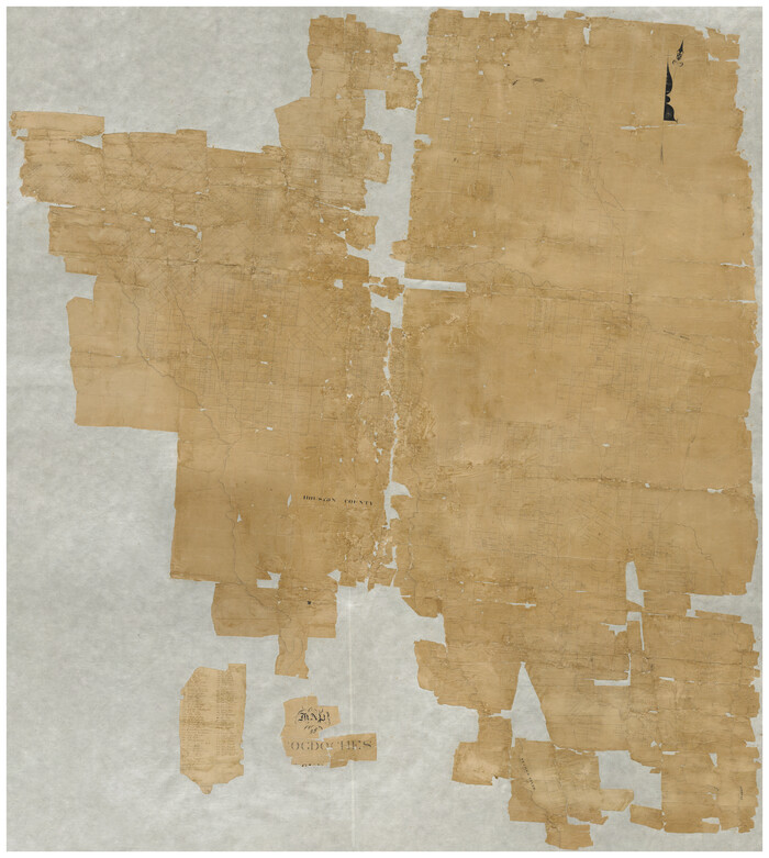
Print $40.00
- Digital $50.00
[Map of Nacogdoches County]
1840
Size: 79.3 x 69.8 inches
10784
Rusk County Sketch File 36

Print $20.00
Rusk County Sketch File 36
1950
Size: 23.8 x 18.0 inches
12274
Rusk County Sketch File 37

Print $20.00
Rusk County Sketch File 37
1951
Size: 23.3 x 26.2 inches
12275
Rusk County Sketch File 41

Print $20.00
Rusk County Sketch File 41
1951
Size: 23.1 x 26.2 inches
12277
Rusk County Sketch File 43

Print $20.00
Rusk County Sketch File 43
1951
Size: 23.5 x 26.6 inches
12278
Angelina County Sketch File 15

Print $8.00
- Digital $50.00
Angelina County Sketch File 15
1848
Size: 12.5 x 7.5 inches
12960
Angelina County Sketch File 15c

Print $16.00
- Digital $50.00
Angelina County Sketch File 15c
1838
Size: 12.2 x 8.0 inches
12972
Map of Nacogdoches County

Print $40.00
- Digital $50.00
Map of Nacogdoches County
1839
Size: 83.3 x 79.2 inches
16775
Map of Nacogdoches County

Print $40.00
- Digital $50.00
Map of Nacogdoches County
1896
Size: 64.0 x 59.7 inches
16776
[Map of Line Dividing Fannin and Nacogdoches Districts]
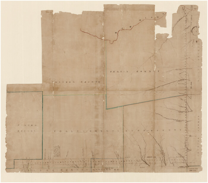
Print $20.00
- Digital $50.00
[Map of Line Dividing Fannin and Nacogdoches Districts]
1850
Size: 34.2 x 39.0 inches
1707
Field Notes of Mercer's Colony, Robertson, Nac[a]gdoches, Fannin, & Lamar Counties.
![1953, Field Notes of Mercer's Colony, Robertson, Nac[a]gdoches, Fannin, & Lamar Counties., General Map Collection](https://historictexasmaps.com/wmedia_w700/pdf_converted_jpg/qi_pdf_thumbnail_897.jpg)
Print $30.00
- Digital $50.00
Field Notes of Mercer's Colony, Robertson, Nac[a]gdoches, Fannin, & Lamar Counties.
1845
Size: 9.5 x 14.8 inches
1953
[Cherokee Reserve, West Boundary Line, plat and field notes]
![2000, [Cherokee Reserve, West Boundary Line, plat and field notes], General Map Collection](https://historictexasmaps.com/wmedia_w700/pdf_converted_jpg/qi_pdf_thumbnail_931.jpg)
Print $54.00
[Cherokee Reserve, West Boundary Line, plat and field notes]
1841
Size: 9.4 x 14.7 inches
2000
Gregg County Sketch File 14

Print $6.00
- Digital $50.00
Gregg County Sketch File 14
1946
Size: 14.3 x 8.8 inches
24613
Gregg County Sketch File 15

Print $6.00
- Digital $50.00
Gregg County Sketch File 15
1946
Size: 14.3 x 8.8 inches
24616
Hopkins County Sketch File 2

Print $28.00
- Digital $50.00
Hopkins County Sketch File 2
1845
Size: 11.1 x 7.9 inches
26678
[Map of Line Dividing Fannin and Nacogdoches Districts]
Print $20.00
- Digital $50.00
[Map of Line Dividing Fannin and Nacogdoches Districts]
1850
Size: 35.6 x 40.8 inches
3134
Plat of Jasper, Sabine, San Augustine, Shelby, Harrison and South Part of Nacogdoches Counties

Print $2.00
- Digital $50.00
Plat of Jasper, Sabine, San Augustine, Shelby, Harrison and South Part of Nacogdoches Counties
1841
Size: 13.7 x 9.2 inches
3174
Nacogdoches County Sketch File 1

Print $4.00
- Digital $50.00
Nacogdoches County Sketch File 1
Size: 10.2 x 7.8 inches
32233
Nacogdoches County Sketch File 2

Print $4.00
- Digital $50.00
Nacogdoches County Sketch File 2
1852
Size: 8.0 x 6.4 inches
32235
Nacogdoches County Sketch File 3

Print $8.00
- Digital $50.00
Nacogdoches County Sketch File 3
Size: 6.5 x 8.2 inches
32237
Nacogdoches County Sketch File 4

Print $4.00
- Digital $50.00
Nacogdoches County Sketch File 4
1858
Size: 10.0 x 7.8 inches
32241
Nacogdoches County Sketch File 5

Print $4.00
- Digital $50.00
Nacogdoches County Sketch File 5
1859
Size: 12.6 x 8.1 inches
32243
Nacogdoches County Sketch File 6

Print $10.00
- Digital $50.00
Nacogdoches County Sketch File 6
Size: 8.2 x 6.8 inches
32245
Nacogdoches County Sketch File 7

Print $6.00
- Digital $50.00
Nacogdoches County Sketch File 7
1875
Size: 10.4 x 15.0 inches
32250
Nacogdoches County Sketch File 9

Print $20.00
- Digital $50.00
Nacogdoches County Sketch File 9
Size: 8.3 x 26.9 inches
32252
Nacogdoches County Sketch File 10

Print $6.00
- Digital $50.00
Nacogdoches County Sketch File 10
1886
Size: 12.9 x 11.0 inches
32253
Nacogdoches County Sketch File 11

Print $2.00
- Digital $50.00
Nacogdoches County Sketch File 11
Size: 8.0 x 8.8 inches
32255
Rusk County Sketch File 32
Print $20.00
Rusk County Sketch File 32
1949
-
Size
33.5 x 28.4 inches
-
Map/Doc
10596
-
Creation Date
1949
Rusk County Sketch File 34
Print $20.00
Rusk County Sketch File 34
1949
-
Size
33.4 x 28.2 inches
-
Map/Doc
10597
-
Creation Date
1949
[Map of Nacogdoches County]
Print $40.00
- Digital $50.00
[Map of Nacogdoches County]
1840
-
Size
79.3 x 69.8 inches
-
Map/Doc
10784
-
Creation Date
1840
Nacogdoches Co.

Print $40.00
- Digital $50.00
Nacogdoches Co.
1905
-
Size
50.7 x 42.0 inches
-
Map/Doc
10787
-
Creation Date
1905
Rusk County Sketch File 36
Print $20.00
Rusk County Sketch File 36
1950
-
Size
23.8 x 18.0 inches
-
Map/Doc
12274
-
Creation Date
1950
Rusk County Sketch File 37
Print $20.00
Rusk County Sketch File 37
1951
-
Size
23.3 x 26.2 inches
-
Map/Doc
12275
-
Creation Date
1951
Rusk County Sketch File 41
Print $20.00
Rusk County Sketch File 41
1951
-
Size
23.1 x 26.2 inches
-
Map/Doc
12277
-
Creation Date
1951
Rusk County Sketch File 43
Print $20.00
Rusk County Sketch File 43
1951
-
Size
23.5 x 26.6 inches
-
Map/Doc
12278
-
Creation Date
1951
Angelina County Sketch File 15
Print $8.00
- Digital $50.00
Angelina County Sketch File 15
1848
-
Size
12.5 x 7.5 inches
-
Map/Doc
12960
-
Creation Date
1848
Angelina County Sketch File 15c
Print $16.00
- Digital $50.00
Angelina County Sketch File 15c
1838
-
Size
12.2 x 8.0 inches
-
Map/Doc
12972
-
Creation Date
1838
Map of Nacogdoches County
Print $40.00
- Digital $50.00
Map of Nacogdoches County
1839
-
Size
83.3 x 79.2 inches
-
Map/Doc
16775
-
Creation Date
1839
Map of Nacogdoches County
Print $40.00
- Digital $50.00
Map of Nacogdoches County
1896
-
Size
64.0 x 59.7 inches
-
Map/Doc
16776
-
Creation Date
1896
[Map of Line Dividing Fannin and Nacogdoches Districts]
Print $20.00
- Digital $50.00
[Map of Line Dividing Fannin and Nacogdoches Districts]
1850
-
Size
34.2 x 39.0 inches
-
Map/Doc
1707
-
Creation Date
1850
Field Notes of Mercer's Colony, Robertson, Nac[a]gdoches, Fannin, & Lamar Counties.
Print $30.00
- Digital $50.00
Field Notes of Mercer's Colony, Robertson, Nac[a]gdoches, Fannin, & Lamar Counties.
1845
-
Size
9.5 x 14.8 inches
-
Map/Doc
1953
-
Creation Date
1845
[Cherokee Reserve, West Boundary Line, plat and field notes]
Print $54.00
[Cherokee Reserve, West Boundary Line, plat and field notes]
1841
-
Size
9.4 x 14.7 inches
-
Map/Doc
2000
-
Creation Date
1841
Gregg County Sketch File 14
Print $6.00
- Digital $50.00
Gregg County Sketch File 14
1946
-
Size
14.3 x 8.8 inches
-
Map/Doc
24613
-
Creation Date
1946
Gregg County Sketch File 15
Print $6.00
- Digital $50.00
Gregg County Sketch File 15
1946
-
Size
14.3 x 8.8 inches
-
Map/Doc
24616
-
Creation Date
1946
Hopkins County Sketch File 2
Print $28.00
- Digital $50.00
Hopkins County Sketch File 2
1845
-
Size
11.1 x 7.9 inches
-
Map/Doc
26678
-
Creation Date
1845
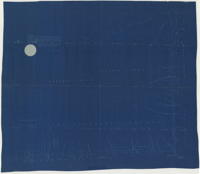
[Map of Line Dividing Fannin and Nacogdoches Districts]
Print $20.00
- Digital $50.00
[Map of Line Dividing Fannin and Nacogdoches Districts]
1850
-
Size
35.6 x 40.8 inches
-
Map/Doc
3134
-
Creation Date
1850
Plat of Jasper, Sabine, San Augustine, Shelby, Harrison and South Part of Nacogdoches Counties
Print $2.00
- Digital $50.00
Plat of Jasper, Sabine, San Augustine, Shelby, Harrison and South Part of Nacogdoches Counties
1841
-
Size
13.7 x 9.2 inches
-
Map/Doc
3174
-
Creation Date
1841
Nacogdoches County Sketch File 1
Print $4.00
- Digital $50.00
Nacogdoches County Sketch File 1
-
Size
10.2 x 7.8 inches
-
Map/Doc
32233
Nacogdoches County Sketch File 2
Print $4.00
- Digital $50.00
Nacogdoches County Sketch File 2
1852
-
Size
8.0 x 6.4 inches
-
Map/Doc
32235
-
Creation Date
1852
Nacogdoches County Sketch File 3
Print $8.00
- Digital $50.00
Nacogdoches County Sketch File 3
-
Size
6.5 x 8.2 inches
-
Map/Doc
32237
Nacogdoches County Sketch File 4
Print $4.00
- Digital $50.00
Nacogdoches County Sketch File 4
1858
-
Size
10.0 x 7.8 inches
-
Map/Doc
32241
-
Creation Date
1858
Nacogdoches County Sketch File 5
Print $4.00
- Digital $50.00
Nacogdoches County Sketch File 5
1859
-
Size
12.6 x 8.1 inches
-
Map/Doc
32243
-
Creation Date
1859
Nacogdoches County Sketch File 6
Print $10.00
- Digital $50.00
Nacogdoches County Sketch File 6
-
Size
8.2 x 6.8 inches
-
Map/Doc
32245
Nacogdoches County Sketch File 7
Print $6.00
- Digital $50.00
Nacogdoches County Sketch File 7
1875
-
Size
10.4 x 15.0 inches
-
Map/Doc
32250
-
Creation Date
1875
Nacogdoches County Sketch File 9
Print $20.00
- Digital $50.00
Nacogdoches County Sketch File 9
-
Size
8.3 x 26.9 inches
-
Map/Doc
32252
Nacogdoches County Sketch File 10
Print $6.00
- Digital $50.00
Nacogdoches County Sketch File 10
1886
-
Size
12.9 x 11.0 inches
-
Map/Doc
32253
-
Creation Date
1886
Nacogdoches County Sketch File 11
Print $2.00
- Digital $50.00
Nacogdoches County Sketch File 11
-
Size
8.0 x 8.8 inches
-
Map/Doc
32255